Oregon, a Pacific Coast state of the United States, is known for its vast forests. Forests of evergreen trees cover almost half the state. Many Oregon cities have mills that make wood products. Oregon ranks among the leading states in lumber production.
Oregon’s rugged beauty attracts millions of tourists every year. Skiers delight in the heavy snowfall on the state’s numerous slopes. Hunters shoot deer and elk and other game in Oregon’s wooded regions. People enjoy fishing in the sparkling lakes and rivers, and in Pacific waters.
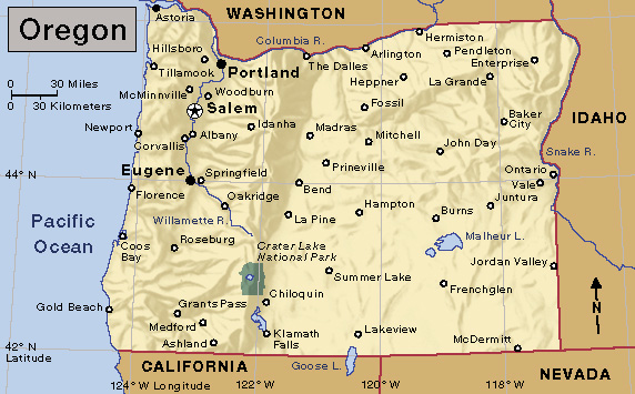
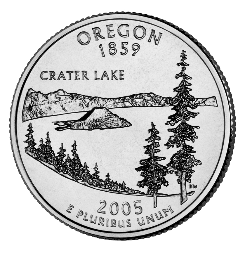
Oregon is often called the Pacific Wonderland because of its natural wonders. These include Crater Lake in the Cascade Mountains, the Columbia River Gorge, Hells Canyon on the Snake River, and Oregon Caves National Monument. Mount Hood, Mount Jefferson, and other snow-covered peaks rise majestically in the Cascade Range. The Wallowas, in northeastern Oregon, also offer spectacular mountain scenery. Steep cliffs rise along much of Oregon’s wave-swept coast. But parts of the coast have sandy beaches and protected harbors.

The dry lands east of the Cascade Mountains have large livestock ranches. Onions, potatoes, and other vegetables grow in irrigated areas of eastern Oregon. Wheat is Oregon’s most valuable food crop. It comes chiefly from the north-central area of the state. Orchard fruits are also primarily grown in the north-central part of the state.
The mighty Columbia River forms most of the boundary between Oregon and Washington. Huge dams on the Columbia supply electric power for homes and industries. The dams improve the river for shipping. They also provide water for irrigation.
The Columbia River was at one time called the Oregon, or Ouragan. The name means hurricane in French. Some authorities think that Oregon’s name came from this historic name. Oregon is known as the Beaver State because the region supplied thousands of beaver skins during fur-trading days.
In the early days, Oregon meant the end of the trail for many pioneers. During the 1840’s and 1850’s, thousands of settlers traveled by covered wagon on the Oregon Trail. They stopped in the fertile farmlands of the Willamette Valley.
Today, the Willamette Valley is Oregon’s center for trade and industry. It is also important for greenhouse and nursery products, flower bulbs, fruits, milk, seed crops, and vegetables. Most of Oregon’s large cities are in the Willamette Valley. They include Portland, the largest city, and Salem, the state capital. Portland extends along both banks of the Willamette River near where the Willamette flows into the Columbia. It is an industrial city and a major seaport.
People
Population.
The 2020 United States census reported that Oregon had 4,237,256 people. The state’s population had increased 11 percent over the 2010 census figure, 3,831,074. According to the 2020 U.S. census, Oregon ranks 27th in population among the 50 states. About 85 percent of the people of Oregon live in the state’s metropolitan areas (see Metropolitan area). 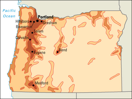
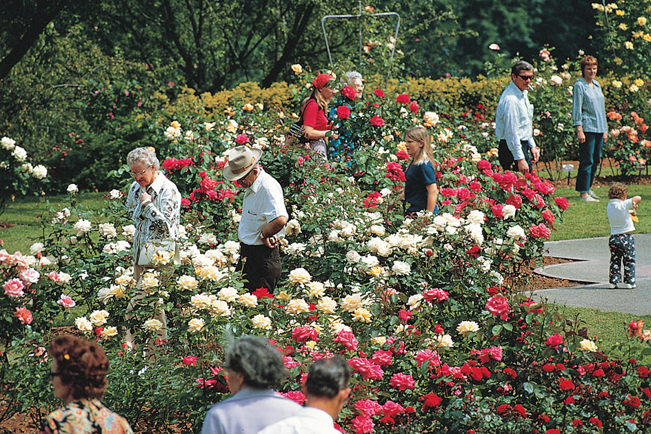
Most of Oregon’s large cities lie in the rich Willamette Valley in the northwestern part of the state. Portland, Oregon’s largest city, is the commercial, industrial, and cultural center of the state. Its lovely rose gardens give it the nickname City of Roses.
Eugene ranks as the second largest city in Oregon. Eugene is a trading and processing center. It is also the home of the University of Oregon. Salem is the state capital. The largest cities outside the valley are Bend in central Oregon and Medford in the southwest.
Some of Oregon’s people trace their ancestry to settlers who came on the Oregon Trail. Oregon’s largest population groups include people of Native American, English, French, German, Hispanic, Irish, Italian, Norwegian, Scottish, and Swedish descent.
Schools.
Jason Lee, a Methodist missionary, established a school for Indigenous (native) children in French Prairie as early as 1834 (see Lee, Jason). After the Oregon Territory was organized in 1848, an act provided funding for schools. The act ordered that income from two sections (1,280 acres, or 518 hectares) of land in each township be set aside for education. In 1849, the territorial legislature passed laws providing for a free public school system. The first public school in Oregon opened in 1851. 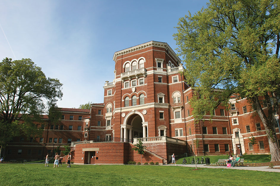
Today, a State Board of Education heads Oregon’s public school system. Board members are appointed by the governor. The governor, acting as the superintendent of public instruction, appoints a deputy superintendent who oversees the public school system. Children from age 7 through 18 must attend school.
Libraries.
Oregon’s first subscription library was organized in Oregon City in 1842. The Library Association of Portland (now the Multnomah County Library) was the first to serve the public on a large scale. It began in 1864 on a membership basis. It became a free public library in 1902.
Today, Oregon has public libraries and branches throughout the state. The Multnomah County Library is the largest public library system in the state. The State Library of Oregon in Salem provides information to the state government. It also serves as the library for the blind.
Museums.
The Portland Art Museum displays a large collection of paintings and sculpture. These works feature Native American art from the Northwest Coast and pre-Columbian art. The Jordan Schnitzer Museum of Art at the University of Oregon in Eugene has a large collection of Korean art. The Oregon Museum of Science and Industry in Portland features interactive exhibits representing every major branch of science. The Oregon Historical Society’s museum in Portland features exhibits from every era in the state’s history. The Favell Museum in Klamath Falls has collections of Western art and Native American artifacts.
Visitor’s guide
Oregon is known for its beautiful mountains and coastal scenery. Majestic snow-covered Mount Hood towers above the Cascade Range about 50 miles (80 kilometers) east of Portland. United States Highway 26 skirts Mount Hood. The highway offers close-up views of Mount Hood’s glacier-clad slopes. United States Highway 101 follows the Oregon coastline for about 300 miles (480 kilometers). Motorists along this route see white sand dunes, coastal lakes and bays, and cliffs rising above the shore.
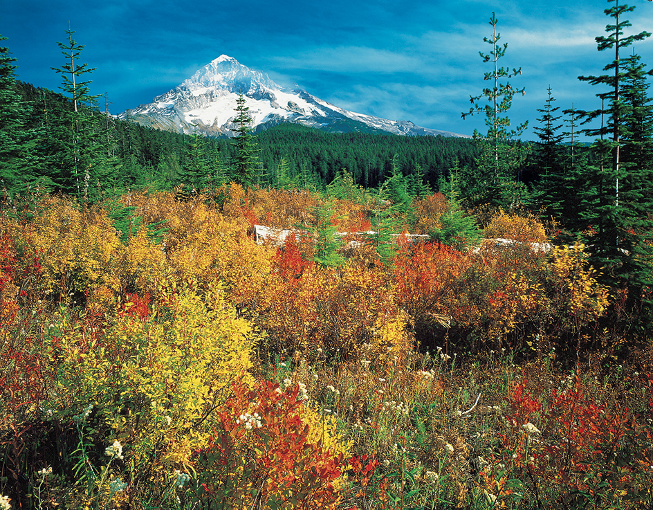
Oregon is a recreational paradise. Deer, elk, and pronghorns roam the fields and forests. People catch salmon, steelhead, trout, and other game fish. Grouse, pheasant, quail, and other game birds are plentiful.
Slopes in the Cascade, Siskiyou, and Blue mountains offer excellent skiing. Timberline, on Mount Hood, has skiing the year around. The skiing season in most other areas begins in November and lasts through April.
One of Oregon’s most famous events is the Oregon Shakespeare Festival in Ashland. Plays are presented from late February or early March through late October. Outdoor plays are presented from June through mid-October. The “Green Show” before showtime features dancers, jugglers, and musicians dressed in costumes from the 1500’s.
Other leading events are the Portland Rose Festival in late May or early June and the Pendleton Round-Up and Happy Canyon Pageant in September. The Rose Festival features parades, stage events, an international rose show, auto races, and a carnival. The festival’s main event is a spectacular Grand Floral Parade. The Pendleton Round-Up includes a tipi camp and ceremonial dancing by local Native American tribes.
Land and climate
Land regions.
Oregon has six main land regions. They are the Coast Range, the Willamette Lowland, the Cascade Mountains, the Klamath Mountains, the Columbia Plateau, and the Basin and Range Region.
The Coast Range
region borders the Pacific Ocean. It extends from Washington’s Chehalis Valley on the north to the Klamath Mountains of Oregon on the south. The rolling coast ranges run parallel to the shoreline. They are the lowest of Oregon’s main mountain ranges. Their average elevations are less than 2,000 feet (610 meters). Marys Peak, southwest of Corvallis, rises 4,097 feet (1,249 meters). It is the highest point in the region. Forests of Douglas-fir, hemlock, spruce, and other evergreen trees cover much of the area.
Several valleys in the region, such as Triangle Lake Valley, are beds of ancient lakes. Many small coastal lakes formed when the mouths of streams sank and sand dunes dammed their waters. Along much of the coast, the land rises from the sea in sheer cliffs. Some of them are nearly 1,000 feet (300 meters) high. In some places, the coastal mountains rise in a series of terraces. Each terrace was once the coastline.
The Willamette Lowland
is a narrow strip wedged between the Coast Range on the west and the Cascade Mountains on the east. The Willamette River and its branches flow north to the Columbia River. They drain the farm and forestlands of the Willamette Valley. Over half the state’s people live in the region. Rich soil and a favorable climate make it the most important farming and industrial area in the state. See Willamette River.
The Cascade Mountains
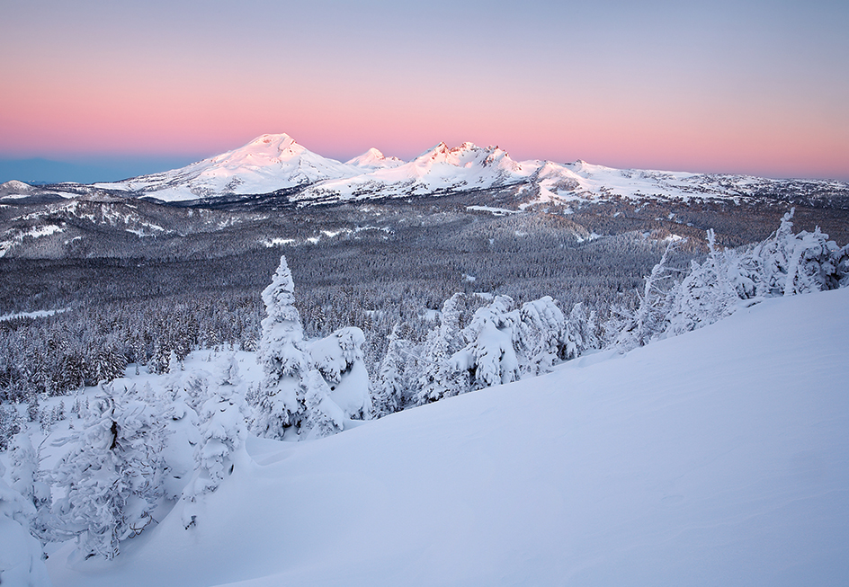
region is a broad belt of rugged land crowned by volcanic peaks. It includes some of the highest mountains in North America. Mount Hood, the highest peak in Oregon, rises 11,239 feet (3,426 meters) above sea level. Mount Jefferson is 10,497 feet (3,199 meters) high. Other peaks in the Cascade Mountains include the Three Sisters, more than 10,000 feet (3,000 meters) high, and Mount McLoughlin, 9,495 feet (2,894 meters) high. See Cascade Range.
The Klamath Mountains
cover the southwestern corner of Oregon. Thick forests grow on the mountainsides. The woodlands provide shelter for a variety of animals. This region also has the state’s richest mineral deposits.
The Columbia Plateau
covers most of eastern Oregon. It extends into Washington and Idaho. This region is also called the Columbia Intermontane. Thousands of years ago, lava flowed out of cracks in Earth’s crust to form the plateau. Deep canyons of the Deschutes, John Day, and other rivers cut through the plateau in north-central Oregon. The state’s great wheat ranches lie there. Much of the so-called “plateau” in Oregon is actually rugged and mountainous. The Blue and Wallowa mountains rise in northeastern Oregon. Timberlands cover the Blue Mountain area. The Wallowa Mountains, cut by glaciers, provide spectacular scenery. The Snake River has carved Hells Canyon on the Oregon-Idaho border. This great gorge lies between the Wallowa Mountains and Idaho’s Seven Devils Mountains. Its average depth is about 5,500 feet (1,680 meters).
The Basin and Range Region
covers part of southeastern Oregon. It extends into California and other nearby states. In Oregon, the region consists of high basins broken by occasional steeply sloped mountains. The Cascade Range to the west cuts off moisture-bearing winds from the Pacific Ocean. As a result, much of the area is almost as dry as a desert.
Coastline.
Oregon’s coastline extends 296 miles (476 kilometers) along the Pacific Ocean. Much of the shore is rugged. Steep cliffs rise from the sea. But many bays and harbors have been formed where rivers from the coast ranges and Klamath Mountains flow into the sea. These bays and harbors include Tillamook, Yaquina, Alsea, Winchester, and Coos.
Rivers, waterfalls, and lakes.
The mighty Columbia River flows westward to the Pacific Ocean. It forms most of the border between Oregon and Washington. The Columbia drains more than half of Oregon. The Columbia and its branch, the Willamette River, form the largest system of navigable waterways in the state. The Snake River forms much of the Oregon-Idaho border. It joins the Columbia in Washington. The Snake and its branches drain the easternmost part of Oregon. The Deschutes River travels northward through central Oregon. It empties into the Columbia. The John Day River rises in the Strawberry Mountains in eastern Oregon. It flows west and north to the Columbia. The John Day River drains much of north-central Oregon.
Hundreds of streams in the Cascade Mountains rush down the slopes in rapids and waterfalls. Among the best known waterfalls are Benham, Pringle, Salt Creek, and Steamboat. There are also many falls along Silver Creek. About a dozen waterfalls tumble into the Columbia River Gorge. These waterfalls include Bridal Veil, Coopery, Elowah, Horsetail, Latourell, and Multnomah. Some of them are over 200 feet (61 meters) high.
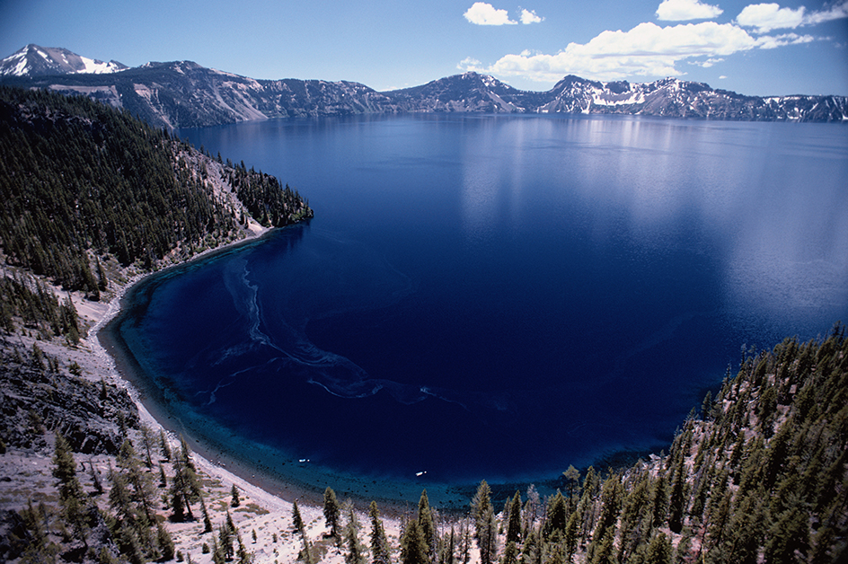
The Cascade Mountains region has many lakes. Crater Lake in the Cascades is the deepest lake in the United States. It is 1,943 feet (592 meters) in depth, The lake lies in the caldera (crater) of an extinct volcano (see Crater Lake). Wallowa Lake in the Wallowa Mountains is famous for its sparkling clear water. Most of the lakes in southeastern Oregon are shallow and salty. Some evaporate during dry seasons and leave salt deposits in the lake beds. But a few, such as Harney and Malheur, are large year-round lakes. A number of small lakes near the Oregon coast formed when deposits of soil and sand blocked the mouths of streams. The blockage kept the streams from emptying into the ocean.
Plant and animal life.
Forests cover nearly half of Oregon. Softwood trees include cedars, firs, hemlocks, pines, and spruces. Hardwoods include alders, ashes, cottonwoods, junipers, madrones, maples, and willows. Many kinds of wildflowers grow in Oregon because the state has a variety of climates and elevations. Oregon is famous for its azaleas, laurels, and other flowering shrubs. The state flower, the Oregon grape, grows in most parts of the state.
Columbian black-tailed deer and Roosevelt elk live in Oregon’s Cascade Mountains and coastal forests. Mule deer, Rocky Mountain elk, and bighorn sheep are found east of the Cascades. Pronghorns thrive in the southeast. A small number of mountain goats live in the Wallowa Mountains. Smaller animals found in Oregon include beavers, bobcats, coyotes, foxes, minks, muskrats, and river otters. Seals and sea lions live along the coast.
Every year, thousands of salmon leave the ocean and swim up Oregon’s rivers to lay their eggs. The fish leap up low waterfalls. They climb fish ladders to get around dams. Cod, halibut, herring, ling cod, sablefish, sole, and tuna live in Oregon’s coastal waters.
The steelhead is perhaps the most prized of Oregon’s many game fishes. Other fishes in the state’s rivers and lakes include perch; striped bass; sturgeon; and cutthroat, brook, and rainbow trout.
Climate.
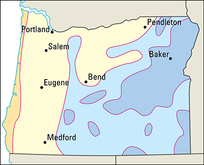
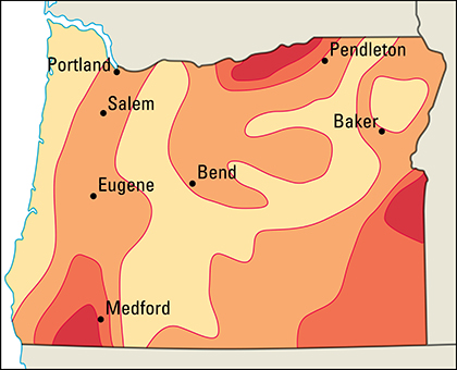
Mild, moist winds from the Pacific Ocean give western Oregon an unusually mild climate for a state so far north. Coastal temperatures average 45 °F (7 °C) in January. Temperatures average 60 °F (16 °C) in July. The winds become cooler when they rise over the coast ranges. Much of their moisture condenses and falls as rain. In some coastal mountain areas, yearly precipitation exceeds 180 inches (457 centimeters). 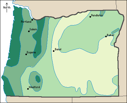
In the Willamette Valley, east of the Coast Range, precipitation averages about 40 inches (100 centimeters) a year. Most of it falls between November and March. As the winds rise up the western slopes of the Cascade Mountains, more of their moisture falls. Precipitation in this area averages 50 to 75 inches (130 to 191 centimeters) a year.
The winds are usually dry by the time they have crossed the Cascades. Dry winds do not keep the climate mild, as moist winds do. For this reason, eastern Oregon has cold winters and hot summers. In the southeast, temperatures average 30 °F (–1 °C) in January. They average 72 °F (22 °C) in July. Much of eastern Oregon receives only 6 to 12 inches (15 to 30 centimeters) of precipitation a year. Oregon’s record low of –54 °F (–48 °C) occurred on Feb. 9, 1933, at Ukiah. The same temperature was reached on Feb. 10, 1933, at Seneca. The highest temperature, 119 °F (48 °C), occurred at Pendleton on Aug. 10, 1898, and at Moody Farms and Pelton Dam on June 29, 2021.
Economy
Service industries, taken together, account for over half of Oregon’s gross domestic product. Gross domestic product is the total value of all goods and services produced in the state in a year. Manufacturing is also an important industry, accounting for much of the state’s gross domestic product and employment. The electronic products industry became Oregon’s most important manufacturing sector during the 1990’s. Factories in the Portland area produce such high-technology products as computer products and digital televisions. Wood processing was formerly the leading manufacturing activity. It still plays a significant role. The economies of many Oregon cities rely almost entirely on this industry.
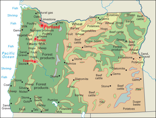
The Cascade Mountains divide Oregon into two major economic regions. Manufacturing and service industries are concentrated in the Willamette Valley in western Oregon. Western Oregon also produces flower bulbs, milk, seed crops, timber, and vegetables. The dry lands east of the Cascades are most important for cattle, wheat, and potato production.
Millions of tourists visit Oregon yearly. Tourism contributes billions of dollars annually to the state’s economy.
Natural resources.
Oregon’s many natural resources include vital forestlands, small deposits of many minerals, a plentiful water supply, and fertile soils.
Forests.
Oregon is one of the leading states in timber production. Forests cover nearly half the state. Oregon has two forest regions, the Douglas-fir region west of the Cascade Mountains and the ponderosa (western yellow) pine region east of the mountains. 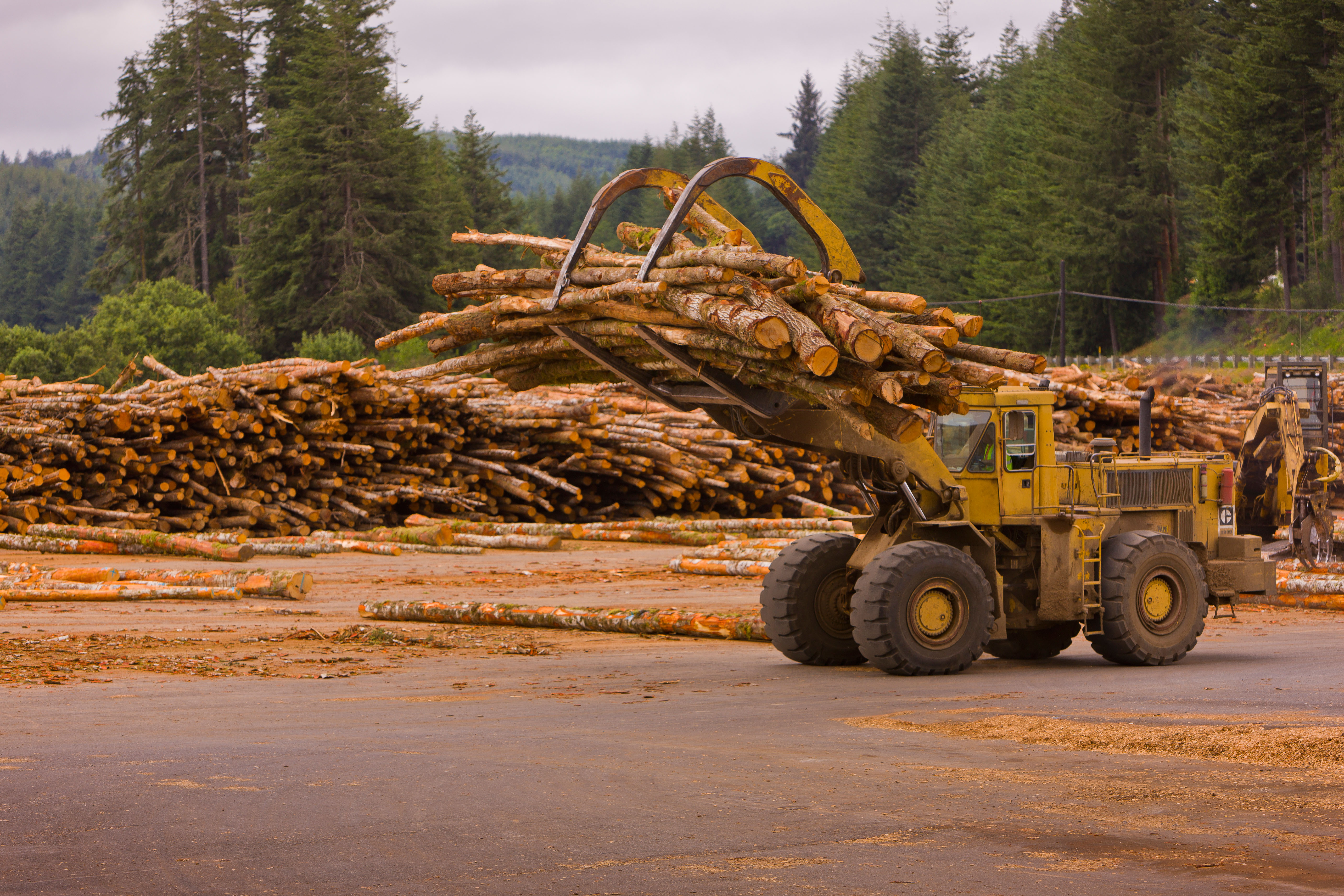
The Douglas-fir, Oregon’s state tree, provides the largest amount of timber. Ponderosa pine, western hemlock, western redcedar, Sitka spruce, and several kinds of true firs also grow in the Douglas-fir region. Some Douglas-fir trees grow in the ponderosa pine region. So do Engelmann spruce, western white pine, lodgepole pine, sugar pine, and true firs. See Douglas-fir.
Minerals.
Widespread deposits of crushed stone and of sand and gravel are Oregon’s most important mined resources. These resources are found in almost all parts of the state.
A small natural gas field lies beneath Columbia County in the northwestern part of the state. Diatomite, which is used to make filters, is found in east-central Oregon. The state also has deposits of clays, copper, gemstones, gold, lime, pumice, and talc.
Water
is one of Oregon’s most important resources. Melted snow and winter rain from the mountains feed Oregon’s rivers. The rivers provide unusually pure water for industry and home use. The Columbia River and its tributaries provide water for power and irrigation.
Soils.
Gray-brown soils cover the Coast Range and Klamath Mountains regions. The Willamette Lowland has deep, fertile soils. Shallow soils cover most of the eastern Cascade slopes, and the Basin and Range Region. The wheat belt of north-central Oregon has rich soils good for growing crops.
Service industries
produce the largest portion of Oregon’s employment and gross domestic product. These services are concentrated in the state’s metropolitan areas, especially in the Portland area.
Portland is the state’s main financial center. Oregon Health and Science University in Portland is a center of medical research. The Port of Portland, one of the largest ports on the West Coast, handles much wholesale trade. Its trade includes the import of foreign cars and the export of wheat.
Many hotels, restaurants, and retail trade establishments are in the Eugene, Portland, and Salem areas. State government agencies are based in Salem, Oregon’s capital. Nike, a distributor of athletic shoes and other sportswear, is based in Beaverton.
Manufacturing.
Computer and electronic products are Oregon’s leading manufactured products. Most of these products are made in the Corvallis, Eugene, and Portland areas. Oregon’s factories manufacture computer components, digital television sets, microprocessors, and oscilloscopes.
Much of Oregon’s manufacturing is dedicated to processing its agricultural and forest products. The Portland and Salem areas are the leading food-processing areas. Frozen fruits and vegetables are the leading products of this industry. Other foods made in the state include baked goods and dairy products. Oregon is a leading state in lumber production. It is also a major producer of particleboard, plywood, and veneer. Many parts of western Oregon have large wood-processing plants. Paper mills are mostly in northwestern Oregon.
The Portland area is the center of production for fabricated metal products, machinery, primary metals, and transportation equipment. Fabricated metal products include machine shop products, tools, and other items. Factories produce machinery for the wood products and metalworking industries. Primary metal products include aluminum and steel. Motor homes, ships and boats, and parts for motor vehicles and the aerospace industry are important transportation products.
Agriculture.
Farmland covers about a fourth of Oregon’s land area. Greenhouse and nursery products are among the state’s leading agricultural products. Northwestern Oregon is an important bulb-growing region. Farmers there grow daffodils, gladioli, irises, lilies, peonies, and tulips for bulbs. 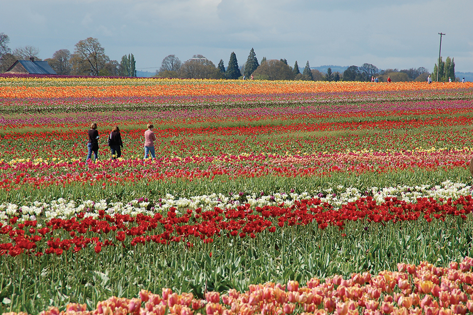
Timber is another valuable agricultural product in Oregon. The most important timber trees are Douglas-fir and ponderosa pine. Douglas-fir trees grow mainly in the Cascade Mountains region and in smaller ranges west of the Cascades. Ponderosa pines grow primarily in the Blue Mountains of eastern Oregon. The state is a leading producer of Christmas trees.
Beef cattle and milk are also important agricultural products in Oregon. Most beef cattle are raised on ranges east of the Cascades. Northwestern Oregon has many herds of dairy cattle.
Wheat is Oregon’s most valuable food crop. Most wheat grows in the northern part of the Columbia Plateau. Hay is Oregon’s most important feed crop. Much of the hay is grown in the southeastern part of the state.
Oregon ranks among the top states in vegetable production. Onions and potatoes are the leading vegetables. Large onion and potato crops grow on irrigated land in the eastern part of the state. Much of the state’s other vegetables grow in the Willamette Valley, the state’s most diverse agricultural region. These vegetables include green peas, snap beans, and sweet corn. Other western Oregon crops include hops, which are used in making beer, and hazelnuts (also called filberts). Oregon is the nation’s only hazelnut producer.
Oregon is among the leading states in the production of berries, pears, and sweet cherries. North-central Oregon leads the state in apple, cherry, and pear production. Berries grow mainly in the northwestern part of the state.
Oregon farmers specialize in several crops that are not grown widely in many other states. For example, Oregon produces most of the nation’s seed for crimson clover, fescue, orchardgrass, and ryegrass. Bentgrass and Kentucky bluegrass are also important products in Oregon. These crops are grown mainly in Willamette Valley counties. Oregon is also a leader in the production of peppermint oil.
Sheep are raised primarily in western Oregon. Willamette Valley farmers raise most of the state’s chickens. Farmers in Oregon also raise goats, hogs, and minks.
Mining.
Two mined products—sand and gravel and traprock—provide much of Oregon’s mining income. These products are mined in several regions of the state. Oregon is a leading state in the production of diatomite, gemstones, perlite, and pumice. Other mined products include clays, lime, and portland cement. Oregon is the only state to produce emery.
Fishing industry.
Oregon ranks as a leading state in the catch of crabs, hake, sablefish, salmon, and tuna. Shrimp and squid are also among the state’s leading catches.
Electric power and utilities.
Hydroelectric plants supply about half of the state’s electric power. Most of the hydroelectric power comes from dams on the Columbia River between Oregon and Washington. They include Bonneville, John Day, McNary, and The Dalles. The remaining hydroelectric power comes from dams on rivers entirely within Oregon, including the Deschutes, Rogue, and Willamette. Plants powered by natural gas or wind supply most of the rest of the power.
Transportation.
From 1841 to the coming of the railroads in the 1860’s, thousands of people traveled the famous Oregon Trail to Oregon. Today, Oregon has an extensive system of roads and highways. Rail lines carry freight on thousands of miles of rail track in the state. Passenger trains serve several Oregon cities.
Portland International Airport is one of the major airports in the western United States. Oregon also has airports in Eugene, Hillsboro, and Medford.
Portland is a major ocean port, though it is about 100 miles (160 kilometers) inland. Oceangoing ships follow a deepened channel up the Columbia and into the Willamette River to reach Portland’s harbor. Oregon’s other major ports are Astoria and Coos Bay. 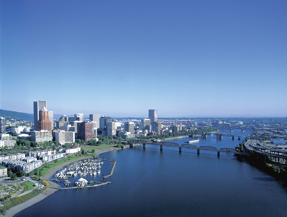
Communication.
Oregon’s first newspaper, the Oregon Spectator, began publication at Oregon City in 1846. It is no longer published. The Oregonian was established in Portland in 1850 as the Weekly Oregonian. The Oregon Statesman (now the Statesman Journal) appeared in Oregon City in 1851. It later moved to Salem. These two papers are still published today. Other leading newspapers in Oregon include the Mail Tribune of Medford and The Register-Guard of Eugene.
Government
Constitution.
The present state Constitution was adopted in 1857, two years before Oregon joined the Union. Constitutional amendments may be proposed by either house of the legislature. A majority of each house must approve the amendments. Voters must then approve the amendments in the next regular general election, unless the legislature orders a special election.
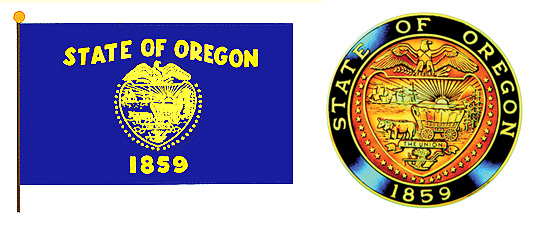
Constitutional amendments may also be proposed and passed directly by the people. These powers are called initiative and referendum (see Initiative and referendum). The Constitution may also be revised by a constitutional convention. A convention may be called after a majority of legislators and voters give their approval.
Executive.
Oregon voters elect the governor to a four-year term. The governor has the power to appoint members of many state boards and commissions. Other top state officials include the attorney general, commissioner of labor and industries, secretary of state, and treasurer. These officials are also elected to four-year terms.
Legislature
is called the Legislative Assembly. It consists of a Senate of 30 members and a House of Representatives of 60 members. The state has 30 senatorial districts and 60 representative districts. Voters in each senatorial district elect one senator. Voters in each representative district elect one representative. 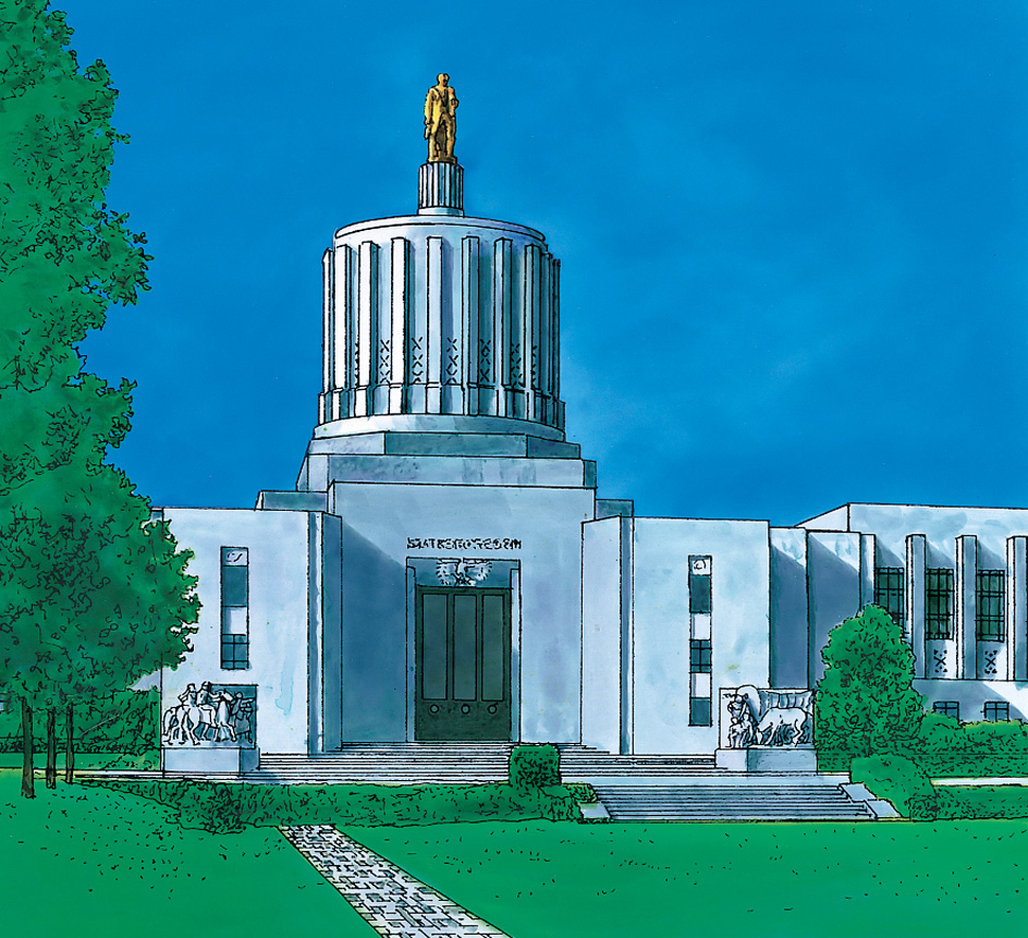
State senators serve four-year terms. Representatives serve two-year terms. Legislative sessions begin in January in odd-numbered years and February in even-numbered years. Regular sessions run no longer than 160 days in odd-numbered years and 35 days in even-number years.
Courts.
The highest court in Oregon is the state Supreme Court. It has seven justices elected to six-year terms. The court elects one of its members to serve a six-year term as chief justice. The next highest state court is the Court of Appeals. It has 13 judges who are elected to six-year terms.
Oregon is divided into 27 judicial districts. Each judicial district has one or more circuit court judges. Voters elect the circuit court judges to six-year terms by nonpartisan (no-party) ballot. A special Tax Court ranks with the circuit courts. Lower courts in Oregon include district, county, justice, and municipal courts.
Local government.
Oregon gives its cities and towns home rule. This means they have the right to choose their own form of government. Most cities with more than 5,000 people have the council-manager form of government. Portland has a mayor and four commissioners. Most of Oregon’s smaller cities have a mayor and a city council.
A 1958 amendment to the state Constitution extended home rule privileges to Oregon counties. However, only 9 of the state’s 36 counties have taken action under this law. The nine home rule counties in Oregon are Washington and Lane (1962), Hood River (1964), Multnomah (1967), Benton (1972), Jackson (1978), Josephine (1980), Clatsop (1989) and Umatilla (1993). A three- or five-member board of commissioners governs most counties in Oregon. In most cases, the county commissioners are elected to four-year terms.
Revenue.
Taxes account for about two-fifths of the state government’s general revenue (income). Other sources of revenue include charges for government services and grants from the federal government. The most important source of tax revenue is a personal income tax. Other major sources of tax revenue are taxes on corporate income, motor fuels, motor vehicle licenses, and tobacco products. The state also receives revenue from a lottery. Oregon has no state sales tax.
Politics.
The Republican Party controlled Oregon politics during most of the state’s history. Many industrial workers who settled in Oregon cities after the 1940’s caused changes in the state’s politics. In the mid-1950’s, registered Democrats began to outnumber registered Republicans.
Oregon’s population became significantly more urban following economic changes in the mid-1900’s. The trend helped tilt the state toward the Democrats, who have their greatest strength in larger cities. Since the late 1980’s, Democrats have dominated their Republican foes in elections for governor and president.
History
Early days.
When the first white people entered the Oregon region, many Indigenous tribes lived there. The white people called these people Indians. The Chinook lived along the lower Columbia River. They fished for salmon. The Clackama, Kalapuya, Multnomah, and Tillamook also made their homes in the northwest. The Bannock, Cayuse, Paiute, Umatilla, and a major band of the Nez Perce lived east of the Cascade Mountains. The Klamath and the Rogue lived near the border with California.
Exploration and settlement.
Spanish explorers sailing north from Mexico in 1543 were the first white people to see the Oregon coast. Sir Francis Drake of England may have seen Oregon’s southern coast in 1579 while searching for a water route between the northern Pacific and Atlantic oceans.
In 1778, British explorer James Cook sailed to Yaquina Bay. Cook also named Cape Foulweather as he went north. In 1788, the first American ships arrived off the Oregon coast. One ship was led by Captain Robert Gray. In May 1792, Gray became the first to sail into the Columbia River, which he named for his ship. A few weeks later, British captain George Vancouver was exploring the Northwest coast, Vancouver sent William Broughton, one of his lieutenants, into the Columbia. Broughton probably sailed as far as the Sandy River, east of present-day Portland. He named such landmarks as Mount Hood and Mount St. Helens. The explorers Meriwether Lewis and William Clark reached the mouth of the Columbia by land in 1805. The Lewis and Clark expedition, together with Gray’s trip on the Columbia River, gave the United States a strong claim to the Oregon region. 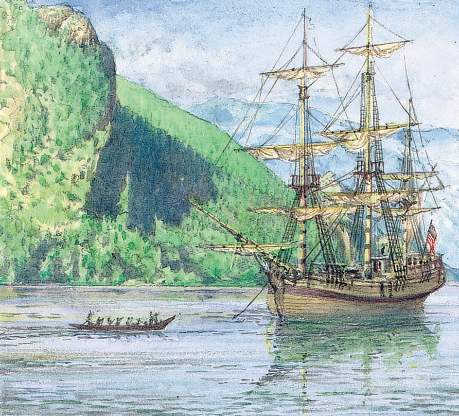
In the early 1800’s, the Oregon region stretched from Alaska to California. Alaska was claimed by Russia. California was claimed by Spain. The Oregon region extended eastward from the Pacific Ocean to the Rocky Mountains. Russia, Spain, the United Kingdom, and the United States claimed parts of the region. Russia based its claims on Russian explorations along the northern Pacific Coast. In treaties with the United Kingdom and the United States in 1824 and 1825, Russia gave up its interests south of 54°40′ north latitude. In 1819, by treaty, Spain gave up its claim north of 42° north latitude. That line forms Oregon’s present southern boundary. The United Kingdom and the United States could not agree on a boundary line. They signed a treaty in 1818 that permitted citizens of both countries to trade and settle in the region. The treaty was renewed in 1827.
John Jacob Astor, an American fur trader, began the white settlement of Oregon. His company, the Pacific Fur Company, set up a fur-trading post at Astoria in 1811. But the North West Company, a British fur company, gained possession of Astoria in 1813 during the War of 1812. In 1821, the company merged with the Hudson’s Bay Company, another British trading firm. This firm founded Fort Vancouver (now Vancouver, Washington) in 1825. John McLoughlin guided the activities of the Hudson’s Bay Company. He ruled the region for about 20 years. McLoughlin played a leading part in settling the region. He later became a U.S. citizen. Today, he is known as the father of Oregon (see McLoughlin, John).
In 1834, Methodist missionaries established the first permanent American settlement in the Willamette Valley. The first large overland migration into Oregon came in 1843. That year, about 900 people traveled the Oregon Trail and settled in the Willamette Valley. Hundreds of American settlers arrived each year from then on. The increasing number of settlers put pressure on the U.S. government to settle the boundary dispute with the British. In 1844, James K. Polk based his campaign for the presidency partly on the claim that land south of latitude 54° 40′ belonged to the United States (see Fifty-Four Forty or Fight). In 1846, President Polk signed a treaty with the United Kingdom. It fixed the 49th parallel as the chief dividing line between United States and British territory. 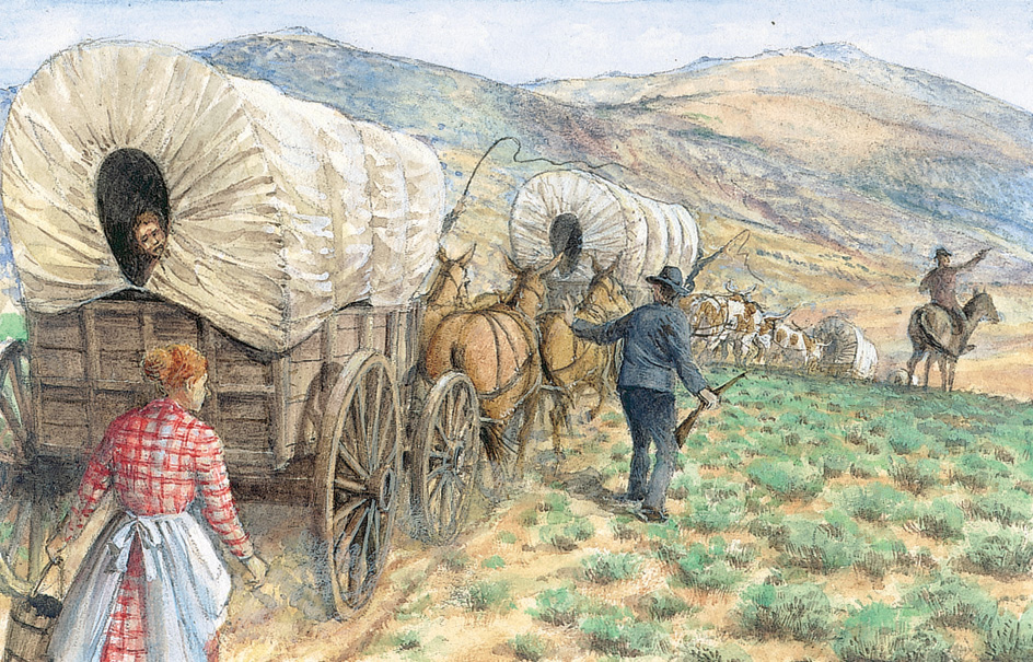
Treaties and conflicts.
In 1847, Cayuse warriors killed the American pioneer Marcus Whitman, along with his wife and several other settlers, near present-day Walla Walla, Washington (see Whitman, Marcus; Whitman, Narcissa). These killings led to the Cayuse War of 1847-1848. They also resulted in the execution in 1850 of five Cayuse held responsible for the killings.
The federal government began negotiating treaties with Oregon’s Indigenous peoples in the 1850’s. In several treaties, Native Americans ceded (gave up) millions of acres of land to the United States. The tribes kept small reservations and off-reservation rights for themselves. The treaties did not halt conflict between Native Americans and settlers, however. The discovery of gold in southwest Oregon during the early 1850’s led to a series of conflicts between white miners and Indigenous peoples. The resulting Rogue River War ended in 1856. The Native Americans were removed to a reservation on the central coast of Oregon.
One of the major so-called Indian wars, the Modoc War, lasted from November 1872 to June 1873. The U.S. government forced the Modoc tribe onto the Klamath Reservation. But many Modoc fled from the reservation. They hid near the California border among lava beds, which provided a natural fortress. A small band of warriors kept more than a thousand U.S. soldiers at bay until they finally surrendered.
The Nez Perce War occurred in 1877. That year, the government ordered several Nez Perce bands to move from their traditional lands in the Wallowa Valley and other areas to a reservation in Idaho. Some bands resisted. One group, led by Chief Joseph, tried to escape through Idaho and Montana. Joseph and more than 400 Nez Perce finally surrendered near the Canadian border. The Paiute and Bannock tribes rose against Oregon settlers in 1878. But they were quickly defeated.
Provisional and territorial governments.
In 1843, settlers in the Willamette Valley met at Champoeg (near present-day Newberg) and organized a provisional government. The settlers adopted a set of laws based on the laws of Iowa.
Oregon became a territory in 1848. Oregon City was proclaimed the territorial capital in early 1849. The legislature moved to Salem in 1851. Oregon’s northern boundary was drawn in 1853, when Congress created the Washington Territory.
The Donation Land Law of 1850 spurred territorial growth and development. This law gave land to any male American citizen over 18 who settled in Oregon before December 1850. Each man could receive 320 acres (129 hectares) of land. His wife could also receive 320 acres of her own. To qualify for ownership, a man had to cultivate his claim for four years. From December 1850 to December 1855, a settler had to be at least 21 to receive land. He also got less land, only 160 acres (65 hectares). A settler’s wife could receive the same amount.
Progress as a state.
Oregon joined the Union as the 33rd state on Feb. 14, 1859. Salem became the state capital. During the American Civil War (1861-1865), state volunteers protected eastern Oregon against attacks from Indigenous warriors. The attacks continued for 15 years after the war. The white population increased rapidly after the war. The population increased because former soldiers sought opportunities in the West. The population grew from about 52,000 in 1860 to over 300,000 by 1890. Much of this increase occurred during the 1880’s after the arrival of the transcontinental railroads. 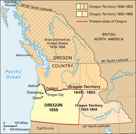
The early 1900’s.
In 1902, Oregon adopted the initiative and referendum. These procedures permit voters to take a direct part in lawmaking (see Initiative and referendum). In 1908, Oregon adopted the recall. The recall is a procedure for removing undesirable officials from office. The use of these direct-government procedures became known as the Oregon system. Many states have passed initiative, referendum, and recall laws based on this system.
In 1903, Heppner, in north-central Oregon, suffered one of the worst natural disasters in the state’s history. Flash floods killed about 200 people. The flooding destroyed about one-third of the town.
In 1912, Oregon gave women the right to vote. Passage of the law followed a long and difficult campaign for women’s rights led by Abigail Jane Scott Duniway. See Duniway, Abigail Jane Scott.
During the Great Depression of the 1930’s, the federal government provided money to build Bonneville Dam on the Columbia River. The dam and nearby locks supplied electric power for industry. They also improved the river for navigation. Owyhee Dam was completed in 1932. The dam provided irrigation water for vast areas of farmland in the Owyhee and Snake river valleys.
The mid-1900’s.
By 1940, Oregon’s population had grown to more than a million. During World War II (1939-1945), many of the state’s factories produced military equipment. Portland became a major port for shipment of supplies to the Soviet Union and to U.S. armed forces in the Pacific. The city’s shipyards produced cargo vessels and warships. Thousands of people from other states came to work in Oregon defense plants. Many of them settled in the state after the war.
During the 1950’s, McNary and The Dalles dams were built on the Columbia River. The dams increased Oregon’s supply of low-cost electric power. In 1956, pipelines brought natural gas into the state. Both developments contributed to Oregon’s industrial growth. Many people began to move from rural to urban areas to take manufacturing jobs.
Important changes took place in the Oregon timber industry during the 1960’s. In the past, sawdust, bark, and other logging by-products had been wasted. Now, Oregon companies began to use many of these materials to make hardboard, pulp, and other wood products. Forestry specialists discovered new uses for forest products. They also studied ways to conserve the state’s timber reserves. The industry replanted an increasing number of trees to replace those that had been cut down.
Changes also occurred in Oregon agriculture. The state’s farms became larger and more closely linked with food processing. Farmers used more machinery. Irrigation projects allowed farmers to grow fruits and vegetables on land that once had been too dry for any crops except grasses.
Low-cost hydroelectric power from dams on the Columbia and Willamette rivers helped Oregon’s economy grow during the 1960’s. Industries grew in importance. They included the manufacture of electrical equipment, machinery, and metals.
Some of the worst floods in Oregon’s history occurred in 1948 and 1964. They caused millions of dollars of damage. The floods killed several people and forced thousands from their homes.
The late 1900’s.
In the late 1960’s, Oregon became known for its legislation to protect the environment. In 1967, Governor Tom McCall led efforts to pass the Oregon Beach Bill. That law protected the state’s beaches from private development. In 1971, the state legislature passed the Beverage Container Act, or “bottle bill.” It required that nearly all beverage containers be returnable for a cash refund. In 1973, Oregon formed the nation’s first statewide urban growth management system. The system protected the state’s farmland and forestlands by setting boundaries to city expansion.
A number of dams were completed on the Columbia and Snake rivers during the early 1970’s. The dam building provided deepwater transportation from the mouth of the Columbia to Lewiston, Idaho. These dams also increased the hydroelectric power capacity in Oregon. The power output of Bonneville Dam more than doubled in 1982. The doubling resulted from construction of a second powerhouse. Bonneville Dam was the first federal dam on the Columbia River.
In the early 1980’s, Oregon experienced its worst economic crisis since the Great Depression. A decline in housing and construction led to hard times in the lumber, wood processing, and construction industries. Many Oregon lumber mills closed. Many jobs were lost in the wood and construction industries. Low prices for farm products, including wheat and dairy and livestock products, contributed to the crisis.
Improvements in Oregon’s economy began in the mid-1980’s and continued in the 1990’s. Some of the lumber mills that had closed reopened. The electronics industry became important. Employment in trade and other service industries grew more rapidly than jobs in manufacturing. Expansion of the fruit, grass seed, nursery, nut, and wine industries also improved economic conditions.
Recent developments.
In 1991, Barbara Roberts became Oregon’s first woman governor. She served until 1995. John Kitzhaber, who was elected governor in 1994, 1998, 2010, and 2014, resigned in 2015 while under investigation for an ethics scandal and other potentially criminal matters. Secretary of State Kate Brown succeeded Kitzhaber in office.
On Oct. 1, 2015, a mass shooting occurred at Umpqua Community College in Roseburg, Oregon, about 180 miles (290 kilometers) south of Portland. A gunman shot 16 people, killing 9, before he was killed in a shootout with police.
In early 2016, a standoff between law enforcement and armed protesters drew national attention to eastern Oregon. For several weeks, protesters demonstrating against federal land-use policies occupied the Malheur National Wildlife Refuge in Harney County, Oregon. One of the protesters was killed in a conflict with state police. In February, a federal grand jury indicted several protesters with “conspiracy to impede officers of the United States from discharging their official duties through the use of force, intimidation, or threats.” Only one of the protesters charged was an Oregon resident. In October, a federal jury found the protesters not guilty of the conspiracy charges.
In the early 2020’s, the nation’s West Coast experienced its worst wildfire seasons in recorded history. A number of large fires burned during dry, windy conditions in Western Oregon in September 2020. Numerous communities were evacuated, and thousands of homes were destroyed. In mid-2021, a record-breaking heat wave contributed to more than 100 deaths in Oregon. High temperatures and drought led to the spread of severe wildfires.
