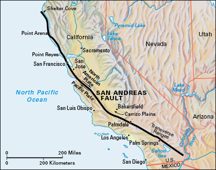
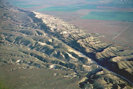
San Andreas, << `san` an DRAY uhs, >> Fault is a long fracture in the earth’s crust marked by a zone of disrupted land in California. The fault extends about 600 miles (970 kilometers) from off the coast of northwestern California to the southeastern part of the state.

According to the theory of plate tectonics, the earth’s outer shell consists of a number of rigid plates that are in slow, continuous motion with respect to one another. During the past 15 million years, the San Andreas Fault has formed part of the boundary between the Pacific Plate and the North American Plate. During this time, coastal California, along with the rest of the Pacific Plate, has moved about 190 miles (300 kilometers) in a northwesterly direction with respect to North America. Today, movement along the San Andreas Fault averages 2 to 21/4 inches (5 to 6 centimeters) yearly.

The movement of the plates along the San Andreas Fault produces strain on the rocks near the plate boundary. Along some segments of the fault, the strain is released by frequent small earthquakes that do little damage. But along certain other segments of the fault, the plates are locked in place, and the strain builds up over many years. The built-up strain occasionally produces a major earthquake. In 1857, a sudden movement along a segment of the San Andreas Fault in the Transverse Ranges caused a severe earthquake in southern California. In 1906, movement along another fault segment resulted in a major earthquake in San Francisco. These two areas of the fault are locked and are likely to produce a major earthquake once every few hundred years.
See also Earthquake ; Plate tectonics ; San Francisco earthquake of 1906 .
