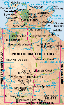
Simpson Desert lies in Australia on the border of Queensland, South Australia, and the Northern Territory. It is about 200 miles (320 kilometers) long and 100 miles (160 kilometers) wide. The center of the desert is an area of sand drift. The outer parts of the desert include bare, rocky hills, sand ridges that range up to 50 feet (15 meters) high, and rounded stones called gibbers. The Simpson Desert is located in the driest region of Australia. Average rainfall in the desert is about 6 inches (15 centimeters). The Simpson Desert is extremely hot during the day but it turns cool at night. Daily high temperatures between 100 °F (40 °C) and 120 °F (50 °C) are common in the summer. In the winter, temperatures can fall below freezing.
Aboriginal people have lived in the Simpson Desert region for thousands of years. The British explorer Charles Sturt in 1845 became the first European to see the desert. The first person of European descent to successfully cross the Simpson Desert was Edmund Albert Colson. In 1936, Colson, with the help of his Aboriginal companion Peter Ains and five camels, traveled 550 miles (885 kilometers) in 35 days. The Australian geologist and explorer Cecil Thomas Madigan led a team that conducted the first biological survey of the desert in 1939. Madigan named the desert after A. A. Simpson, the sponsor of the expedition and the former president of the South Australian branch of the Royal Geographical Society of Australia.
Part of the Simpson Desert lies within Munga-Thirri National Park, Queensland’s largest protected area. The South Australian section of the desert is divided into three protected areas: the Simpson Desert Conservation Park, the Simpson Desert Regional Reserve, and the Witjira National Park. The Simpson Desert is home to many mammals, reptiles, and bird species. Some of the rare animal species that live in the Simpson Desert region include the kowari (a small, carnivorous marsupial) and the grey grasswren.
