Gujarat (pop. 60,439,692) is a state in northwestern India, on the border with Pakistan. The state takes its name from the Gujara, who ruled the area during the 700’s and 800’s. The state covers an area of 75,685 square miles (196,024 square kilometers). The capital is Gandhinagar, on the outskirts of Ahmadabad.
Agriculture is the principal economic activity but there is substantial industry, particularly around the textile city of Ahmadabad. The state is rich in minerals and, along with Assam, is the country’s major petroleum producer.
People and government
People.
The majority of the population speak Gujarati. Gujarati developed from Sanskrit and other ancient languages. Maritime contacts with Arabia, England, the Netherlands, Persia, and Portugal introduced many words from the languages of those countries.
Hinduism is the main religion, with minorities of Christians, Jains, Muslims, and Parsis. The state has always had a policy of religious tolerance toward its people. The main traditional, local tribes are the Bhil, the Bhangi, the Dhubla, the Koli, and the Naikda. The folk culture of the region derives from the mythology of Lord Krishna as told in the Puranas, one of Hinduism’s sacred texts. The architecture of Gujarat is famous for its fine detail. The region has a long tradition of handicrafts, such as bandhani (tie-dyed cloth), jari (gold and silver embroidery), patola (a beautifully patterned silk for which the thread is tie-died before being woven), perfumes, and woodcarving. 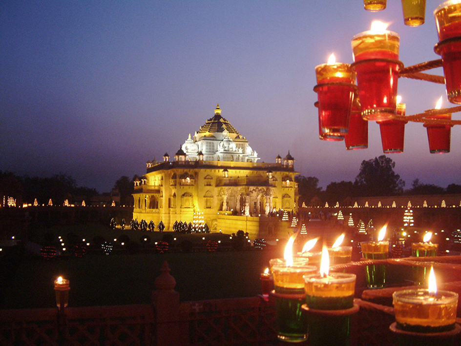
Government.
Gujarat is a federal state with a governor, appointed by the president of India, as its head. A council of ministers, under the chief minister, advises the governor. The state’s legislative assembly has 182 members.
Gujarat has 26 elected members in the Lok Sabha (lower house) and 11 nominated representatives in the Rajya Sabha (upper house) of the Indian national parliament.
At the district level, the chief administrative officer is called the collector. The highest judicial authority in the state is the High Court. Each district has its own court.
The panchayat raj (local council) system extends to all and involves the populace in government and administration. The scheme comprises a gram panchayat (village council) for each village or group of adjacent villages, or a nagar panchayat (town council) for urban areas. These are grouped into taluka panchayats (county councils), which in turn form district panchayats. The people elect representatives to all these bodies.
Economy
Agriculture.
Much of the population works in agriculture. About half of the land area is cultivated. The main crops include bajra (millet) and wheat. Rice is grown in the wetter parts or where irrigation is possible. Corn is also grown.
Gujarat produces much of India’s cotton, peanut, and tobacco crops. Cotton and peanuts provide a foundation for important textile, edible oil, and soap industries. Other important cash crops are bananas, cumin, mangoes, and sugar cane. Cash crops slightly exceed food crops in value and make an important contribution to the regional economy.
With its long coastline, Gujarat has good fishing waters. Pomfret, a favorite in restaurants throughout India, is caught there. Other specialities include Bombay duck, prawns, and tuna.
Manufacturing.
The textile industry has traditionally formed the industrial base of Gujarat. However, in the 1970’s and 1980’s, manufacturing grew rapidly. An expanding petrochemical industry developed around Koyali oil refinery. The pharmaceutical industry, which is centered around Vadodara (Baroda), Ahmadabad, and Atul (Valsad), produces much of the national total. The battery, cement, industrial machinery, and vegetable oil manufacturers are also major contributors to the regional economy. An electronics estate at Gandhinagar produces components for India’s increasingly sophisticated consumer market.
The dairy industry has developed rapidly. Gujarat has many milk processing plants and is a leading producer of milk in India. The state government gives financial support and organizational advice to new cooperatives. To support milk production, many factories have been built to process cattle feed. There has been a steady growth in small-scale industry.
Embroidery, leather work, and hand block printing have been important village industries for hundreds of years. Gujarat is particularly well known for its bandhani work. Silk and gold brocade is produced in Surat, and inlay work, especially on wood, is also popular. Ahmadabad is a major center of metalwork, especially brass and copper. It also produces fine jewelery.
Gujarat is rich in agate, bauxite, calcite, feldspar, gypsum, lignite, limestone, manganese, and quartz sand. The production of oil and natural gas at Ankalesvar, Khambhat, and Kalol makes Gujarat one of India’s leading petroleum-producing states. Koyali has an oil refinery.
Transportation.
Gujarat has tens of thousands of miles of roads, including thousands of miles of national highway. The broad-gauge railway also connects Gujarat with centers in north and west India.
The main airport is at Ahmadabad, which has flights to Mumbai, Jaipur, and Delhi. The state has several other smaller airports.
Kandla is the major international shipping port, and is supported by numerous intermediate and minor ports.
Land and climate
Location and description.
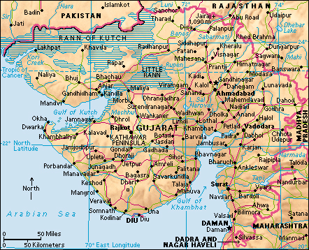
Gujarat has boundaries with Rajasthan to the north, Madhya Pradesh to the east, Maharashtra to the south, the Arabian Sea to the west, and Pakistan to the northwest. It has nearly 1,000 miles (1,600 kilometers) of coastline. No part of the state is more than about 125 miles (200 kilometers) from the sea.
Land features.
Gujarat is a land of great physical contrasts. Kutch, in the northwest, is an arid region. It is bounded to the south by the Gulf of Kutch and to the north and east by the saline wastes of the Rann of Kutch and the Little Rann. The Rann of Kutch is one of the world’s largest salt marshes. During the monsoon rains, the Rann floods, isolating Kutch from the rest of India. The hot, dry summer months bring troublesome dust storms to Kutch.
Farther south, the Kathiawar or Saurashtra Peninsula lies between the Gulf of Kutch and the Gulf of Cambay. This arid peninsula is about 270 miles (430 kilometers) long and 200 miles (320 kilometers) wide. The land rises from the coast to low shrub-covered hills at the center. The towns lie on the coast and in small pockets of fertile land. There are only two major rivers, the Sabarmati and the Mahi. Many of the watercourses are seasonal. The underlying rocks produce poor soils but good building stone. Porbandar is known for its quarries.
Northeastern Gujarat is a continuation of central Kutch, with small plains and low hills. The railway line from Mumbai to Delhi runs through these hills, which surround Ahmadabad.
In the central region around Vadodara, the soils are more fertile. The Narmada River has deposited large quantities of alluvium (soil and silt), producing good agricultural land.
The districts of Broach and Surat lie to the south of Vadodara. The Tapi (or Tapti) River flows through Surat. These two districts have rich soils and produce excellent cotton crops. The forested Western Ghats (mountains) extend into southeast Gujarat.
Climate.
The rainfall in the north and west is very low. The whole of Saurashtra receives less than 20 inches (50 centimeters) a year. At Ahmadabad, rainfall averages 28 inches (70 centimeters) per year, most of this falling during the monsoon months of June to September. The daily winter maximum temperature is 81 °F (27 °C), and the minimum 54 °F (12 °C) (although subzero cold snaps have been recorded). In summer, the daily maximum temperature can reach 118 °F (48 °C), though 108 to 109 °F (42 to 43 °C) is more common. The summer minimum temperature is 77 °F (25 °C). Rainfall is higher in the central region, and the range of temperature is narrower. The highlands in the south receive about 80 inches (200 centimeters) of rain during the monsoons.
Plants and animals.
Vegetation changes according to latitude and altitude. In areas with less than 23 inches (60 centimeters) of rain a year, there is scrub forest with acacia, babul, caper, jujube, and the toothbrush tree. Deciduous trees (trees that shed their leaves annually) grow where local rainfall reaches 40 inches (100 centimeters). Species there include axlewood, bakligum, butea gum, catechu, and teak. The densest concentrations are in Saurashtra and the south and east. Heavier rainfall produces commercially valuable timbers, such as heartleaf adina, Malabar simal, vengai padauk, and woolly tomentosa. The east coast produces paper reed, used for papermaking since ancient times.
The last Asiatic lions live in the Gir National Park and Wildlife Sanctuary in Gujarat. The Little Rann of Kutch has the only surviving wild donkeys in India.
There is a rich birdlife. Peacocks are common throughout the state. Migratory birds from north Europe arrive in Gujarat during the winter. At Nalsarovar Bird Sanctuary, near Ahmadabad, more than 200 species arrive during the year, including cormorant, ibis, pelican, and sarus crane. The Rann of Kutch is the only Indian nesting ground of the large flamingo.
Rivers and lakes.
The major river of Gujarat is the Narmada, which flows through the southern part of the state and enters the Gulf of Cambay. Farmers use its waters for irrigation. The smaller Tapti River runs to the south of the Narmada. Also in this southern region of Gujarat are numerous short, minor rivers which flow off the Western Ghats. The Sabarmati and Mahi rivers flow into the Gulf of Cambay. Some seasonal rivers flow into the Little Rann of Kutch where they dry up.
History
Early empires.
Archaeologists have found Stone Age settlements around the Sabarmati and Mahi rivers in the south and east of the state. The settlements probably date from the time of the Indus Valley civilization. There were also Harappan centers at Lothal, Rampur, Amri, Lakhabaval, and RozdiI.
Rock inscriptions in the Girnar Hills show that the Mauryan emperor Ashoka extended his domain into Gujarat in about 250 B.C. After the fall of the Mauryan Empire, the Sakas or Scythians controlled the region from A.D. 130 to 390. Under Rudradaman, their empire contained Malwa (in Madhya Pradesh), Saurashtra, Kutch, and Rajasthan. During the 300’s and 400’s, the area formed part of the Gupta Empire, which was succeeded by the Maitraka dynasty. During the 900’s, the Solanki dynasty came to power. Under the Solanki, Gujarat reached its greatest extent. There then followed a long period of Muslim rule. Ahmad Shah, the first independent Muslim ruler of Gujarat, founded Ahmadabad in 1411.
The Mughal emperor Akbar conquered Malwa and Gujarat in the 1570’s. The region remained under Mughal rule for nearly 200 years, until the Marathas overran the state in the mid-1700’s.
The coming of the Europeans.
The Dutch, English, French, and Portuguese all established bases along the coast of the region in the 1600’s. The British East India Company set up its first headquarters in India at Surat in 1612. It later moved to Bombay. As British maritime supremacy developed, all but the British and the Portuguese at Daman and Diu withdrew.
The state came under the control of the British East India Company in 1818. After the Indian Rebellion of 1857, the British government ruled directly, dividing the area into a number of princely states.
Until independence, the region of Kathiawad was divided into 86 states, many of them tiny. Even the largest, Junagadh, only had an area of 3,475 square miles (9,000 square kilometers).
Independence and partition.
On Indian independence in 1947, all of Gujarat except Saurashtra and Kutch became part of Bombay state. On May 1, 1960, the government split Bombay state into the states of Maharashtra and Gujarat. All Gujarati-speaking areas were brought together as the present state of Gujarat.
Since partition, India and Pakistan have disputed possession of parts of the Rann of Kutch. In 1965, the dispute became an armed conflict. In 1968, an international tribunal decided that 90 percent of the state should remain with India and 10 percent should pass to Pakistan.
In the 2000’s.
In 2001, an earthquake struck western India and Pakistan, causing at least 30,000 deaths and widespread damage to property. Most of the victims were in Gujarat. In 2002, rioting between Hindus and Muslims in Gujarat killed more than 1,000 people, mostly Muslims.
