Leicestershire (pop. 712,366) is a county in the East Midlands of England. It covers an area of 804 square miles (2,083 square kilometers). Leicestershire is also a ceremonial county. The British monarch appoints royal representatives, including a lord lieutenant and high sheriff, to each of England’s ceremonial counties. The area around the city of Leicester, which lies within Leicestershire, is highly industrialized. Leicestershire first became an administrative division of England in the 800’s.
From 1974 until 1997, Leicestershire included Rutland, which had been the smallest county in England. The people of Rutland fought off an attempt to combine the two counties in 1963. But in a reorganization of England’s local government in 1974, Rutland became part of Leicestershire. In 1996, Rutland and Leicester became separate administrative areas called unitary authorities.
People and government
Local customs.
Many people visit Hallaton on Easter Monday to see the traditional scrambling for hare pie and bottle kicking. Oakham Castle has an interesting collection of horseshoes. Peers of the realm who are passing through Oakham follow a custom of presenting a horseshoe to the castle. Queen Elizabeth I followed the custom, and members of the present Royal Family have also followed the custom.
Recreation.
Point-to-point horse racing is popular in Leicestershire. The region’s cricket team plays in first-class cricket. Mallory Park, near Earl Shilton, and Donington Park, near Castle Donington, have regular motorcycle and automobile races. Leicestershire’s canals, pools, and rivers attract many fishing enthusiasts.
Local government.
Leicestershire, excluding the city and unitary authority of Leicester, is divided into seven local government areas, including four boroughs and three districts. These boroughs and districts are: Blaby << BLAY bee >>, which includes Narborough; Charnwood, which includes Loughborough; Harborough, which includes Market Harborough; Hinckley and Bosworth; Melton; North West Leicestershire, which includes Coalville and Ashby de la Zouch; and Oadby and Wigston. Leicestershire County Council, which has headquarters at Glenfield, near Leicester, provides many public services throughout the county. The Crown Court meets at Leicester. The county’s police force, the Leicestershire Constabulary, has headquarters at Leicester.
Economy
Manufacturing.
Producing hosiery (socks and stockings) was long one of Leicestershire’s main industries. The county also produced knitted fabrics and knitted garments. Many associated industries, such as dyeing and the manufacture of knitting machines, developed. Hinckley has engineering and motor-vehicle industries. Loughborough has engineering works and factories that produce electrical goods and pharmaceuticals. One of the town’s most famous industrial sites is its bell foundry, which was set up more than 100 years ago. The biggest bell that rings in England was cast there. It is Great Paul, at St. Paul’s Cathedral in the City of London.
The town of Melton Mowbray is famous for pork pies. It also produces pet foods and cheese. The town of Ashby de la Zouch, once known for making soap and biscuits, hosts a number of high-technology companies.
Agriculture.
Much of the county’s farmland is permanent grassland, on which beef cattle, dairy cattle, and sheep graze. The county’s best-known dairy products are cheeses, particularly Stilton and Red Leicester. On the arable land, important crops are barley, oats, and wheat. Rose growing is also important.
Mining.
Coal was once mined at Asfordby, near Melton Mowbray. Coal surface mines operated in the northwestern part of Leicestershire until the late 1900’s. Limestone is quarried near Ashby de la Zouch, and granite is quarried in the Charnwood Forest area. The northwestern part of the county produces a type of clay used for making bricks, pipes, and tiles.
Transportation and communication.
The main railroad line from London to Sheffield passes through Leicestershire. Cross-country lines run from Leicester through Hinckley to Birmingham, and from Leicester through Melton Mowbray and Oakham to Peterborough and Norwich.
The M1 and M42 motorways (highways) pass through the county. The M69 links Leicester with Coventry and Birmingham. East Midlands Airport at Castle Donington has regular flights to other parts of the United Kingdom and to the continent of Europe. BBC Radio Leicester is based in Leicester. Several towns publish their own weekly newspapers.
Land and climate
Location and size.
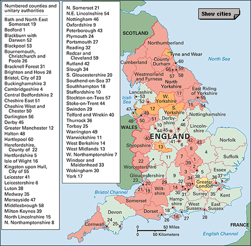
Leicestershire is an almost heart-shaped county, bounded by the counties of Nottinghamshire and Derbyshire to the north, Lincolnshire and the unitary authority of Rutland to the east, Northamptonshire to the south, and Warwickshire and Staffordshire to the west. The unitary authority of Leicester lies in the middle of the county. The distance between Bottesford, the most northern town in Leicestershire and the southern tip of the county is about 50 miles (80 kilometers). The widest part of the county is about 53 miles (86 kilometers) from east to west.
Land regions.
The River Soar divides Leicestershire into two parts as it flows northward to join the River Trent. The two parts are not alike. Gently undulating, grassy hills rise to the west of the Soar. They range from 295 to 395 feet (90 to 120 meters) above sea level. Hills in Charnwood Forest, to the northwest, reach 912 feet (278 meters) at Bardon Hill, the highest point in the county. Charnwood rocks are among the oldest in England and are of great interest to geologists.
High, grassy uplands rise to the east of the Soar. They generally range from 395 to 590 feet (120 to 180 meters) above sea level. But in some places they reach heights of over 690 feet (210 meters) in flat-topped summits, such as Whatborough and Robin-a-Tiptoe.
Rivers.
The two main rivers draining the county are the River Soar and the River Wreake, which joins the Soar just below Leicester. The River Welland forms much of Leicestershire’s southern boundary, and the River Trent forms part of the northern boundary.
Climate.
Leicestershire’s average yearly rainfall is about 25 inches (66 centimeters). September is the wettest month. The average temperature for January is 39 °F (4 °C), and the average temperature for July is 61 °F (16 °C). Winters tend to be dry and severe. In the spring, cold easterly winds often blow as late as May. Summers are warmer than the average for many parts of England, but tend to be sultry, with frequent thunderstorms.
History
Leicester probably already existed as a settled community in about 50 B.C. It was certainly the tribal capital of the Coritani, a late Iron Age tribe. Following their invasion of Britain in A.D. 43, the Romans named the city Ratae Coritanorum after the tribe. Leicester has substantial remains dating from the Roman period.
Leicestershire—the shire (administrative division) of Leicester—was probably first created in the late 800’s, after the Danish occupation of Mercia in 876. John of Gaunt, fourth son of Edward III, became Duke of Lancaster in 1362 and made Leicester Castle one of his favorite residences. He died there in 1399.
A decisive battle was fought at Bosworth Field, in Leicestershire, in 1485. The future Henry VII defeated Richard III, who was killed in the battle. Richard was buried in the church of the Grey Friars. Historians claim that his body was dug up and thrown into the River Soar after the dissolution of the Grey Friars’ monastery in the 1500’s. In 2012, archaeologists discovered Richard’s remains in Leicester, not far from Bosworth Field. In 2015, the remains were buried in a royal tomb at Leicester Cathedral.
The historian Lord Macaulay was born at Rothley Temple. George Fox, founder of the Society of Friends (Quakers), was born at Fenny Drayton, near Hinckley. The conspirator Titus Oates was born at Oakham.
