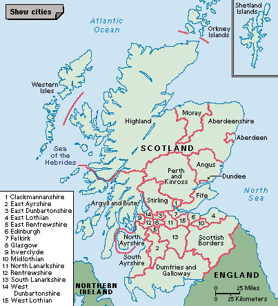
Dumfries and Galloway (pop. 145,895) is the southernmost region of Scotland. It is a council area, the primary form of local government in Scotland. Most of the region is agricultural, with beautiful moorland, forest, and coastal scenery. Dumfries is the region’s largest town.

The northern and eastern parts of Dumfries and Galloway are a plateau covered with bleak moorland. The plateau rises to about 2,750 feet (840 meters). The low-lying land along the coast varies from rocky headlands to mud flats along the estuaries. The Mull of Galloway has cliffs 270 feet (82 meters) high. The main rivers are the Nith, Annan, and Esk.
Many farmers in Dumfries and Galloway raise sheep and cattle. Lowland farms specialize in the production of milk. The Forestry Commission has planted many trees on former grazing lands among the hills. High rainfall and peaty soils encourage rapid growth of conifer trees, especially Sitka spruce, an important source of lumber. Textile manufacturing is Dumfries and Galloway’s leading industry. Tourism also contributes to the economy.
Archaeologists have found many remains from the New Stone Age and Bronze Age in the region. The Iron Age Celtic culture arrived in the area around 300 B.C. The people built hill forts, such as Burnswark, north of Annan. When the Romans moved into the area, they built a fort near Burnswark. Saint Ninian brought Christianity to Whithorn in the late A.D. 300’s.
During the 900’s, the region was overrun by mixed Norse-Celtic invaders, the Gallghaidel. The invaders’ name gave rise to the name Galloway. After David I became king of Scotland in 1124, the area was influenced by the Normans. The Normans founded abbeys and churches and built castles there.
The first overlords of the area were the Balliol family, followed in 1455 by the Douglas family. In the 1400’s, Dumfries became a center of textile manufacturing. The region was the scene of much fighting during the Reformation and other disturbances of the 1500’s and 1600’s.
