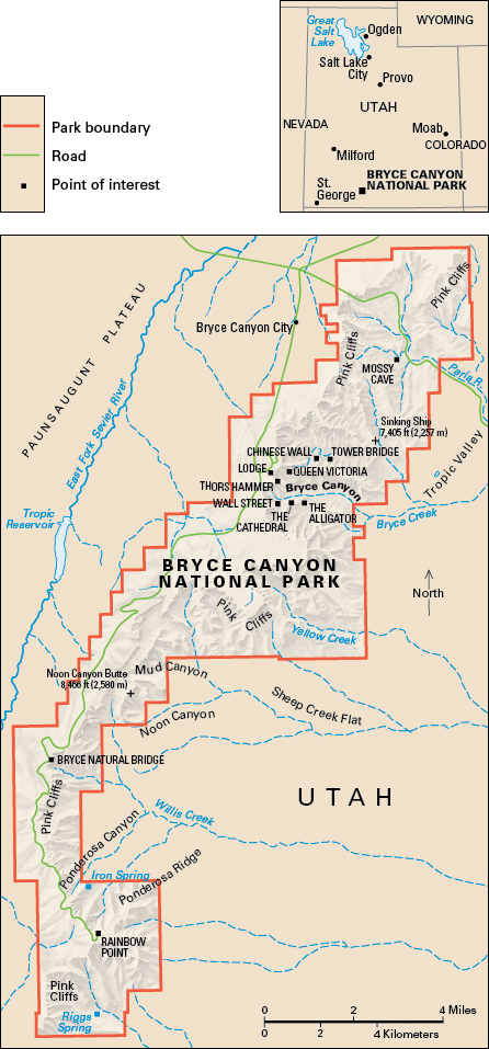
Bryce Canyon National Park, which lies in southern Utah, contains some of the world’s most oddly shaped and beautifully colored rocks. It covers part of the Grand Canyon Region of the Colorado Plateau . It was named for Ebenezer Bryce, a pioneer who settled in the region in 1875.

Water and ice have worn the canyon rocks into odd shapes in numerous shades of red, pink, copper, and cream. The bright colors change with the sunlight. Geologists say that between 40 million and 130 million years of history of Earth’s crust can be read in the rocks.
The park contains a series of valleys that are as much as 1,000 feet (300 meters) deep in some places. Rocks rise up into the shapes of spires, temples, cathedrals, castles, mountains, and wild animals. Bryce Natural Bridge spans a ravine at the south end of the park.
Bryce Canyon National Park was established in 1928. For the area of the park, see National Park System (table: National parks) .
