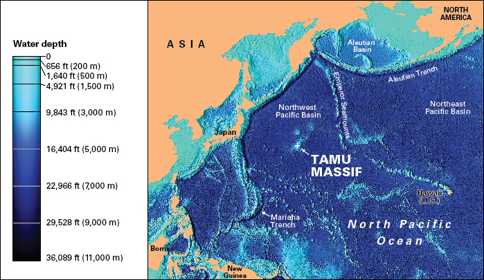
Tamu Massif << MAS ihf or ma SEEF >> is a huge underwater volcano in the Pacific Ocean, about 1,000 miles (1,600 kilometers) east of Japan. Massif is a term in geology for a type of massive rock structure that is harder than the surrounding material. The base of Tamu Massif lies about 4 miles (6.5 kilometers) beneath the ocean surface. Tamu Massif has a total surface area of about 120,000 square miles (310,000 square kilometers) and a height of over 2.5 miles (4 kilometers) from its base. Scientists believe it is the largest single volcano on Earth.

Tamu Massif was discovered by a team of researchers led by William Sager, a marine geophysicist working at Texas A&M University. The name Tamu comes from a common abbreviation of the university’s name. The researchers, who had been studying the huge underwater structure since about 1993, originally thought it was a series of small volcanoes close together. However, information gathered by the Integrated Ocean Drilling Program (IODP) and other underwater surveys confirmed the structure to be a single volcano (see Ocean drilling programs).
Geologists describe Tamu Massif as a shield volcano. The volcano grew from continuously flowing lava building layer upon layer as it cooled. Tamu Massif formed about 145 million years ago, during the late Jurassic Period to the early Cretaceous Period. The volcano was only active for a few million years, and it is currently inactive. The discovery that Tamu Massif is a single, huge volcano has changed how scientists think about marine geology. The sides of Tamu Massif have a broad, gentle slope, leading scientists to suspect that many plateaus on the ocean floor may be extinct shield volcanoes similar to Tamu Massif.
