Colorado River, one of the major rivers in the United States, is 1,450 miles (2,334 kilometers) long. It flows across 1,360 miles (2,189 kilometers) of the United States and 90 miles (145 kilometers) of Mexico. It rises in the Rocky Mountains of Colorado and flows southwest into Utah. It is joined by the Green River in eastern Utah and by the San Juan River in southern Utah. The Colorado then continues southwest into Arizona. After merging with the Little Colorado River in northern Arizona, the river swings west through the Grand Canyon. The Virgin River of Nevada joins its course beyond the Grand Canyon. The Colorado then turns south and forms the Arizona-California border. It then flows across the Mexican border to the Gulf of California. Arizona’s Bill Williams and Gila rivers merge with the river north of the Mexican border. The Colorado drains an area of about 250,000 square miles (650,000 square kilometers).
Loading the player...Colorado River
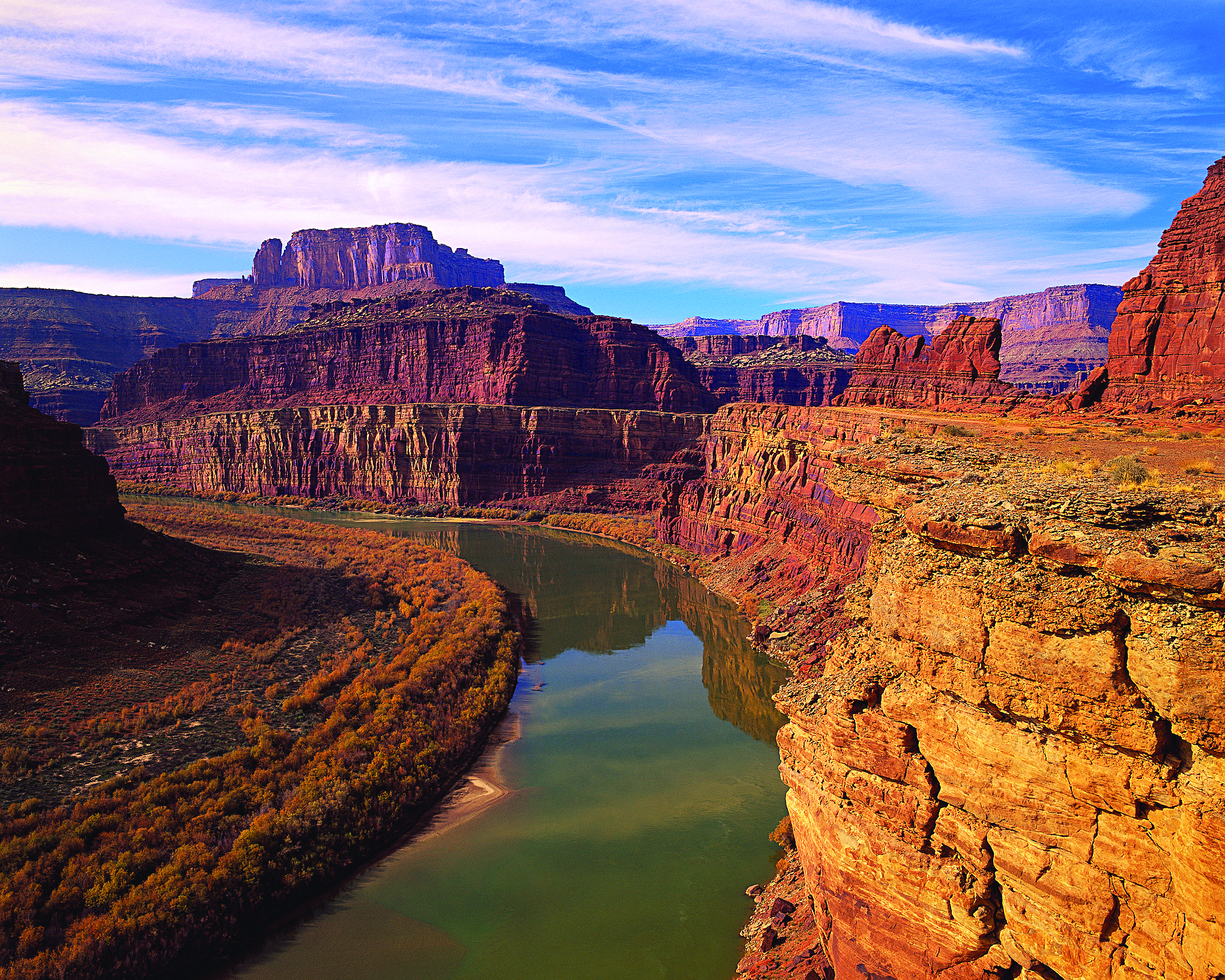
The Grand Canyon of the Colorado River presents an outstanding example of the effects of wind, water, and weather on the earth’s surface. For millions of years, the river worked its way into layer after layer of rock, gradually deepening and broadening its channel. Sand, pebbles, and boulders carried by the river produced a constant grinding action. The action of wind and temperature and the gradual elevation of the Colorado plateau added to the effect of the grinding. The Grand Canyon now consists of a great gash in the earth 1 mile (1.6 kilometers) deep. It ranges from less than 1 mile to 18 miles (29 kilometers) wide.
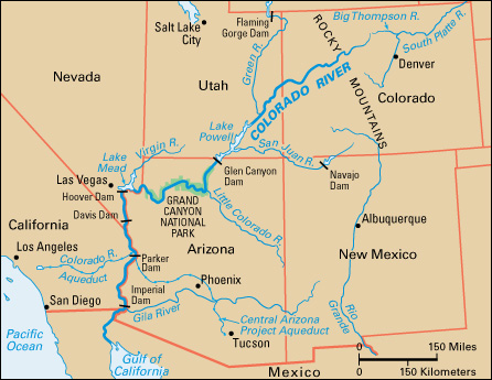
Many rapids and waterfalls lie along the course of the Colorado. The waters carry tons of silt and sand. Until Hoover Dam was built, the river deposited these materials in its lower river valley, forming a rich delta country in Mexico. The Hoover Dam, completed in 1935, helps check floods and erosion. In most years, it provides a dependable supply of water and electric power. Davis, Parker, and Imperial dams, which lie downstream from Hoover Dam, also help regulate the flow of water. In 1956, Congress passed a bill providing for the construction of a number of power dams and water-supply units on the Colorado and its branches. The Navajo Dam was completed in 1963, and the Flaming Gorge and Glen Canyon dams were completed in 1964. The Colorado-Big Thompson Project diverts water from the Colorado. The water is used to irrigate 720,000 acres (291,000 hectares) of land in northeastern Colorado.
Under a plan announced in 1963, officials developed wildlife preserves, state parks, and recreational areas along the lower Colorado River. In 2005, officials adopted a new conservation plan for the lower Colorado. The 50-year plan was designed to protect endangered wildlife without reducing the amount of water available for human use. In 2019, during an extended period of drought, states in the Colorado River basin agreed to reduce water usage should reservoir levels fall below certain benchmarks. In 2021, federal officials for the first time declared a water shortage at Lake Mead, the reservoir created by the Hoover Dam. The declaration required Arizona, Nevada, and Mexico to reduce withdrawals of water from the reservoir.
