Compass is a device for determining direction. The simplest form of the compass is a magnetized needle mounted on a pivot so that it can turn freely. The needle aligns itself with Earth’s magnetic field and points roughly toward the North Pole. Under the needle is a circular compass card. On the card, evenly spaced points and degrees are marked to indicate direction. The four cardinal points of the compass are north, east, south, and west. Midway between these points are northeast, southeast, southwest, and northwest. These directions are called the intercardinal points.
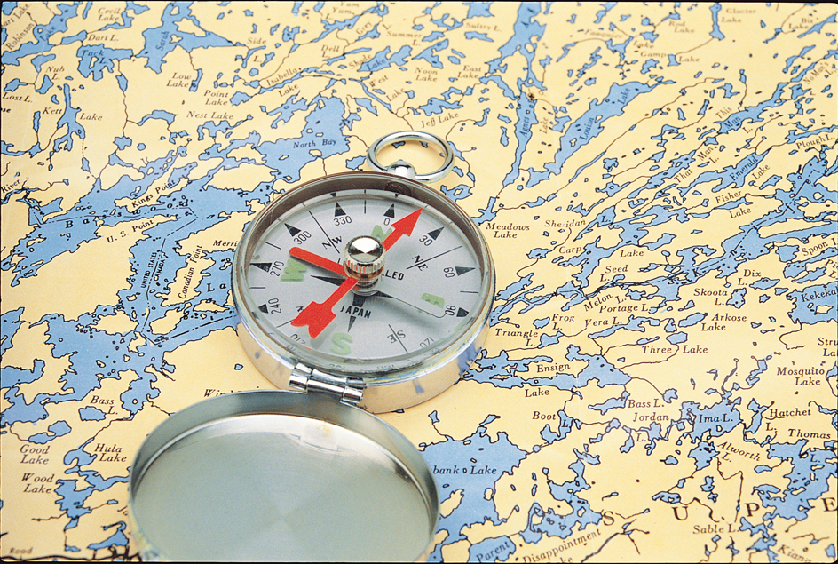
Large compasses are also marked, clockwise, with the 360 degrees of a circle. North corresponds to 0 or 360 degrees. Northeast is 45 degrees. East is 90 degrees. Southeast is 135 degrees. South corresponds to 180 degrees. Southwest is 225 degrees, west is 270 degrees, and northwest is 315 degrees.
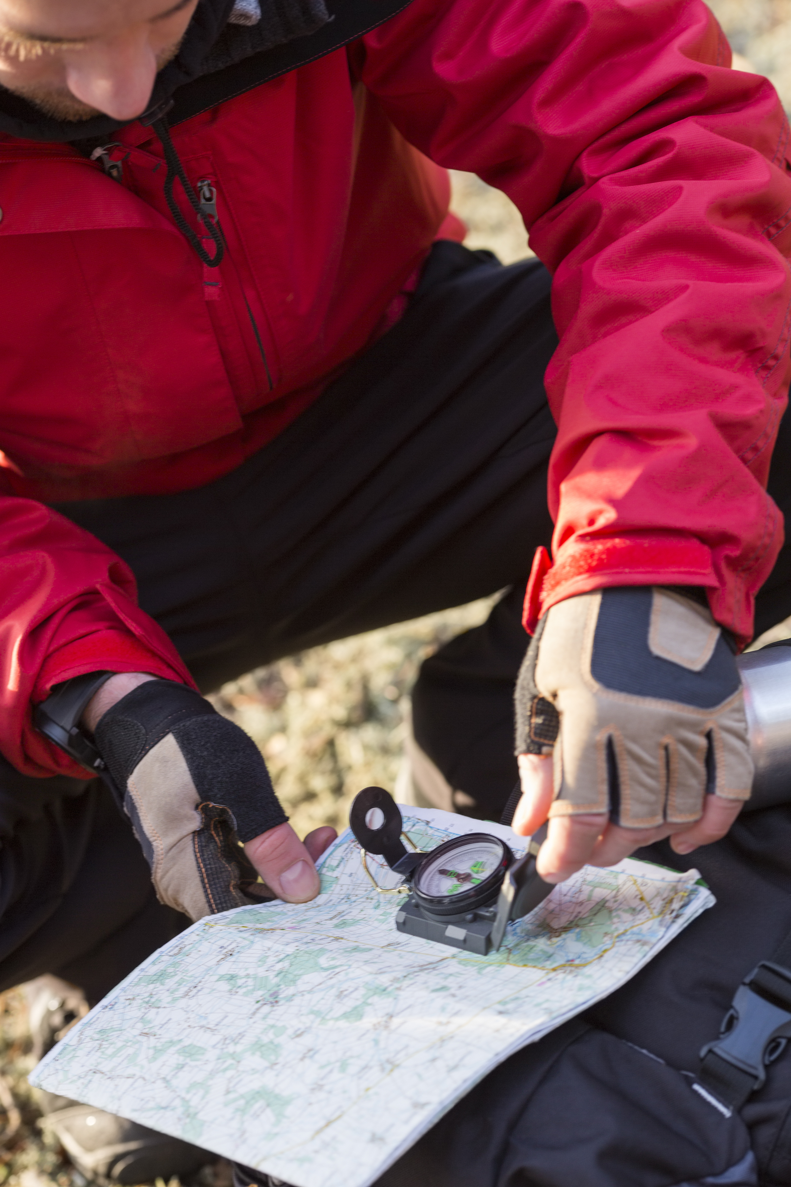
A simple pocket compass helps people find their way when there are no landmarks to guide them. For example, if a person must walk west to reach the nearest town, he or she lines up the needle so that its ends are over the north and south marks on the compass card. The person then travels in the direction 90 degrees to the left of the north end of the compass needle.
A mariner’s compass is a magnetic compass used aboard a boat or ship. In most cases, the magnetized needle is fastened on the underside of a compass card. The card rests on a pivot so it can turn freely inside the compass bowl. The needle thus can always point toward the magnetic pole. The compass bowl has a transparent cover. The bowl is filled with a liquid mixture of alcohol and water or glycerin and water. This mixture floats the card and at the same time damps (slows) the movement of the card so that it does not constantly swing from side to side with the motion of the ship.
Variation.
The North Pole and the South Pole are the “top” and “bottom” of the globe, located at 90° north latitude and 90° south latitude. They are also known as the geographic poles and the true north and south poles. The magnetic poles, on the other hand, shift positions as Earth’s magnetic field changes. They lie several hundred miles or kilometers from the geographic poles.
The angle between the direction of the magnetic pole and the geographic pole at any location is called variation or declination. The variation of a compass is different at different places on Earth. Because Earth’s magnetic field changes over time, the variation is also different at different times of the year and from one year to the next. Thus, to use a magnetic compass accurately, a person must know the amount of variation at his or her location. The person must make a variation correction in reading the compass. Information about the variation appears on mariners’ charts and on many maps.
Deviation.
If a magnetic compass is placed close to a metal object that contains iron, it will be drawn toward that object. The angle formed between the magnetic pole and the direction the compass points is known as deviation.
When a mariner’s compass is installed on a ship, it is mounted in gimbals (supporting rings that pivot). The compass often sits on a stand called a binnacle. The binnacle has magnetic devices that cancel out deviation caused by the metal and other magnetic influences of the ship itself. The navigator also swings the ship. That is, he or she heads the ship in different directions, checking the direction by a known landmark. For each of 24 points of direction—that is, every 15 degrees around a complete circle—the navigator notes how many degrees of deviation the compass shows from the true direction. For example, by checking a landmark, a navigator may know that the ship is heading exactly east. But after he or she has corrected the compass reading for variation, the compass may indicate the ship is heading two degrees south of east. Thus, to head directly east when the ship is out of sight of land, the navigator will steer a course two degrees south of east on the compass, after correcting for variation. The navigator may also check direction using a gyrocompass. A gyrocompass always points toward true north. Many pleasure boaters check deviation for only 12 points of direction—that is, every 30 degrees.
Some automobiles are equipped with a digital electronic compass. Such a compass uses an electronic circuit that oscillates (changes back and forth) to determine the direction of Earth’s magnetic field. After a digital electronic compass is installed, it must be adjusted to cancel out deviation caused by metals or other magnetic influences in the automobile itself. Many digital electronic compasses can also detect and automatically compensate for distortions in the magnetic field. Such a distortion may occur when, for example, the vehicle crosses a metal bridge.
History.
Chinese and Mediterranean navigators probably first used magnetic compasses to guide their ships in about the 1000’s or 1100’s. These compasses were simple pieces of magnetic iron. The iron usually floated on straw or cork in a bowl of water. In about the 1300’s, the compass card was marked off into 32 points of direction. During the following years, navigators learned more about deviation or variation of compasses in various parts of the world. As a result, navigators came to use magnetic compasses with greater accuracy.
When iron and steel vessels appeared in the late 1800’s, it became more difficult to make accurate magnetic compass readings aboard a ship. The metal of the ships affected the readings. As a result, inventors developed the gyrocompass. A gyrocompass is not affected by magnetism and points toward true north.
Large ships and aircraft today carry both magnetic compasses and gyrocompasses. In the 1940’s and 1950’s, scientists developed special gyroscopes for compasses used in the polar regions. In addition to a compass, many ships and aircraft use a satellite network called the Global Positioning System to aid in navigation.
