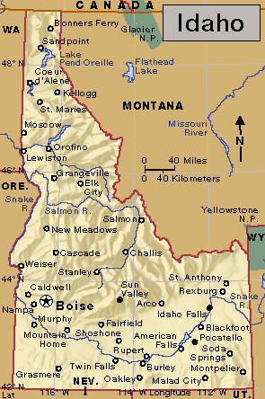
Idaho is a Rocky Mountain state of the United States with exciting scenery and enormous natural resources. Idaho has towering, snow-capped mountain ranges, swirling white rapids, peaceful lakes, and steep canyons. The canyons of Idaho’s Snake River include Hells Canyon, which is deeper than the Grand Canyon. Shoshone Falls, on the Snake River, plunges down rugged cliffs from a height greater than that of Niagara Falls. Among the mountains in the northern part of the state lies quiet Lake Pend Oreille, one of the world’s most beautiful lakes. Boise, which is in the southwestern part of the state, is the capital and the largest city of Idaho.
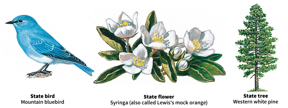
Idaho’s natural resources include fertile soil, rich mineral deposits, thick forests, and great water supplies. Idaho farmers grow sugar beets, wheat, and many other crops. But Idaho’s most famous crop is potatoes. Idaho ranks first among the states in potato production. Beef and dairy cattle are also a major source of farm income in Idaho.
The processing of such electronic goods as computer microchips is an important manufacturing activity in Idaho. The production of farm and forest products continues to be of great importance to the state’s economy.
Most of Idaho’s workers are employed in service industries, which include education, recreation, and retail trade. Spending by tourists benefits many service industries. Idaho also has an important mining industry. The state’s leading mineral products include phosphate rock and silver.
Idaho has one of the most colorful histories of any of the states. Prospectors discovered gold in Idaho during the 1860’s. Thousands of miners then poured into the region hoping to strike it rich. Farmers and ranchers came after the miners. As the mines in the area were worked out, many of the miners moved on to other areas. But the farmers and ranchers stayed—and built a state.
Idaho became a state in 1890. It grew quickly as its natural resources were developed. Its forests were tapped, and it became a leading timber-producing state. Mining became an industry. The get-rich-quick prospectors for gold and silver were replaced by scientists. These modern prospectors found that Idaho had many other valuable minerals besides gold and silver. Rich, fertile soils and tremendous water resources, harnessed for irrigation, prompted the growth of agriculture. Today, agriculture is still an important part of Idaho’s economy. But manufacturing and service industries have grown rapidly. As a result, the focus of Idaho’s economy has shifted from the state’s rural areas to its urban areas.
The name Idaho was first suggested in 1860 for the area that became the Colorado Territory in 1861. The name’s promoter insisted that Idaho was a Native American name meaning Gem of the Mountains, but he had actually invented the word. Lawmakers rejected the name after discovering the falsehood. But in 1863, the name was chosen for the territory that included what is now the state of Idaho. The popular name of Idaho is the Gem State.
People
Population.
The 2020 United States census reported that Idaho had 1,839,106 people. The population had increased by 17 percent over the 2010 figure, 1,567,582. According to the 2020 census, Idaho ranks 38th in population among the 50 states.
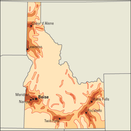
Idaho has no great manufacturing industries to encourage the growth of large cities. The Census Bureau reported that in 2020 Idaho had only 14 cities with more than 20,000 people. Most of these cities are located along or near the Snake River.
About three-fourths of Idaho’s people live in seven metropolitan areas—Boise City, Coeur d’Alene, Idaho Falls, Lewiston, Logan (Utah), Pocatello, and Twin Falls. Two-fifths of Idaho’s people live within the Boise City metropolitan area (see Metropolitan area). Boise is Idaho’s largest city and capital. During the early 1960’s, rapidly growing Boise annexed all or parts of the surrounding areas of Franklin, Mountain View, and Whitney. Other large cities include Caldwell, Idaho Falls, Meridian, Nampa, and Pocatello.
Pocatello, the state’s sixth largest city, is the center of one of Idaho’s metropolitan areas. Pocatello is eastern Idaho’s major industrial center.
Many Idahoans are descendants of early English, Irish, and Scottish settlers from the Eastern and Midwestern States. Other large population groups include French, Germans, Norwegians, and Swedes. Approximately 25,000 Native Americans live in Idaho.
Schools.
When Idaho became a state, Congress gave two sections (1,280 acres, or 518 hectares) of each township for the support of schools. Little of this land has been used for school sites. However, it provides income for schools. Almost all funds for Idaho schools come from taxation. Children age 7 through 15 must attend school.
The State Board of Education oversees and assists the public schools in the state. The board is made up of seven appointed members and the state superintendent of public instruction. The governor names the appointed members to five-year terms. The voters elect the superintendent to a four-year term. For information on the number of students and teachers in Idaho, see Education (table: U.S. students, teachers, and school expenditures).
Libraries.
Idaho has public libraries throughout the state. Other libraries include the Idaho State Law Library in Boise, the Eli M. Oboler Library at Idaho State University in Pocatello, and several other university and college libraries. The University of Idaho has special collections that emphasize the history of Idaho and the Pacific Northwest. The Idaho State Historical Society operates a library and archives in Boise.
Museums.
The Idaho State Historical Society in Boise maintains a museum of Idaho history. Other museums include the Boise Art Museum, the Idaho Museum of Natural History in Pocatello, the Herrett Center for Arts and Science in Twin Falls, and the museum at the visitor center of Craters of the Moon National Monument near Arco. Numerous local museums are throughout the state.
Visitor’s guide
Idaho’s natural wonders thrill thousands of sightseers every year. Visitors can go with experienced guides on exciting boat trips through Hells Canyon and along the Salmon River. Hunters in Idaho shoot deer, bear, elk, pheasant, partridge, and duck in the forests and mountains and on the plains. Fishing enthusiasts catch bass, crappie, whitefish, and numerous varieties of trout in the state’s quiet lakes and rushing streams.
Idaho is a skier’s paradise. Its ski trails rank among the most popular in the world. Idaho’s best-known ski resort is Sun Valley. This resort, which is in the southern part of the state, lies 6,000 feet (1,800 meters) above sea level and is surrounded by high mountain peaks. Other favorite Idaho ski resorts include Bogus Basin, near Boise; Brundage, near McCall; Schweitzer, near Sandpoint; Silver Mountain, near Coeur d’Alene; Pebble Creek, near Pocatello; and Grand Targhee, near Driggs.
Sports events and regional fairs are among Idaho’s most important annual events. The state’s rodeos are well known.
Land and climate
Land regions.
Idaho has three major land regions. These are, from north to south: (1) the Rocky Mountains region, (2) the Columbia Plateau, and (3) the Basin and Range Region.
The Rocky Mountains
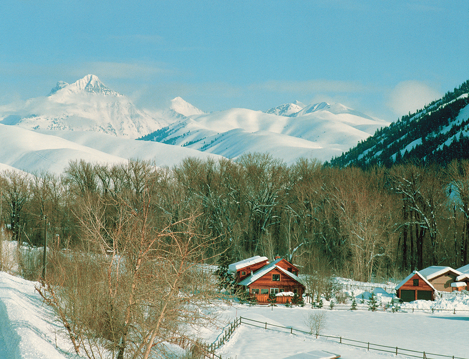
form the state’s largest land region. The mountains cover the Idaho Panhandle (the northern tip of Idaho between Washington and Montana), the area east and north of the Columbia Plateau, and a strip along the Idaho-Wyoming border. The Rocky Mountains region has great timber supplies and the state’s most important mining areas.
The Rocky Mountains region of Idaho has some of the most rugged areas in the United States. Throughout the region, steep canyons and plunging gorges have been carved by swift mountain streams. The region has several wilderness areas that the U.S. Forest Service has preserved without roads, logging developments, or modern improvements. The federal government owns about two-thirds of Idaho’s land. The wilderness areas can be explored only on foot, on horseback, in boats, or from planes.
Many plateaus and valleys lie among the mountains and ranges of the Rocky Mountains region. These plateaus and valleys include fertile areas in western Idaho County and in parts of Clearwater and Latah counties. There, farmers raise wheat and peas.
The Columbia Plateau
follows the sweep of the Snake River across southern Idaho. The plateau then stretches along Idaho’s western border as far north as the Panhandle, where it meets the rolling Palouse hills of the state of Washington. The Columbia Plateau includes the fertile plateau and valley areas of Lewis, Nez Perce, and western Latah counties. In the center of the plateau, the Snake River Plain covers a 20- to 40-mile (32- to 64-kilometer) strip on each side of the Snake River. The plain was built up from many lava flows that came from cracks in the earth. On the plain, farmers grow potatoes, alfalfa, beans, sugar beets, and other crops on land irrigated by well or river water. Cattle and sheep graze on the irrigated lands during the winter and on nearby mountains in summer.
Farmers in the fertile plateaus and valleys along Idaho’s western border raise wheat, peas, fruits, and other crops. Dry southwestern Idaho is almost entirely a grazing and irrigated farming area.
The Basin and Range Region
lies southeast of the Columbia Plateau. Part of the Rocky Mountains region lies to the east. Deep valleys and grassy plateaus lie among the region’s mountains. Herds of sheep graze on the mountain slopes during the summer.
Mountains.
Idaho has about 50 mountain peaks that rise above 10,000 feet (3,000 meters). Borah Peak, the state’s highest mountain, towers 12,662 feet (3,859 meters) northwest of Mackay. The great Bitterroot Range lies on the Idaho-Montana border. Highways cross these mountains through passes from 5,000 to 7,000 feet (1,500 to 2,100 meters) high. The Seven Devils Mountains rise on the Oregon border.
Many other ranges also rise in Idaho. In the northern Panhandle are the Coeur d’Alene Mountains, part of the Bitterroot Range. The Coeur d’Alenes have an average height of 6,000 feet (1,800 meters). South of the Coeur d’Alenes are the Clearwater Mountains. South of these are the Salmon River Mountains, which include the spectacular Bighorn Crags. The Bighorn Crags are rough, bare mountains of granite that nature has worn into sharp spires and ridges. They are among the most rugged mountains in the entire Northwest.
The Sawtooth Mountains rise south of the Salmon River Mountains. The Sawtooths are considered the state’s most beautiful mountains, with lovely lakes and colorful meadows. The Lost River Range extends southeast from the Salmon River almost to Arco. It includes Idaho’s highest peaks. The Lost River Range is a vast wilderness of snow-capped peaks. The Lemhi Range stretches east of the Lost River Range. The Snake River Range extends southeast from Rexburg along the Snake River. The Caribou Range is northeast of Grays Lake, and the Blackfoot Mountains rise northeast of Blackfoot.
Rivers, waterfalls, springs, and lakes.
Idaho has several large rivers and thousands of small ones. Most of the rivers are rapid-flowing mountain streams. Many of them, such as the Bruneau River in Owyhee County, flow through deep canyons.
The Snake River, which is 1,038 miles (1,671 kilometers) long, flows into Idaho from its source south of Yellowstone National Park in Wyoming. The river crosses southern Idaho and forms about a third of the state’s western border. In 1915, engineers completed a canal on the Columbia River so that stern-wheel vessels could travel up the Columbia and Snake rivers as far as Lewiston. This town then became a Pacific Ocean “port,” although it is almost 500 miles (800 kilometers) from the ocean. To use this waterway to the sea to fullest advantage, dams have been built on the Snake River, and Lewiston has enlarged its port facilities.
The Snake River system drains most of the state. A main branch of the Snake is the Salmon River, which rises in the Sawtooth Mountains. It is called the River of No Return, because travelers once could not navigate upstream against its furious current and rapids. Other branches of the Snake include the Clearwater, Big Wood, Blackfoot, Boise, Payette, and Weiser rivers.
Several northern Idaho rivers drain into the Columbia River. The most important of these is the Kootenai River, which begins in Canada. The Pend Oreille River, which drains Lake Pend Oreille, also flows northwest and empties into the Columbia. The third important Idaho stream that drains westward is the Spokane River. It begins in Coeur d’Alene Lake. Several rivers flow into this lake. They include the Coeur d’Alene River, which flows westward from the Coeur d’Alene Mountains, and the tree-lined, shadowy St. Joe River, which drains the Bitterroot Range.
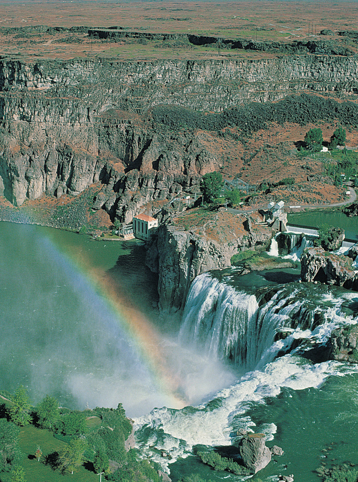
Idaho has hundreds of large waterfalls and many small ones. Shoshone Falls, on the Snake River, plunges 212 feet (65 meters) over a horseshoe-shaped rim. Twin Falls, above Shoshone Falls on the Snake River, plunges 135 feet (41 meters). Mesa Falls, on the North Fork of the Snake River, has an upper drop of 114 feet (35 meters) and a lower drop of 65 feet (20 meters). Other waterfalls in Idaho include the Moyie Falls on the Moyie River and the Auger Falls on the Snake River.
Southern Idaho has more than a hundred mineral springs. Some of them are hot, and some are cold. The most famous springs include Big Creek Springs in Lemhi County, Bald Mountain Springs in Ketchum, Warm Springs in Boise, Lava Hot Springs near Pocatello, and Magic Springs near Twin Falls. The waters of Warm Springs have a temperature of 170 °F (77 °C). They are piped into some homes in Boise to provide heat. The springs in and around Soda Springs are highly charged with carbonic acid and are believed to have healthful qualities.
Idaho has more than 2,000 well-known lakes. There are also many hundreds of lakes in remote mountain areas of the state. Lake Pend Oreille, covering 148 square miles (383 square kilometers) near the Canadian border, is Idaho’s largest lake. Coeur d’Alene Lake, one of Idaho’s most scenic lakes, has many resort homes and sawmills that dot its bays. Other popular recreational lakes include Alturas, Bear, Grays, Henrys, Payette, Pettit, Priest, Redfish, and Stanley.
Plant and animal life.
Forests cover about 40 percent of Idaho’s land area. Most of the state’s trees are cone-bearing softwoods. They include Douglas-fir, Engelmann spruce, hemlock, lodgepole pine, ponderosa pine, redcedar, western larch, white fir, and white pine. Hardwood trees include birch, cottonwood, and quaking aspen.
Shrubs that grow throughout Idaho’s mountains and valleys include dogwood, elderberry, huckleberry, ocean spray, purple heather, snowberry, and thimbleberry. Meadow flowers found in Idaho include the buttercup, columbine, fireweed, larkspur, lily, and violet. The state flower is syringa, also called Lewis’s mock orange.
Bears, cougars, deer, elk, moose, mountain goats, pronghorns, and Rocky Mountain sheep live in forests and on rangeland throughout Idaho. Smaller animals include beavers, mink, muskrats, otters, and raccoons. Bobcats and coyotes are also common. Chukar partridges, pheasants, and other game birds nest in many range and farm areas. Great numbers of salmon breed in the Salmon River. Steelhead are found in the Clearwater, Salmon, and Snake rivers. Kamloops trout are found in Lake Pend Oreille.
Climate.
Most of Idaho has a milder climate than Great Plains states in the same latitude. Winds from the Pacific Ocean bring warm sea air to the state. The high mountains east of Idaho protect it from the cold blasts from Canada and the Great Plains during the winter. 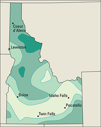
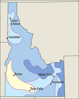
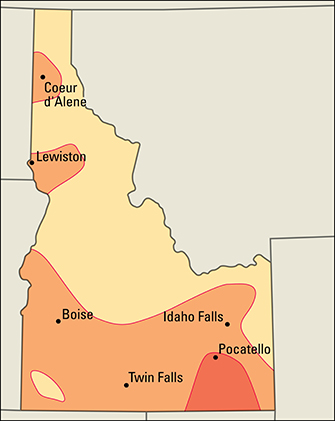
Idaho’s average annual temperature is 48 °F (9 °C), but temperatures vary with the elevation. The temperature in the Sawtooth Mountains may be 40 °F (4 °C), while in nearby Boise, on the Snake River Plain, it is 76 °F (24 °C). The state has an average January temperature of 26 °F (–3 °C), and an average July temperature of 69 °F (21 °C). The state’s record low of –60 °F (–51 °C) was set at Island Park Dam on Jan. 18, 1943. The record high of 118 °F (48 °C) was set at Orofino on July 28, 1934. Idaho has an annual average precipitation of 19 inches (48 centimeters). Most of it comes as snow during the winter. Northern Idaho averages more snow than the rest of the state.
Economy
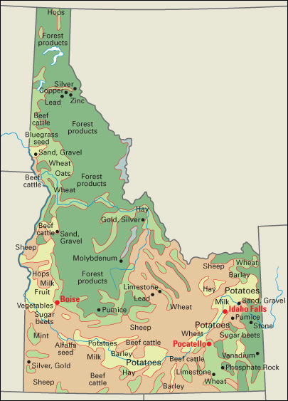
Idaho’s economy relies heavily on resources found within the state. Timber from Idaho’s rugged mountains and farm products from its fertile plateaus provide raw materials for manufacturing. Rapid rivers provide low-cost hydroelectric power. Rich deposits of metal ores lie in several parts of the state.
Idaho’s natural beauty attracts many tourists, who travel to the state for skiing, camping, fishing, and whitewater rafting. Tourism is an important source of income for the state. Service industries provide most of Idaho’s gross domestic product—the total value of goods and services produced within the state in a year.
Natural resources
of Idaho include fertile soils, vast mineral deposits, plentiful water, and dense forests.
Soil
is one of Idaho’s greatest treasures because it is the basis of agriculture. Idaho has several types of soil. Soils developed on glacier-deposited material support the northernmost forests. The prairie and plains soils were developed on broken-up lava and windblown material called loess. Alluvial soil, made up of material deposited by streams, covers some mountain valleys.
Minerals.
Valuable mineral deposits have been found in all of Idaho’s counties. The state’s richest mineral resources include phosphate rock and silver. Some of the largest mineral deposits lie in the northern Panhandle. All of Idaho’s phosphate rock comes from the southeastern part of the state. Copper, lead, silver, and zinc deposits lie in Shoshone County. Deposits of antimony, cadmium, clay, cobalt, garnet, gold, limestone, molybdenum, sand and gravel, thorium, tungsten, uranium, and vanadium are found in the state.
Water
is often said to be Idaho’s most valuable natural resource. Five large river systems cross Idaho, and one large river, the Salmon, is the longest river that lies entirely within the boundaries of a state. In addition, Idaho has enormous underground water resources.
Forests
cover about 40 percent of Idaho’s land area. Most of Idaho’s trees are cone-bearing softwoods, especially Douglas-fir, Engelmann spruce, hemlock, lodgepole pine, ponderosa pine, redcedar, western larch, and white pine. Deciduous trees (trees that shed their leaves annually) grow throughout Idaho. These trees include birch, cottonwood, and quaking aspen.
Service industries
account for most of Idaho’s gross domestic product and employment. Most of the service industries are concentrated in Boise and other urban areas. Boise, the state capital, is the center of government activities. The city is also Idaho’s chief financial center. Albertsons, a large food-store chain, is headquartered in Boise.
Idaho’s restaurants, hotels, and ski resorts benefit from the billions of dollars tourists spend in the state each year. The federal government owns much of the land in Idaho’s mountainous areas and controls logging and mining operations there. Mountain Home Air Force Base in southwestern Idaho is a major employer. Several shipping firms are based at the port of Lewiston.
Manufacturing.
Computer and electronic equipment is one of Idaho’s leading manufactured products in terms of value added by manufacture. Computer components, the chief type of electronic equipment made in Idaho, are made in the Boise-Nampa area.
Much of Idaho’s manufacturing is dedicated to processing its agricultural and forest products. Most of the food-processing plants are in southern Idaho. The state has many beet-sugar refineries, dairies, meat-processing plants, and potato-processing plants. Boise Cascade, a major U.S. wood-products company, is based in Boise. Chemical and fabricated metal manufacturing is also important in Idaho.
Agriculture.
Idaho’s farms and ranches cover over a fifth of the state. Most of Idaho’s cropland is irrigated.
Livestock account for over half of Idaho’s agricultural income. Beef cattle and milk are Idaho’s most valuable farm products. Most of the state’s cattle ranches and dairy farms operate along the Snake River Valley. Idaho ranks as an important producer of sheep and wool.
Potatoes rank as Idaho’s leading crop, and the state harvests more potatoes than any other state. Farmers grow potatoes mainly in the irrigated Snake River area. Sugar beets and wheat are also grown in the Snake River area. Hay is grown primarily in eastern and south-central Idaho. Idaho is a leading producer of barley, hay, and sugar beets. Important grass and seed crops include alfalfa seed, bluegrass seed, hops, and mint. 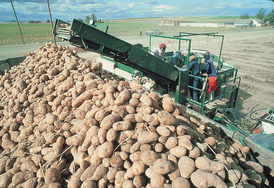
Mining.
Phosphate rock, sand and gravel, and silver are among Idaho’s most valuable mined products. Other important mined products include lead, limestone, and traprock. Idaho is a leading producer of lead, phosphate rock, and silver. Shoshone County in northern Idaho is one of the nation’s chief silver-mining areas.
Electric power and utilities.
Hydroelectric plants account for about half of Idaho’s electric power. Sites of federal hydroelectric plants include Brownlee Dam, Cabinet Gorge Dam, Dworshak Dam, and Palisades Dam.
Transportation.
The Oregon Trail, one of the great early overland routes in the United States, wound through the wild Idaho frontier. The first railroad crossed the Idaho-Utah border in 1874.
Today, Idaho has one of the nation’s finest transportation networks. Highways connect the state’s major urban centers with other states. Railroads supply freight service. The Snake River provides access to the Pacific Ocean. Boise has the state’s largest airport.
Lewiston is a river port. Dams on the Columbia and Snake rivers permit barges and tugs to haul farm and forest products between the city and the Pacific Coast.
Communication.
The first newspaper in Idaho was the Golden Age, published at Lewiston from August 1862 to January 1865. Today, Idaho’s daily newspapers with the largest circulation include The Idaho Statesman of Boise, the Lewiston Morning Tribune, the Post-Register of Idaho Falls, and The Times-News of Twin Falls.
Government
Constitution.
Idaho is still governed under its original state Constitution. The Constitution was adopted in 1889, 11 months before the Idaho Territory became a state. Since then, the Constitution has been amended more than 100 times.
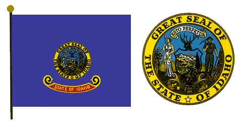
Amendments to the Constitution are proposed either by a two-thirds vote of both houses of the state Legislature or by a convention called by the Legislature for that purpose. To be adopted, an amendment must be approved by a majority of the people voting on the amendment.
Executive.
Voters elect the governor to a four-year term. The governor does not have the power to appoint the top state officials, which include the lieutenant governor, secretary of state, controller, treasurer, superintendent of public instruction, and attorney general. Voters elect these officials to four-year terms.
Legislature
of Idaho consists of a 35-member Senate and a 70-member House of Representatives. Idaho has 35 legislative districts. Voters in each district elect two representatives and one senator. Senators and representatives serve two-year terms. The state Legislature meets every year. Regular sessions of the Legislature begin the Monday on or nearest January 9. Legislative sessions have no time limit. The governor may call special sessions of the Legislature. Such legislative sessions are limited to 20 days. 
Courts.
The highest court in Idaho is the state Supreme Court. It has a chief justice and four associate justices. The justices serve six-year terms. The voters elect two justices in one year, two others two years later, and one justice two years after that. The Supreme Court justices elect one of their members to serve as chief justice for a four-year term.
After the Supreme Court, Idaho’s next highest court is the Court of Appeals. It has a chief judge and three other judges, all elected to six-year terms. Voters in seven judicial districts elect district court judges to four-year terms. Each county has at least one magistrate.
Local government.
Idaho has 44 counties, each governed by three commissioners. Two of the commissioners are elected to two-year terms. The third commissioner is elected to a four-year term. One of the commissioners is selected by the other two to serve as head of the commission. Other county officials include the sheriff, assessor, prosecuting attorney, coroner, treasurer (who is also tax collector), and clerk of the district court (who also serves as auditor and recorder). All these officials are elected to four-year terms. Almost all the cities of Idaho have a mayor-council form of government.
Revenue.
Taxes provide about half of the state government’s general revenue (income). Most of the rest comes from federal grants and other United States government programs. The major sources of tax revenue in Idaho are a general sales tax and a personal income tax. Other significant sources of the state’s revenue include corporate income taxes, motor fuel taxes, and motor vehicle licenses.
Politics.
In elections for governor, Idahoans have elected more Republicans than Democrats. Idahoans have also sent more Republicans than Democrats to the U.S. Senate and the U.S. House of Representatives.
Since 1952, Idahoans have voted for the Republican candidate in every presidential election but one. The exception was 1964, when Idaho supported Democrat Lyndon B. Johnson.
History
Early days.
Indigenous (native) Americans lived in the Idaho region more than 10,000 years ago. Remains of early Indigenous cultures have been found in hundreds of locations, and many present-day place names have Indigenous origins. The tribes that lived in Idaho included the Nez Perce, Coeur d’Alene, Pend d’Oreille, Shoshone, Kootenai, Paiute, and Bannock. The two largest tribes were the Nez Perce and the Shoshone.
Exploration and early settlement.
In 1805, the famous explorers Meriwether Lewis and William Clark became the first white men to explore the Idaho region. They crossed the great Bitterroot Range. Then, aided by the Shoshone and Nez Perce, the explorers built canoes and floated down the Clearwater and Snake rivers to the Columbia River. See Lewis and Clark Expedition.
In 1809, David Thompson, a Canadian explorer, built a fur-trading post on the shores of Lake Pend Oreille. In 1834, two more posts were built. They were Fort Hall, founded by the American Nathaniel Wyeth, and Fort Boise, founded by Thomas McKay of the British Hudson’s Bay Company. In 1836, Henry and Eliza Spalding, two Presbyterian missionaries, traveled to the Idaho region. That year, they established the Lapwai Mission Station near present-day Lewiston. Eliza Spalding was one of the first white women to journey overland to the Northwest. The couple planted Idaho’s first potato crop. 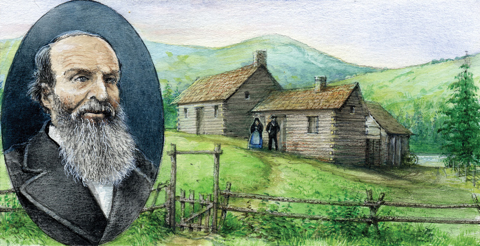
A group of Mormons began farming in eastern Idaho in 1855. They built Fort Lemhi and started Idaho’s first irrigation projects. But they did not stay in the area. In 1860, another band of Mormons founded Idaho’s first permanent settlement, at Franklin.
In 1860, E. D. Pierce, a prospector, found gold on Orofino Creek. In 1862, George Grimes discovered gold in the Boise Basin. News of these and other rich strikes spread rapidly, and gold seekers poured into the Idaho region. Towns grew up almost overnight near the discoveries.
Territorial development.
The Idaho Territory was established on March 4, 1863, with Lewiston as the capital. The territory included present-day Idaho, Montana, and almost all of Wyoming. Montana became a separate territory in 1864, and Wyoming was made a territory in 1868. In 1864, Boise became the capital of the Idaho Territory.
The development of railroads in Idaho brought a wave of settlers to the territory. Mormons brought the Utah Northern Railroad into Idaho at Franklin in 1874. Silver-lead mines in northern Idaho stimulated railroad construction in that region. By 1884, the Oregon Short Line Railroad linked mines at Hailey and the Big Wood River with Oregon.
Expansion and conflict.
As white settlements expanded in the Northwest, conflicts with Indigenous people—people then known as Indians—increased. In 1877, the U.S. Army, under pressure from the settlers, tried to force the Nez Perce to move from Oregon to the Lapwai Reservation in Idaho. The Nez Perce resisted. On June 17, 1877, they crushed the troops in a battle at White Bird Canyon in north-central Idaho. However, the Nez Perce were soon forced to retreat before larger numbers of soldiers. In October, near the Canadian border, they surrendered. See Indian wars (The Nez Perce War (1877)). 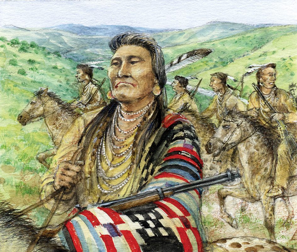
In 1878, the Bannock people rebelled because of lack of food and other problems on their reservation. They had also been deprived of their traditional hunting grounds. The Bannock tried to dig camas roots on the prairie in order to find food, but settlers objected because their cattle grazed there. During the rebellion, Chief Buffalo Horn was killed. After the chief’s death, the Bannock split into several groups and were defeated.
Early statehood.
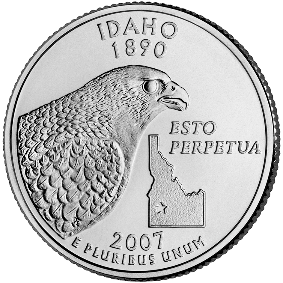
In 1889, the Idaho Territory adopted a constitution. Idaho entered the Union as the 43rd state on July 3, 1890. George L. Shoup, a Republican, became the first state governor. 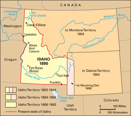
During the 1890’s, disputes arose between miners and mine owners. The quarrels often flared into bloody violence. Battles also broke out between nonunion miners and members of a labor union called the Western Federation of Miners. This organization was the chief union in the Industrial Workers of the World (see Industrial Workers of the World). In 1892, the Coeur d’Alene region became the scene of dynamiting and shooting as union miners fought nonunion men and mine owners in a violent strike. Violence and a second strike broke out again in 1899. Governor Frank Steunenberg declared martial law and called in federal troops, who eventually broke the strike.
Steunenberg, no longer governor, was murdered in 1905. He was killed when he opened his front gate and set off a bomb attached to the gate. Harry Orchard, who was a member of the Western Federation of Miners, confessed to the crime and said three union officials were also involved. The murder trial, held in 1907, attracted worldwide attention. It brought national fame to United States Senator William E. Borah, a lawyer for the state. The famous defense attorney Clarence Darrow represented the accused union leaders, headed by William D. “Big Bill” Haywood. Haywood and another of the officials were freed, and charges were dropped against the third official. Orchard received a sentence of life imprisonment.
In the early 1900’s, irrigation projects brought water to Idaho’s desert lands, and agriculture expanded in the state. In 1905, the Twin Falls Land and Water Company, organized by Ira B. Perrine, diverted water from the Snake River to irrigate 60,000 acres (24,000 hectares) of land. In 1906, the U.S. Bureau of Reclamation completed the Minidoka Dam on the Snake River. This irrigation system opened up more than 100,000 acres (40,000 hectares) of land to farmers.
World War I and after.
World War I brought a boom to Idaho’s agricultural economy after the United States entered the war in 1917. Wartime food shortages created farm prosperity. Wartime inflation also boosted prices of land and operating costs. However, when the war ended, Idaho’s prosperity collapsed.
In the 1920’s, Idaho’s farmers, like many farmers in the United States, were hard pressed. Idaho’s economy worsened during the Great Depression of the 1930’s, and many banks in the state went bankrupt. The federal government set up agencies to help farmers and other Idahoans. The Civilian Conservation Corps (CCC), an important federal agency during the Depression, did conservation work in Idaho’s forests.
Modern highway construction also progressed during the 1930’s in Idaho. By 1938, a paved highway finally connected the northern and southern sections of the state.
World War II.
During World War II (1939-1945), many Idahoans worked in factories that made airplanes, arms, and other military supplies. Idaho supplied large amounts of food to the armed services. Soon after the United States entered the war, Japanese Americans living on the West Coast and in southern Arizona were moved to relocation camps. Camp Minidoka, near Twin Falls, received Japanese Americans from the areas of Oregon and Washington. These people worked on potato and sugar beet farms, filling the shortage of farmworkers caused by the war.
Postwar changes.
After the war, Idaho’s economy began to change from one based chiefly on agriculture to one that included food processing and manufacturing. A housing boom followed the war and spurred Idaho’s lumber industry. Materials that were once considered to be waste products were used to produce paper containers, plywood, and wood pulp.
Idaho’s population began to shift from rural to urban areas. In 1940, only about a third of the people lived in cities. But Idaho’s farms, like those in many other states, began to decrease in number and increase in size. The use of farm machinery grew, and fewer farmworkers were needed. People began to move to urban areas and take jobs in manufacturing. By 1960, about half of Idaho’s population lived in cities or towns.
In 1949, the Atomic Energy Commission (AEC) built the National Reactor Testing Station (now Idaho National Laboratory) near Idaho Falls. Scientists at the station had the job of making, testing, and operating nuclear reactors and related devices. In December 1951, at the testing station, electric power was generated from nuclear energy for the first time in history. The scientists also built a model reactor for the first nuclear submarine, the U.S.S. Nautilus. In 1955, Arco became the first community in the world to receive its entire power supply from nuclear energy. The station supplied the town’s power for one hour on July 17. By the mid-1960’s, the Idaho Falls station had one of the world’s largest assortments of nuclear reactors.
During the 1950’s, Idaho’s expanding agriculture and industry made increasing demands for more hydroelectric power. In 1955, the Idaho Power Company began to build a series of three dams on the Snake River. The company completed its Brownlee Dam in 1959, its Oxbow Dam in 1961, and its Hells Canyon Dam in 1968.
The late 1900’s.
During the 1970’s, the state suffered two of the worst disasters in its history. In 1972, an underground fire in the Sunshine silver mine resulted in 91 deaths. In 1976, the Teton Dam on the Teton River collapsed. Billions of gallons of water swept through Sugar City, Rexburg, and several other farming communities in the upper Snake River area. As a result, flooding caused at least 11 deaths and damaged about $400 million worth of property.
In the 1980’s and 1990’s, Idaho’s mining and logging industries declined in importance. Low metal prices and decreasing ore reserves caused several of the state’s silver and molybdenum mines to close. Also in the 1980’s and 1990’s, disputes took place between Idahoans who wanted to conserve the state’s natural environment and those who wanted to encourage the economic development of its natural resources. Using its natural resources wisely continued to be a challenge for the state.
During the late 1900’s, Idaho’s population grew rapidly. From 1970 to 1980, the population increased by 32 percent, putting a strain on schools, roads, and sewage systems. From 1980 to 1990, Idaho’s rate of population growth slowed to only 7 percent. But from 1990 through the 2010’s, the rate of increase was 83 percent.
Recent developments.
Today, agriculture remains vital to Idaho’s economy, but other economic activities have grown in the state. In the last half of the 1900’s, many small industries moved to Idaho. Large construction, food processing, and lumber companies established headquarters in Boise, and a major computer firm set up operations there.
The tourist industry continues to contribute to the economy. Sun Valley, a famous vacation area, attracts large numbers of visitors. New vacation sites developed in other parts of Idaho have experienced rapid growth.
