Arizona, once thought to be an almost worthless desert, has become a prosperous state of the United States. It is rich in farm and mineral products, and it is growing rapidly in manufacturing and population. Vast irrigation systems transform the desert soil into rich farmland. Dams built by the government or with federal funds provide water to irrigate large areas of land. These dams also generate electric power for the state’s cities and industries.
Although the desert summers are hot, Arizonans stay comfortable. They live in air-cooled homes, work in air-conditioned factories, and travel in air-conditioned automobiles.
The desert winters are warm and pleasant. Arizonans, along with thousands of vacationers, enjoy the desert sun while winter chills other parts of the United States.

Arizona’s climate attracts so many people that the state has become one of the nation’s fastest-growing areas. Between 1950 and 2020, Arizona’s population grew by almost nine times.
Most of Arizona’s people live in desert areas, but more than half the state is mountain and plateau country. These higher, cooler areas have the largest ponderosa pine forest in the United States. Large herds of cattle graze in these regions.
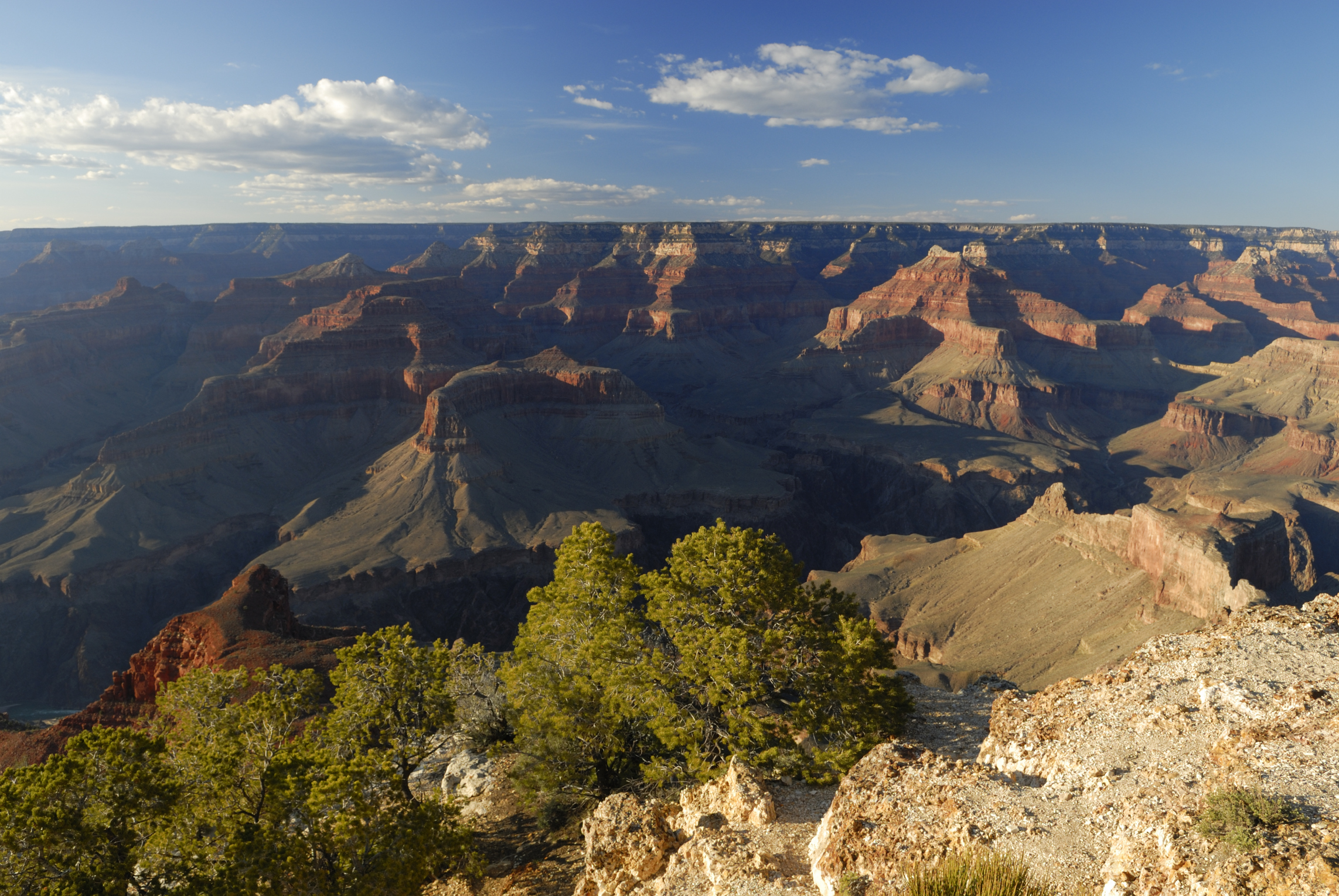
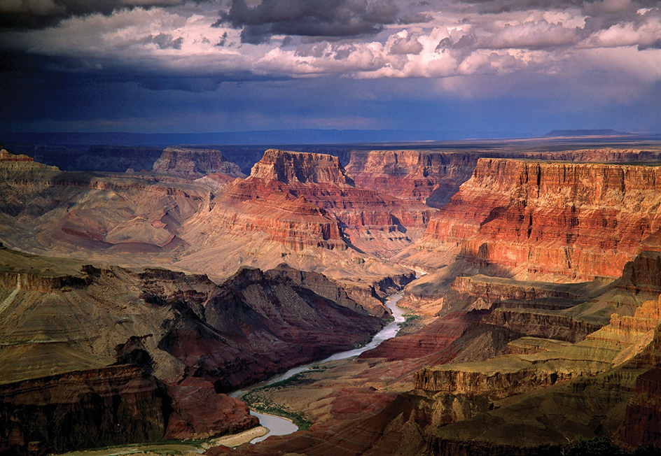
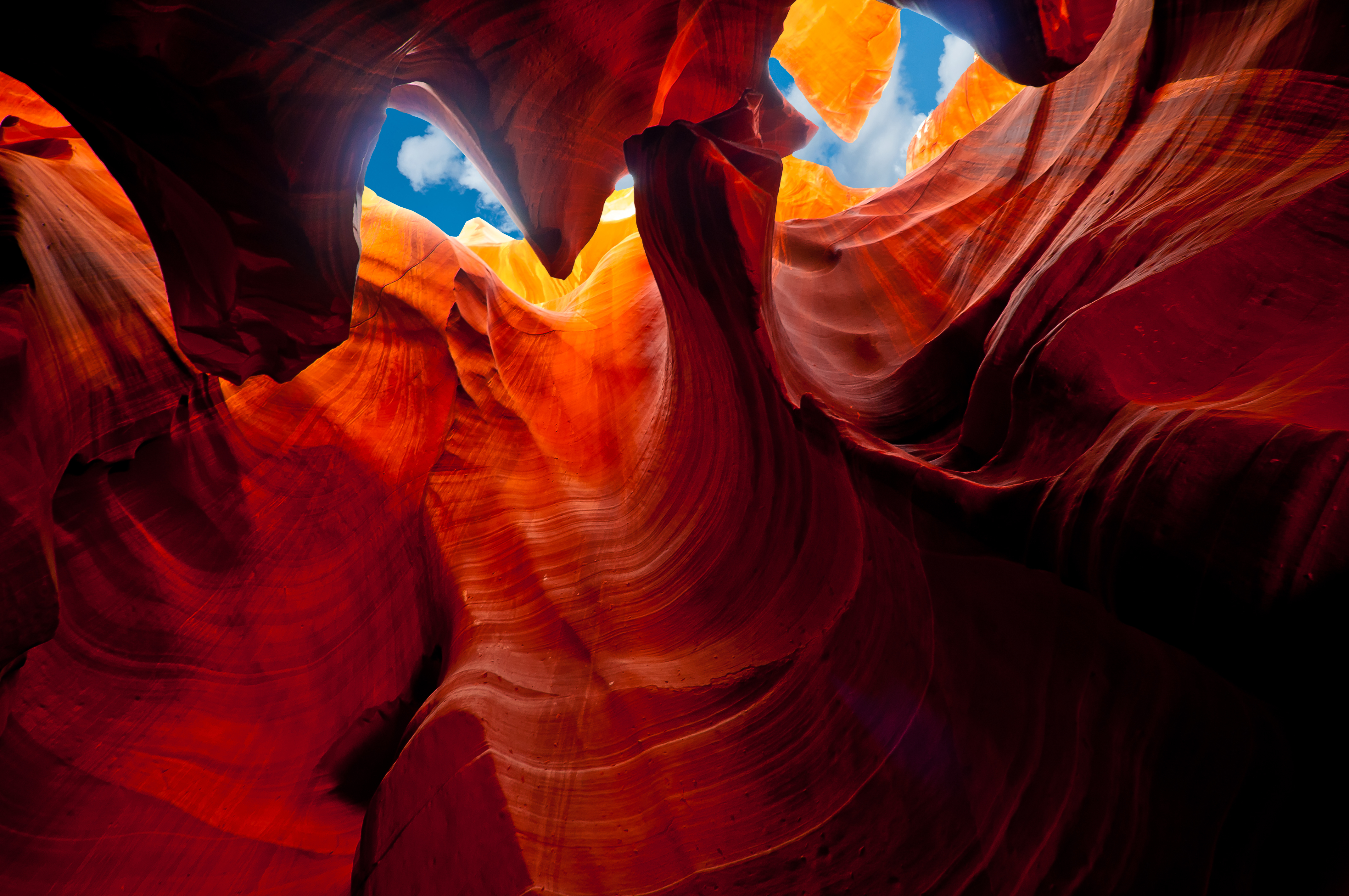
The northwestern part of the state has one of the greatest scenic attractions in the United States—the mighty Grand Canyon of the Colorado River. Arizona’s other scenic wonders include the Painted Desert, the Petrified Forest, and numerous national parklands. These areas attract millions of tourists to the state each year.
Arizona has the third largest Native American population in the United States. Only California and Oklahoma have more Indigenous (native) residents. Indian reservations cover more than a fourth of Arizona’s land. Over 330,000 Native Americans live in Arizona. More than half of them live on 21 reservations in the state.
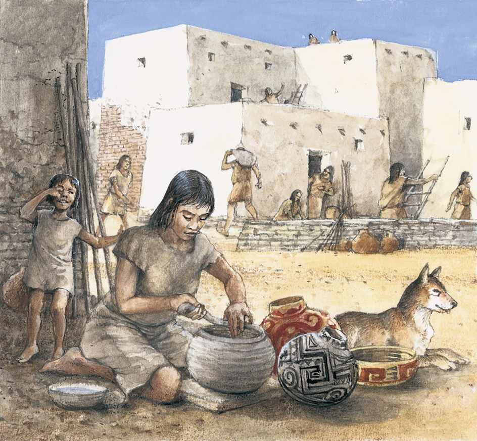
Native Americans have contributed much to Arizona’s history. Some still live in communities built more than 800 years ago. Hundreds of years before Europeans arrived on the continent, Hohokam people in what is now central Arizona built the largest irrigation system in North America. After Europeans arrived in Arizona, the Indigenous people fought to keep their rugged, beautiful land. Cochise and Geronimo, leaders of the Chiricahua Apache, led war parties in Arizona long after most other Indigenous people had surrendered.
Arizona’s history also includes many years of rule by Spanish conquerors, and by Mexicans who freed the region from Spanish control. Today, a large number of Americans of Mexican ancestry live in Arizona. Their influence is apparent in the customs, foods, and place names found in the state.
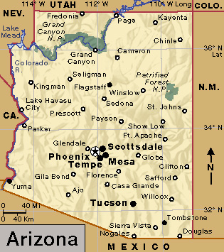
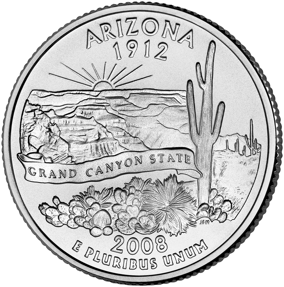
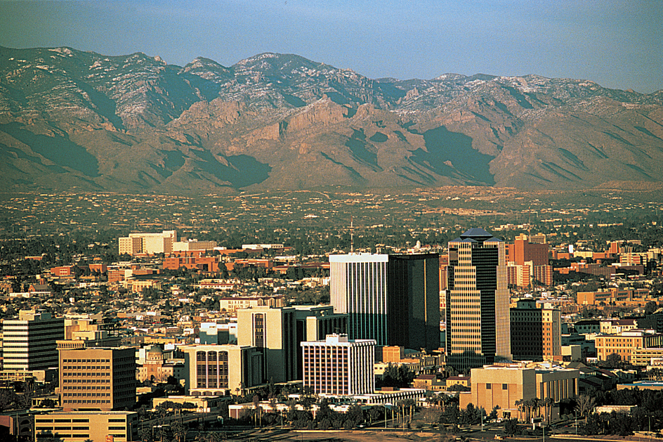
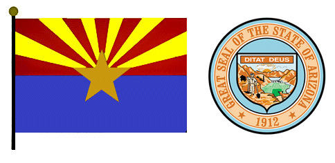
Arizona derives its nickname, the Grand Canyon State, from its most famous physical feature. Phoenix is the state’s capital and largest city.
People
Population.
The 2020 United States census reported that Arizona had 7,151,502 people. The population had increased 12 percent over the 2010 figure, 6,392,017. According to the 2020 census, Arizona ranks 14th in population among the 50 states.
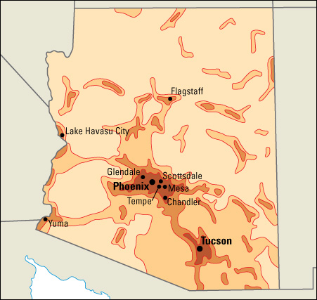
About 95 percent of Arizona’s people live in metropolitan areas. Over 65 percent live in the Phoenix-Mesa-Chandler metropolitan area, and about 15 percent live in the Tucson metropolitan area (see Metropolitan area).
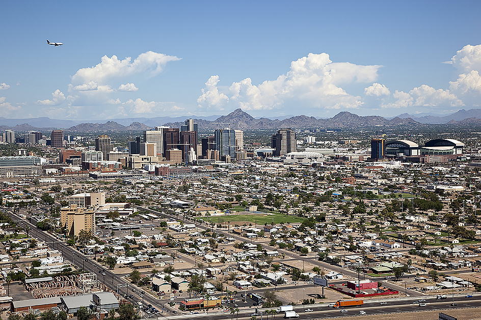
Phoenix, the largest city in Arizona, is a trading and shipping center for a rich agricultural district. Tucson is the second largest city in the state. Both of these cities are important manufacturing centers and vacation areas. Arizona’s other large cities include Chandler, Glendale, Mesa, Scottsdale, and Tempe.
About 5 out of every 100 Arizonans are Native Americans. Arizona has the third largest Indigenous population in the nation. Only California and Oklahoma have more Indigenous residents. The Navajo are the largest tribe in Arizona. The Hopi settlement of Oraibi, in northern Arizona, is one of the oldest continuously inhabited places in the United States. The Hopi people built the settlement in the 1100’s. Arizona has 16 tribal councils. These councils help govern the various tribes and supervise their property.
About 30 percent of Arizona’s people are Hispanic Americans. People of Mexican ancestry account for 90 percent of the state’s Hispanic population. Many families in these groups speak Spanish at home, but the children in the families learn English at school. Mexican foods and customs are very popular among Arizonans. The state also has many people of English, German, and Irish descent.
Schools.
The first schools in Arizona were established in the 1700’s by Spanish missionary priests. These schools taught little except religion. In the late 1820’s, the Mexican government expelled Spanish-born priests. By the 1840’s, missions were abandoned. The first public school in Arizona opened in Tucson in 1871.
The state’s school system is headed by an elected superintendent of public instruction. This official is a member of and carries out policy made by the State Board of Education. Other members of the board are appointed by the governor. The board is made up of a classroom teacher, a president of a state university or college, a representative of the state community colleges, a representative of a charter school, a county school superintendent, a high school district superintendent, and four private citizens. Schools are financed chiefly by taxes.
Children are required to attend school from the age of 6 to 16, or until they complete grade 10. For the number of students and teachers in Arizona, see Education (table).
Navajo Community College (now Diné College), with its main campus in Tsaile, Arizona, was the first tribally controlled community college in the United States. It was established in 1968.
Libraries and museums.
Mission libraries were the first libraries in Arizona. In the 1860’s, Samuel Colt, the famous pistol maker, had a mine in Arivaca, and he provided books for his workers. Tucson had a rental library in the 1870’s. By 1878, both Phoenix and Prescott had small libraries. The Arizona Territorial Library, founded in 1864, became the Arizona State Library, Archives and Public Records.
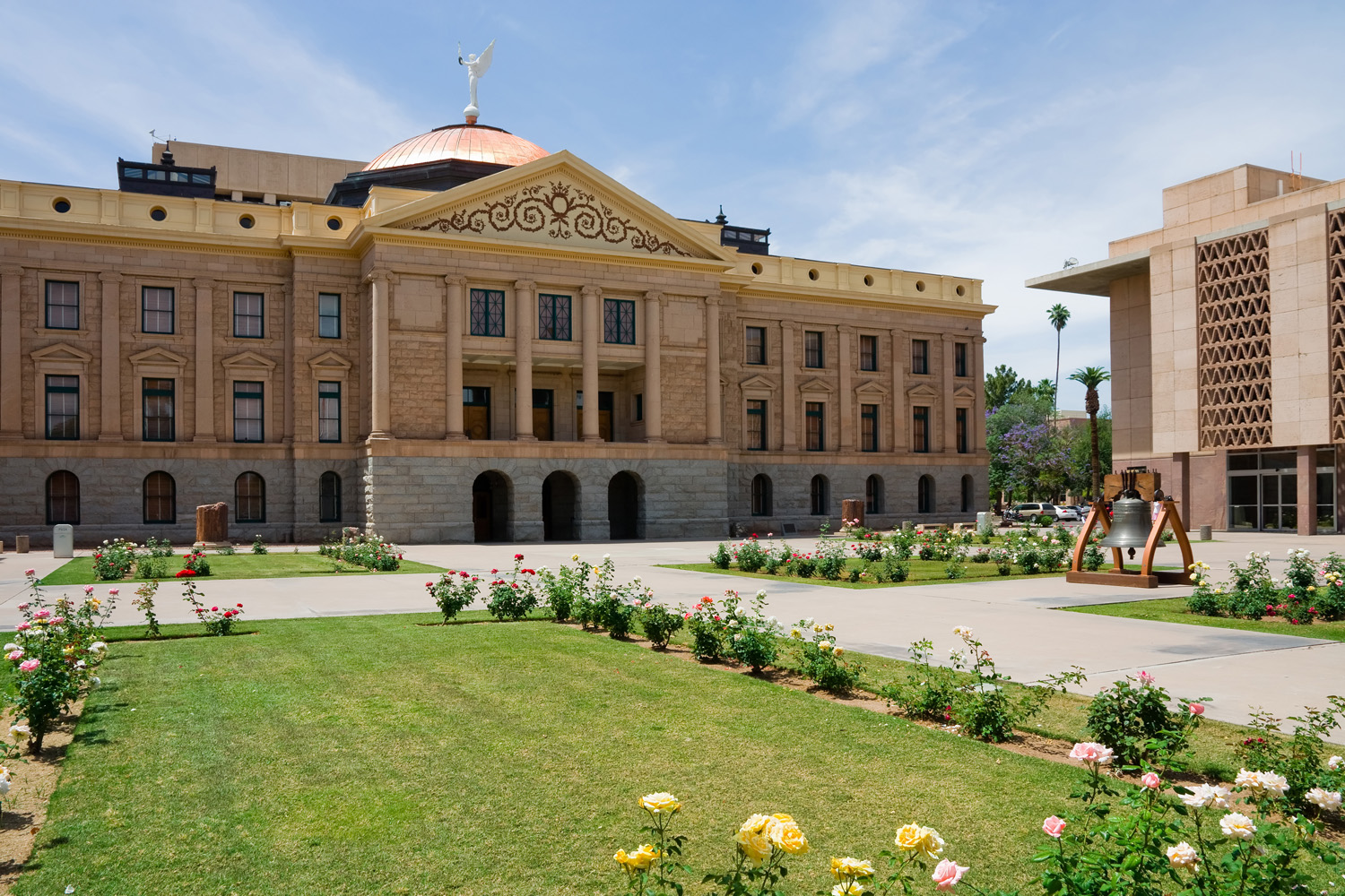
Arizona museums feature art, science, history, and Native American cultures. The Arizona State Museum at the University of Arizona in Tucson and the Arizona Historical Society’s Tucson museums are among the oldest in the state. The Arizona-Sonora Desert Museum, the International Wildlife Museum, and the Pima Air & Space Museum are also in the Tucson area. The Museum of Northern Arizona, near Flagstaff, has exhibits of Indigenous arts and crafts. Museums in the Phoenix area include the Phoenix Art Museum; the Musical Instrument Museum; the Heard Museum, which features Native American art; Pueblo Grande Museum and Archaeological Park, with the remains of a prehistoric village; the Arizona Capitol Museum, with exhibits on state government history; and the Wells Fargo History Museum in Phoenix.
Visitor’s guide
Arizona attracts visitors throughout the year. But its winter season has become nationally famous. Thousands of vacationers flock to the sunny desert playgrounds when other parts of the country are cold. At the same time, ski resorts in the mountains of northern Arizona lure winter sports lovers. Dude ranches, historic sites, and magnificent scenery draw other travelers to the state. The outstanding scenic feature is the world-famous Grand Canyon, one of the natural wonders of the world. This giant gorge, 277 miles (446 kilometers) long and 1 mile (1.6 kilometers) deep, cuts through the rock of northwestern Arizona. Every year, millions of visitors gaze at its splendor. The Petrified Forest in northeastern Arizona is made up of ancient logs that were buried in mud, sand, or volcanic ash years ago and have turned to stone. Grand Canyon National Park and Petrified Forest National Park are among Arizona’s many national parklands.
Arizona’s popular annual events include rodeos, county fairs, and Native American ceremonials. These events are held throughout the year. On May 5, Arizona communities celebrate Cinco de Mayo. This Mexican holiday honors the victory of a Mexican army over an invading French force at Puebla, Mexico, in 1862.
Land and climate
Land regions.
Arizona has three main land regions: (1) the Colorado Plateau, (2) the Transition Zone, and (3) the Basin and Range Region.
The Colorado Plateau,
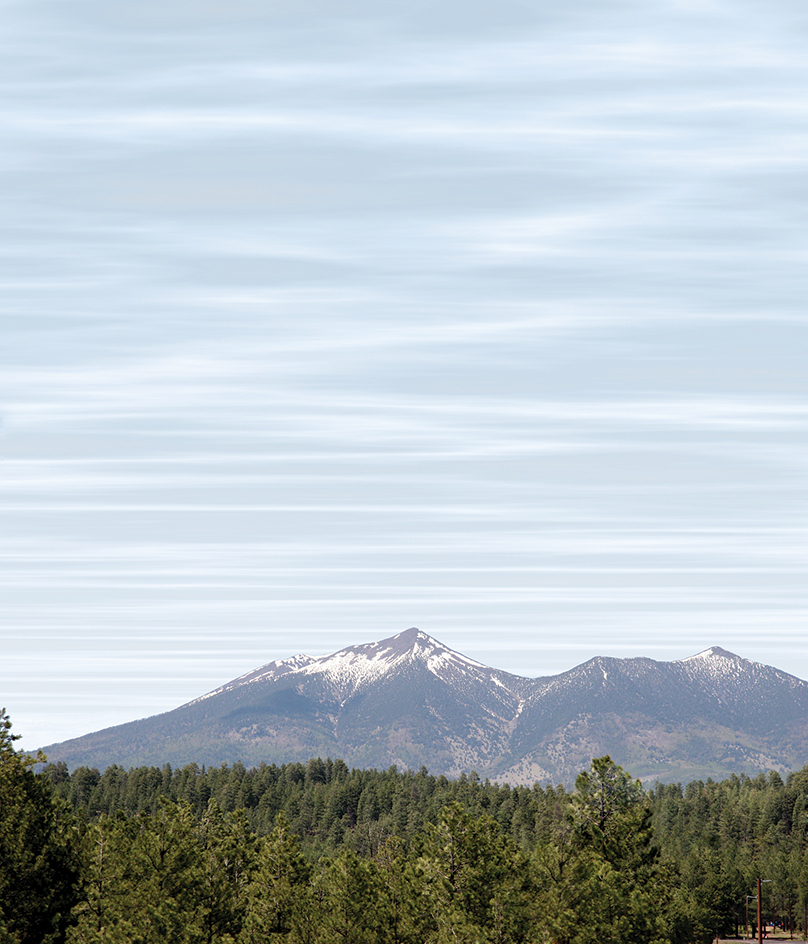
in northern Arizona, covers about two-fifths of the state. The region consists of a series of plateaus with fairly level surfaces. This pattern is broken here and there by a few mountains and canyons. Humphreys Peak, the highest mountain in the state, rises 12,633 feet (3,851 meters) near Flagstaff. The deepest canyon is the famous Grand Canyon on the Colorado River. Tributaries of the Colorado have cut other beautiful canyons into the flatland. These include Canyon de Chelly and Oak Creek Canyon.
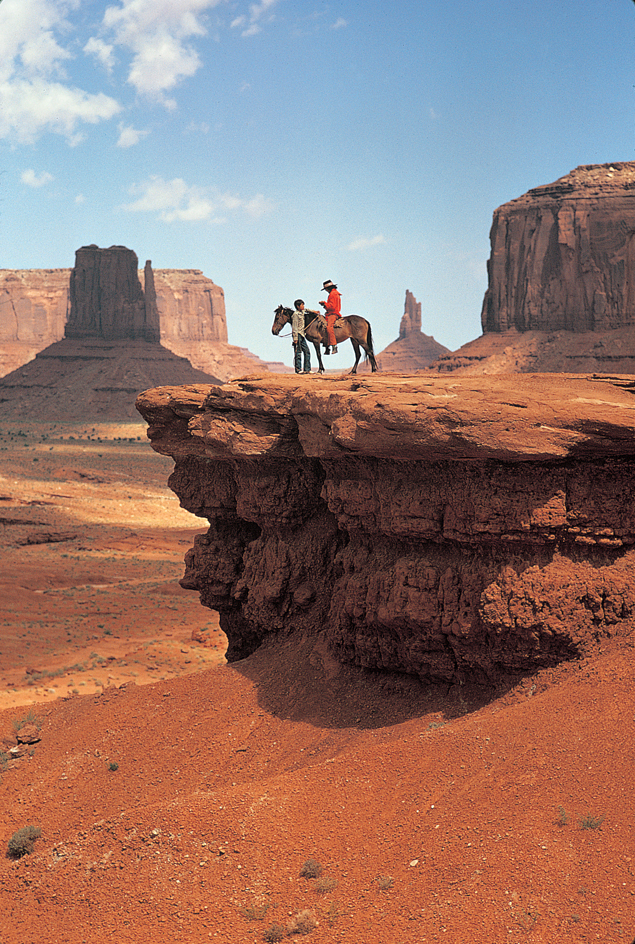
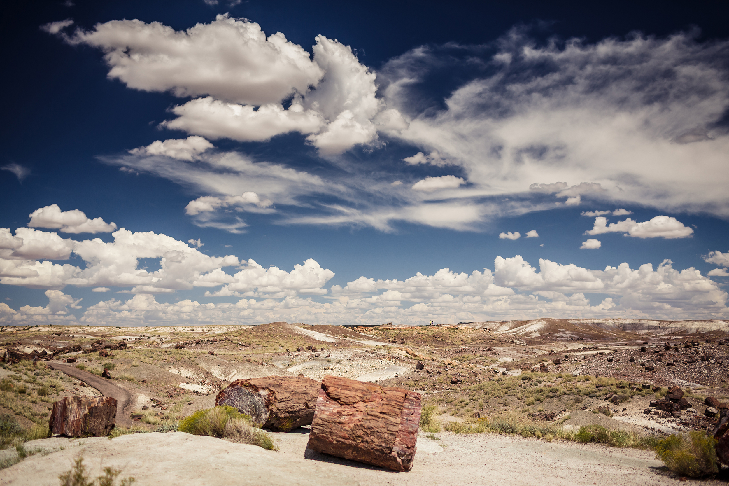
Many of the mountains are forested, but the region also has dry deserts with little vegetation. Along the Arizona-Utah border in the northeast, strange and beautiful rock formations rise from the floor of a broad valley. Because of these formations, the valley is called Monument Valley. The colorful Painted Desert and the Petrified Forest are two well-known parts of the region. The series of level plateaus that make up the region end in the Mogollon Rim on the south. The Mogollon Rim is a steep rock wall almost 2,000 feet (610 meters) high. It extends from central Arizona to the Mogollon Mountains in southwestern New Mexico. The principal industries of Arizona’s Colorado Plateau are tourism, lumbering, and raising livestock.
The Transition Zone
is a narrow strip of land that lies just south of the Colorado Plateau. This region has a number of mountain ranges. The ranges are close together in an area of rugged peaks and narrow valleys. This rough country includes the Mazatzal, Santa Maria, Sierra Ancha, and White mountain ranges.
The Basin and Range Region
includes most of the southern part of the state and a narrow strip in the west. Mountain ranges run through the Basin and Range Region from northwest to southeast. The most important mountain ranges are the Chiricahua, Gila, Huachuca, Hualapai, Pinaleno, Santa Catalina, Santa Rita, and Superstition ranges. The mountain valleys are broad and fertile. This part of the Basin and Range Region produces excellent crops when the soil is irrigated. The state’s largest cities developed in this area.
In the extreme west and south of the Basin and Range Region, the mountains are low and barren. Broad desert basins lie between the ranges. This area of the state gets little rain, and it has almost no vegetation. Along the western border of Arizona, water from the Colorado River is used to irrigate the dry land. The irrigated land produces excellent crops.
Rivers, waterfalls, and lakes.
Arizona’s most important river is the Colorado. In Arizona, the river is 688 miles (1,107 kilometers) long. It enters the state from Utah almost in the middle of the northern border. Then it winds west through the Grand Canyon and turns south. The river forms almost the entire western boundary of Arizona.
The Colorado and its tributaries drain most of the state. Before 1935, the muddy Colorado carried about a million tons of rich soil to the Gulf of California every day. Irrigation and power dams on the great river and its branches have helped control the flow, and the river is much clearer today.
Few small streams in Arizona flow all year. Some mountain creeks have a steady flow, but most streams often seem dry. Rushing water fills the riverbeds of the Bill Williams, Little Colorado, San Pedro, and Santa Cruz rivers after a rain. At other times, these rivers appear to be dry. However, water always flows beneath their sandy beds. Many mountain streams tumble down cliffs and canyon walls in waterfalls and cascades. The best-known falls include Beaver, Bridal Veil, Havasu, Mooney, and Navajo. All of these falls are on Havasu Creek in the Supai Canyon area of the Grand Canyon.
Several small natural lakes lie in the mountain areas of the state, but all the largest lakes are artificially created. Many artificial lakes have been made by damming streams for irrigation and for water conservation. The largest of these lakes include Theodore Roosevelt Lake and San Carlos Lake. Lake Mead, behind Hoover Dam, lies partly in Nevada. Part of Lake Havasu, formed by Parker Dam, is in California. Lake Powell, which was created by Glen Canyon Dam, lies partly in Arizona and partly in Utah.
Plant and animal life.
Forests cover more than a fourth of Arizona’s land. The mountain regions of the state have the largest area of ponderosa pine in the United States. Other trees in the state include aspen, blue spruce, cottonwood, Douglas-fir, juniper, pinon, walnut, and white fir.
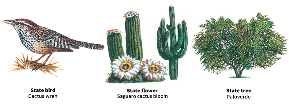
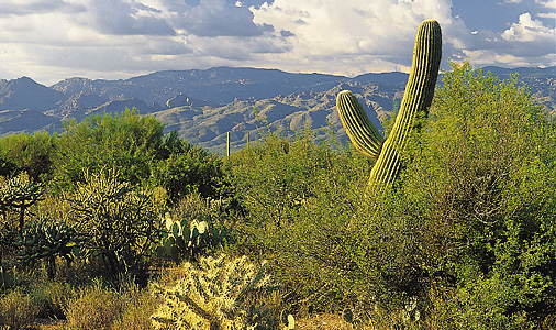
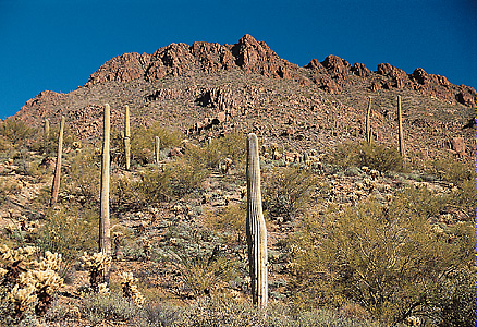
Arizona is famous for its cactuses. The sharp-spined cholla cactus is common in the hot desert areas. Creosote bushes and prickly pear cactuses also grow in the desert. The organ-pipe cactus is found in desert areas near sea level. The saguaro, which is common in southern Arizona, grows larger than any other cactus in the United States. The saguaro blossom is the state flower.
Other unusual plants that grow in Arizona include the night-blooming cereus and several varieties of the yucca plant. Arizona wildflowers include the geranium, golden columbine, paintbrush, phlox, pink, poppy, and sand verbena.
Animal life in Arizona includes large numbers of mule deer and white-tailed deer. Other large animals include black bears, elk, bighorn sheep, and pronghorns. Several members of the cat family, including bobcats and mountain lions, prowl in the forested areas. Jaguars are occasionally sighted in southern Arizona.
Other Arizona animals include badgers, beavers, foxes, raccoons, skunks, squirrels, and weasels. The state is also home to the collared peccary or javelina, an animal distantly related to the wild hog.
Arizona has over 40 kinds of lizards, including the poisonous Gila monster. Rattlesnakes live in most parts of the state, and the rare, poisonous coral snake is found in the desert. The state’s hotter areas have scorpions and tarantulas. 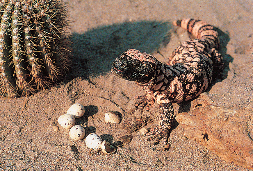
Arizona’s game birds include doves, grouse, quail, wild turkeys, and various waterfowl. Trout swim in the Colorado River and in the mountain streams. Other fishes include bass, bluegills, and crappies.
Climate.
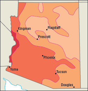
Temperatures vary greatly in Arizona. Mountain areas often have winter temperatures below 0 °F (–18 °C). The southern deserts may go for years without freezing weather. The dry air in the deserts makes cold or heat seem more comfortable there than in humid regions. 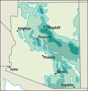
The state’s highest temperature, 128 °F (53 °C), was recorded at Lake Havasu City on June 29, 1994. Hawley Lake, near McNary, had the record low, –40 °F (–40 °C), on Jan. 7, 1971. In Phoenix, temperatures average about 95 °F (35 °C) in July, and about 56 °F (13 °C) in January.
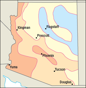
Precipitation varies greatly throughout the state. The deserts of the southwest get only 2 to 5 inches (5 to 13 centimeters) of moisture a year. Arizona’s high mountain areas may receive as much as 30 inches (76 centimeters) a year.
Economy
Service industries provide the vast majority of jobs for residents of this rapidly growing state. Many service industries benefit from spending by tourists and by retired people who live in the state all or part of the year.
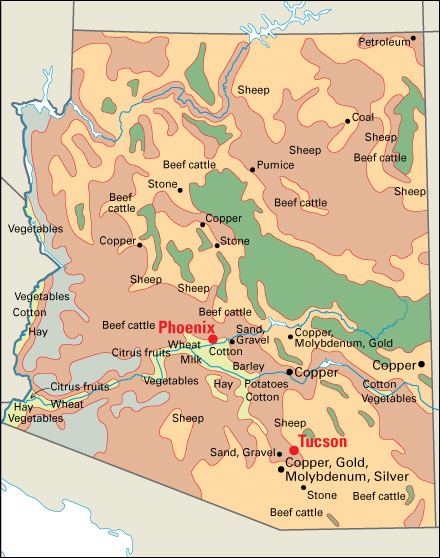
Arizona’s manufacturing is based on high-technology products, such as computer components and aerospace vehicles. Agriculture and mining are also important in Arizona. The state has many cattle ranches and is the nation’s leading copper producer.
Natural resources.
Arizona’s leading natural resources are its warm climate and its mineral deposits.
Water
is a scarce resource in Arizona. Expanding urban areas require more water. Farmers must bring water to their land to make crops grow. A system of canals supplies the water. The canals follow ancient canals built by the Hohokam people hundreds of years before Europeans came to the area. The water comes from mountain reservoirs fed by winter snow and spring rain. But Arizona uses more water than it can get from its streams and storage reservoirs. The state’s underground water supply is being used up faster than nature can replace it.
In 1968, the United States Congress approved funding for the Central Arizona Project, a system of canals, tunnels, and pipelines. The system, completed in 1991, provides for pumping large quantities of water from the Colorado River to the Phoenix and Tucson areas for agricultural and other purposes. Arizona has also put in place a statewide water management and water reclamation program to meet current water needs while replenishing the state’s supply of underground water.
Minerals.
Arizona’s mountains and plains contain large deposits of minerals and other materials, the most valuable of which is copper. Sand and gravel come from almost all of the counties in the state. Molybdenum, which is used in hardening steel, is also present. Other mined products in Arizona include gemstones, gold, lime, perlite, silver, and stone.
Soil.
Only about an eighth of Arizona’s soil is suitable for farming because of the limited amount of water available for irrigation. Soils of the plateau region in northern and eastern Arizona are thin and gray. The mountain soils also are thin and are brown or gray. The lowlands of southwestern Arizona have red soils. In some parts of this region, the soil lies over another layer of soil called caliche. This concretelike soil can be so hard that power tools are sometimes needed to dig holes.
Service industries
account for the majority of both Arizona’s employment and its gross domestic product—the total value of goods and services produced in the state in a year. Most of the service industries in the state are concentrated in the Phoenix and Tucson areas.
Phoenix, the state capital, is the center of government activities. Several financial institutions are in Phoenix and its surrounding area. The majority of hotels, restaurants, and retail trade establishments are in the Phoenix and Tucson areas. Hotels and restaurants especially benefit from the tens of millions of tourists who visit Arizona each year.

Manufacturing.
Arizona’s leading manufactured products are computer and electronic products and transportation equipment. Factories in the Phoenix area produce most of the electronic products. Electronic products include search, detection, and navigation instruments and semiconductors. Both the Phoenix and Tucson areas turn out large amounts of transportation equipment. Most of the transportation equipment is aerospace products, including aircraft and aircraft parts, guided missiles, helicopters, and space vehicles.
Other manufactured products include chemicals, fabricated metal products, nonmetallic minerals, and processed foods. All of these products are primarily manufactured in the Phoenix and Tucson areas. Cleaning products and pharmaceuticals (medicinal drugs) are the leading chemicals made in the state. Important fabricated metal products include structural metals, including sheet metal and frames for windows and doors. Concrete is the leading nonmetallic mineral product. Food products include baked goods and dairy products.
Agriculture.
Farmland covers more than a third of the state. All of Arizona’s counties have some irrigated land.
Crops account for over half of Arizona’s total farm income, even though less than 5 percent of its land is used for growing crops. Lettuce is the most valuable crop. Most lettuce is produced in Yuma County. Cotton and hay are also valuable crops. Cotton production and hay production are concentrated in southern Arizona, especially in Maricopa and Pinal counties. Arizona is also among the leading producers of citrus fruits, melons, and vegetables.
Livestock accounts for less than half of Arizona’s farm income. Beef and dairy cattle are among the leading sources of farm income in the state. Ranchers raise beef cattle in many parts of the state. Most of the state’s dairy cows are in Maricopa and Pinal counties. Angora goats, hogs, and sheep are also raised in Arizona.
Mining.
Copper provides most of Arizona’s mining income, and Arizona is the leading copper-producing state. Greenlee, Pima, and Pinal counties in the southern part of the state supply most of the copper. Gila and Yavapai counties also have major copper mines. Large amounts of gold, molybdenum, and silver are recovered as by-products of mining copper ore. Freeport-McMoRan Copper & Gold Inc., a major mining company, is headquartered in Phoenix.
Crushed stone and sand and gravel are also important mined products in Arizona. Granite and limestone are the state’s leading crushed stone products.
Electric power and utilities.
Nuclear plants and power plants that burn natural gas supply most of Arizona’s electric power. Hydroelectric plants and solar installations produce much of the remaining power. Cheaper prices for natural gas and renewable energy sources led to the decline in use of coal for power generation in the 2010’s. 
Transportation.
Arizona has an extensive system of roads and highways. Interstate 10 connects Tucson, Phoenix, and Los Angeles. Interstate 40 passes through Flagstaff in the upper third of the state. The part of Arizona north of the Colorado River is isolated from the rest of the state by the Grand Canyon. No roads cross the canyon.
Phoenix Sky Harbor International Airport is the state’s busiest commercial airport. Tucson International Airport is also a major airport. In 1919, Tucson became the first U.S. city to have its own municipal airport.
Rail lines provide freight service, and passenger trains serve several cities in the state. The Southern Pacific (now part of the Union Pacific) became the first railroad to enter the region, reaching Yuma in 1877.
Communication.
Arizona’s first newspaper, the Weekly Arizonian, began publication in Tubac in 1859. Today, Arizona’s leading newspapers include The Arizona Republic of Phoenix and the Arizona Daily Star of Tucson.
Government
Constitution.
Arizona is governed under its original constitution, which was adopted in 1911. The Constitution has been amended (changed) about 150 times.
All amendments must be approved by a majority of the voters in an election. Amendments may be proposed by a majority of both houses of the State Legislature, by petition from the voters, or by a constitutional convention. A convention may be called if approved by a majority vote of both houses, and then by a majority of the people voting on the question in an election.
Executive.
The governor of Arizona is elected to a four-year term. The governor may serve any number of terms, but no more than two terms in a row.
Arizona has no lieutenant governor. A governor who dies or resigns is succeeded by one of the other four state officials elected by the voters. These are, in order of succession, the secretary of state, attorney general, state treasurer, and superintendent of public instruction. All serve four-year terms. They may serve any number of terms, but no more than two in a row.
Legislature
consists of a 30-member Senate and a 60-member House of Representatives. Each of Arizona’s 30 legislative districts elects one senator and two representatives to two-year terms. These officials may serve any number of terms, but no more than four in a row. The Legislature meets each year on the second Monday in January. Rules have been adopted to end the sessions no later than the Saturday after the 100th day. The president of the Senate and the speaker of the House of Representatives may extend a session, but for no longer than seven days. After that, the session can be extended only by a majority vote of the Legislature. The governor may call a special session, which has no time limit.
Courts.
The highest court in Arizona is the state Supreme Court. Its seven justices are appointed to six-year terms by the governor from a list of candidates submitted by a judicial nominating commission. At the end of each justice’s term, the judge runs unopposed as a nonpartisan candidate and the voters decide if the judge should be retained. The justices elect one of their members as chief justice for a five-year term.
A state Court of Appeals was created in 1964. This court has two divisions, one centered in Phoenix and the other in Tucson. The Phoenix division has 16 judges, and the Tucson division has 6 judges. These judges serve six-year terms and are selected and retained in the same way as are Arizona Supreme Court justices. Superior Courts in each county handle most major criminal and civil cases. Superior Court judges in Cocomino, Maricopa, Pima, and Pinal counties are appointed by the governor to four-year terms. In other counties, Superior Court judges are elected to four-year terms. After that, voters decide whether they are retained. Other Arizona courts include justice and municipal courts.
Local government
in Arizona is carried on through 15 counties and about 90 incorporated cities and towns. Counties are governed by a three- or five-member board of supervisors. Supervisors are elected to four-year terms. Counties have either a county-manager or an administrator who conducts the daily business of the county and is guided by the board of supervisors.
Communities with over 1,500 people may vote to incorporate their community as a town. Cities must have at least 3,000 people. Towns in Arizona are governed by councils of five or seven members, depending on the size of the community. The council elects one of its members as mayor. Some Arizona cities also use this same system. However, a city may adopt a home rule charter, which allows it to change the form of its government. Many cities, including most of the largest ones, have city managers.
Revenue.
Taxes provide about two-fifths of the state government’s general revenue (income). Four taxes produce almost all the tax money. These are (1) a sales tax, (2) income taxes on corporations and individuals, (3) a tax on motor fuels, and (4) property taxes. Federal grants and U.S. and local government programs also provide much of the general revenue. Most of the rest of the government’s revenue comes from taxes on licenses and tobacco.
Politics.
For many years, Democrats controlled Arizona politics, particularly on the local level. In the second half of the 1900’s, however, Republicans won the support of many voters in Arizona’s rapidly growing cities. Among the Republican leaders who helped make Arizona a two-party state was U.S. Senator Barry M. Goldwater, the Republican candidate for president in 1964.
Maricopa County, which includes Phoenix, Mesa, and several large suburbs, has a majority of the state’s voters. As a result, that county is extremely important in elections. The state’s largest city, Phoenix, has leaned Democratic since the late 1900’s. Democratic support is also strong in Apache and Pima counties. Republicans have strength in many rural areas and small towns.
In presidential elections, Arizona has voted for Republican candidates about two-thirds of the time, including most of the presidential elections since 1952.
History
Early days.
Indigenous peoples have lived in Arizona for at least 12,000 years. Over the centuries, many of them built large settlements and developed civilizations known as the Ancestral Pueblo, once called the Anasazi; Hohokam; and Mogollon. The Ancestral Pueblo, who lived in the north, were the ancestors of the present-day Pueblo people. The Hohokam, who settled in the Gila and Salt river valleys, constructed the largest irrigation systems in North America before Europeans arrived. Their descendants are the Pima and the Tohono O’odham, also known as the Papago. The Mogollon lived in what are now eastern Arizona and western New Mexico. The Apache and Navajo moved into the Arizona area shortly before the Spaniards arrived.
Spanish exploration.
During the 1530’s, stories reached the Spaniards in Mexico of the great wealth of the Seven Cities of Cíbola. Spanish authorities sent a small group headed by Franciscan priest Marcos de Niza to find the cities. Niza, in 1539, became the first European known to enter the Arizona region. He reported seeing one of the seven cities from a distance. In 1540, a much larger expedition led by explorer Francisco Vásquez de Coronado traveled to Zuni pueblos and other Pueblo settlements in what is now northern New Mexico. Lieutenants of Coronado visited Hopi pueblos and the Grand Canyon in what is now northern Arizona. The expedition found neither gold nor silver and returned to Mexico disappointed.
Spanish settlement of Arizona began in 1629, when Franciscan priests established missions among the Hopi. In 1680, however, the Hopi killed their missionaries and threw off Spanish rule. In the late 1600’s and early 1700’s, Jesuit missionary Eusebio Kino founded a number of missions among the O’odham people in what are now northern Mexico and southern Arizona.
Because Spanish and mission Indigenous settlements had cattle, horses, sheep, and goats, they became targets of raids by Apache warriors. The threat of Apache attacks limited permanent Spanish settlement to the Santa Cruz River Valley. There, in 1752, Spanish troops established the state’s first white settlement, a military post at Tubac. During 1775 and 1776, the soldiers moved to Tucson. They built a fort there with high, thick adobe walls to protect themselves and the settlers from Apache attacks.
Mexico won its independence from Spain in 1821, and the land that is now Arizona became part of the new country. In 1846, the United States went to war with Mexico. U.S. forces took control of the region. Under the terms of the Treaty of Guadalupe Hidalgo, which ended the war in 1848, the United States took possession of New Mexico. At that time, New Mexico included Arizona as far south as the Gila River. Many Easterners opposed the treaty because they feared that slavery would be established in the newly acquired land. But the U.S. Senate approved the treaty.
In 1853, the United States and Mexico signed the Gadsden Purchase. Through this treaty, the United States acquired the region south of the Gila River that forms the present boundary between the United States and Mexico.
Territorial days.
The Civil War (1861-1865) brought great political changes to Arizona. In the 1850’s, Arizona settlers had asked Congress to create an Arizona Territory, but their requests were ignored. After the Confederacy was formed, many settlers wanted to join it because they had come from the South. They chose a delegate to the Confederate Congress.
In 1862, the Confederacy sent troops to occupy the New Mexico and Arizona areas. Union forces defeated the Southerners. In 1863, the Confederate government created the Confederate Territory of Arizona. The action had little meaning because of the earlier military defeat.
The Confederate activity led to action by the United States. Congress created the Arizona Territory with boundaries about the same as those of the present state. On Dec. 27, 1863, John N. Goodwin officially took control of the area as territorial governor. Goodwin established his headquarters at Fort Whipple. A log house was built for him not far from the fort. The town of Prescott grew up around this house.
Conflict.
Arizona’s few settlers lived in fear of being attacked by Indigenous groups. The Navajo were defeated in 1864 in a campaign led by the famous scout Kit Carson. But the Apache continued to fight. Small bands of warriors made hundreds of raids on lonely ranches and outposts throughout the Southwest. Under such leaders as Cochise and Geronimo, the Apache even attacked forts and towns. The last raiding party under Geronimo finally surrendered on Sept. 4, 1886.
Territorial progress.
In spite of almost constant fighting with Indigenous groups, Arizona made great progress. Discoveries of gold and silver brought many miners to the territory. As early as 1867, farmers in the Salt River Valley near present-day Phoenix began irrigating their fields. Ranching became a large-scale business during the 1880’s. The rich copper mines of Arizona became highly developed in the 1880’s and 1890’s. The Southern Pacific Railroad entered Arizona from California on Sept. 30, 1877.
Statehood.
Strong movements began about 1890 to make the territory a state. But Congress refused to act. In 1910, Congress permitted Arizona to draw up a Constitution and apply for statehood. But again there was a delay. President William Howard Taft vetoed the bill because the proposed state Constitution would have permitted the voters to remove judges from office by a process known as recall (see Recall). This clause was taken out of the Constitution, and statehood was approved. Arizona became the 48th state on Feb. 14, 1912. The people soon changed their Constitution to allow the recall of judges. 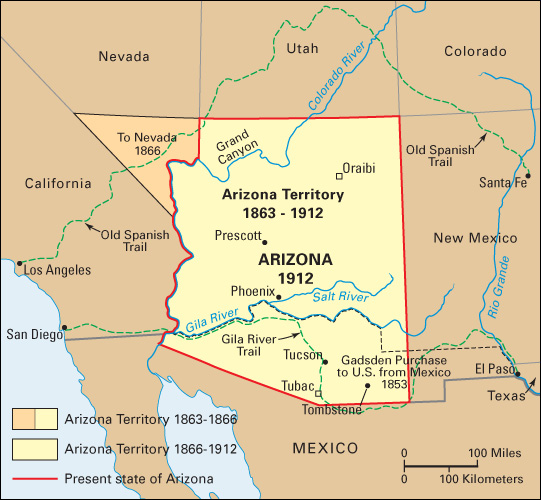
Progress as a state.
George W. P. Hunt, a Democrat, greatly influenced Arizona’s early history. He became the state’s first governor and served seven terms. Hunt supported the development of dams and irrigation systems, and he worked for laws favorable to the ranching and mining industries.
Federal projects helped the new state in water development and tourism. The first big dam providing irrigation water was the Theodore Roosevelt Dam, completed in 1911 on the Salt River above Phoenix. More dams were built during the next 25 years. Coolidge Dam on the Gila River, Bartlett Dam on the Verde River, and three more dams on the Salt River added greatly to the state’s irrigated area. The biggest dam, Hoover Dam on the Colorado River, was completed in 1935. The U.S. government helped increase tourism by developing scenic and historic spots. The warm, dry climate attracted health seekers and winter visitors. 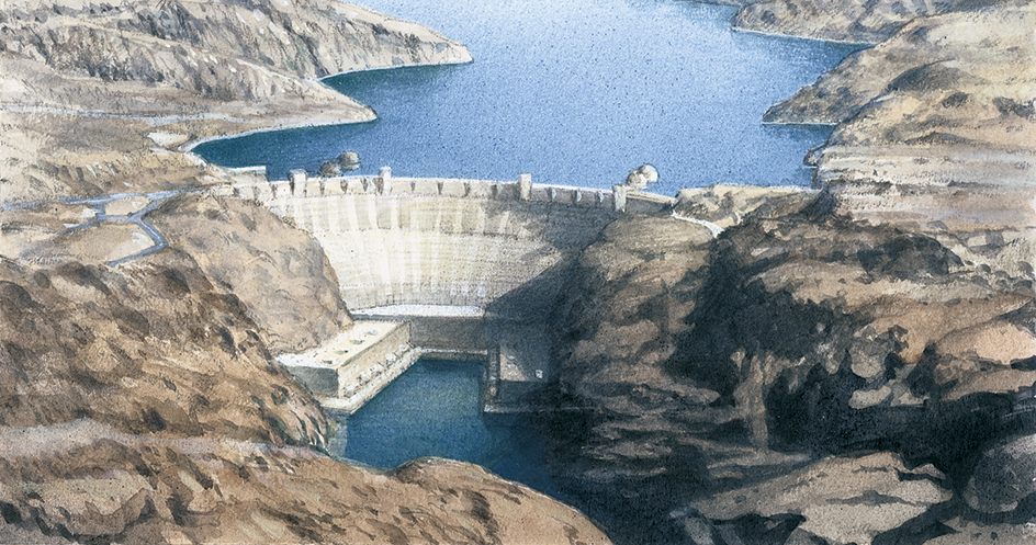
During World War I (1914-1918), cotton became an important crop. The amount of irrigated land expanded rapidly, and agricultural production increased. Farmers became reliant on water pumped from the ground. Arizona’s copper production increased through the 1920’s. The Great Depression of the 1930’s forced workers in many parts of the nation to seek new jobs. Some of them settled in Arizona. Between 1920 and 1940, the population grew from 334,162 to 499,261.
The mid-1900’s.
During World War II (1939-1945), the government built many air bases in Arizona because the large number of sunny days provided ideal flying weather. The demand for Arizona’s chief products—cattle, copper, and cotton—increased rapidly during the wartime boom. Phoenix doubled in size.
The boom continued into the 1950’s. Thousands of veterans who had been stationed in Arizona returned with their families to live there. Air conditioning became widespread and made life pleasant in the desert region. As a result, many people, including large numbers of retired persons, moved to Arizona from the East. The state’s population rose by about 50 percent during the 1940’s and by about 74 percent in the 1950’s.
In 1948, Arizona’s Native Americans won the right to vote. The Arizona Supreme Court struck down parts of the state Constitution that had kept Native Americans from voting.
Arizona shifted from an agricultural to a manufacturing economy during the 1950’s and 1960’s. By 1967, the value of industrial production had reached $1 billion, compared with about $600 million for agricultural products. New factories produced a wide variety of electrical and electronic goods, including appliances, computers, and refrigeration equipment. Arizona’s warm winters attracted an increasing number of vacationers, and tourism became an even larger industry.
Growth in agriculture, manufacturing, and population during the 1940’s and 1950’s strained Arizona’s water resources. By the 1960’s, the state was pumping more water from its underground water supply than it was getting from rainfall. In 1963, the Supreme Court of the United States gave Arizona rights to 2,800,000 acre-feet (3.5 billion cubic meters) of water a year from the Colorado River. One acre-foot (1,233 cubic meters) is equal to 1 acre (0.4 hectare) of water 1 foot (30 centimeters) deep and will supply approximately five city dwellers for one year.
In 1965, Judge Lorna Lockwood was elected chief justice of the Arizona Supreme Court. Her election by her fellow judges made her the first woman in the United States to head a state supreme court.
Arizona’s Native Americans made economic gains during the 1960’s. Several Native American groups started to operate business companies, factories, and industrial and recreational areas on their reservations. Navajo Community College, the first college ever built on an Indian reservation, opened at Many Farms, on the Navajo reservation in northeastern Arizona, in 1969. The college moved to Tsaile in 1973.
The late 1900’s.
In 1974, construction began on the Central Arizona Project, a system of canals, tunnels, and pipelines designed to ensure the state a sufficient supply of water. The project was completed in 1991. The system covers 336 miles (541 kilometers) and extends from Lake Havasu on the Colorado River to the San Xavier Indian Reservation southwest of Tucson.
In 1975, Raul H. Castro became governor. He was the first Mexican American to be elected to the office.
In 1981, President Ronald Reagan appointed Arizona Judge Sandra Day O’Connor to the Supreme Court of the United States. She became its first woman member. 
In the late 1900’s, casino gambling became an important source of revenue for many Arizona Native American groups, funding health, education, and housing programs on reservations. Tribes also used their allotments of Central Arizona Project water to create new agricultural projects or to sell to cities.
In 1988, Governor Evan Mecham was removed from office by the state legislature. He had been charged with illegally lending state money to his automobile dealership and trying to block an investigation into charges that one of his aides had made a death threat against a grand jury witness. The state House of Representatives impeached him. The Senate convicted Mecham on the charges, resulting in his removal from office. Secretary of State Rose Mofford finished Mecham’s term, becoming the first woman to serve as Arizona’s governor.
In 1997, Governor Fife Symington resigned after being convicted of fraud for filing false financial statements with banks. The actions occurred while he was a real estate developer, and before he was governor. Symington appealed his conviction in 1998. In 1999, the federal appeals court overturned the conviction. Secretary of State Jane Dee Hull, who had replaced Symington, ran in 1998 for a full term as governor. Her election victory made her the first woman to be elected governor of the state.
The early 2000’s.
The state’s economy remained strong through the late 1900’s and into the 2000’s. But declining copper prices and long labor disputes led to severe economic problems in several mining areas.
Arizona continued to be one of the nation’s fastest-growing states. Its population increased by 40 percent between 1990 and 2000 and by another 40 percent between 2000 and 2020. The population growth shifted to cities and away from rural areas.
In April 2010, Governor Jan Brewer signed a controversial state law targeting illegal immigration. The law makes it a state crime to be in the United States illegally. Supporters said the law was needed to fight crime and discourage people from illegally crossing the border from Mexico. Opponents said the law would unfairly target Hispanic Americans regardless of their immigration status. In July, just before the law went into effect, a federal judge blocked some of its key elements. The judge found that several parts of the state law conflicted with federal authority over immigration. The ruling blocked provisions that would have required police to question people about their immigration status and would have demanded that immigrants carry papers. In June 2012, the U.S. Supreme Court rejected most parts of the controversial law. However, the court upheld the provision that requires police to check the immigration status of people they detain.
In January 2011, a gunman killed 6 people and wounded 13 at an event held by U.S. Representative Gabrielle Giffords in Tucson. Giffords, a Democrat representing a district in southeastern Arizona, was shot in the head. Doctors expected her to need lengthy rehabilitation to help her regain lost function. Jared Loughner of Tucson was charged with the shootings. A federal judge ruled Loughner unfit to stand trial and sent him to a federal mental health facility for treatment. In August 2012, a federal judge ruled Loughner competent to stand trial. Loughner pleaded guilty to 19 counts, including murder and attempted murder. In November, a judge sentenced Loughner to seven consecutive life sentences, plus 140 years, in federal prison.
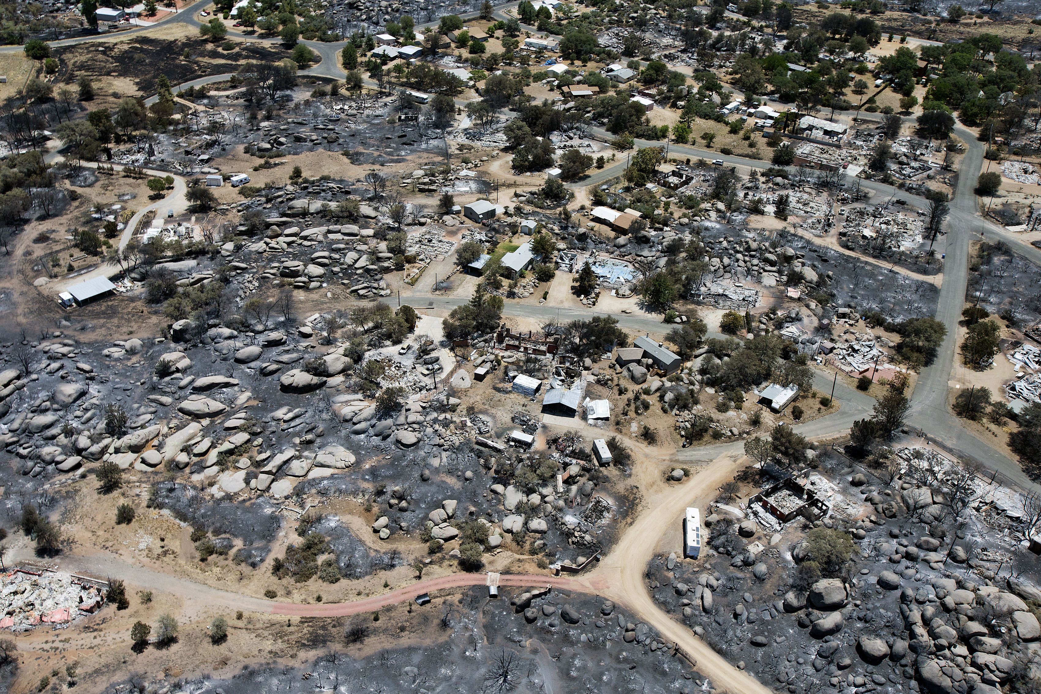
From May through July 2011, several major wildfires raged in eastern Arizona. One called the Wallow Fire charred more than 800 square miles (2,070 square kilometers) in the White Mountains and the Apache-Sitgreaves National Forest. Other large fires burned in the Coronado National Forest in the southeast corner of the state. Officials said the Wallow Fire was the largest in state history. On June 30, 2013, 19 firefighters from Prescott, Arizona, were killed while fighting the Yarnell Hill Fire, northwest of Phoenix. Officials said that the wildfire was the deadliest in state history.