Black Hills are a range of low mountains located in southwestern South Dakota and eastern Wyoming. The region is a favorite vacation ground among tourists because of its beauty. The Black Hills cover 6,000 square miles (16,000 square kilometers). They rise from 2,000 to 4,000 feet (610 to 1,200 meters) above the surrounding plains.
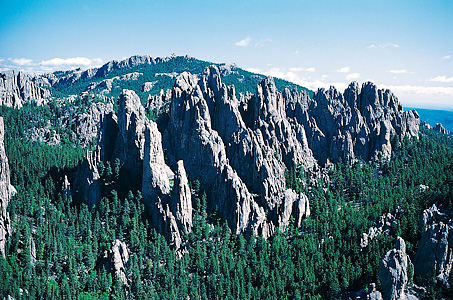
The Black Hills were formed millions of years ago when pressure from below raised the crust of the earth into a huge dome. Erosion wore this dome into the gigantic rock stubs that are now called the Black Hills. The Sioux people called this region the Black Hills because pine forests covering the slopes looked black when seen from the plains.
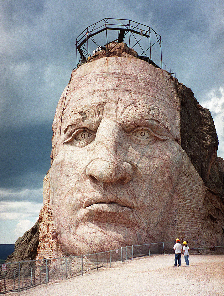
The Black Hills region has many canyons, streams, and rock formations. Black Elk Peak (7,242 feet, or 2,207 meters) is the highest point in South Dakota. It overlooks Sylvan Lake. Other high peaks in the region include Terry Peak, Custer Peak, Parker Peak, and Crows Nest Peak. In the region are Mount Rushmore National Memorial, Crazy Horse Memorial, Wind Cave National Park, and Custer State Park.
The Black Hills were once part of a reservation for the Sioux. But thousands of white settlers poured in after gold was discovered in 1874. The federal government took possession of the territory from the Sioux in 1877. Mining towns sprang up, the most noted of which was Deadwood. Later, other minerals, including silver, copper, lead, and building stone, were mined in the Black Hills. The pine forests were logged. Farmers began to raise crops. Tourism became an important industry for the region. Rapid City is the largest town in the Black Hills region.
