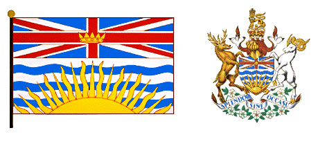
British Columbia is Canada’s third largest province. Only Quebec and Ontario are larger. The province is often referred to by its initials, “B.C.” British Columbia is the only province that lies on the Pacific Ocean. It includes the Haida Gwaii island group, 60 miles (97 kilometers) from the mainland, and Vancouver Island, 285 miles (459 kilometers) long, off the southwestern coast.
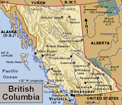
More than half of all British Columbians live in the Vancouver-Victoria region in the southwestern corner of the province. Vancouver, British Columbia’s largest city, is a port on the mainland. Victoria, on the southeastern tip of Vancouver Island, is the capital of the province. The Vancouver-Victoria region has a mild climate and fertile lowlands for farming. Ferries carry goods and passengers between Vancouver Island and the mainland.
British Columbia has a larger area than California, Oregon, and Washington together. A narrow strip of Alaska separates the northern part of the province from the Pacific Ocean.
Southern British Columbia has a rugged coastline known for its natural beauty. Steep, forested mountains rise along the shore. Narrow arms of the sea reach far inland, winding among the mountains. Islands dot the coastal waters.
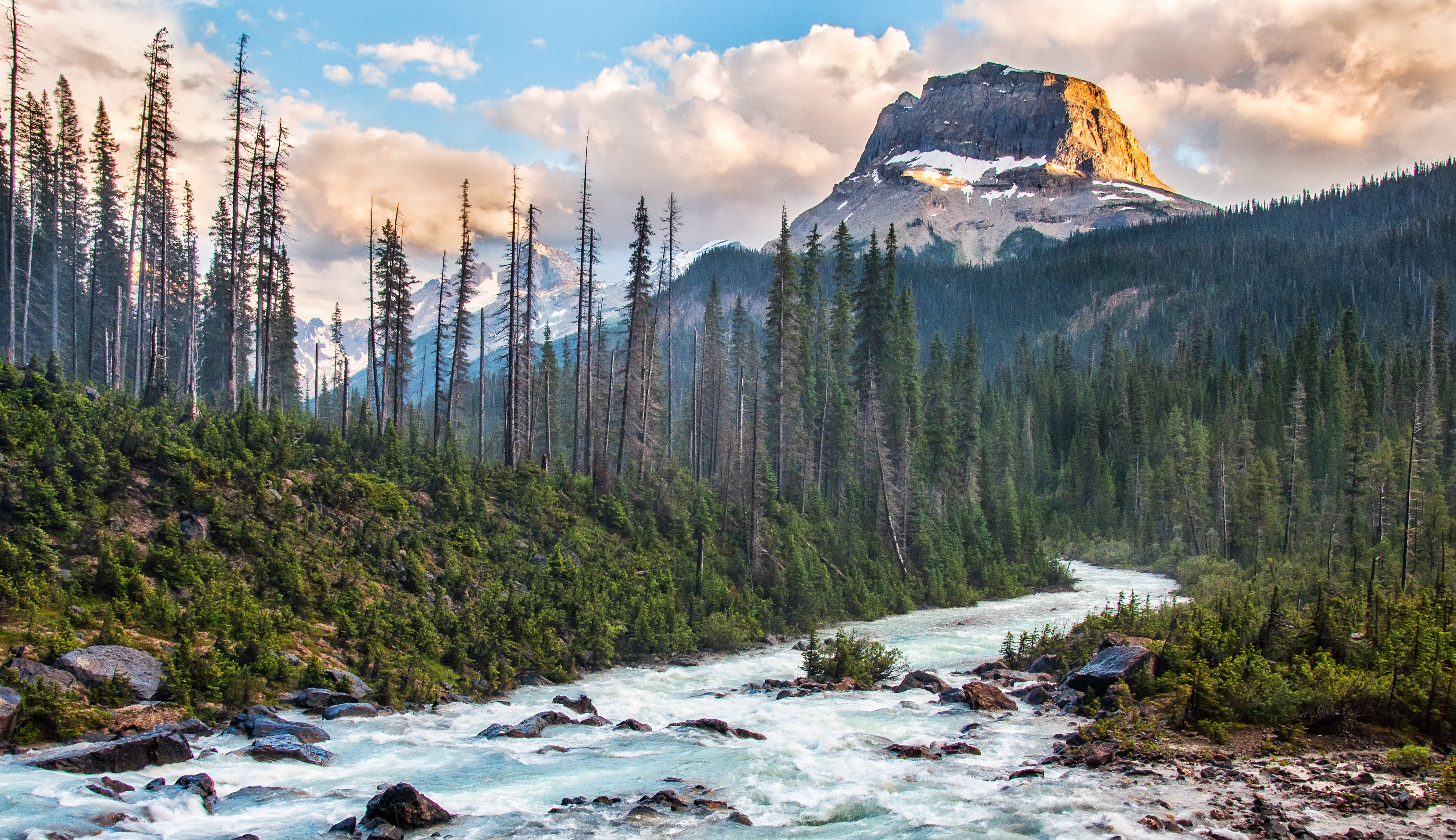
The large inland area of British Columbia, usually called the interior, has high mountain ranges and rugged plateaus. Cold air from Yukon may bring bitterly cold winter weather, and the rugged land and severe climate can make transportation difficult. But the interior of British Columbia has beautiful mountains, sparkling lakes and rivers, and abundant wildlife.
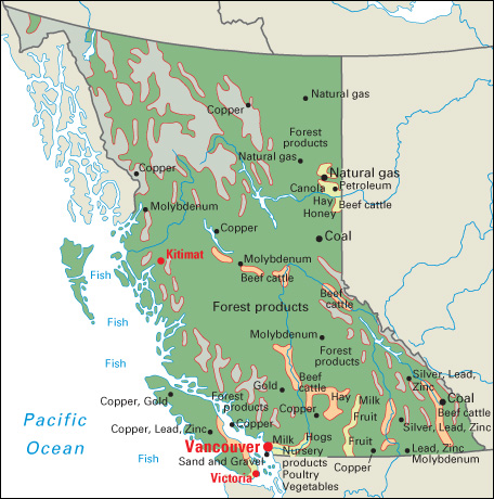
The forests of British Columbia provide about half of Canada’s lumber. Mines in the province yield coal, copper, gold, molybdenum, sand and gravel, silver, zinc, and other minerals. Natural gas and oil are piped from fields in the northeast. British Columbia is a leading province in fishing.
British Columbia has a colorful frontier history. Gold strikes near the Fraser River in the late 1850’s opened up the interior. Most of the miners left the region after the gold ran out, but settlers stayed on to farm, fish, and log. Frontier days in British Columbia did not end in that period. Since the mid-1900’s, several resource towns, including Kitimat, Mackenzie, and Tumbler Ridge, have been built in sparsely settled areas. These towns serve such resource-based industries as mining and logging. Roads and railroads have been built to link the northern interior of the province with the industrial southwest. Huge dams and power projects also have been constructed.
People
Population.
The 2021 Canadian census reported that British Columbia had a population of 5,000,879. The population had increased about 8 percent over the 2016 figure of 4,648,055.
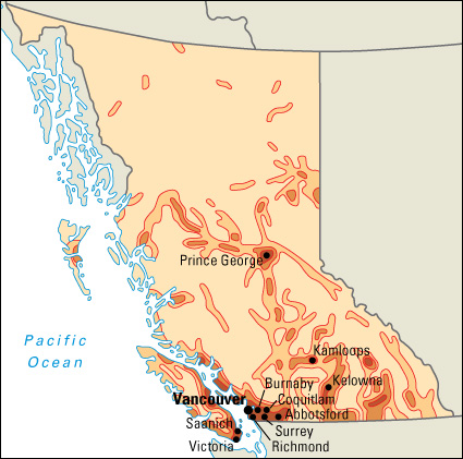
Southwestern British Columbia is the most heavily populated part of the province. About half of the people of British Columbia live in the Vancouver metropolitan area. This area and the Abbotsford-Mission, Chilliwack, Kamloops, Kelowna, Nanaimo, and Victoria metropolitan areas are Census Metropolitan Areas as defined by Statistics Canada (see Metropolitan area).
Vancouver, the province’s largest city, lies near the mouth of the Fraser River. Vancouver is a major seaport and an important business and financial center. Many of the province’s other large communities lie within the Vancouver metropolitan area. These include Burnaby, Coquitlam, Richmond, and Surrey. Victoria, the capital of British Columbia, lies on Vancouver Island. Victoria has many gardens, winding streets, and parliament buildings. Kamloops and Prince George are the largest cities north of the Vancouver area. Kelowna in the Okanagan Valley is a rapidly growing community.
About 70 percent of British Columbia’s people were born in Canada. The largest groups from other countries came from China, India, the Philippines, and the United Kingdom. The province’s largest ethnic groups include people of Chinese, English, French, German, Irish, and Scottish descent. About 190,000 people in British Columbia have some First Nations or Inuit ancestry. First Nations and Inuit are Indigenous peoples of Canada.
Schools.
In 1849, the Hudson’s Bay Company, a British trading firm, began operating a school for the children of its employees on Vancouver Island. The Public School Act of 1872 established a free provincial school system. Today, the Ministry of Education is responsible for the administration of the public school system. The minister, a member of the cabinet, sits in the Legislative Assembly as a member of the governing party.
Each school district in British Columbia is administered either by an elected board of school trustees or by a trustee appointed by the province’s lieutenant governor in council. Parents also may send their children to independent (private) schools. Many of these schools stress learning about a particular culture, religion, or value system. Independent schools must operate according to provincial standards, and some receive government funds. Children from age 5 to 16 must attend school.
Libraries and museums.
Public libraries serve people throughout British Columbia. The University of British Columbia in Vancouver, the University of Victoria in Victoria, and Simon Fraser University in Burnaby have large academic libraries. The Legislative Library in Victoria provides reference services for the legislature and for departments of the provincial government.
The British Columbia Archives in Victoria have a fine collection on the history of British Columbia. The Royal British Columbia Museum in Victoria has exhibits on natural history, ocean life, First Nations culture, and modern history. The H. R. MacMillan Space Centre in Vancouver includes a planetarium and an observatory. The Maritime Museum of British Columbia in Victoria has an outstanding collection of exhibits on maritime heritage and culture. The Vancouver Maritime Museum displays the Arctic exploring ship St. Roch.
Visitor’s guide
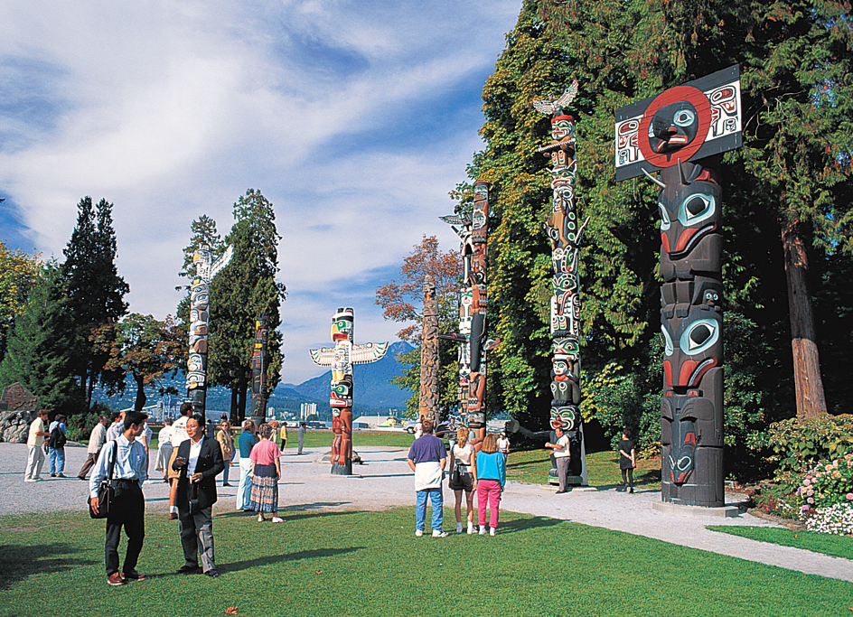
British Columbia is a favorite destination for tourists from around the world. Imported British goods and antiques are for sale in Victoria, Vancouver, and other southwestern coastal cities. Tourists in Victoria enjoy winding streets and trim gardens that lead people to call the city “a bit of old England.” Visitors may tour the attractive stone buildings of British Columbia’s legislature. Native American carvings and other artwork displayed in parks and museums recall the province’s history.
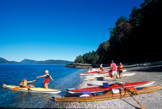
Magnificent mountains and coastal scenery are among British Columbia’s chief attractions. Numerous highways running through the province offer views of snow-capped peaks, thick green forests, and sparkling lakes and streams. Ferries and shipping lines operate among the coastal cities and between the coastal islands and the mainland. Passengers are treated to views of steep mountains rising from the sea, and of forested islands. Several hot-spring resorts in British Columbia are also popular with visitors. 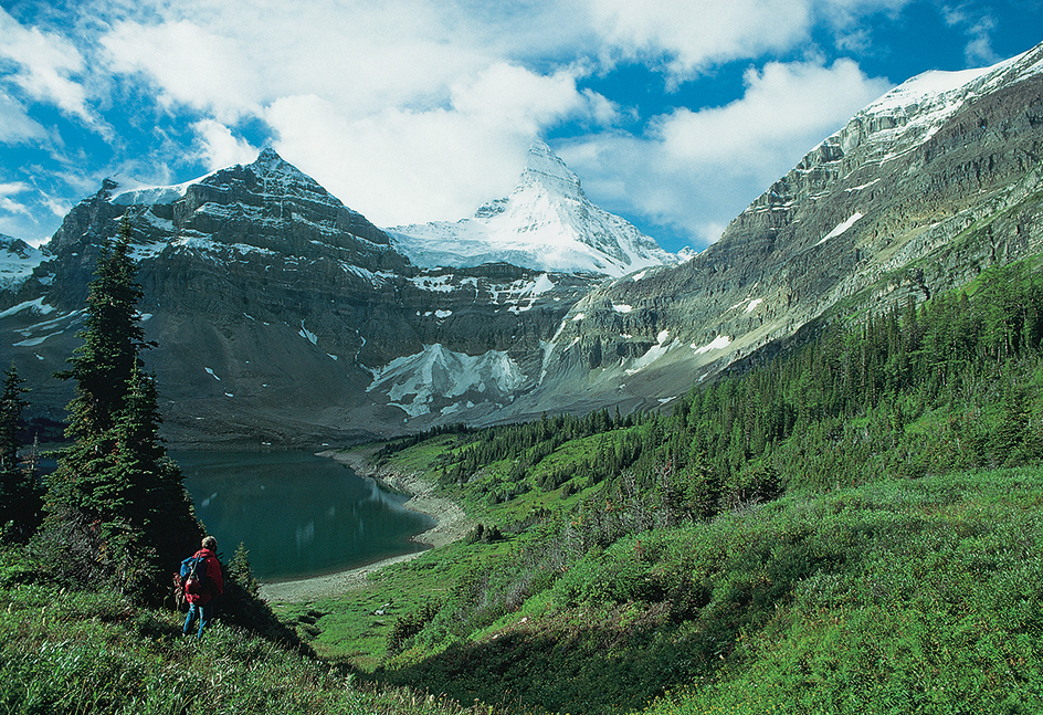
The province offers skiing in the mountains and water sports on the southern lakes. Mountainside ski villages are especially popular. Visitors enjoy British Columbia’s vast unspoiled wilderness with its variety of wildlife, including bears, eagles, and elk. Anglers catch steelhead, salmon, and other prized game fish.
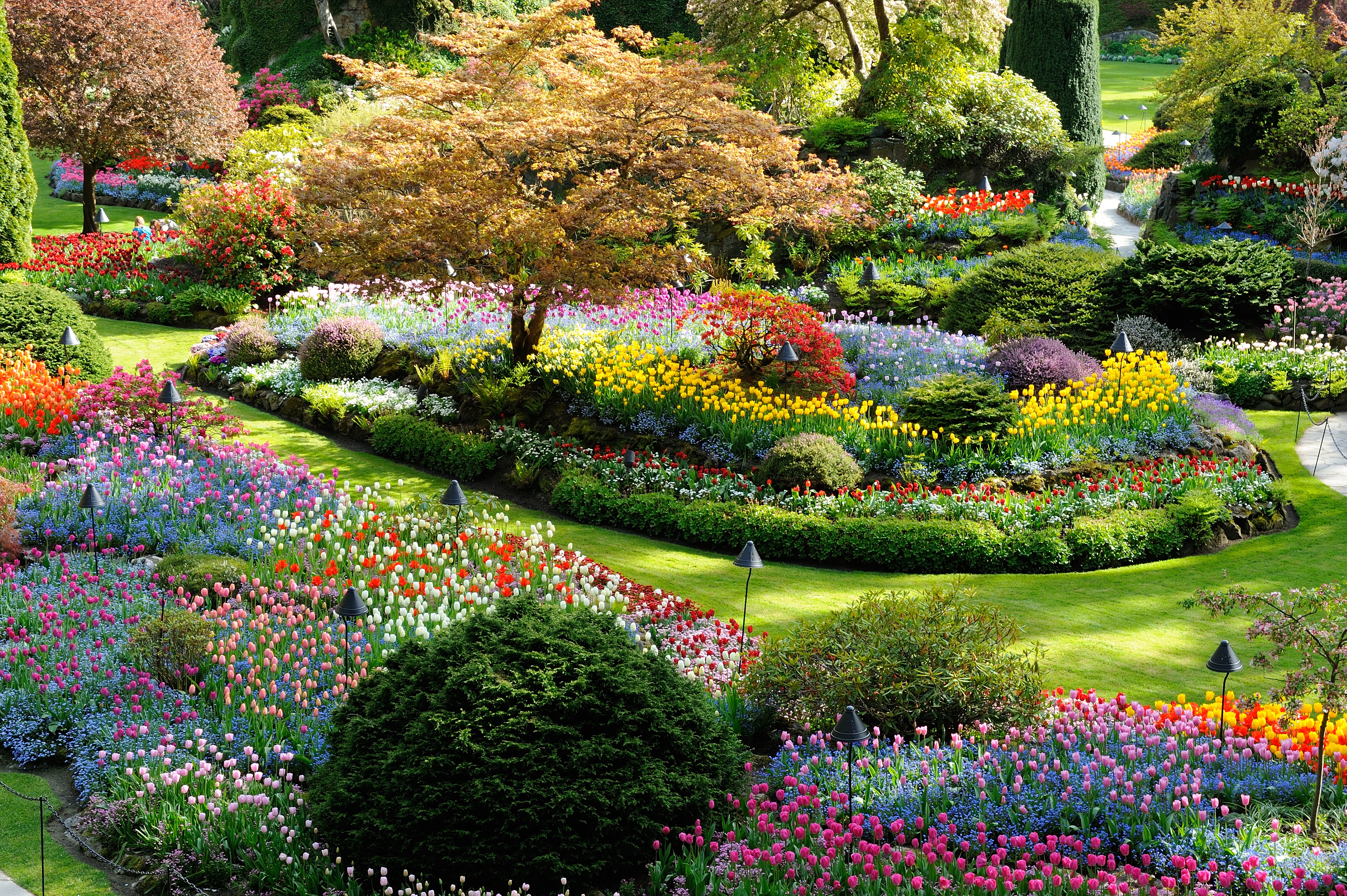
British Columbia has many cultural attractions. In Vancouver, tourists visit the Vancouver Art Gallery, the H. R. MacMillan Space Centre, and expansive Stanley Park. The Butchart Gardens and the Royal British Columbia Museum are in Victoria.
Land and climate
Land regions.
Most of British Columbia is covered by a belt of parallel mountain ranges that extend northwest and southeast. This mountain mass is called the Cordillera. It is about 300 miles (480 kilometers) wide at the northern boundary of the province and about 500 miles (800 kilometers) wide at the southern border.
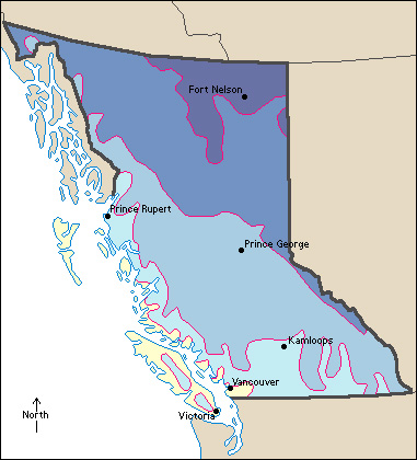
British Columbia has six main land regions: (1) the Insular Mountains, (2) the Lower Fraser Valley, (3) the Coast Mountains, (4) the Interior Plateau, (5) the Eastern Mountains, and (6) the Transmontane Plains.
The Insular Mountains
are part of a mountain range that lies mostly under the ocean and is an extension of the Olympic Mountains in the U.S. state of Washington. The higher parts form the many islands along British Columbia’s coast. Vancouver Island, by far the largest, is 285 miles (459 kilometers) long and averages 60 miles (97 kilometers) in width. Some of its peaks are over 5,000 feet (1,500 meters) high. But its east coast is a broad, rolling lowland. The Haida Gwaii islands are also part of the submerged range. These islands have a large swampy lowland in the northeast.
The Lower Fraser Valley
is a delta region in the southwestern corner of the mainland. Dikes protect much of the lowlands from being flooded. The Lower Fraser Valley is the main farming region of the province. This region has fertile soils and a mild climate.
The Coast Mountains
extend northwestward from the Lower Fraser Valley into Yukon and the Alaska Panhandle. They give the mainland a high, indented coastline. Fairweather Mountain, the highest point in British Columbia, rises 15,300 feet (4,663 meters) in the Coast Mountains on the Alaskan border. Mount Waddington, the tallest peak in the southern Coast Mountains, is 13,104 feet (3,994 meters) high.
The Interior Plateau
lies east of the Coast Mountains. The southern section of this region has several long, narrow lakes and rivers. Some lake and river valleys, such as the Nicola, Okanagan, and Thompson, are important farming, fruit-growing, and grazing areas. The Cascade Mountains of Oregon and Washington extend into British Columbia. These mountains form the southwestern boundary of the Interior Plateau. The northern part of the plateau is forested and has large areas of level ground.
The Eastern Mountains
include the Rocky Mountains along British Columbia’s eastern border, the Cassiar-Omineca Ranges in the north, and the Columbia Mountain System in the southeast. The Cariboo, Monashee, Purcell, and Selkirk ranges form the Columbia System. The Rocky Mountain Trench, a long, narrow valley, lies between the Columbia Mountains and the Rocky Mountains in the south. In the north, it is east of the Cassiar-Omineca Ranges. The trench forms a north-south route from Montana to Yukon. Several rivers, including the Kootenay, Columbia, Fraser, Parsnip, and Finlay, flow along the trench.
The Transmontane Plains
are flat lands and hilly lands that lie in the northeastern corner of the province. The Peace River District is the most developed part of the region.
Coastline
of British Columbia is 15,985 miles (25,725 kilometers) long. The province’s many islands account for about three-fourths of the total coastline. High mountains rise along most of the coastline. Narrow inlets extend far inland. The narrow waterway between the small islands near the coast and Haida Gwaii and Vancouver Island is called the Inside Passage. It provides a sheltered passageway for ships.
Rivers, waterfalls, and lakes.
Most of the chief rivers of British Columbia drain into the Pacific Ocean. The Fraser River begins in the Rocky Mountains and winds 850 miles (1,370 kilometers) to the Pacific. The Nechako, Quesnel, Chilcotin, and Thompson flow into the Fraser. The Columbia River begins in southeastern British Columbia. It flows northward along the Rocky Mountain Trench. Then it makes its “big bend” around the north end of the Selkirk Mountains and flows southward into the state of Washington. The Canadian part of the Columbia is 460 miles (740 kilometers) long. The Kootenay River is the chief tributary of the Columbia in British Columbia. The Okanagan River flows southward through south-central British Columbia and enters the Columbia in Washington.
In northwestern British Columbia, the Skeena and Stikine rivers cut through the Coast Mountains and empty into the Pacific Ocean. The Nass River flows from the Skeena Mountains into Portland Inlet.
The Peace and Liard rivers in northeastern British Columbia flow eastward through the northern Rockies. They are part of the Mackenzie River System, which empties into the Arctic Ocean.
British Columbia’s many waterfalls include Della Falls (1,443 feet, or 440 meters, high) on central Vancouver Island, Hunlen Falls (900 feet, or 274 meters) near the Bella Coola River in the Coast Mountains, and Takakkaw Falls (833 feet, or 254 meters) in the Yoho Valley of the Rockies.
British Columbia has many lakes. Okanagan and Shuswap in south-central British Columbia are among many lakes in the province that attract tourists and campers. The largest natural lake entirely within the province is Babine Lake, covering 250 square miles (647 square kilometers). The largest lake is Williston Lake, formed by the W.A.C. Bennett Dam on the Peace River. It covers 680 square miles (1,761 square kilometers).
Plant and animal life.
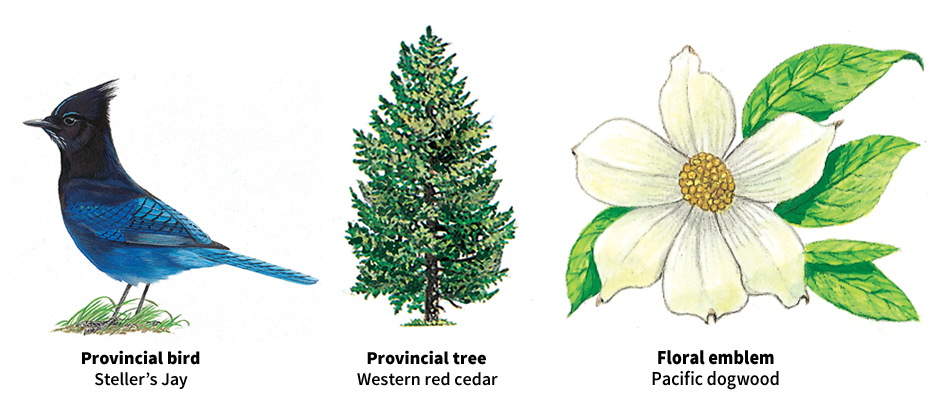
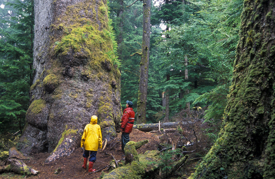
Forests cover about 230,000 square miles (600,000 square kilometers) of British Columbia, or about 15 percent of Canada’s forestland. Most of this land is on Vancouver Island, Haida Gwaii, the Coast Mountains, the western slopes of the Columbia Mountains, and the central interior around Prince George. Hemlock, fir, and spruce are the most valuable timber trees. Wildflowers, such as bleeding hearts, Pacific dogwoods, shooting stars, and yellow arums grow in many parts of British Columbia.
British Columbia has bear, caribou, deer, elk, moose, mountain goat, and mountain sheep, and such fur-bearing animals as beaver, lynx, and marten. Grouse, pheasant, and other game birds are plentiful. In addition, both the coastal and inland waters abound with fish.
Climate.
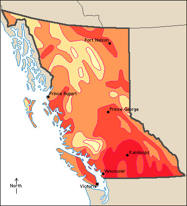
Mild winds from the Pacific Ocean warm British Columbia’s coast in winter and cool it in summer. Average temperatures are 28 °F (–2 °C) in January and 63 °F (17 °C) at most points in July. The Coast Mountains keep this mild air from reaching the interior, which receives cold air from Yukon in winter. Average temperatures at Kamloops, in the south, are 27 °F (–3 °C) in January and 72 °F (22 °C) in July. The Peace River District in the northeast averages 9 °F (–13 °C) in January and 60 °F (16 °C) in July. 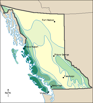
Moist ocean winds bring much rain to the coastal regions, especially in autumn and winter. When winds rise over mountain ranges, much of their moisture condenses and falls on the western slopes. Land areas just east of the ranges may be dry. Western Vancouver Island gets over 100 inches (250 centimeters) of precipitation (rain, melted snow, and other forms of moisture) annually, but Victoria, on the east coast, gets only about 35 inches (88 centimeters). The Peace River District gets about 18 inches (45 centimeters). The Thompson and Okanagan valleys get about 12 inches (30 centimeters).
Economy
Since the mid-1900’s, service industries have grown in importance throughout British Columbia, especially in the Vancouver area. In the rest of the province, the economy is based heavily on such natural resources as forests and mineral deposits. Tourism is also important and benefits many of the province’s service industries.
Natural resources.
British Columbia’s chief natural resources include large timber reserves, mineral deposits, many fish and game animals, an abundant water supply, and small areas of good soil.
Minerals.
British Columbia produces many different kinds of mined products. Coal, copper, natural gas, and petroleum are the most important.
Soil.
Much of the land in British Columbia is mountainous or forested, and is not suitable for raising crops. However, the southern interior valleys have brown soils that, with irrigation, are excellent for growing crops. The Lower Fraser Valley has rich alluvial soils.
Service industries
account for three-fourths of British Columbia’s gross domestic product (GDP)—the total value of all goods and services produced in the province in a year—and about four-fifths of its employment. Many of these industries are in the province’s major cities, especially Vancouver.
The Vancouver area is a leading financial center of western Canada. Vancouver is also the province’s leading trading center and the hub of the transportation industry. Provincial government activities are centered in Victoria, the province’s capital.
Manufacturing.
A majority of manufacturing jobs are in the lower mainland or southwest region of the province. Much of British Columbia’s manufacturing is dedicated to processing its forest and agricultural products.
British Columbia’s forests are used for manufacturing wood and paper products, two of the province’s leading manufactured products. British Columbia ranks among the leading U.S. states and Canadian provinces in the manufacture of wood products. Some companies that make wood products operate paper mills alongside their large sawmills. 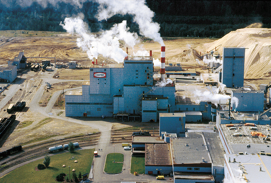
Food and beverage processing is also important. Plants process large amounts of baked goods, dairy products, fish, fruits and vegetables, and meat. Beer, soft drinks, and wine are also made in the province. Other types of manufactured products made in British Columbia include computer equipment, concrete, industrial machinery, primary metal products, and transportation equipment.
Mining.
Coal and natural gas are leading sources of mining income in British Columbia. Coal is mined in the southeastern corner of the province and southwest of Dawson Creek. Natural gas is mined in the northeastern part of the province. Copper is also important. Canada’s largest copper mine is near Kamloops.
Forestry.
Forests cover more than half of British Columbia. Evergreen forests make up most of the forestland. Most of the timber is harvested from the interior areas, although some comes from the coastal area. In the early 2000’s, warmer winters caused an infestation of mountain pine beetles that devastated the lodgepole pines in the west-central interior of the province. 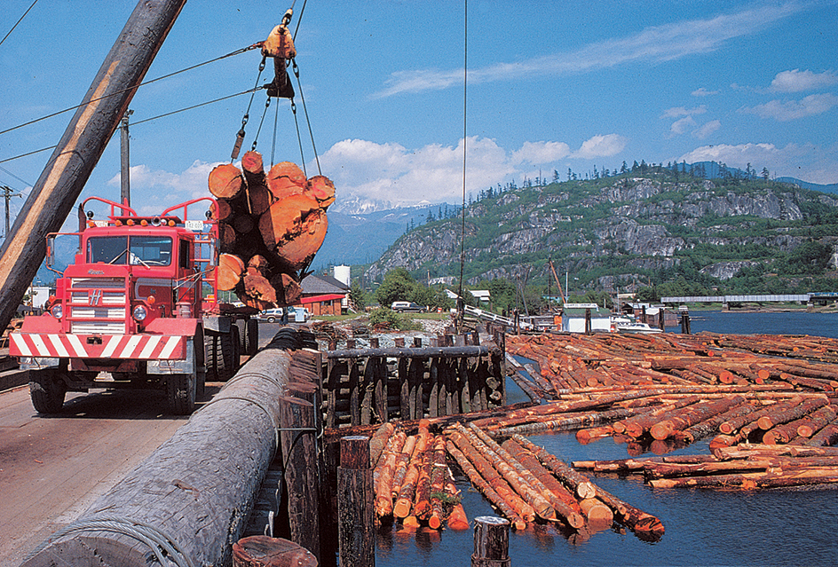
Agriculture.
Most of British Columbia’s agricultural production is in the southern half of the province. Beef, dairy products, greenhouse vegetables, nursery products, and poultry products are among the province’s leading sources of farm income.
The Fraser Valley is British Columbia’s most concentrated farming region. Dairy products, eggs, hogs, poultry, and vegetables are some of the important commodities produced there. The central part of the Interior Plateau region is known for its cattle industry. Nearly all of the province’s tree-fruits and wine grapes are grown in the Okanagan River region. The southern Gulf Islands, off southeast Vancouver Island, also have some vineyards. Canola, cattle, livestock feed, and most of the province’s grain, along with canola, cattle, and livestock feed, are produced in the Peace River area.
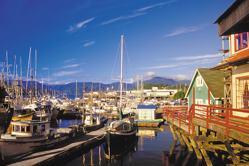
Fishing industry.
British Columbia is an important province in commercial fishing. Farmed salmon also accounts for much of the value of the province’s fishing income.
Electric power and utilities.
British Columbia’s many fast-flowing rivers provide enormous potential hydroelectric power. Most of the province’s electric power comes from hydroelectric plants. Plants that burn natural gas also produce some of British Columbia’s power.
Transportation
developed slowly in British Columbia. Mountains made it difficult to build roads and railroads. In the 1860’s, workers hacked through 385 miles (620 kilometers) of canyon walls to build the Cariboo Road into the gold rush country. The Alaska Highway in the northeast helps link Dawson Creek with Fairbanks, Alaska. The Trans-Canada Highway crosses the province in the south.
Canada’s first transcontinental railroad, the Canadian Pacific Railway, was completed in 1885 at Craigellachie in British Columbia. Canadian Pacific Railway (CPR) and Canadian National Railway (CNR) carry freight from eastern Canada to the ports of Prince Rupert and Vancouver. In addition, CPR operates aquatrain, or railcar barge, service to Vancouver Island. CNR operates aquatrain service from Prince Rupert to Whittier, Alaska. BC Ferries runs one of the world’s largest ferry systems. 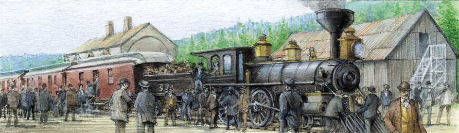
Vancouver International Airport handles most of the province’s air passenger traffic. Vancouver also has Canada’s busiest port, which serves as the main shipping center between Canada and Asia.
Communication.
The Vancouver Sun and The Province of Vancouver are British Columbia’s leading daily papers. Other important papers include theDaily Courier of Kelowna and the Times Colonist of Victoria.
Government
Lieutenant governor
of British Columbia represents the British monarch, Canada’s official head of state, in the province. He or she is appointed by the governor general in council, the governor general of Canada acting with the advice and consent of the Cabinet. The lieutenant governor’s position is largely honorary. Occasionally, however, the lieutenant governor exercises important constitutional functions.
Premier
of British Columbia is the actual head of the provincial government. British Columbia has a parliamentary form of government. The leader of the political party with the most seats is appointed premier.
The premier presides over the Executive Council (cabinet).The council includes ministers chosen by the premier from among party members in the Assembly. Most council members direct one ministry of the provincial government. The government resigns if it loses the support of a majority of the Assembly.
Legislative Assembly
makes the laws that govern the province. The Assembly has 87 members. Each is elected from a separate electoral district. The members normally serve four-year terms. 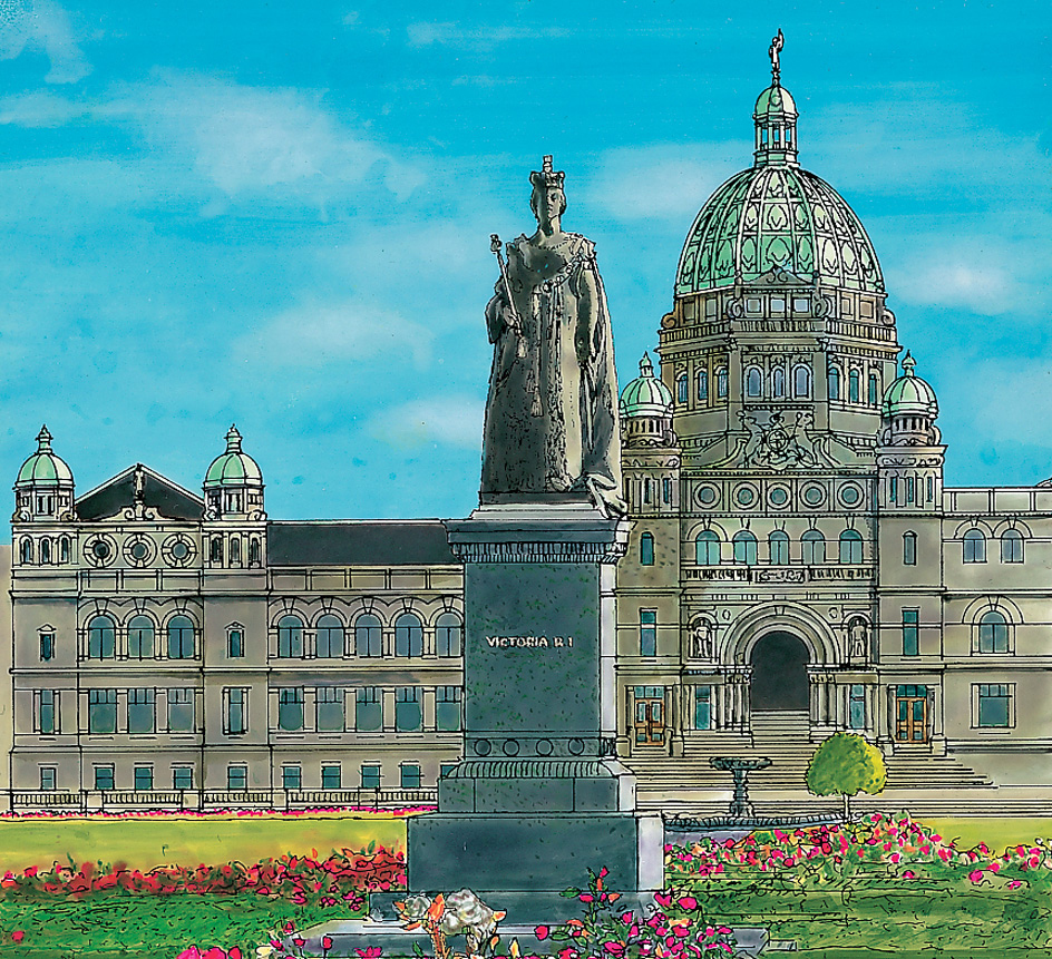
Courts.
The highest court in British Columbia is the Court of Appeal. The Court of Appeal consists of the chief justice of British Columbia and about 20 justices of appeal in this court. The Supreme Court is lower than the Court of Appeal. The Supreme Court consists of a chief justice and about 100 Supreme Court justices. The province also has about 150 judges in Provincial Court, the lowest-level court in British Columbia.
Local government.
British Columbia has about 160 incorporated areas (cities, towns, district municipalities, and villages). A council headed by a mayor governs each area. These officials are elected to four-year terms.
The province is divided into 27 regional districts, plus one unincorporated region. Each district is governed by a regional board of directors from the district’s incorporated and unincorporated areas. The councils of incorporated areas appoint members to the regional board. Voters in unincorporated areas elect directors to the regional board to serve four-year terms.
Revenue.
Taxes levied by the provincial government account for about three-fifths of British Columbia’s general revenue (income). Most of this revenue is generated by taxes on personal income and retail sales. Corporate income and the sale of property are also taxed.
About 15 percent of the province’s general revenue comes from contributions from the federal government. Other revenue comes from premium fees, licenses, permits, and the sale of liquor, which is under government control. Additional revenue comes from government regulated corporations or agencies such as the BC Hydro and Power Authority, the BC Lottery Corporation, the BC Railway Company, and the Insurance Corporation of British Columbia.
Politics.
A number of political parties are active in British Columbia. Two of the main ones are the British Columbia Liberal Party and the New Democratic Party (NDP). The British Columbia Liberal Party is a right-of-center party that has no official ties to the federal Liberal Party of Canada. The New Democratic Party is a social-democratic party.
History
Early days.
First Nations, original peoples of what is now Canada, lived in the British Columbia region long before Europeans arrived in the area. The Athabascans in the north and the Salish in the southern interior were the most populous groups at the time of the Europeans’ arrival. But the Haida, Kwakiutl, Nootka, and Tsimshian peoples were the richest and most advanced groups. They lived along the coast, catching whales, sea otters, salmon, and halibut for food. They developed great artistic skills, and their carved totem poles are tourist attractions today. The First Nations in the interior hunted and fished along the great rivers. They dug keek-wilie houses in the ground for winter shelter. These houses had roofs made of wood covered with earth. During the summer, the First Nations lived in mat lodges, which were pole frameworks covered with fiber mats or branches.
European contact.
In 1774, a Spanish fleet under Juan Perez sighted the region that is now British Columbia, but did not land. Perez and his crew were the first Europeans known to have seen British Columbia. The English explorer James Cook became the first European to land in the region. He led two British ships into Nootka Sound on the west coast of Vancouver Island in 1778. Cook was seeking a passage from the Pacific Ocean to the Atlantic. His crew traded clothes, beads, and knives to the First Nations for otter skins and sold the skins in China and Europe. By 1786, the British had a flourishing fur trade with the First Nations. 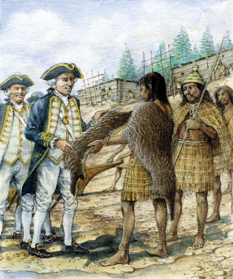
The Nootka Sound controversy
between the Spaniards and the British developed in 1789. Spain claimed the Nootka Sound area because of Perez’s voyage, and because treaties between Spain and Portugal gave all land west of the Line of Demarcation to Spain. The Spaniards became alarmed at the growing British trade. They seized several British ships in Nootka Sound, and the two countries nearly went to war. The dispute was settled by the Nootka Convention of 1790. Ownership remained unsettled, but the British and the Spaniards received equal trading rights.
George Vancouver, an English explorer, set out in 1791 on a three-year survey of the Pacific Coast from California to Alaska. On this voyage, he and his crew named many inlets and other coastal features.
The overland fur traders.
Alexander Mackenzie, a Scottish-born Canadian fur trader, crossed the Rocky Mountains and reached the Pacific Ocean in 1793. Two other members of the fur-trading North West Company, Simon Fraser and David Thompson, followed in 1805 and 1807, respectively. Fraser and Thompson opened fur-trading posts as they came west from eastern Canada. Their chain of posts became Canada’s overland fur-trade route. In 1808, Fraser explored the river that now bears his name. Thompson reached the mouth of the Columbia River in 1811.
The border dispute.
After 1821, the Hudson’s Bay Company, a powerful British trading firm, controlled the fur trade in British Columbia. The company also controlled fur trading in the area that makes up present-day Washington and Oregon. During the late 1830’s and early 1840’s, many American settlers moved into the southern part of this region. They refused to recognize the authority of the British company and asked the United States to establish a government in the area.
Democrats in the United States made U.S. claims to the area an issue in the 1844 presidential election campaign. They wanted the territory on the Pacific Coast as far north as latitude 54° 40′, and they coined the slogan “Fifty-Four Forty or Fight.” The British wanted the southern boundary of British territory to follow the 49th parallel from the Rocky Mountains to the Columbia River, and then to follow the river south and west. This would have given the British all of what is now western Washington. The Democrats won the election, and James K. Polk became president. He proposed a compromise, and the United States and the United Kingdom signed a treaty in 1846. The treaty set the 49th parallel as the southern boundary for all British territory except Vancouver Island. The British kept Vancouver Island, part of which lies south of the 49th parallel.
The colonial period.
The Hudson’s Bay Company founded Fort Victoria (now Victoria) in 1843. In 1849, the British government gave the company the responsibility for colonizing Vancouver Island. In 1851, James Douglas, an official of the company, became governor of the colony. Douglas established the legislative assembly of Vancouver Island in 1856.
The discovery of gold in the Fraser River region in the 1850’s brought thousands of fortune hunters into the territory in 1858. They came by boat from San Francisco, crowding into Fort Victoria to buy supplies. They came overland by horse and wagon and on foot.
The British were anxious to strengthen their hold on the mainland region. They formed the colony of British Columbia in 1858. In 1859, the capital was established at New Westminster. Douglas became governor of the mainland colony and also continued as governor of Vancouver Island. The British united the colonies in 1866. New Westminster was the capital until 1868, when Victoria became the capital.
The colonists debated whether they should apply for annexation to the United States, or become a province in the new Dominion of Canada. In 1871, they agreed to become a part of Canada, on the condition that the federal government would build a railroad to link British Columbia with eastern Canada. John Foster McCreight became British Columbia’s first premier. 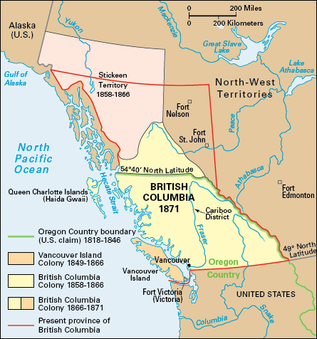
Progress as a province.
The union with the Dominion was an unhappy one at first. The government had promised to build the transcontinental railroad within 10 years. But construction did not start until 1881, and it proceeded slowly. The delay irked British Columbians, who threatened to withdraw from the Dominion. The railroad reached the province in 1885.
The young province soon ran heavily into debt. Spending ran far above revenues. Many people believed that the cost of governing a mountainous area with a scattered population such as British Columbia’s would always be high. British Columbia’s premier, Richard McBride, consulted with the Dominion about the question of aid. In 1906, the other provinces agreed that British Columbia should receive $1 million from the Dominion in annual payments of $100,000.
Railroad routes opened some of the central parts of the province between 1910 and 1920. The railroads speeded the development of lumber camps, mining, farming, and industries. British Columbia’s fishing industry became the biggest in Canada. The province also became a leader in sawmill products and in lead and zinc production. Vancouver, already the western terminal for the Canadian Pacific Railway, became a leading world port after the Panama Canal opened in 1914. The canal provided a cheaper way to ship grain, lumber, and fish products to Europe and the eastern United States.
The mid-1900’s
were years of great progress in British Columbia. Widespread development took place in the northern part of the province. The 1,422-mile (2,288-kilometer) Alaska Highway opened in 1942. The highway extends from Dawson Creek, British Columbia, to Delta Junction, Alaska, where it links up with another highway and continues north to Fairbanks, Alaska.
In 1951, natural gas and oil were discovered near Fort St. John in the Peace River District of British Columbia. Pipeline construction boosted industrial expansion throughout the province. The Kemano hydroelectric project reversed the flow of the Nechako River to power an aluminum plant that began operating in Kitimat in 1954. In 1958, the Pacific Great Eastern Railway completed an extension north into the Peace River District.
In 1964, the Pacific Great Eastern built a branch rail line from Summit Lake to Fort St. James in the interior. This line opened much unused land to the logging and mining industries. It also brought important changes in the timber industry. Previously, logging had centered on the west coast and almost all the wood had been used for lumber. During the 1960’s, the interior forests became important sources of wood.
In the 1960’s, British Columbia opened new parts of the province for settlement and commercial development. The Social Credit government of Premier W. A. C. Bennett sponsored a series of long-term development programs. The major project, a hydroelectric power dam on the Peace River, started operating in 1968.
In 1964, Canada and the United States approved the Columbia River Treaty, which called for the construction of four dams in the Columbia River basin—three in Canada and one in the United States. The Duncan Dam was completed in 1967. The Hugh Keenleyside Dam was dedicated in 1969. The Libby Dam in northwest Montana began operating in 1972, and the Mica Dam was completed in 1973.
The late 1900’s.
Trade with Japan brought further growth to British Columbia’s economy during the 1970’s. Previously, British Columbia had looked to the eastern provinces and the United States for its major markets. In 1968, a coal company in British Columbia signed an agreement to export about 50 million tons (45 million metric tons) of coal to Japan over a 15-year period. In 1970, a port built by the provincial and federal governments to handle coal shipments opened at Roberts Bank, south of Vancouver. In the 1980’s, coal deposits near Tumbler Ridge in east-central British Columbia were developed to supply the Japanese market.
In 1971, the Pacific Great Eastern Railway reached Fort Nelson in the northeast. The line opened the way for development of the area’s natural resources. In 1972, its name was changed to British Columbia Railway Company. The company turned its freight operations over to CN Rail in the early 2000’s.
In 1972, British Columbia voters elected the province’s first social-democratic government. David Barrett of the New Democratic Party headed the new government. In 1973, the provincial legislature set up government-owned corporations to compete with private firms in the insurance and the pulp and paper industries. From 1975 to 1991, the Social Credit Party again governed British Columbia. In 1991, the New Democratic Party regained control and governed the province until 2001. That year, British Columbia’s Liberal Party won control of the government.
Expo 86, a worldwide exposition of communication and transportation technologies, was held in Vancouver in 1986. It helped promote tourism in the province. The construction of highways between Hope, Kamloops, and the Okanagan Valley in the late 1900’s contributed to the development of the southern interior.
The 2000’s.
In 2000, the Canadian government ratified the Nisga’a Treaty, which settled land claims by the Nisga’a people of British Columbia. The treaty granted the Nisga’a control over about 775 square miles (2,000 square kilometers) of land in northern British Columbia as well as cash and other economic benefits. It also provided for a form of self-government for the Nisga’a. Since that time, a number of other First Nations have signed such treaties, and many others continue to negotiate treaties with Canada and the province.
In 2010, the Winter Olympic Games were held in Vancouver and Whistler, British Columbia. Canadians won a record number of medals.
British Columbia experienced some extreme environmental events in the early decades of the 2000’s. For example, the 2017, 2018, and 2023 wildfire seasons set records for the area of land burned in the province. The area burned in 2023 was more than twice the area burned in 2018. In June 2021, an extreme heat wave hit western Canada, a region with historically mild summers. It broke daily maximum-temperature records for many areas of British Columbia, as well as the record for Canada. In November, a series of storms rapidly drenched southwestern British Columbia with torrential rains that led to flooding and mudslides. Such extreme events affected some populated areas. They caused destruction of infrastructure and personal property, and even deaths, in some communities.
The New Democratic Party has been British Columbia’s governing party since 2017. David Eby became the leader of the NDP and the premier of British Columbia in 2022, upon the retirement of Premier John Horgan.
