Cloud is a mass of tiny water droplets, ice crystals, or both that appears in the sky. Clouds play an important part in Earth’s weather. They bring needed water to many kinds of life in the form of rain and snow . Clouds can also bring destruction or even death, in the form of hail or tornadoes. In addition, clouds have a strong influence on the amount of heat that is retained or lost in the atmosphere.

Some clouds are great fleecy masses, and others look like giant feathers. Still others are gray or black sheets that darken the sky. Most clouds change shape continuously, as new droplets or ice crystals form in some parts of the cloud and evaporate in others. Clouds also change because of the action of winds and other moving air.
Kinds of clouds
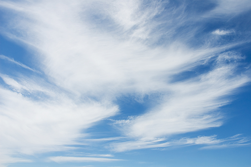
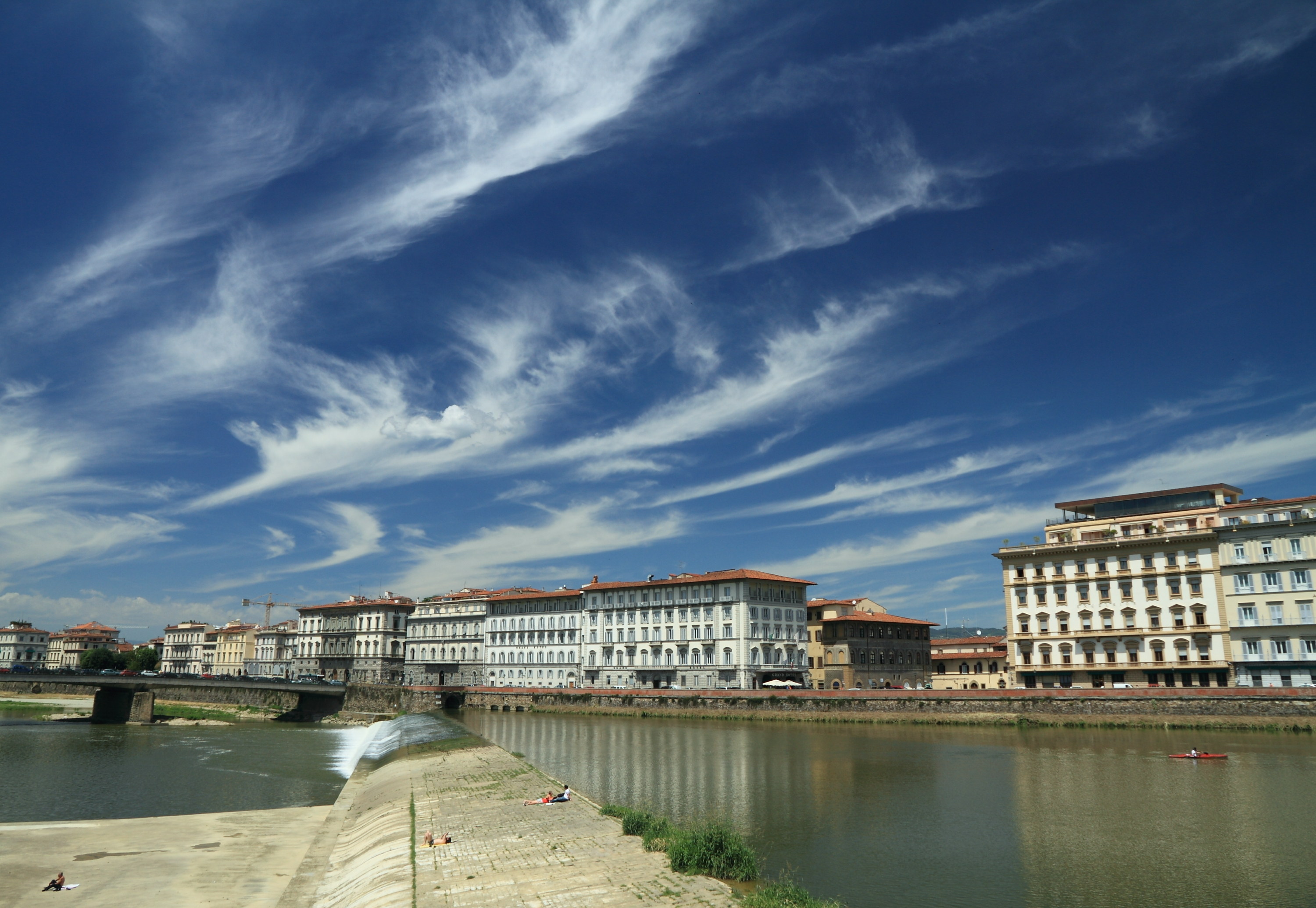
Scientists give names to clouds that describe their appearance. For example, the prefix strato- means layerlike or sheetlike. Clouds that appear as layers or sheets are called stratus clouds. The prefix cumulo- means pile or heap, and cumulus clouds are piled-up masses of white clouds. The prefix cirro- means curl, and cirrus clouds appear curly. These terms and a few others are used to form the names of the most common clouds. The various types of clouds are grouped into different classes primarily according to their height above the ground.
Low clouds.
Two kinds of clouds, stratus and stratocumulus, are usually seen at low altitudes. The bases of most of these clouds are less than 6,000 feet (1,800 meters) above Earth. A stratus cloud looks like a smooth, even sheet. Drizzle often falls from it. A stratocumulus cloud is not as even in thickness as a stratus cloud. It has light and dark areas on the bottom, indicating, as its name suggests, that there are piles of clouds in the layer.
Middle clouds,
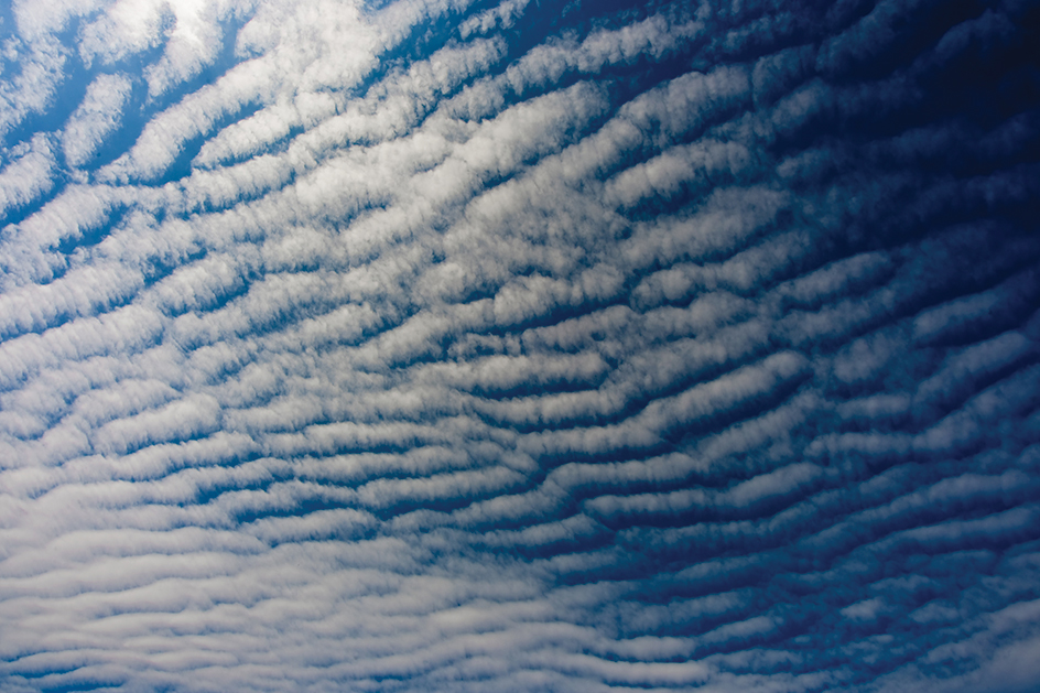
called altostratus, altocumulus, and nimbostratus, usually lie from 6,000 to 20,000 feet (1,800 to 6,100 meters) above Earth. Nimbostratus clouds sometimes may be closer to the ground. An altostratus cloud forms a smooth white or gray sheet across the sky. If the cloud is not too thick, the sun may be seen through it. Altocumulus clouds appear in many shapes. They might form bands or unconnected piles. A nimbostratus cloud is a smooth layer of gray. Frequently, the cloud itself cannot be seen because of the rain or snow that is falling from it.

High clouds,
called cirrus, cirrostratus, and cirrocumulus, are formed entirely of ice crystals. Other clouds are mainly water droplets. Cirrus clouds are the delicate wispy clouds that appear high in the sky, sometimes higher than 35,000 feet (10,700 meters). A cirrostratus cloud is a thin sheet of cloud. It often causes a halo to appear around the sun or moon. This halo is a good way to recognize a cirrostratus cloud. Cirrocumulus clouds look like many small tufts of cotton hanging high in the sky. These clouds are rare.

Clouds that grow vertically.
Cumulus and cumulonimbus clouds may grow to great heights while their bases are near the ground. Cumulus clouds are heaped-up piles of clouds. They can look like small cotton balls, or they can grow into the most spectacular of all clouds, the cumulonimbus.
A cumulonimbus cloud may reach heights as great as 60,000 feet (18,000 meters) from its base. Its top, which contains ice crystals, spreads out in the shape of an anvil. This kind of cloud is often called a thunderhead because it frequently produces thunder. Cumulonimbus clouds also produce heavy rain and lightning. Sometimes hail or, on rare occasions, a deadly tornado comes from a cumulonimbus cloud.
How clouds form
Clouds form from water that has evaporated from lakes, oceans, and rivers, or from moist soil and plants. The evaporated water, called water vapor, is a gas that mixes with the air. Air can hold only a certain amount of water vapor at a given temperature. Warm air can hold more water vapor than cool air can. When the air temperature drops to a level known as the dew point, the water vapor begins to condense (change from a gas to a liquid), forming tiny water droplets. The level of the dew point depends upon the amount of water vapor in the air—the more vapor, the higher the dew point.

For water vapor to condense into clouds, particles so small they can be seen only through a microscope must be present. These particles, called cloud condensation nuclei, become the centers of the droplets. Many of the nuclei form from chemical reactions involving sulfuric acid and ammonia. These nuclei include particles of ammonium sulfate and magnesium sulfate. Other condensation nuclei include tiny particles of dust and particles from smoke. Scientists are not sure whether particles of salt from ocean spray can also act as condensation nuclei. Most droplets measure from 1/2,500 to 1/250 inch (0.01 to 0.1 millimeter) across.
Cloud droplets do not readily freeze at temperatures below 32 °F (0 °C), and droplets can remain liquid down to a temperature of -40 °F (-40 °C). For cloud droplets to freeze above this temperature, a small particle called a freezing nucleus or ice nucleus is required. Examples of ice nuclei include a small dust particle or a tiny speck of plant debris. The ice initially forms as a six-sided crystal—a miniature snow crystal.
Water drops and snow crystals fall when they grow too heavy to be held up by the air. Droplets grow into raindrops through the condensation of additional water vapor onto their surfaces and by combining with smaller droplets. A snow crystal can become heavy enough to fall by growing as water vapor deposits onto it. In some cases, this water vapor comes from evaporating cloud droplets. A snow crystal can also collect and freeze cloud droplets. In addition, snow crystals can collide with, and stick to, other snow crystals to form snowflakes that are heavy enough to fall. If the snow crystal or snowflake falls through warm enough air, it melts and falls to the ground as rain.
Clouds form in rising air, unless they form as fog near the ground. As air rises, it expands and cools. The expanding air loses heat because it uses energy to push other air aside—and heat is a form of energy. If the expanding air contains so much water vapor that it can cool this vapor to the dew point, clouds will form.
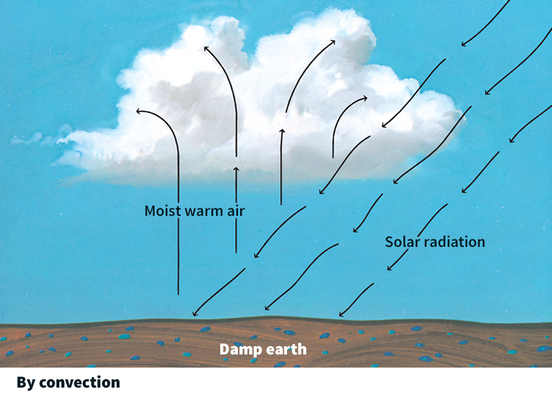
The air can rise in several ways. When the sun heats the ground, the air next to the ground is warmed. Because warmer air is lighter than cooler air, the warm air rises. The upward flow of the warm air is called a convection current, and a cloud formed by this process is called a convective cloud.
Clouds also form by lifting. When warm, moist air moves up the side of a hill or over a mountain range, it is lifted, and it cools by expansion. This cooling causes the water vapor to condense, forming clouds that hang over the mountains.
Frontal lifting, the lifting of air along weather fronts, also produces clouds. A front is the boundary between air masses that differ in density. In fronts where cold air and warm air meet, the warm air rises above the cold air as the cold air slides underneath. As the rising air cools, its water vapor condenses and clouds are formed.
Clouds and the weather
Storms.
Certain types of clouds often appear before storms. The clouds arrive in a definite order over several days. By watching the clouds, one can often predict the storm. The clouds appear as follows to an observer in the middle latitudes—from about 30° to 60° north latitude and from about 30° to 60° south latitude: First, a few wispy cirrus clouds appear in the west. These gradually thicken and merge, forming cirrostratus clouds that cover the sky. The cirrostratus clouds are later hidden or replaced by a lower layer of altostratus clouds that becomes thicker and hides the sun. Light rain or snow may begin to fall from the altostratus layer. The base of the clouds becomes still lower as nimbostratus clouds move in with heavier rain or snow.
Cumulonimbus clouds may also develop, especially in spring and summer. As a result, the rain may include heavy showers.
As the storm moves past, the rain or snow ends but the sky remains overcast with stratocumulus clouds. Fair weather returns when these low clouds disappear.
Heating and cooling
of Earth are influenced by clouds. Most cloudy days are cooler than clear days because the clouds reflect much sunlight back into space. At night, clouds have an opposite influence on the temperature of the air near the surface of Earth. Earth cools by giving off heat toward space. Clouds intercept much of this heat and send it back toward the ground. For this reason, most cloudy nights are warmer than clear nights.
