Colorado is a state of unusual natural beauty in the Rocky Mountain region of the United States. The scenic wonders of the Rockies and the cool, pleasant climate make the state a center for summer tourists. In winter, the deep, powdery snow of Colorado attracts skiers to world-famous resorts. Each year, millions of visitors travel to such tourist areas as Aspen, Estes Park, and Colorado Springs.
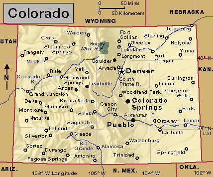
But not all of Colorado is mountainous, and only part of the state’s income comes from tourists. Most of the people of Colorado live and work on the dry, flat plains that make up the eastern two-fifths of the state. Tunnels bored through the mountains bring water to the plains for busy cities and prosperous farms. The state’s location halfway between the major cities of California and the Midwest has helped make it the main transportation and distribution center for the Rocky Mountain region. Colorado’s regional importance has led many large financial and manufacturing companies to set up branch offices in the state. Food processing and the manufacture of computer and electronic products are leading Colorado industries.
Herds of cattle and sheep graze on the mountains and plains of Colorado. Irrigated farms produce rich crops of potatoes and sugar beets. Wheat and corn fields spread across the plains. Fields of hay, which is used for cattle feed, can be found in most parts of the state.
Mining also has an important part in the state’s economy. Gold and silver mining booms in the last half of the 1800’s sparked Colorado’s early growth and development. Mines in Colorado still produce gold and silver ores. Today, however, the state’s chief mineral products include coal, natural gas, and petroleum.
The U.S. government owns more than a third of Colorado’s land. The government controls grazing, logging, and mining on those lands. The U.S. Mint in Denver makes coins. The U.S. Air Force has its academy close to Colorado Springs and its defense headquarters in nearby Cheyenne Mountain.
Spanish explorers who came in the 1600’s were the first Europeans to visit the Colorado region. The Spanish word colorado means colored red. The explorers gave the name to the Colorado River, which flows through canyons of red stone. The state was named for the river.
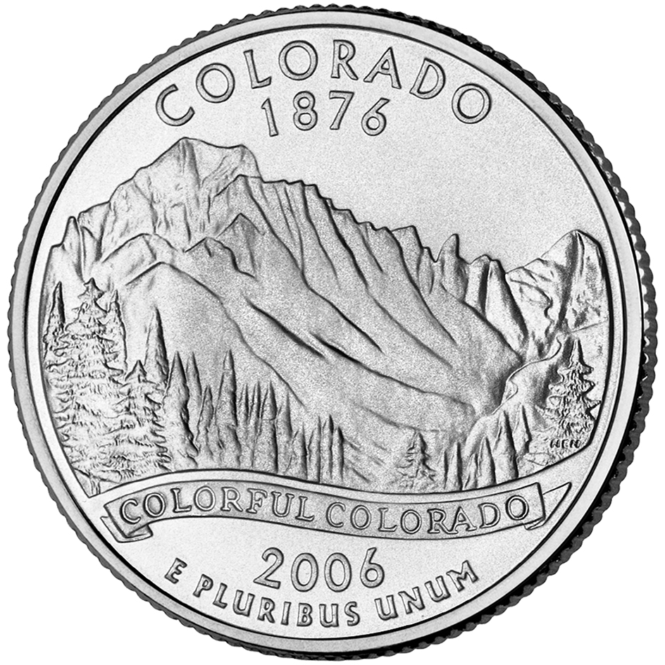
Colorado’s nickname is the Centennial State. The state has that name because it joined the Union in 1876, the centennial (100th anniversary) of the Declaration of Independence. Denver is the capital and largest city of Colorado.
People
Population.
The 2020 United States census reported that Colorado had 5,773,714 people. The population had increased 15 percent over the 2010 census figure, 5,029,196. According to the 2020 census, Colorado ranks 21st in population among the 50 states.
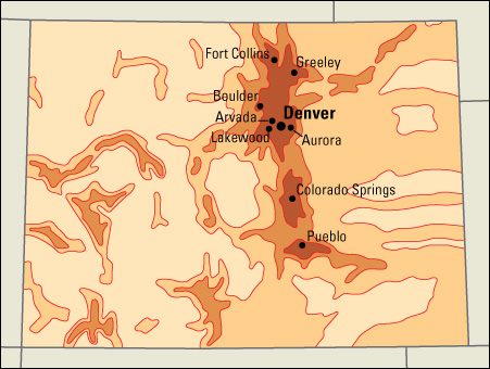
About 90 percent of Coloradans live in one of the state’s metropolitan areas—Boulder, Colorado Springs, Denver-Aurora-Centennial, Fort Collins-Loveland, Grand Junction, Greeley, and Pueblo (see Metropolitan area).
The state has 13 cities with populations over 100,000. They are, in order of size, Denver, Colorado Springs, Aurora, Fort Collins, Lakewood, Thornton, Arvada, Westminster, Pueblo, Greeley, Centennial, Boulder, and Highlands Ranch. 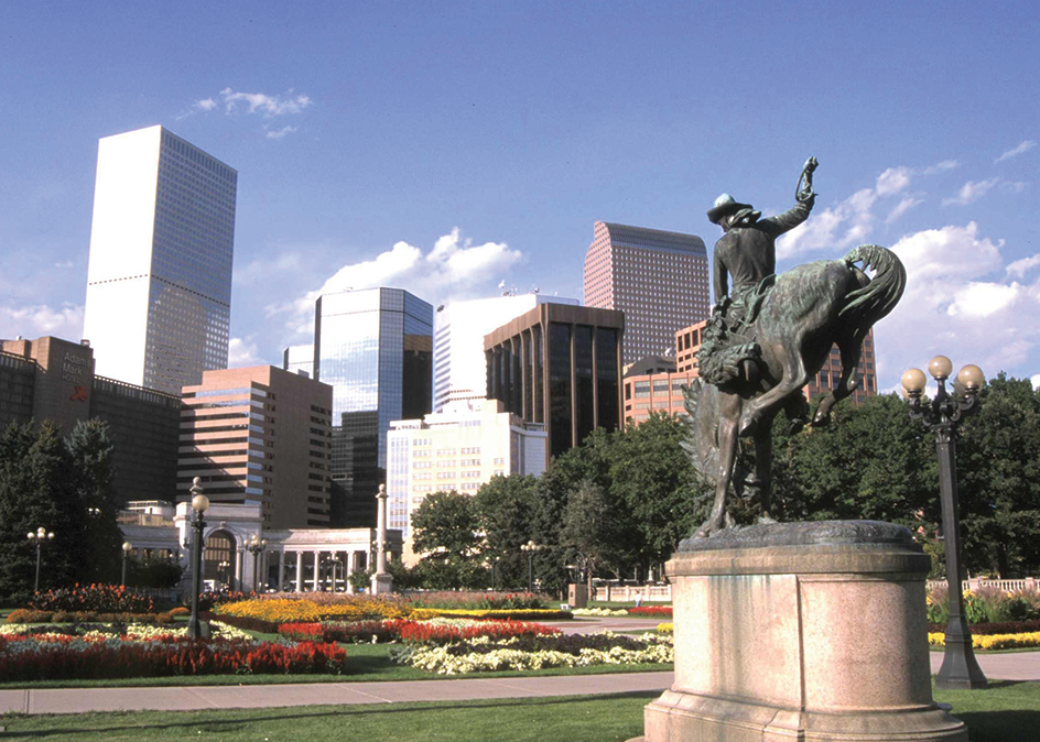
Most of Colorado’s cities grew up near the eastern edge of the mountains. Denver, the largest city in the state, is a business, financial, and manufacturing center. Colorado Springs attracts large numbers of tourists. Colorado Springs also serves several military bases, including the United States Air Force Academy. The largest city in western Colorado is Grand Junction.
Schools.
O. J. Goldrick opened the first school in Colorado in 1859. The students at the school were the children of gold miners in the Cherry Creek area (now Denver).
Today, a State Board of Education heads Colorado’s Department of Education. Board members are elected to six-year terms. They appoint a commissioner of education to direct the department. Elected school boards and appointed superintendents run the local districts.
Children must attend school from age 6 to 17. For the number of students and teachers in Colorado, see Education (table).
Libraries.
Colorado’s first public library was established in Denver in 1860. Today, Colorado has public libraries throughout the state. The University of Colorado at Boulder and the University of Denver have large libraries. The Colorado State Library is in Denver.
Museums.
The Denver Art Museum features a collection of art of the Indigenous (native) peoples of North America. The Denver Museum of Nature & Science has displays about animals. The Dinosaur Journey Museum in Fruita displays dinosaur fossils. History Colorado (formerly the Colorado Historical Society) operates museums in Denver, Fort Garland, Georgetown, Leadville, Montrose, Platteville, Pueblo, and Trinidad.
Visitor’s guide
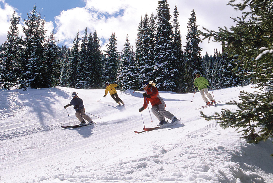
Beautiful Colorado attracts millions of tourists each year. In summer, visitors enjoy the state’s cool climate. Campers pitch their tents on forested mountain slopes or near beautiful mountain streams. High peaks test the skill of mountain climbers. Old mining towns and ancient cliff dwellings lure tourists interested in history. People who like to fish cast for trout in the clear, swift streams. In autumn, hunters search for deer and other big game. In winter, skiers visit such famous Colorado resorts as Aspen, Arapahoe Basin, Steamboat Springs, Vail, and Winter Park. The ski season in Colorado begins in November and ends in April.
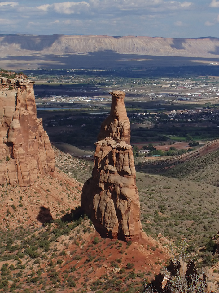
Many Colorado cities and towns hold fairs, festivals, races, and rodeos during the summer. In winter, the state hosts a variety of skiing and other winter sports events and competitions. In addition, many art, business, education, and religious groups hold conferences in Colorado.
Land and climate
Land regions.
Colorado has four main land regions: (1) the Colorado Plateau, (2) the Intermontane Basin, (3) the Rocky Mountains, and (4) the Great Plains.
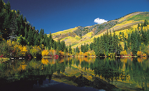
The Colorado Plateau,
along the western border, covers about a fifth of the state. It is an area of high hills, plateaus, deep valleys, and mesas (flat-topped hills with steep sides). Farmers raise a variety of crops in the valleys. During summer months, cattle and sheep graze on the grasslands of the mesas.
The Intermontane Basin,
north of the plateau, is Colorado’s smallest land region. It is a region of rolling hills and sagebrush plateaus wedged between mountain ranges near the northwest corner of the state. The word intermontane means between mountains. Herds of sheep graze on the plateaus, and forests cover the hills in this region.
The Rocky Mountains
cover the middle two-fifths of Colorado. The Colorado Rockies have been called the Roof of North America because about 55 peaks reach 14,000 feet (4,270 meters) or more above sea level. These peaks are the tallest in the entire Rocky Mountain chain, which stretches from Alaska to New Mexico.
The Continental Divide runs through the Colorado Rockies. Streams east of the divide flow into the Atlantic Ocean. Those west of it flow into the Pacific. The Colorado Rockies are one of the country’s most popular areas for mountain climbing, fishing, hunting, and skiing.
The Rocky Mountains of Colorado consist of five main mountain ranges: (1) the Front Range, (2) the Park Range, (3) the Sawatch Range, (4) the San Juan Mountains, and (5) the Sangre de Cristo Mountains. The easternmost group is the Front Range, which includes 14,264-foot (4,348-meter) Mount Blue Sky (formerly Mount Evans), Longs Peak (14,255 feet, or 4,345 meters), Pikes Peak (14,110 feet, or 4,301 meters), and other mountains that rise to the west of Denver and Colorado Springs. The Sangre de Cristo (Blood of Christ) Mountains are just south of the Front Range. Together, the Front Range and the Sangre de Cristo Mountains form a wall that faces the Great Plains to the east.
The Park Range, west of the Front Range, stretches from a point near the Wyoming border south to the beginning of the Arkansas River. South of the Park Range is the Sawatch Range, which includes Mount Elbert (14,433 feet, or 4,399 meters), the highest peak of the Rocky Mountains. The rugged San Juan Mountains occupy southwestern Colorado.
The mountains of Colorado surround many level, almost treeless areas called parks. The largest of these areas include North Park, Middle Park, South Park, and the San Luis Valley. See Rocky Mountains.
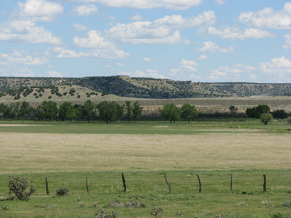
The Great Plains
cover roughly the eastern two-fifths of Colorado. Colorado’s Great Plains region is part of the vast Interior Plain of North America that stretches from Canada to Mexico. It slopes gently upward from east to west toward the base of the Rocky Mountains. Farmers once thought the area was too dry for farming. But irrigation projects in the valleys and dryland farming on the higher lands have made large-scale agriculture possible (see Dryland farming; Irrigation).
Rivers and lakes.
More important rivers begin in Colorado than in any other state. These rivers provide water for many states. Three major tributaries of the Mississippi-Missouri river system rise on the eastern slope of the Rocky Mountains. These are the Arkansas, South Platte, and Republican rivers. West of the Rockies, the Colorado River begins at Grand Lake, flows through Middle Park, and winds southwest into Utah. The Colorado drains a twelfth of all the land of the United States. Several of the chief tributaries of the Colorado, including the Uncompahgre, Gunnison, San Juan, and Dolores rivers, also rise in the state. The Rio Grande starts in the San Juan range, and flows east and south into New Mexico. The North Platte River flows north from North Park into Wyoming.
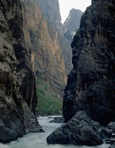
Rivers add much to Colorado’s scenic beauty. Many have carved deep gorges, or tumble down mountains in lovely waterfalls and cascades. The Royal Gorge of the Arkansas River, west of Canon City, is more than 1,000 feet (300 meters) deep. A bridge that stands 1,053 feet (321 meters) above the floor of the Royal Gorge is the highest suspension bridge in the world. In some places, the Black Canyon of the Gunnison River in western Colorado is 2,400 feet (732 meters) below the surrounding land.
Many beautiful lakes lie in the mountains. Grand Lake, formed by glaciers, covers about 600 acres (240 hectares) near the town of Grand Lake. It is Colorado’s largest natural lake. Summit Lake, 12,740 feet (3,883 meters) above sea level, is one of the highest lakes in the country. Many artificial lakes have been created by damming the rushing mountain streams. John Martin Reservoir, formed by a federal flood control project on the Arkansas River, is the largest lake. It covers more than 29 square miles (75 square kilometers) when full. The water is used for irrigation.
Plant and animal life.
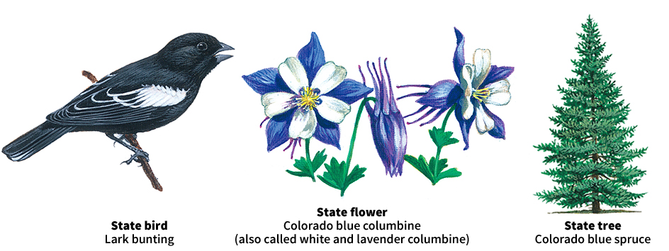
Because of the large differences in altitude and moisture, Colorado’s land has a wide variety of plant life. Plants include many kinds of cactus, greasewood, sagebrush, and yucca in the drier areas. The chief grasses are buffalo and grama grass. Spring wildflowers include buttercups, sand lilies, wild geraniums, and yarrows. Summer brings columbines, dogtooth violets, Indian paintbrushes, mountain lilies and daisies, and wild irises and roses. Forests cover about a third of the state. Common trees found in Colorado include ashes, aspens, cottonwoods, firs, maples, pines, and spruces.
Hundreds of thousands of deer, elk, and other big game animals roam Colorado. Pronghorns and prairie dogs live on the plains. Fur-bearing animals include bears, beavers, bobcats, foxes, marmots, martens, rabbits, and skunks. Game birds include several kinds of grouse, pheasants, and quail. Colorado game fish include bass, catfish, crappies, perch, and trout.
Climate.
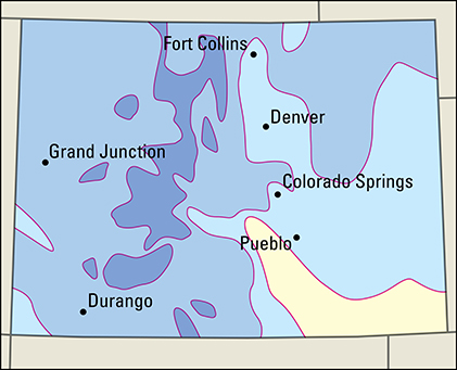
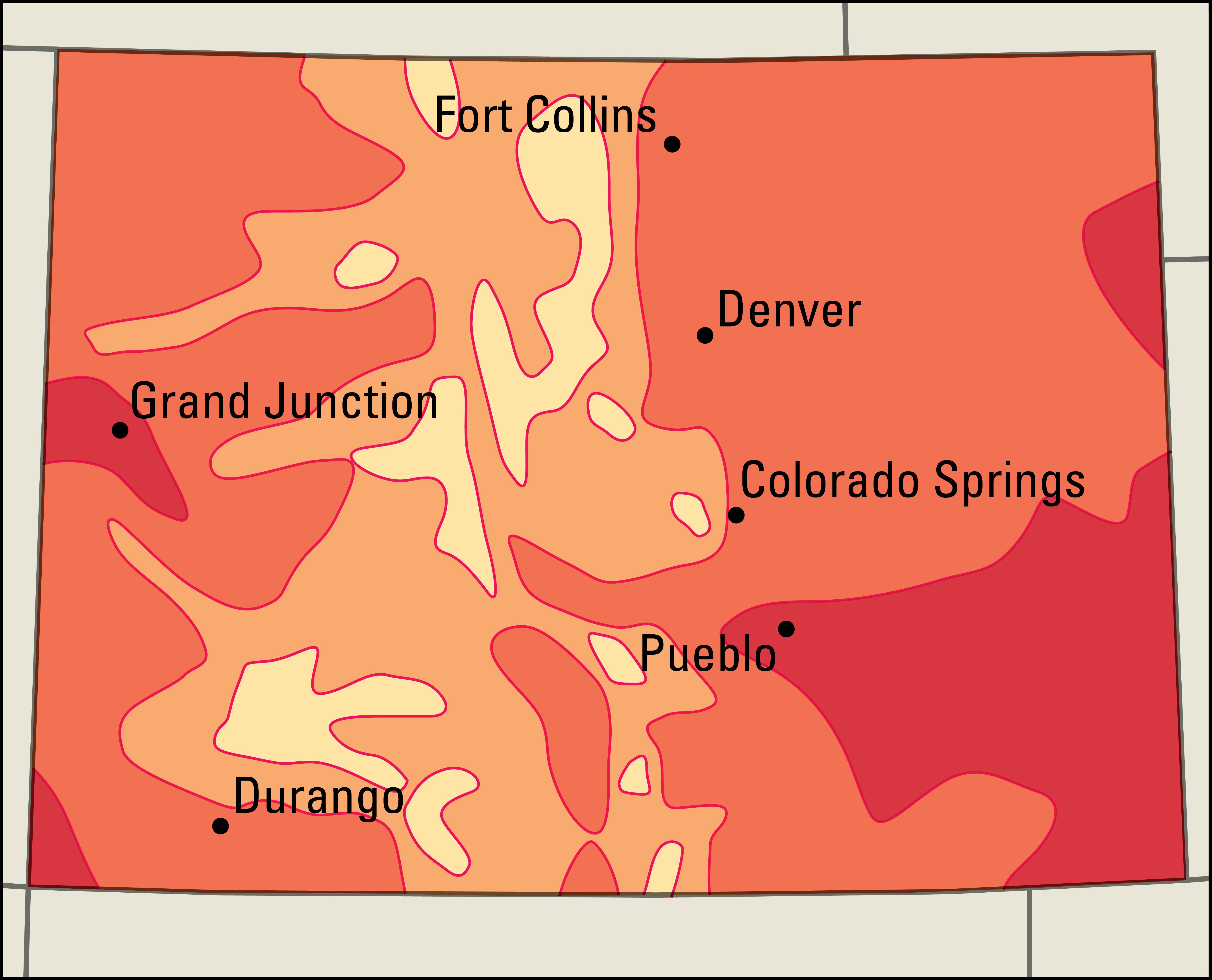
Colorado’s climate is generally dry and sunny. But because of the great differences in altitude, temperatures vary widely in short distances. The mountains are almost always cooler than the plains and plateaus. Burlington, on the plains, has an average January temperature of 30 °F (–1 °C). Leadville, in the mountains, has a January average of 17 °F (–8 °C). Average July temperatures are 75 °F (24 °C) in Burlington and 54 °F (12 °C) in Leadville. Colorado’s highest temperature, 114 °F (46 °C), occurred at Las Animas on July 1, 1933, and at Sedgwick on July 11, 1954. Maybell in Moffat County had the lowest, –61 °F (–52 °C), on Feb. 1, 1985. 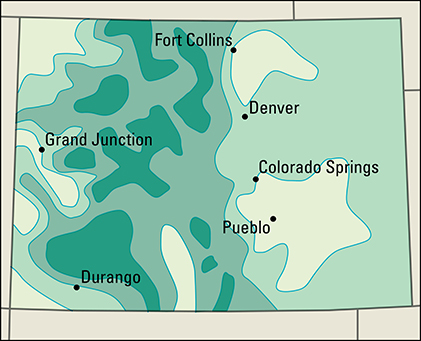
Colorado’s average yearly precipitation is about 15 inches (38 centimeters). This moisture is not distributed evenly. The western slopes get the most rain and snow. The San Luis Valley, in southern Colorado, is the driest area.
The dry air makes Colorado’s climate comfortable. The sun warms the thin air quickly, especially at high altitudes. The chinook, a warm wind that occasionally blows down the eastern slopes in winter, can raise temperatures on the plains by 20 Fahrenheit degrees (11 Celsius degrees) or more in a short time.
Economy
Colorado’s economy is divided roughly along the natural lines of its land. The Great Plains are the state’s main farming region. Along the border between the Great Plains and the Rocky Mountains lie Colorado’s largest urban areas, where service industries and manufacturing are centered. The Rocky Mountains have many recreational areas, including some of the nation’s favorite ski resorts. West of the Rockies and north of Denver lie the state’s main petroleum, coal, and natural gas fields.
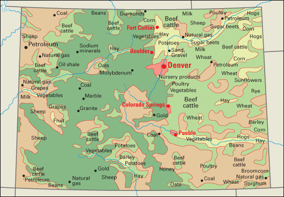
Service industries account for about four-fifths of Colorado’s gross domestic product—the total value of all goods and services produced in the state in a year. Colorado’s popularity as a site for vacations and conventions contributes to the strength of the state’s trade and accommodations industries. Tourists spend billions of dollars a year in Colorado. The state is also known for its growing high-tech sector, which is tied to both the service and manufacturing industries.
Natural resources.
Mineral deposits, rich soils, and water are Colorado’s greatest natural resources.
Soil.
The soils of the Great Plains and the valleys of the western mountains are among the most fertile in the nation. The eastern soils are brown. In years of rainfall, they produce excellent crops. In dry years, the soil must be irrigated. The high mountains and some western plateaus have thin, stony soils called lithosols.
Minerals.
Vast deposits of coal, gold, molybdenum, natural gas, and petroleum help support Colorado’s economy. Huge oil shale deposits offer promise of future mineral development. Supplies of building materials, such as gravel, sand, and stone, are plentiful enough to meet the state’s anticipated future needs.
Water
is precious in the dry West. The control of water sources in the state is a continuing concern to Colorado’s people. Six major rivers rise in Colorado. By agreement with other states and with Mexico, Colorado cannot use more than a specified amount of the water in these streams.
Distribution of water within the state is uneven. The Western Slope (land west of the Continental Divide) covers slightly more than a third of the land area. But it gets more than two-thirds of the surface water (runoff from rain and snow). The Eastern Slope, with almost two-thirds of the land area, gets less than a third of the surface water. There have been bitter legal and political fights over water rights within the state.
Many dams and tunnels have been built for transmountain diversion of water. Western Slope water is brought through tunnels in the mountains for use on the dry but heavily populated Eastern Slope. Some of this water goes to homes and factories. The rest is used to irrigate the fertile soil of the plains. These projects help solve eastern Colorado’s water problems. The future growth of Colorado, both in manufacturing and agriculture, depends on the amount of water available.
Service industries
account for the largest portion of both Colorado’s employment and its gross domestic product. Most of Colorado’s service industries are found along the eastern side of the Rocky Mountains, from Fort Collins to Pueblo, and are concentrated in the Denver metropolitan area.
Colorado is the home of Dish Network Corporation, Level 3 Communications, and Qwest Communications, some of the nation’s leading telecommunications companies. The U.S. Air Force has extensive facilities in the Colorado Springs area, including the Air Force Academy and the North American Aerospace Defense Command. The federal government owns much of Colorado’s unpopulated land. It controls grazing, logging, mining, and recreation there.
Manufacturing.
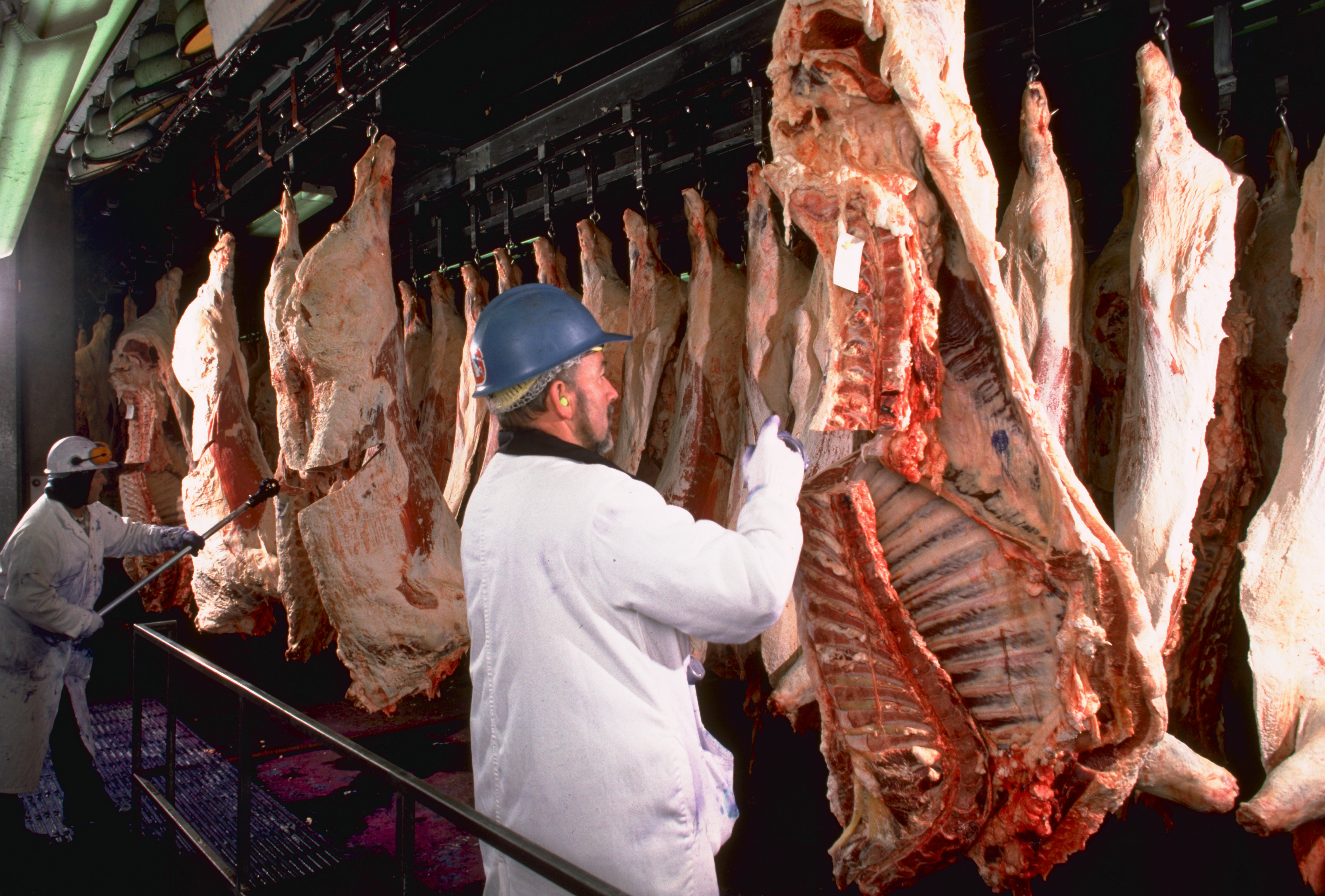
Computer and electronic products and food and beverages are Colorado’s leading manufactures. Many computer and electronics companies are in the Boulder, Colorado Springs, and Denver areas. Important products include communications equipment, electronic medical equipment, and semiconductors. Beer brewing and meat packing are major parts of the state’s food-processing industry. Several breweries operate in Golden and Fort Collins, and microbreweries are popular in the state.
Colorado’s other leading manufactured products include chemicals, medical equipment, and transportation equipment. Pharmaceuticals (medicinal drugs) are produced in the Boulder area. Surgical and medical instruments are manufactured in the Boulder, Colorado Springs, and Denver areas. Colorado’s aerospace industry manufactures guided missiles, satellites, and space vehicles.
Agriculture.
Farmland covers about half of Colorado’s land area. Livestock and livestock products account for most of Colorado’s farm income. Beef cattle are the leading farm product by far, and Colorado is a high-ranking state in beef cattle production. Beef cattle are primarily raised in eastern Colorado. Dairy cattle are raised in the Greeley area. Colorado is a leading producer of sheep for both meat and wool. Colorado farmers also raise hogs and poultry. 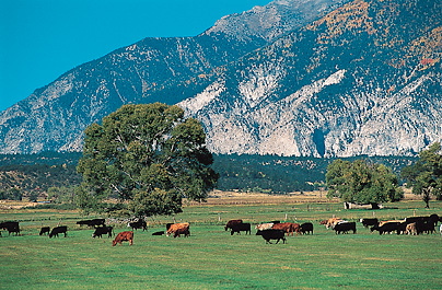
The chief field crops are corn, hay, and wheat. Eastern Colorado produces the most corn and wheat. Colorado is a n important producer of hay, which grows in most parts of the state. Crop farmers also raise large amounts of barley, beans, cabbage, carrots, onions, potatoes, sugar beets, and sunflowers. Peaches are Colorado’s leading fruit crop. Greenhouse and nursery products are an important source of agricultural income. Wine production is a growing industry in the state, especially in Delta and Mesa counties.
Mining.
Coal, natural gas, and petroleum are among Colorado’s chief mined products. Western Colorado is the leading area for coal production. Surface mines in Moffat County and underground mines in Gunnison and Routt counties have major coal production.
Large natural gas fields lie near Denver and Durango. The huge Hugoton field of the country’s Interior Plains region extends into the southeast corner of Colorado.
Weld County in the north has the state’s most productive oil fields. The area east of Denver also has important oil fields.
Colorado’s other mined products include gold, molybdenum, and sand and gravel. Gold and molybdenum come from mines in the Rocky Mountains. Colorado is a leading state in molybdenum production. Molybdenum is used in making strong varieties of steel. Some of the ores that contain gold or molybdenum also contain copper, lead, silver, and zinc. Sand and gravel are obtained from pits along the rivers of the state’s northern Great Plains region. The state also produces granite, limestone, portland cement, and sandstone.
Colorado has large deposits of oil shale, a source of petroleum. Shale, a type of rock, is found in northwestern Colorado. Oil companies have been experimenting with extracting petroleum from shale since the 1920’s. The high cost of processing remains a major obstacle.
Electric power and utilities.
Plants that burn coal and plants that burn natural gas supply over half of the state’s electric power. Wind-powered plants generate much of the rest of the state’s electric power.
Transportation.
Colorado has an extensive system of roads and highways. In winter, highways that cross the mountains are kept open by snowplows. The 1.7-mile (2.7-kilometer) Eisenhower Memorial Tunnel carries motor traffic through the Rockies at about 11,000 feet (3,400 meters) above sea level. It is the world’s highest road tunnel. The highest road in the United States climbs close to the top of 14,264-foot (4,348-meter) Mount Blue Sky, just west of Denver.
Denver International Airport is one of the busiest airports in the world. Colorado Springs has the state’s second busiest airport. A number of ski area airports have direct interstate flights during ski season.
Several major railroads operating within the state provide freight and passenger service. The 6.2-mile (10-kilometer) Moffat Tunnel, one of the longest U.S. railroad tunnels, goes through the Rockies in Colorado.
Communication.
Colorado’s first newspaper was Denver’s Rocky Mountain News, published from 1859 to 2009. Today, Colorado’s leading papers include The Gazette of Colorado Springs; The Denver Post; and The Pueblo Chieftain.
Government
Constitution
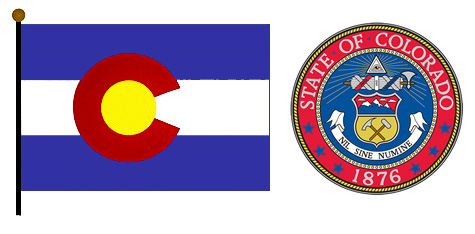
of Colorado was adopted in 1876. It has been amended (changed) more than 150 times. All constitutional amendments must be approved by the people in an election. Amendments may be proposed by a two-thirds vote of the state legislature, by a petition of the voters, or by a constitutional convention. Such a convention requires the approval of two-thirds of the legislators and a majority of the people voting on the issue.
Executive.
The governor and lieutenant governor of Colorado are elected to four-year terms. Voters cast one vote for both officials. Neither office may be held by one person for more than eight consecutive years.
The executive branch includes three principal departments that are under the direction of elected officials. These officials—the secretary of state, attorney general, and treasurer—are elected for four-year terms and may serve up to eight consecutive years. The governor, with the consent of the Senate, appoints most of the heads of the remaining departments.
Legislature,
called the General Assembly, consists of a 35-member Senate and a 65-member House of Representatives. Senators serve four-year terms, and representatives serve two-year terms. Both are limited to no more than eight consecutive years in office. The Assembly begins its regular sessions each January, on or before the second Wednesday of that month. The length of a regular legislative session is limited to 120 days. A special session may be called by a vote of two-thirds of the members of the Senate and the House of Representatives. 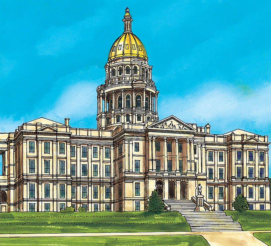
Courts.
Colorado’s highest court is the Supreme Court, composed of a chief justice and six associate justices. The governor appoints the justices to the court. Justices are nominated for appointment by a commission of private citizens. After a justice serves for two years, he or she must win the approval of the voters in an election. If approved, the justice serves a 10-year term. The justice’s later terms are also for 10 years, but he or she must be voted in each time.
Colorado’s next highest court, the Court of Appeals, consists of 22 judges. Most major civil and criminal cases are tried in district courts in the state’s 22 judicial districts. Appellate and district court judges are appointed and approved like justices. However, the appellate court judges serve full terms of eight years, and district court judges serve six years. District courts may act as probate or juvenile courts, except in Denver where those courts are separate. Each Colorado county has a county court, and larger towns have municipal courts.
Local government
is carried on through 64 counties and hundreds of cities and towns. The city and county of Denver operate as a single government, and so do the city and county of Broomfield. Most of the other 62 counties are governed by either three or five commissioners. The commissioners are elected by the voters to four-year terms. They may hold office for no more than eight consecutive years. However, voters in specific counties can elect to let their commissioners serve without term limits.
Communities with larger populations are usually called cities, and those with smaller populations are usually towns. Cities and towns may adopt home rule charters, which give them greater control over their own affairs. Under certain conditions, home rule charters and laws passed under such charters may replace state laws. The governing body of a town is called a board of trustees, and the governing body of a city is called a council. Most of the cities and towns have a chief administrative officer.
Revenue.
Taxes provide about half of the state government’s general revenue (income). A personal income tax, a sales tax, and a motor fuel tax produce the largest amounts. More than a fourth of the revenue comes from federal grants and programs.
Politics.
For much of the 1900’s, Colorado voters supported Republican candidates over Democratic ones. Democrats gained support in the state in the early 2000’s. Voters in the Denver and Pueblo areas usually support Democrats. Voters in Colorado Springs, some Denver suburbs, and many rural areas generally favor Republicans.
History
Early days.
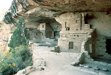
Hundreds of years before Europeans came to the Colorado area, Indigenous people known as the Ancestral Pueblo built high cliff dwellings of stone along the canyon walls of a huge plateau in what is now southwestern Colorado. When the early European explorers arrived, they found the Arapaho, Cheyenne, Comanche, Kiowa, and Pawnee tribes on the plains. The Ute lived in the mountain valleys.
Exploration and settlement.
Spanish explorers who came in the 1600’s were the first Europeans to visit the Colorado region. The Spaniards failed to find gold, and left without attempting to settle the area. In 1682, the explorer René-Robert Cavelier, Sieur de La Salle, claimed for France an area that included what is now eastern Colorado. In 1706, Juan de Ulibarri, a Spanish official, claimed the region for Spain.
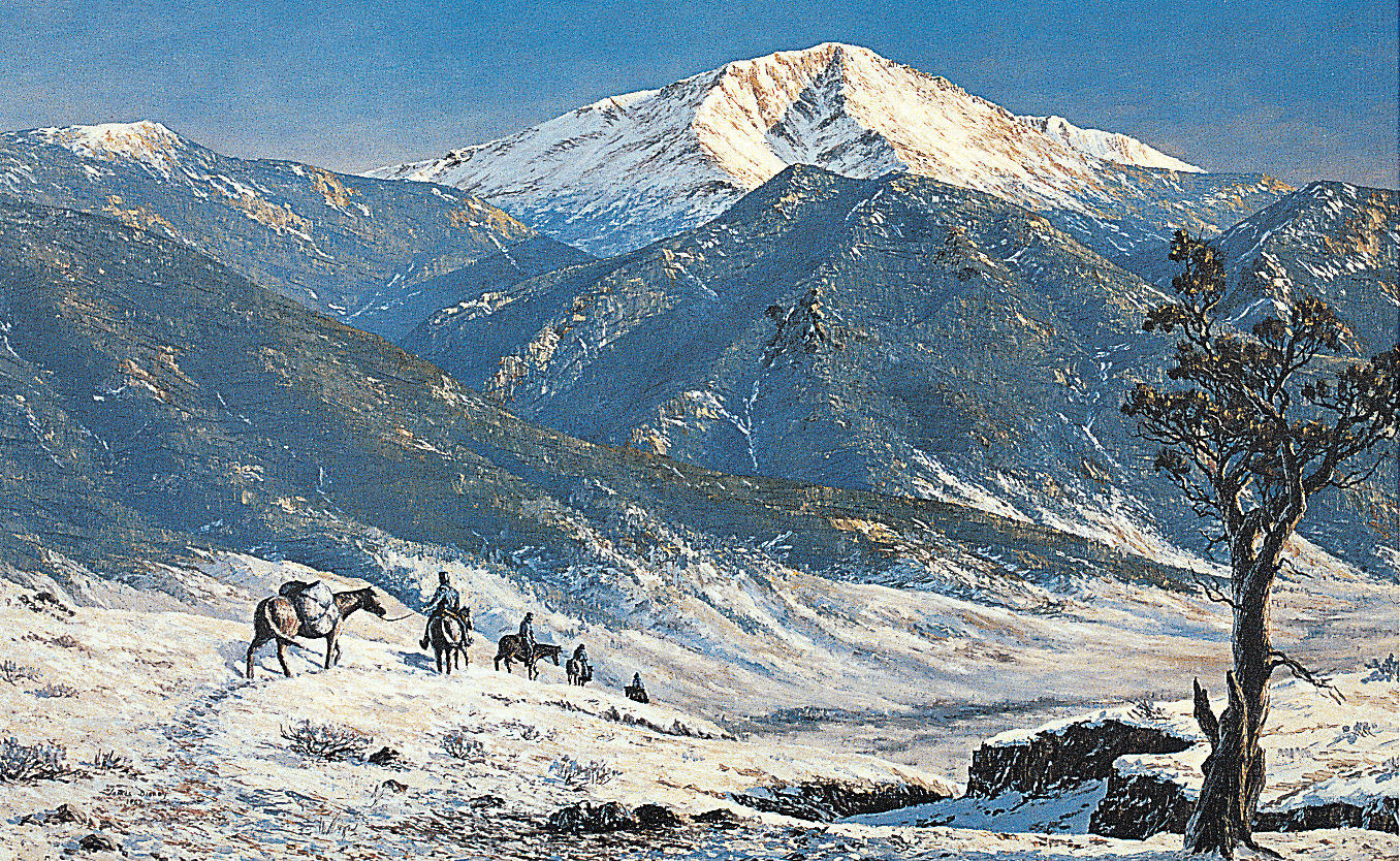
In 1803, the United States bought present-day eastern and central Colorado as part of the Louisiana Purchase. During the next 20 years, Americans explored much of the region. Zebulon M. Pike, an Army officer, entered the Colorado area in 1806. Pike’s record of the trip describes the mighty mountain that was named for him—Pikes Peak. Another officer, Major Stephen H. Long, led an exploring party in 1820. The first permanent American settlement was Bent’s Fort, completed in 1833 near present-day La Junta. The fort, built by the trader William Bent, was used as a base by Kit Carson and other famous frontiersmen for trade in beaver pelts. Mexico won control of western Colorado from Spain in 1821. The United States took control during the Mexican War (1846-1848) and kept the land under the terms of the treaty that ended the war. 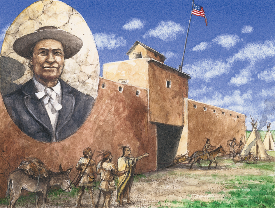
The gold rush.
Colorado had few settlers until the late 1850’s. Then, in 1858, prospectors found gold along Dry Creek near the site of present-day Denver. Gold hunters rushed into the area. “Pikes Peak or Bust” became the slogan of the prospectors as they traveled the long, hard trail to the Colorado gold fields. About 50,000 people had reached the area at the height of the rush, in 1859. 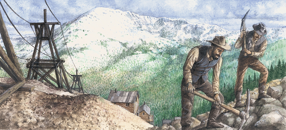
Governing the growing area became a major problem. Indigenous tribes claimed that the land had been given to them by various treaties. The miners ignored such claims and set up what they called the Jefferson Territory. Congress refused to recognize the Jefferson Territory and created the Colorado Territory in 1861. William Gilpin was appointed as the first territorial governor. See Jefferson Territory.
Territorial days.
Indigenous groups and white settlers fought many small clashes and three important battles during the 1860’s and 1870’s. In 1864, troops of the Colorado militia attacked a Cheyenne and Arapaho village at Sand Creek and killed more than 150 people. This battle became known as the Sand Creek Massacre. The U.S. government criticized the attack and paid the Cheyenne and Arapaho for their losses. In 1868, a large force of Indigenous warriors attacked 50 Army scouts on the Arikaree River in eastern Colorado. The scouts fought for several days on Beecher Island in the river. They finally were saved by other troops. 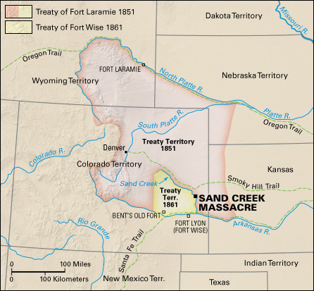
The last major battle in Colorado was the Meeker Massacre in 1879. In this fight, the Ute killed their reservation agent, Nathan C. Meeker, and ambushed a body of troops. After the battle, a respected Ute chief named Ouray helped calm the Ute warriors and settle their problems with the white newcomers.
Many settlers started ranches and farms along the streams. Crude irrigation systems were developed along the eastern edge of the mountains, and in the San Luis Valley. In 1870, Horace Greeley, a famous New York City editor who believed in developing the West, helped sponsor a Colorado farming colony, which was later named for him. Greeley made popular the expression “Go West, young man.”
In 1870, the Denver Pacific Railway was completed to Denver with the main line of the Union Pacific at Cheyenne, Wyoming. This line connected Colorado and the East. The Kansas Pacific built its line to Denver later in 1870.
Statehood.
Colorado was admitted to the Union on Aug. 1, 1876. Territorial governor John L. Routt was elected as the first state governor. 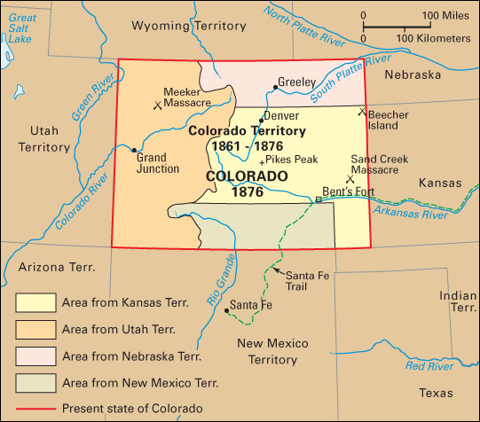
A new mining boom brought wealth to Colorado in the early years of statehood. This time silver caused the growth. Leadville and Aspen boomed as silver centers.
Horace A. W. Tabor became the symbol of this colorful era. He was called the Silver King. With his profits from several mines, Tabor built magnificent buildings in Leadville and Denver. His investments in Denver helped that frontier town become a business and financial center. Tabor even briefly became a U.S. senator. President Chester A. Arthur attended Tabor’s wedding to the beautiful Elizabeth “Baby” Doe.
In 1893, business slumped all across the nation. For this reason, the U.S. government canceled its agreements to buy large amounts of silver. Silver prices dropped. In Colorado, many silver mines closed and the miners lost their jobs. Other businesses suffered because people who were unemployed could not afford to buy their products.
Progress as a state.
Colorado’s growth continued in spite of the state’s troubles. A major gold discovery at Cripple Creek softened the blow of the silver crash. Farmers tried different crops, and expanded their irrigation systems. Sugar beets and potatoes became valuable Colorado crops. The state’s first sugar refinery opened in Grand Junction in 1899. In 1902, construction started on a railroad over the Continental Divide. In 1906, the U.S. Mint in Denver produced its first coins.
By 1910, Colorado had almost 800,000 people. Agriculture had replaced mining as the state’s most important industry. Colorado had more irrigated land than any other state. The food processing industry grew as canneries and more sugar refineries were built.
The 1910’s and 1920’s.
The development of automobiles in the early 1900’s caused rapid growth in two Colorado industries—oil and tourism. The family car made vacation travel easier, and Colorado’s splendid scenery attracted thousands of tourists. Cars also increased the demand for petroleum products. Colorado’s first oil wells were drilled in the Arkansas Valley during territorial days, but production was small. Later, new oil fields were discovered. By 1920, oil had become Colorado’s most important mineral product.
The state government kept pace with the advances in industry. For example, a plan of workers’ compensation was passed in 1915. In 1927, the famous Moffat railroad tunnel was completed with state funds.
The Great Depression.
Colorado’s economy suffered during the Great Depression of the 1930’s. Farm prices dropped sharply and stayed low. A long period of dry weather began on the Great Plains. Wind whipped the dry, powdery soil into huge dust clouds, and dust storms darkened the sky. The state and federal governments began programs to restore the wind-damaged land and to help the unemployed. In 1935, the state adopted a 2 percent sales tax to raise money for old age pensions. Highway construction and other programs helped put the unemployed back to work.
The mid-1900’s.
Colorado’s economy boomed during World War II (1939-1945). The war brought a great demand for Colorado metals and oil. The government established several air bases in the state and several federal agencies in the Denver area. The army opened Fort Carson near Colorado Springs and a huge ordnance plant at Pueblo. Military payrolls in Colorado jumped from $3 million in 1940 to $152 million in 1945.
The population of the state increased after World War II, and Colorado began to rank as one of the nation’s fastest growing areas. Many suburbs developed around major cities in central Colorado.
With the population growth, Colorado’s need for flood control, irrigation, and water storage became severe. Central Colorado and the Great Plains have often suffered either long droughts or sudden floods. Cherry Creek Dam near Denver was completed in 1949. In 1947, the Alva B. Adams Tunnel was completed. This tunnel carries water through the Rocky Mountains from western Colorado to the area northeast of the mountains. It is part of the huge Colorado-Big Thompson Project, which was completed in 1959. This project is a series of dams, pumping stations, reservoirs, and tunnels that irrigates about 720,000 acres (291,000 hectares) of farmland. It also includes six hydroelectric power plants.
More federal offices and military installations were established in Colorado during the 1950’s. The laboratory of the National Bureau of Standards (now the National Institute of Standards and Technology) moved from Washington, D.C., to Boulder in 1954. The United States Air Force Academy opened its Colorado Springs campus in 1958. The North American Air Defense Command, now called the North American Aerospace Defense Command (NORAD), made its headquarters near Colorado Springs. From 1966 to 2006, NORAD operated a command center 1,200 feet (366 meters) underground in Cheyenne Mountain.
By 1954, manufacturing had replaced agriculture as the state’s leading industry. The larger manufacturing plants produced atomic warheads, missiles, and other military items. The manufacture of electronic parts and the mining and milling of uranium became important industries in western Colorado.
Work on the Colorado River Storage Project began in 1956. A major part of this project was the Wayne N. Aspinall Storage Unit on the Gunnison River in central Colorado. This unit, completed in 1976, included power plants, reservoirs, and water purification systems. The project spreads across five other states, along the Colorado River and its tributaries.
In the early 1960’s, work began on the Frying Pan-Arkansas Project. The project transferred water from western Colorado to the plains in the eastern part of the state. The project began operation in 1972 and was completed in 1985.
The late 1900’s.
In 1976, floodwaters of the Big Thompson River swept through an area of homes, summer cabins, trailer camps, and vacation resorts in Big Thompson Canyon, near Loveland. The flood, which was caused by heavy rains, killed more than 135 people.
Colorado, particularly the Denver area, became a center for energy-related activities in response to the nationwide energy shortage that developed during the 1970’s. Energy companies worked to develop Colorado’s vast deposits of coal, natural gas, oil shale, and petroleum. The expansion in energy-related fields resulted in tremendous population growth during the late 1970’s and early 1980’s. This energy boom later collapsed, and by the mid-1980’s, the state faced an economic slump. However, the economy rebounded in the late 1980’s. During the 1990’s, the state’s population grew by about 1 million.
In April 1999, one of the worst mass shootings in U.S. history took place at Columbine High School in the Denver suburb of Littleton. Two teenagers killed 13 people and wounded more than 20.
Early 2000’s.
In July 2012, a mass shooting again took place in a Denver suburb. A man armed with guns and tear gas shot 70 people, killing 12 of them, at a movie theater in Aurora, just east of Denver. In 2015, a jury found the man—James E. Holmes—guilty of the crimes and sentenced him to life in prison without the possibility of parole.
In spite of such events, Colorado’s natural beauty, active lifestyle, and growing economy continued to draw many people to the state in the early 2000’s. The state also continued to face such problems as air and water pollution, overcrowding along the eastern edge of the Rocky Mountains, and urban decay. Agriculture, mining, and population had declined in the state’s rural areas.
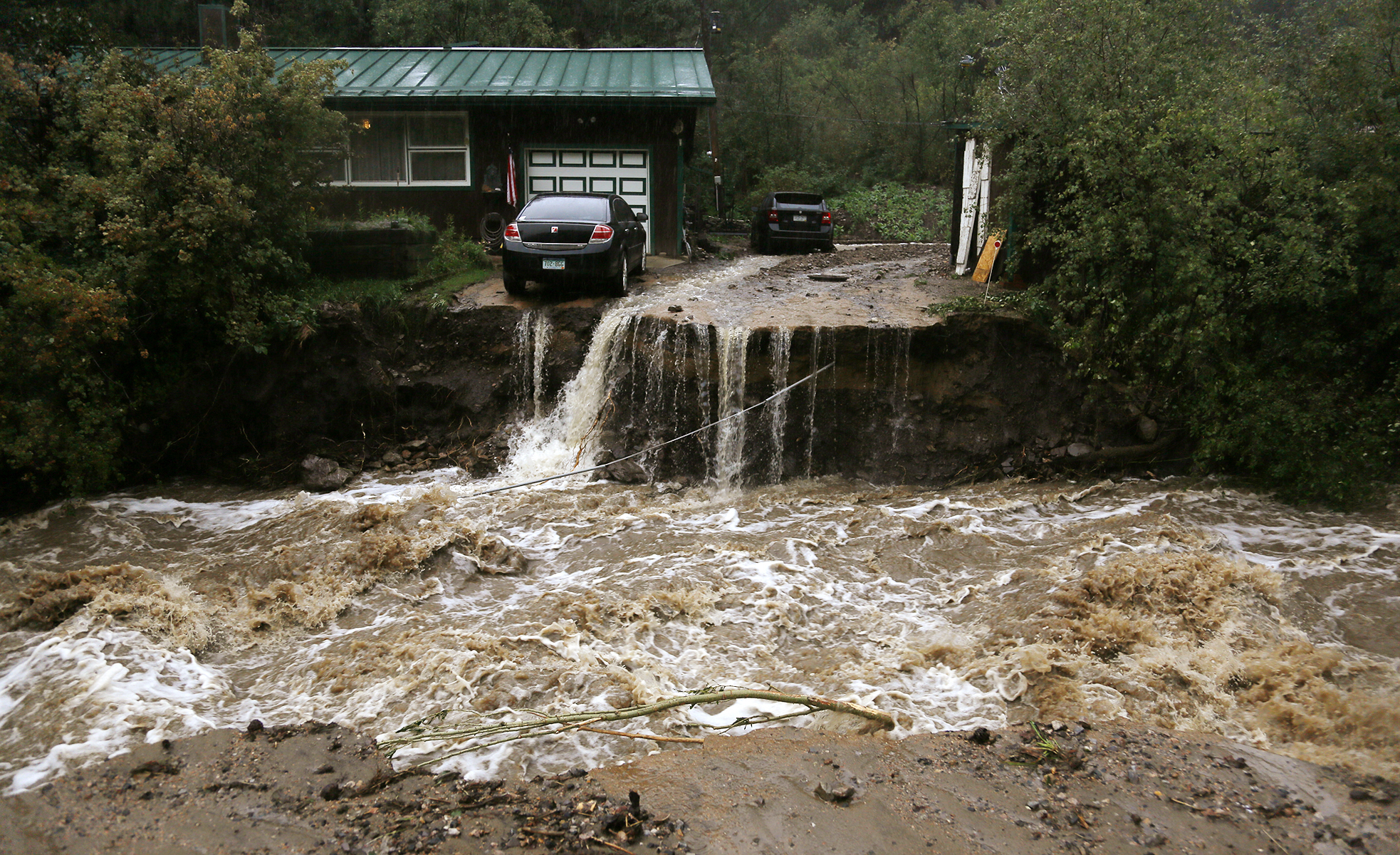
Wildfires and other natural disasters posed threats to state residents and wildlife in the early part of the 2000’s. In 2002, the Hayman Fire and Missionary Ridge Fire together burned about 210,000 acres (85,000 hectares) of forested land. In June 2012, the High Park Fire burned large areas of forestland near Fort Collins. The Waldo Canyon Fire, in June 2012, and the Black Forest Fire, in June 2013, destroyed hundreds of homes near Colorado Springs. In September 2013, heavy rains caused flooding that killed at least 10 people and destroyed thousands of homes and dozens of bridges in northern Colorado. Some of the state’s largest-ever wildfires burned in 2020. In December 2021, extremely strong winds spread fires that burned more than 900 houses in communities southeast of Boulder. About 35,000 people were forced to evacuate their homes.
