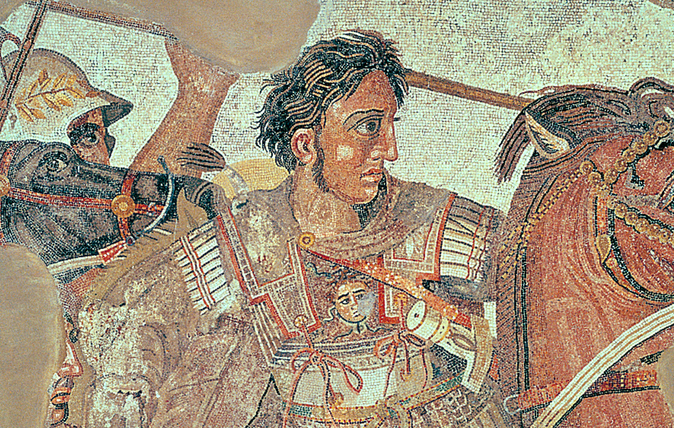
Exploration is the act of people traveling to and investigating places unknown to them. People have explored the world since modern human beings—members of our own species, Homo sapiens—originated more than 100,000 years ago. But we have only a limited understanding of the earliest human exploration. Knowledge of human exploration improves after about 1500 B.C., when people began using written language to record their travels.
People undertook exploration for different purposes. Some explorers traveled for adventure or sought to learn more about an unknown part of the world. Others hoped to gain fame or wealth for themselves or to expand their country’s trade or territory. Still others set out on expeditions to faraway lands for religious reasons.
In many cases, as explorers came upon places that were new to them, they encountered people who had been living in these areas for centuries. What was unknown to explorers was often well known to the people living there. For this reason, scholars use such terms as exploration and discovery carefully. These terms apply only to travelers and their observations of the regions they visit. When Europeans arrived in the Americas in the late 1400’s, for example, they found both continents inhabited by Native Americans. Columbus’s voyage to America was a discovery for the people of Europe. But it was not a discovery to the millions of people already living there.
Native peoples, also called Indigenous peoples, often understood their environments much better than explorers. They sometimes helped explorers by acting as interpreters and providing information about geography and sources of food and water. At other times, explorers ran into conflict with local people who resisted explorers’ efforts to study them, use their labor, or colonize their lands.
The first explorers
Scholars believe that the earliest humans originated in southern and eastern Africa. These early people traveled far from their original homelands. They settled Africa and spread across Asia and Europe. During the last ice age, from about 100,000 to 11,500 years ago, sea levels were lower than they are today. Land joined some areas now separated by water. For example, New Guinea and Australia formed a single continent. More than 65,000 years ago, ancestors of Australia’s Aboriginal peoples sailed from Southeast Asia to Australia. Somewhat later, people from northeast Asia entered Alaska. They traveled across a land bridge that connected North America and Asia. A waterway called the Bering Strait separates the two continents today. Asian explorers may also have traveled by boat along the coasts of Asia and North America. Scholars disagree on when humans first arrived in the Americas. However, by 10,000 years ago, people inhabited nearly all parts of North and South America.
At least 3,000 years ago, the Lapita people from the islands of Southeast Asia set out on the first of many voyages on the Pacific Ocean. These seafarers sailed over long stretches of water in large double-hulled canoes. They lacked navigational instruments but used the stars for navigation. They eventually settled Fiji, Hawaii, New Zealand, Samoa, Tahiti, Tonga, and other Pacific islands. A few scholars believe that these early sailors discovered new islands by accident. But many others think that these early Pacific seafarers planned their voyages of exploration and colonization.
Ancient exploration
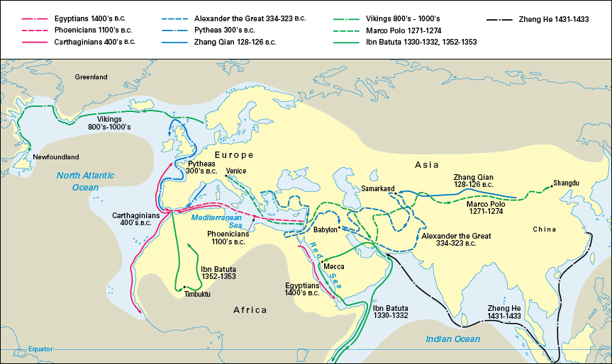
Within the era of written history, ancient peoples in the Middle East and along the shores of the Mediterranean Sea explored parts of Europe, Africa, and Asia. In the 1400’s B.C., Queen Hatshepsut << hat SHEHP soot >> of Egypt sent an expedition by way of the Red Sea to the Land of Punt. The exact location of Punt is not known. It may have been in southwest Arabia or the Somali coast of Africa.
The Phoenicians,
whose civilization developed on the coast of the Mediterranean Sea, were sailors, navigators, and traders. They sailed far into the Mediterranean to trade and establish colonies. About 500 B.C., the Carthaginian statesman and navigator Hanno set out with 60 vessels. Hanno’s expedition took him down the west coast of Africa. He traveled perhaps as far as Sierra Leone or the Gulf of Guinea.
The Greeks
expanded geographical knowledge by founding colonies. There were Greek colonies in Turkey, Italy, and southern France, and along the coast of the Black Sea. The Greeks were also the first people to write about exploration and to describe the world as they knew it. Herodotus << hih RAHD uh tuhs >>, a Greek historian of the 400’s B.C., included much geographical information in his books.
One of the most important Greek explorers was Pytheas << PIHTH ee uhs >>. During the 300’s B.C., he sailed up the coasts of Spain and France and around the islands of Great Britain and Ireland. He then probably entered the North Sea. Pytheas mentioned a land called Thule << THOO lee >>, which may have been Norway. For many years, Mediterranean people considered Thule to be the farthest inhabited part of the world to the northwest.
The Chinese.
An explorer named Zhang Qian << jahng chee ehn >>, also spelled Chang Ch’ien, carried out the most significant Chinese expeditions in ancient times. From 138 to 109 B.C., Zhang traveled in the service of the Emperor Wudi (Wu-ti). The emperor wished to develop diplomatic relations with people in western Asia. Zhang traveled as far as a river called the Amu Darya in Uzbekistan. Zhang’s reports expanded Chinese ideas of the world. They also laid the foundation for later trade between China and the Roman Empire, especially in silk.
The Romans.
The Roman Empire reached its greatest extent about A.D. 100. It stretched from Britain through much of Europe and the Middle East, and across Egypt and the rest of northern Africa. The Romans did not engage in much exploration. Through trade, however, they acquired information about areas beyond their empire, such as the east coast of Africa and the Indian Ocean. The writings of Ptolemy << TAHL uh mee >> preserved much of what was known about the world in ancient times. Ptolemy was a geographer and astronomer who lived in Egypt during the 100’s.
The Dorset culture.
About 4,000 years ago, people from Northeast Asia began a series of migrations across the Bering Strait into Arctic North America. Eventually, some of these people came to produce distinctive artifacts that archaeologists call the Dorset culture. The people who produced the Dorset culture hunted seals, walruses, and small whales. They spread across Canada to Greenland by about 500 B.C. By about 900 A.D., the Dorset had settlements in Greenland, Baffin Island, and Labrador. But they disappeared soon after the Inuit arrived.
Medieval exploration
After the collapse of the western Roman Empire in the late 400’s, Europe was divided into small kingdoms and other states. For about the next 600 to 800 years, most Europeans had neither the means nor the desire to engage in exploration.
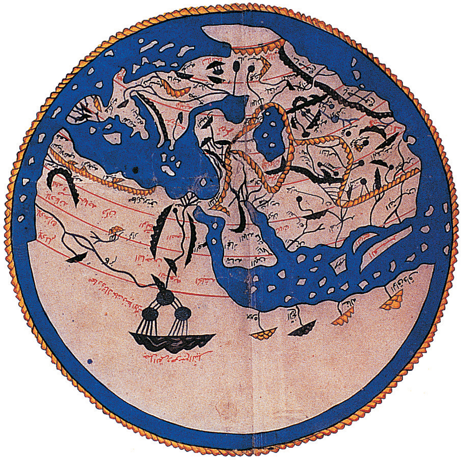
The period of history from about the A.D. 400’s through the 1400’s is called the Middle Ages. During this period, Muslims—that is, followers of the religion of Islam—established a huge empire. The Islamic Empire eventually extended throughout the Middle East and across northern Africa. Many Muslims became expert navigators. Muslim merchant ships with lateen (triangular) sails ranged throughout the Indian Ocean, going as far as eastern Africa and Southeast Asia.
By about the 1200’s, the Chinese and Europeans had a renewed interest in exploration. By that time, explorers could find their direction more easily because of the development of the magnetic compass. Some scholars believe that the Chinese were the first to use the compass for navigation about 1100. Muslims and northern Europeans quickly adopted the device. Other scholars believe that Muslims and northern Europeans independently developed the compass for ship navigation.
Viking exploration.
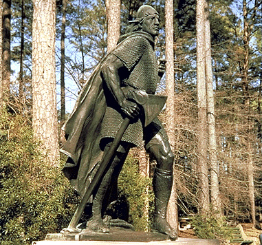
About 1000, Leif Eriksson led an exploring party to the land Herjolfsson had sighted. Leif was the son of Erik the Red. Leif set up a base at a place he called Vinland. Most experts believe that Vinland was the Canadian island of Newfoundland. The Vikings made several other voyages to Vinland and established a colony there. But conflicts with the native peoples and other problems led the Vikings to abandon the colony about 1014.
Muslim exploration.
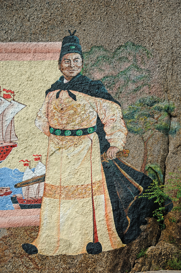
Chinese exploration.
Inuit exploration.
By 1000, the Inuit of northeastern Asia began to migrate into Arctic North America. They gradually displaced the Dorset people, who had originally inhabited the region. The Inuit established settlements across the Arctic, from Alaska to eastern Greenland and south to Labrador and Hudson Bay. Although the Inuit did not record their travels in writing, they passed down stories of their travels through generations. They used wooden carvings as maps of the coastlines they visited. The Inuit developed technology, such as sleds, kayaks, and igloos, that was well-suited for Arctic travel. In the 1800’s and 1900’s, non-Inuit explorers of the Arctic adopted most of these technologies.
Medieval European exploration.
The most famous European traveler in Asia in the 1200’s was Marco Polo, a native of Venice. In 1271, when Marco was 17, he accompanied his father and his uncle to China. The two older men were merchants who had visited China in the 1260’s. Kublai Khan, the Mongol emperor of China, treated them well. Marco made such a favorable impression on Kublai Khan that the Mongol ruler sent him on official missions throughout the kingdom. After Marco returned to Venice in 1295, the Genoese took him prisoner during a conflict between Venice and Genoa. While in captivity, he dictated an account of his travels. His book, called The Description of the World, became widely popular. It was the first to provide Europeans with detailed and accurate information about China’s impressive civilization.
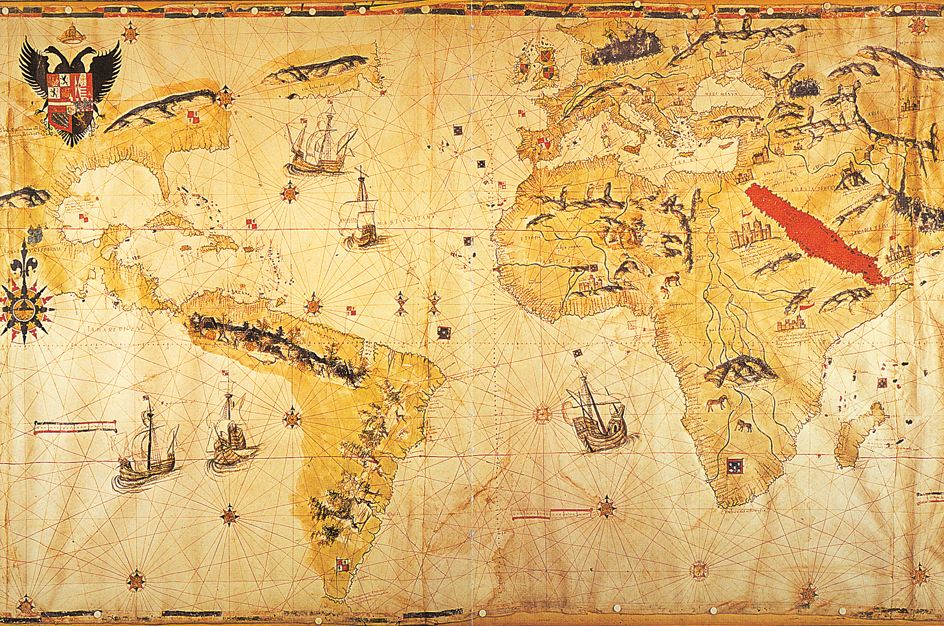
The age of European exploration
By the 1400’s, many Europeans wanted to buy products from Asia. The most desired products included jewels, silk, and such spices as cinnamon, cloves, and pepper.
Turkish Muslims controlled much of the main overland route between Europe and Asia. Muslims also controlled the sea routes from Asia to the Middle East. The Italian city of Venice held a monopoly on trade in spices and eastern luxury goods between the Muslim ports and the rest of Europe. As a result, other Europeans became eager to bypass the old routes and find a direct ocean route to the eastern part of Asia. Europeans then called that region “the Indies.” Europeans also hoped to make converts to Christianity and so strike a blow against the Muslims.
Portugal and Spain took the lead in seeking a direct ocean route to the Indies. By 1500, a new kind of ship known as the caravel made long voyages possible. The caravel combined square sails with the triangular lateen sails used by Muslims. The invention of new navigation instruments also aided exploration by sea. The most important devices were the astrolabe and quadrant, which enabled sailors to determine latitude more accurately. The expeditions of Portugal and Spain opened an active period of exploration. Their voyages of exploration eventually led to the European colonization of America.
Reaching the tip of Africa.
During the early 1400’s, Portuguese explorers concentrated their attention on the west coast of Africa. Prince Henry, a son of King John I of Portugal, became known as Henry the Navigator. He never went on a voyage of exploration himself. But he encouraged and sponsored many expeditions. Henry wanted to increase Portugal’s trade along the African coast. He wished to discover the source of the gold that Muslim traders had carried north from central Africa for centuries. He also hoped to find the legendary Christian kingdom of Prester John. For hundreds of years, travelers had claimed that a man known as Prester John ruled a vast kingdom in Asia. Explorers traveling to Asia found no evidence of this kingdom, so later reports placed his empire somewhere in Africa.
Henry’s crews sailed farther and farther south along the African coast. By the time Henry died in 1460, they had traced the coast as far south as Sierra Leone. During these voyages, the Portuguese collected gold dust and African captives who were sold into slavery. After 1500, when the settlement of the Americas created a demand for enslaved people, other Europeans began to sail to the west African coast to join in the slave trade.
During the late 1400’s, the Portuguese became increasingly hopeful of reaching the southern end of Africa. They believed that such a discovery would reveal a way of sailing to India. In 1487, the Portuguese explorer Bartolomeu Dias << `bahr` tul uh MEH oo DEE uhs >> set out to find a route around Africa. As Dias sailed along the continent’s southwestern coast, a violent storm blew his ships south of the tip of the continent. He then turned east and sailed into the Indian Ocean in early 1488 without sighting the tip of Africa. After turning north again, Dias reached the east coast of Africa. His crew, however, then forced him to return to Portugal. On the return voyage, he saw a point of land jutting from the continent’s southern tip. The Portuguese named it the Cape of Good Hope because its discovery indicated hope that a sea route to India had been found.
Columbus reaches America.
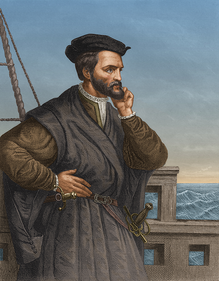
As the Portuguese searched for an eastward sea route to Asia, Christopher Columbus looked west. Columbus, a sea captain from Genoa, Italy, developed a plan to reach Asia by sailing across the Atlantic Ocean. He was convinced that his plan would work. However, he underestimated the distance between western Europe and Japan—and he did not know that a large land mass lay in the way.
Columbus could not persuade the Portuguese to give him command of a westward expedition. In 1485, he went to Spain. He eventually persuaded Queen Isabella to support his plan. The Spanish queen gave him three small vessels: the Niña, the Pinta, and the Santa María.
Columbus and his crew left Palos, Spain, on Aug. 3, 1492. After a stop at the Canary Islands, off the west coast of Africa, the expedition headed westward across the Atlantic. The crew sailed for more than a month without seeing land. Finally, on October 12, they sighted an island.
Columbus landed on one of the Bahamas. He also visited two other islands—Cuba and Hispaniola (now shared by Haiti and the Dominican Republic). Columbus believed he had reached the Indies, and so he called the people he met Indians. He began his return trip in January 1493 and reached Palos in March.
The voyage around Africa.
In 1497, King Manuel I of Portugal chose the navigator Vasco da Gama << VAHSH koo duh GAH muh >> to sail all the way to Asia. On July 8, da Gama set out from Lisbon, Portugal, with four ships. Instead of sailing close to the west African coast, he swung out into the Atlantic to find favorable winds. He rounded the Cape of Good Hope on November 22 and then sailed into the Indian Ocean. At Malindi, in Kenya, he found an experienced Arab pilot, Ahmad Ibn Majid << AHM ahd IHB uhn MAH jihd >>, who agreed to show the way to India.
Da Gama reached Kozhikode on the southwest coast of India on May 20, 1498. Kozhikode’s Hindu ruler had no interest in the goods da Gama brought to trade. The Muslim merchants there considered him a possible business rival. But he obtained some gems and spices, including pepper and cinnamon, to take back to Portugal to prove he had reached Asia. Da Gama made a second voyage to Kozhikode in 1502. He arrived with a fleet of 20 ships, bombarded the town, and established Portuguese rule there. The Portuguese called the town Calicut, a variation of Kalikat, the town’s Arabic name.
Exploring the New World.
Columbus made three more voyages across the Atlantic from 1493 to 1504. He explored Jamaica, Puerto Rico, and Trinidad. He also visited the coasts of Venezuela and Central America. Columbus always believed that he had been in or near Asia. However, people gradually realized that he had come upon lands previously unknown to Europeans.
In 1497, John Cabot, an Italian navigator, became the first European to visit the northeast coast of North America since the Vikings. Sailing in the service of King Henry VII of England, Cabot landed on the east coast of Canada. Cabot’s voyage helped lay the foundation of English claims to North America.
Other explorers began to visit South America. In 1500, two explorers independently reached the area where Portugal would later establish its colony of Brazil. One of the explorers was Vicente Yáñez Pinzón << bee THEHN tay YAH nyehth peen THAWN >>. Pinzón was a Spaniard who had commanded the Niña on Columbus’s first voyage. Pinzón explored the mouth of the Amazon River. The other explorer to reach Brazil was Pedro Álvares Cabral << PAY throo AHL vuh reesh kuh BRAHL >>, a Portuguese captain. Cabral was sailing west in the Atlantic on his way to India.
Amerigo Vespucci << uh MEHR uh goh veh SPOO chee >>, a merchant and navigator born in Italy, also traveled to the Americas. He sailed along the eastern coast of South America from 1499 to 1504. He was the first person to refer to the lands he had visited as a “New World.” In 1507, a German geographer placed a Latin version of Vespucci’s first name—that is, America—on a map of the newly found southern continent. This name was later applied to North America as well.
In 1513, the Spanish explorer Vasco Núñez de Balboa << VAHS koh NOO nyayth day bal BOH uh >> led an expedition across Panama. Balboa traveled from Panama’s Atlantic coast to its Pacific coast. He became the first European to see the eastern shore of the Pacific Ocean. His finding helped prove that the New World was indeed a huge land mass between Europe and Asia.
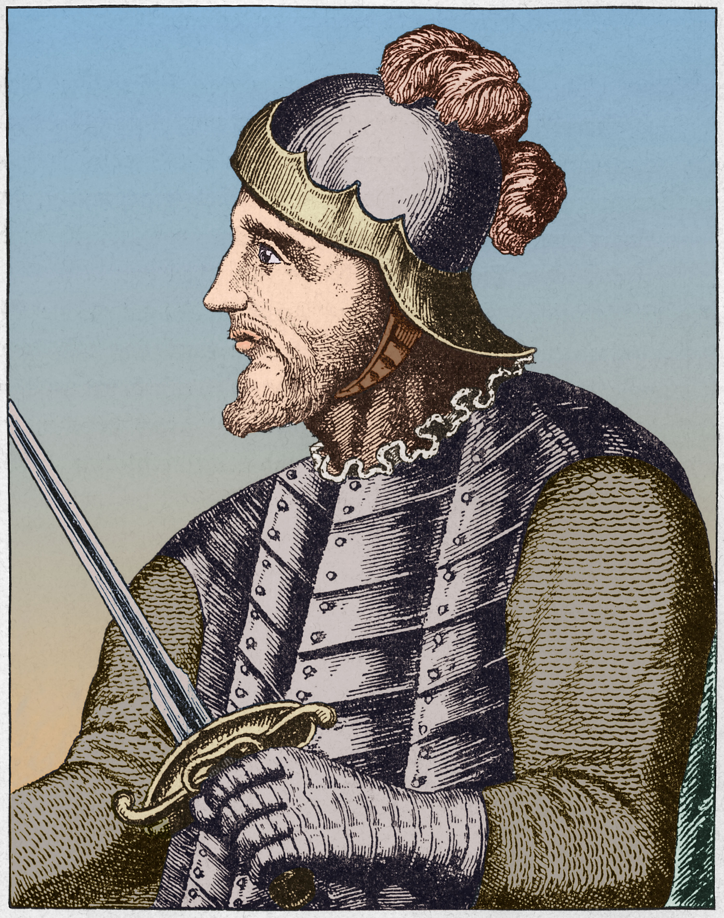
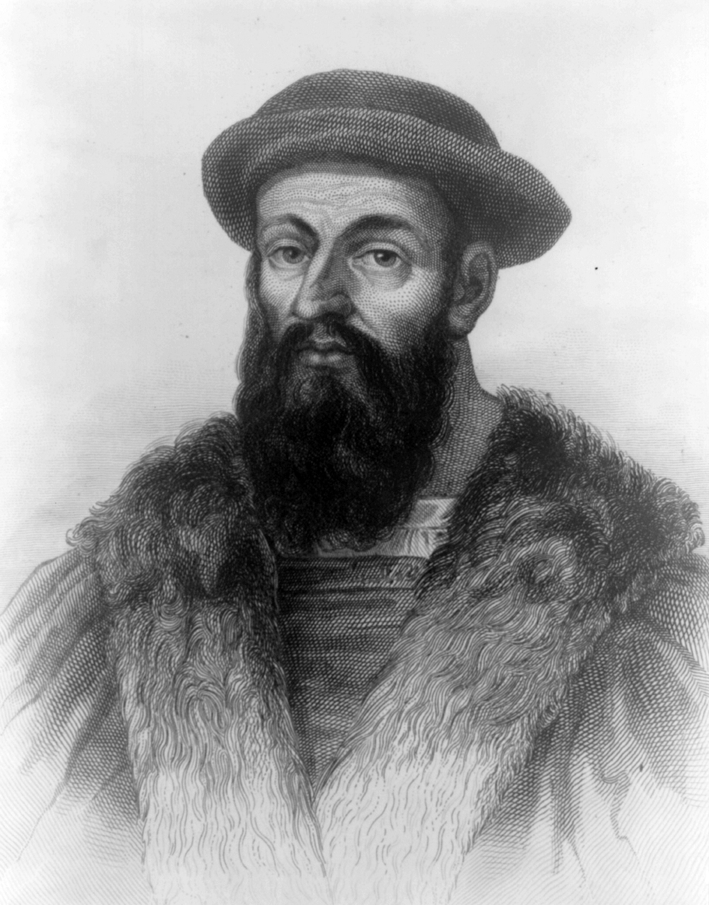
Magellan’s globe-circling expedition.
In 1518, the Portuguese navigator Ferdinand Magellan << muh JEHL uhn >> persuaded King Charles I of Spain to sponsor a westward expedition to the Spice Islands, now part of Indonesia. The king agreed to sponsor Magellan’s expedition because the Portuguese controlled the route to Asia around Africa. If Magellan succeeded, Spain would have its own route to Asia. At the time, Magellan did not know how large South America was. 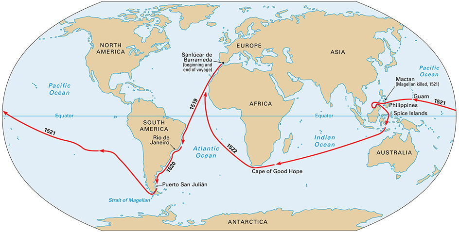
Magellan sailed from Spain on Sept. 20, 1519, with five ships. After reaching the northeast coast of Brazil, he sailed southward. He arrived at Puerto San Julián, Argentina. He spent the winter there and farther south at Puerto Santa Cruz, Argentina.
Magellan set sail from Puerto Santa Cruz on Oct. 18, 1520. Three days later, the ships entered a passage now known as the Strait of Magellan at the southern tip of South America. On November 28, three of the five ships sailed out of the strait into the Pacific Ocean. One of the other two ships had been wrecked in a storm, and one had turned back to Spain.
In the Pacific, the explorers sailed for more than three months without sighting any land except two uninhabited islands. Food ran out, and the sailors ate oxhides and rats to stay alive. In March 1521, Magellan reached the island of Guam, where he was able to gather supplies. He then sailed to the Philippine Islands. There, he became involved in a conflict among the native people. Magellan was killed in a battle on April 27, 1521.
After Magellan’s death, the expedition abandoned another ship. The remaining two vessels sailed to the Spice Islands (now part of Indonesia). One ship, the Victoria, then sailed west. Magellan’s lieutenant, Juan Sebastián de Elcano, commanded the ship. The Victoria crossed the Indian Ocean and sailed around the Cape of Good Hope. Badly damaged, the ship reached Spain on Sept. 6, 1522. It had completed the first trip around the world.
Spain’s conquests in the New World.
During the early 1500’s, Spanish explorers pushed across most of Central and South America. They carried with them smallpox and other diseases that were unknown in the Americas. Native Americans had no resistance to these diseases. As a result, thousands sickened and died. The Spanish explorers established colonies in the new lands. Royal officials, Roman Catholic priests, and settlers arrived soon after the explorers. The Spaniards typically forced the Native Americans to work for them. The Spaniards brought sugar cane, wheat, and other new plants to the Americas. They also introduced cattle, horses, sheep, and other domestic animals. They took back to Europe many plants that were unknown there, such as corn and potatoes. 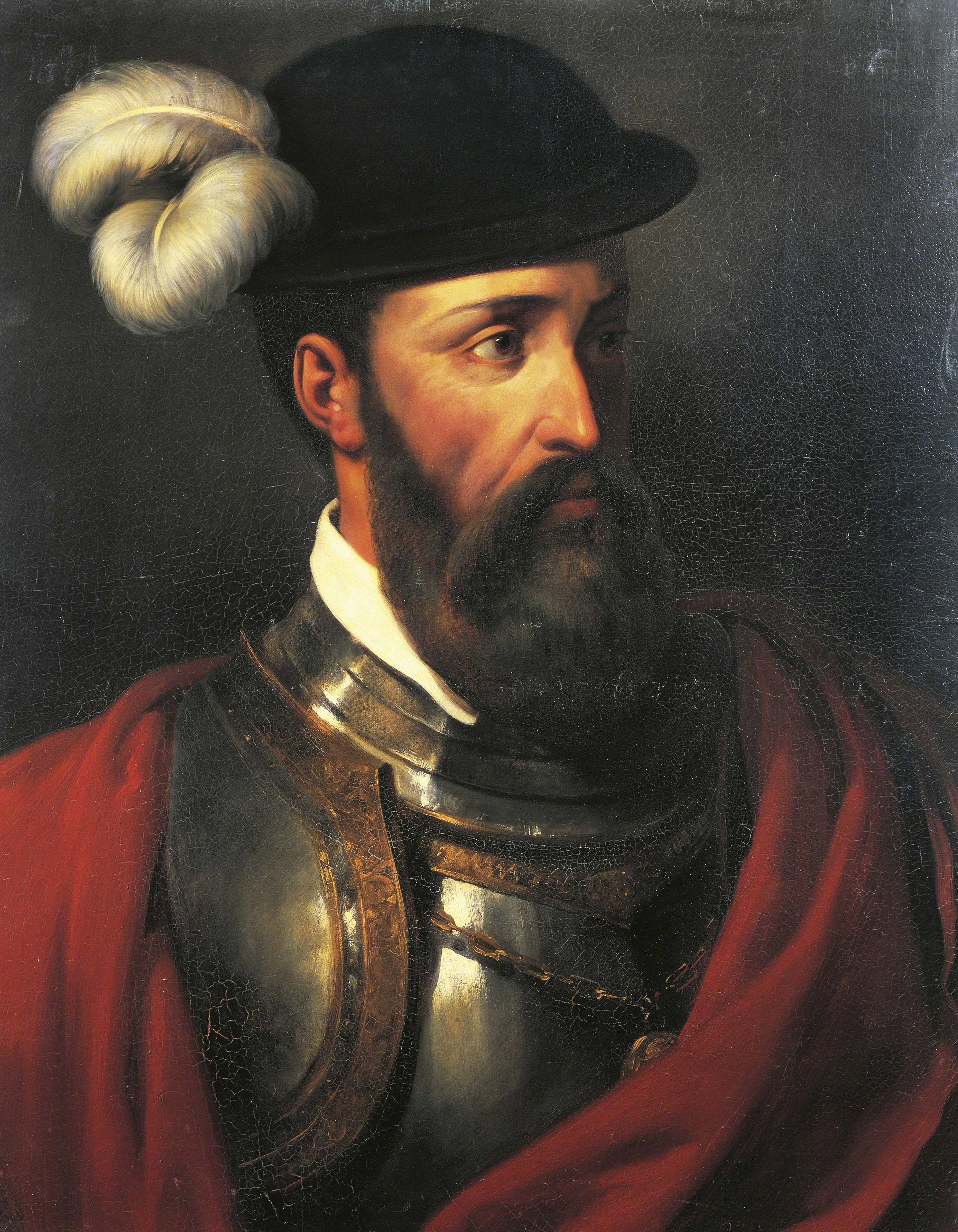
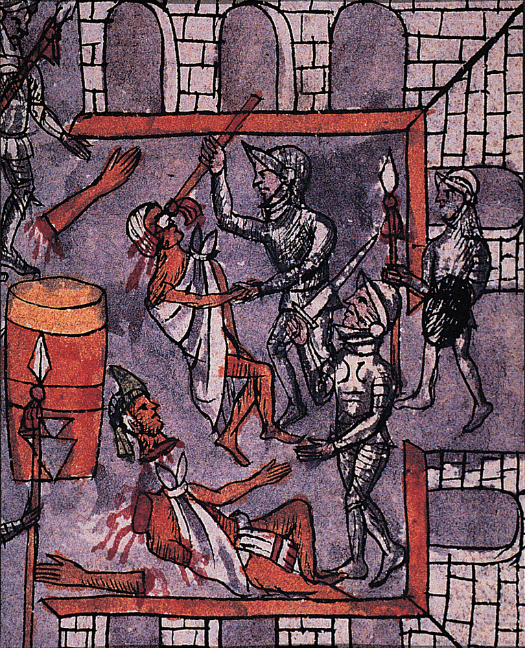
Hernán Cortés << kawr TEHZ >> commanded one of the most important Spanish expeditions in the New World. Cortés left Cuba in 1519 with more than 600 men. He sailed to the Mexican state of Yucatán, which was a center of Maya civilization. Cortés moved along the coast of Mexico and then inland to Tenochtitlan (now Mexico City), the capital of the Aztec Empire. Along the way, he met a Native American woman named Malinche, whom the Spaniards called Doña Marina. Malinche, who knew both the Maya and the Aztec languages, served as an interpreter for Cortés.
Other Spanish expeditions explored and conquered much of South America. From 1527 to 1529, Sebastian Cabot, a son of John Cabot, explored the continent. He sailed up the Río de la Plata and the Paraná and Paraguay rivers in Argentina and Paraguay. Cabot was looking for a “white king” who was supposedly rich in silver. Other explorers searched for a fabulous golden kingdom in South America, especially in Colombia and Venezuela. This kingdom was usually called El Dorado, which means “the gilded.”
In 1532 and 1533, the Spanish explorer Francisco Pizarro << frahn THEES koh pee THAHR oh >> conquered the Inca. From their home in Peru, the Inca ruled a huge empire. It included parts of Argentina, Bolivia, Chile, Colombia, and Ecuador. From 1535 to 1537, Diego de Almagro << DYAY goh deh ahl MAHG roh >>, a member of Pizarro’s party, explored South America. He traveled through parts of Bolivia and Argentina and crossed the Andes Mountains into Chile. Francisco de Orellana << frahn THEES koh day oh ray YAH nah >>, another veteran of Pizarro’s expedition, also explored the continent. In 1541 and 1542, he sailed from the Andes Mountains down the mighty Amazon River to its mouth on the Atlantic Ocean in Brazil.
During the 1500’s, Spaniards explored much territory that became part of the United States. In 1513, Juan Ponce de León << hwahn PAWN say day lay AWN >> sailed from Puerto Rico and landed on the east coast of Florida. He then sailed around the southern tip of Florida and into the Gulf of Mexico. He next explored the southwest coast of Florida before returning to Puerto Rico.
In 1539, Hernando de Soto << dih SOH toh >> led an expedition of more than 600 people. De Soto sailed from Cuba to the west coast of Florida. In search of gold, he traveled through the southern United States, including Georgia, Alabama, Mississippi, and Arkansas. The explorers found no gold, but they became the first Europeans to reach the Mississippi River. After de Soto died of fever in 1542, the survivors sailed down the Mississippi. They eventually reached Mexico by way of the Gulf of Mexico.
In 1540, Francisco Vásquez de Coronado << frahn THEES koh BAHS kayth day kawr uh NAHTH oh >> set out from Campostela near the west coast of Mexico. He hoped to find the legendary Seven Cities of Cíbola. These supposedly rich and flourishing cities were thought to lie north of Mexico City. Coronado traveled through Arizona, New Mexico, Texas, Oklahoma, and Kansas. He found no important cities. But Coronado’s and de Soto’s expeditions gave Europeans a good idea of the width of North America.
The search for a northern passage.
During the 1500’s, the known sea routes to Asia were long, and they were controlled by Spain and Portugal. As a result, other European nations tried to find alternate, shorter routes. Some explorers looked for a Northwest Passage—that is, a waterway that would allow ships to sail through or north of North America to reach Asia. Others looked for a Northeast Passage north of Europe. However, none of the explorers found a Northwest or Northeast passage. The search continued for centuries.
Jacques Cartier << zhahk kahr TYAY >>, a French explorer, also failed to find a passage on two voyages from 1534 to 1536. However, he became the first European to see the St. Lawrence River in Canada. His voyages helped establish French claims to the region.
Several English explorers searched unsuccessfully for a Northwest Passage in North America. From 1576 to 1578, Martin Frobisher made three voyages. He reached what is now called Frobisher Bay in northeastern Canada. In 1585, John Davis, another English navigator, discovered and explored Davis Strait between Greenland and Canada. He also found Cumberland Sound in northeastern Canada. English merchants sent three expeditions in search of a Northeast Passage from 1553 to 1580. However, these expeditions got only as far as the Kara Sea north of Russia before they turned back. Willem Barents << WIHL uhm BAR uhnts >>, a Dutch navigator, looked for the Northeast Passage during the 1590’s. He sailed farther north than any other European had in a recorded voyage. Barents explored Spitsbergen and other islands in the Arctic Ocean.
Linking the globe
By 1600, the Spanish had explored Central and South America and parts of North America. Spain had established numerous colonies there. Spain tried to claim all of North America. But the French and English set up their own colonies and explored much of the continent themselves. Meanwhile, Russians moved east to explore Siberia and Alaska.
During the European Enlightenment, a historical period from the late 1600’s to the late 1700’s, the goals of exploration began to change. Expeditions of the 1500’s and 1600’s focused on trade, religious missions, and colonization. By the 1700’s and into the 1800’s, exploration focused increasingly on science. However, European rulers did not support scientific expeditions simply to increase knowledge. Science offered the promise of more accurate maps, the discovery of new and valuable resources, and international prestige.
European explorers gradually filled in the outlines of the areas unknown to them. They mapped the Pacific Ocean, worked their way through the interiors of Australia and Africa, and reached the Arctic and Antarctic. Finally, in the 1900’s, they raced to reach the North and South poles.
The French and English in North America.
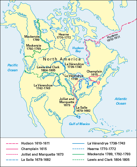
Samuel de Champlain << sham PLAYN >>, a French explorer and geographer, charted the Atlantic coast. He mapped it from Cape Breton Island in Canada to Martha’s Vineyard in Massachusetts. In 1608, he founded the city of Quebec as a fur-trading post. Over the next eight years, he traveled extensively and explored the rivers and lakes of the region. In 1609, Champlain became the first European to reach Lake Champlain, the lake in New York, Vermont, and Quebec that now bears his name.
The French also explored the Mississippi River. In 1673, Louis Jolliet << lwee JOH lee eht >>, a fur trader, and Jacques Marquette << zhahk mahr KEHT >>, a Roman Catholic priest, reached the river. Starting near Prairie du Chien, Wisconsin, they paddled canoes south to where the Mississippi meets the Arkansas River. In 1682, René-Robert Cavelier, Sieur de La Salle << ruh NAY raw BEHR kah vehl YAY syoor duh luh SAL >>, led an expedition down the Illinois River. He began near Peoria, Illinois, and traveled down the Mississippi to its mouth at the Gulf of Mexico. La Salle claimed the entire region drained by the Mississippi for France. He named it Louisiana in honor of King Louis XIV.
Colonists founded the first permanent English settlement in North America at Jamestown, Virginia, in 1607. By the end of 1670, English settlements existed in 12 of the 13 original colonies.
England also claimed much of eastern Canada. England based this claim in part on a voyage of the English navigator Henry Hudson. Hudson was looking for a Northwest Passage. In 1610, he sailed through a strait in northeastern Canada into a large body of water he thought was the Pacific Ocean. It was really the huge bay now known as Hudson Bay.
Crossing North America.
During the 1700’s, French and British explorers pushed westward across the northern parts of North America. They also discovered the northern limits of the continent.
In 1738 and 1739, the French-Canadian fur trader Pierre Gaultier de Varennes, Sieur de La Vérendrye << pyehr goh TYAY duh vah REHN syoor duh lah vay rahn DREE >>, and his sons explored Manitoba and North Dakota. In 1742 and 1743, two of the sons, Louis-Joseph and François, traveled as far as Montana and Wyoming.
From 1770 to 1772, the British explorer Samuel Hearne explored the land north of Churchill, Manitoba. Hearne went as far north as the Coppermine River, which flows into the Arctic Ocean.
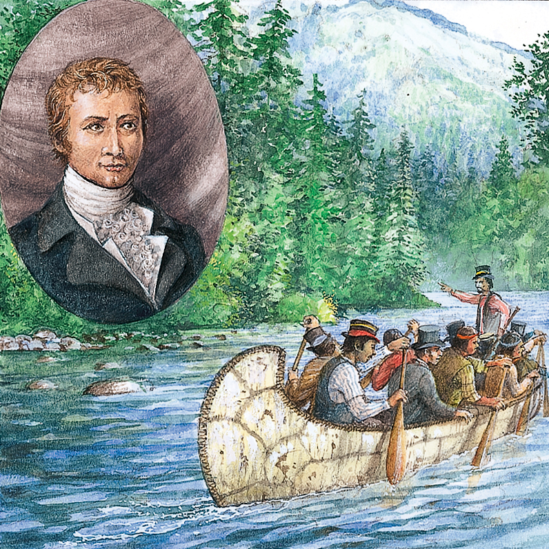
Two U.S. Army officers, Meriwether Lewis and William Clark, began an important expedition to the Pacific Northwest in 1804. In May of that year, they set out from St. Louis and traveled up the Missouri River. They spent the winter with native Mandan people near Bismarck, North Dakota. There, they met Sacagawea << sah `kah` guh WEE uh >>, a Shoshone woman who agreed to be their interpreter. The following spring, the expedition continued up the Missouri and crossed the Rockies. Once past the mountains, the explorers pushed to the Columbia River. They followed the river to the Pacific Ocean, reaching it in November 1805. Lewis and Clark returned to St. Louis in 1806. They brought back valuable information about the land, plant and animal life, and peoples they encountered on their journey.
Although their expedition was successful, it had little impact on Americans back home. Lewis and Clark’s journals remained unpublished for many years, and the materials they collected became lost. Only in the 1900’s did Americans rediscover and begin to appreciate the importance of this expedition.
The Russians in Siberia.
The exploration of Siberia—the vast region in northern Asia between the Ural Mountains and the Pacific Ocean—began in 1581. That year, Yermak Timofeyevich << yur MAHK tyihm uh FYAY uh vyich >>, a Russian military leader, conquered the ruler of a territory called Sibir just east of the Ural Mountains. The name Siberia was then applied to the entire region.
During the early 1600’s, Russians moved eastward across Siberia. They came upon Lake Baikal in 1643. By 1650, Russians had reached the Sea of Okhotsk in the northern Pacific and had rounded the Chukchi Peninsula in northeastern Asia. In the late 1690’s, a Russian soldier named Vladimir V. Atlasov << AT luh sawf >> conquered the peoples of the Kamchatka Peninsula on the Pacific coast of eastern Russia.
Exploring the Pacific.
The Pacific Ocean was still largely unknown to Europeans in 1600. In the 1600’s and 1700’s, Dutch, English, and French navigators sailed throughout the Pacific. They discovered many islands. European voyagers also hoped to find the mysterious Terra Australis Incognita (Unknown Southern Continent). The Europeans of the time believed this legendary large and fertile continent lay in the South Pacific to balance the northern continents of Europe and Asia.
After 1750, two developments made long Pacific voyages safer than they had been. First, sailors began to realize that fresh food would prevent scurvy. This disease, which results from a lack of vitamin C, had caused many illnesses and deaths on earlier voyages. Captains now tried to have supplies of fresh foods on hand for their crews. Second, in the late 1700’s, navigators began to use the chronometer, a precise timepiece that enabled them to determine longitude more accurately. As a result, they could pinpoint their position at sea and establish the exact location of newly found islands.
During the second half of the 1700’s, the French and the British took the lead in exploring the Pacific. In 1766, Louis-Antoine de Bougainville << lwee ahn TWAHN duh boo gahn VEEL >> began what would be the first French voyage around the world. In January 1768, Bougainville entered the Pacific by way of the Strait of Magellan. In April, he reached the island of Tahiti. Samuel Wallis, a British explorer, had visited Tahiti the year before. Bougainville’s later account of the island’s people and climate made Tahiti seem like an earthly paradise to many Europeans.
Bougainville was the first European to see several islands in the Pacific, including one in the Solomon group now named after him. Among Bougainville’s crew was probably the first woman to sail around the world. This young Frenchwoman, named Jeanne Baret << zhahn bah RAY >>, disguised herself as a male servant to one of the scientists on the expedition. The ship’s company did not detect her gender until the expedition reached Tahiti. The Tahitians quickly realized that she was a woman.
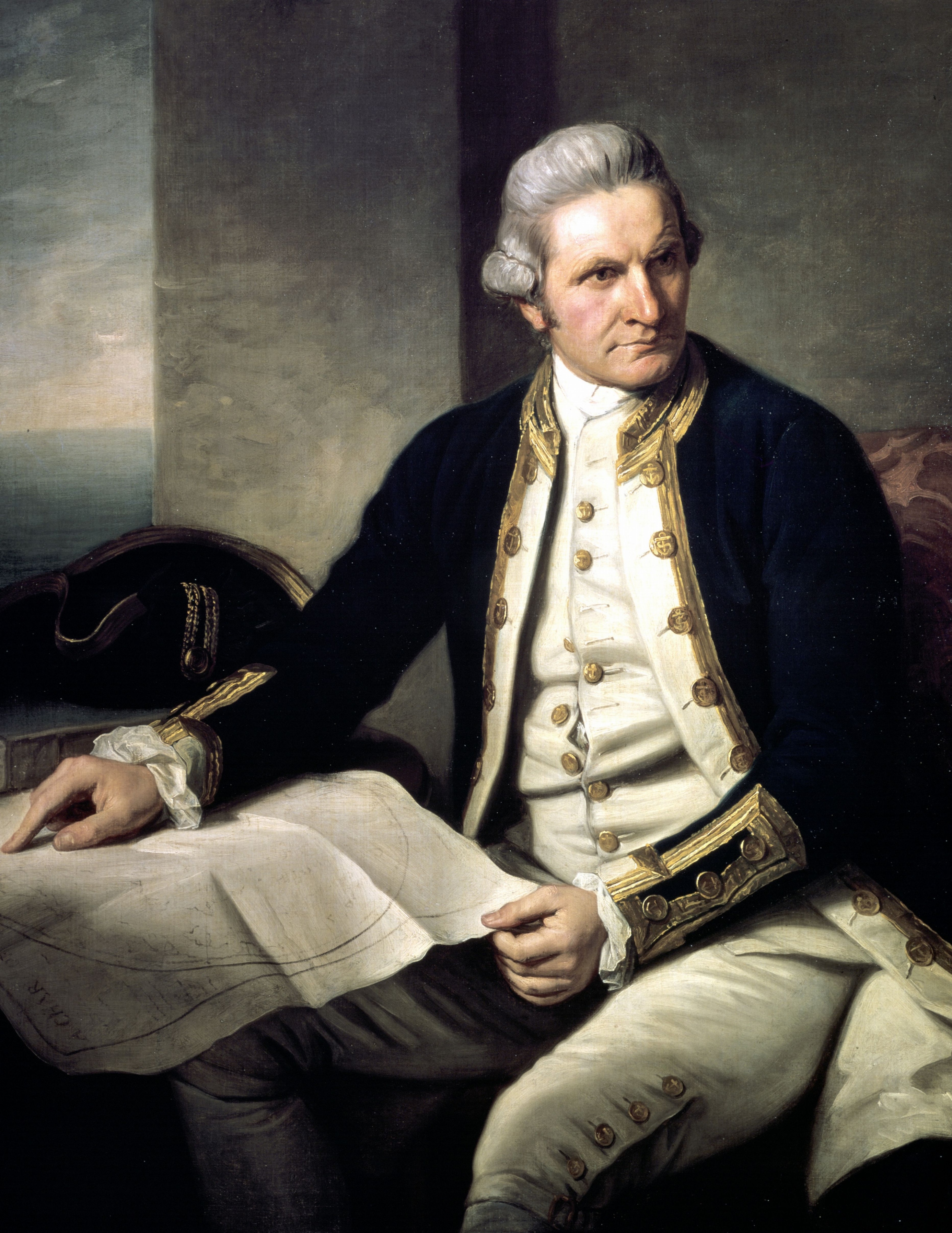
The most influential explorer of the Pacific was James Cook. Cook, a British naval officer, made three long voyages from 1768 to 1779. These voyages provided much scientific information about the waters and islands of the Pacific. The information contributed to European colonization of Australia and other territories. Cook’s first voyage was mainly a scientific expedition. Cook also had orders from the British Navy to look for the Unknown Southern Continent. He did not find it. But he did explore New Zealand and the eastern coast of Australia.
Cook searched for the Unknown Southern Continent during his second voyage as well. In 1773 and 1774, he crossed the Antarctic Circle and went farther south than any other explorer up to that time. But he could not find an Unknown Southern Continent. During his third voyage, Cook set out to look for an outlet of the Northwest Passage in the northern Pacific. In 1778, he sailed north through the Bering Strait until ice blocked his way. He found no outlet. The following year, Cook was killed in a dispute with native people on the island of Hawaii.
Exploring Australia’s interior.
European exploration of Australia began soon after the British established a colony for convicts near Sydney in 1788. Many of Australia’s original inhabitants, the Aboriginal and Torres Strait Islander peoples, died of diseases introduced by the Europeans or in violent conflicts with the British. However, some Aboriginal people acted as guides and pointed out sources of food and water to explorers.
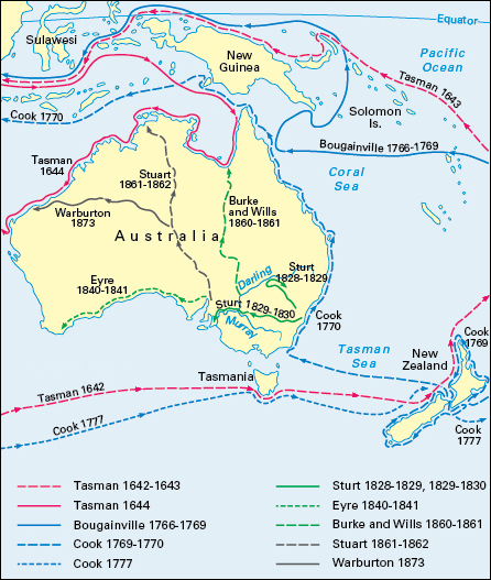
At first, exploration centered on the Sydney area. In 1829, an expedition led by Charles Sturt, a British Army officer, reached the Darling River. In 1829 and 1830, Sturt led a second expedition that sailed down the Murrumbidgee and Murray rivers to the sea near Adelaide.
Exploration of the interior of Australia was difficult and dangerous because much of it is desert. The British explorer Edward John Eyre << air >> became the first European to make an overland journey across Australia from east to west. His expedition in 1840 and 1841 closely followed the southern coast of Australia. The first European party to cross Australia from south to north was led by Robert O’Hara Burke, an Irish-born explorer; and William John Wills, a British-born explorer. Burke and Wills left Melbourne in 1860. They reached the Gulf of Carpentaria in 1861. The two explorers starved to death on the return trip. Meanwhile, John McDouall Stuart, a Scottish-born explorer, also tried to cross Australia. Stuart made several unsuccessful attempts before making a round trip between the southern and northern coasts in 1861 and 1862.
The exploration of Africa.
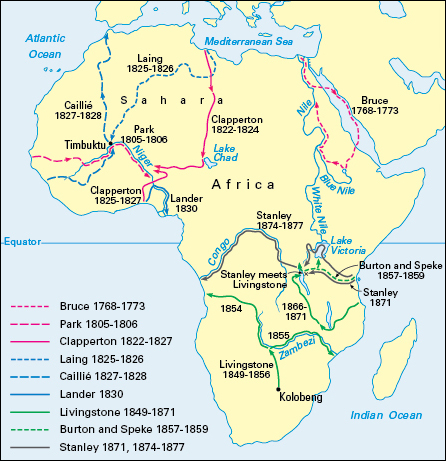
During the late 1700’s and early 1800’s, European explorers tried to solve a mystery that had puzzled geographers for centuries. Ancient writers told of an important African river called the Niger. But they did not know where it began, in what direction it flowed, and where it ended. In 1796, Mungo Park, a Scottish explorer, reached the Niger near Ségou, in Mali. He found that the river flows from west to east. In 1830, the British explorer Richard Lemon Lander sailed down the Niger to its mouth in the Gulf of Guinea. During the 1820’s, Alexander Gordon Laing, a Scottish explorer, and René Caillié << ruh NAY cah YAY >>, a Frenchman, separately visited Timbuktu, a great city near the Niger in Mali.
By the late 1700’s, Europeans were familiar with the lower Nile. The lower Nile is formed by the meeting of two rivers called the Blue Nile and the White Nile at Khartoum, in Sudan. But the source of the rivers remained a mystery. In 1770, James Bruce, a Scottish explorer, reached the source of the Blue Nile in the mountains of Ethiopia.
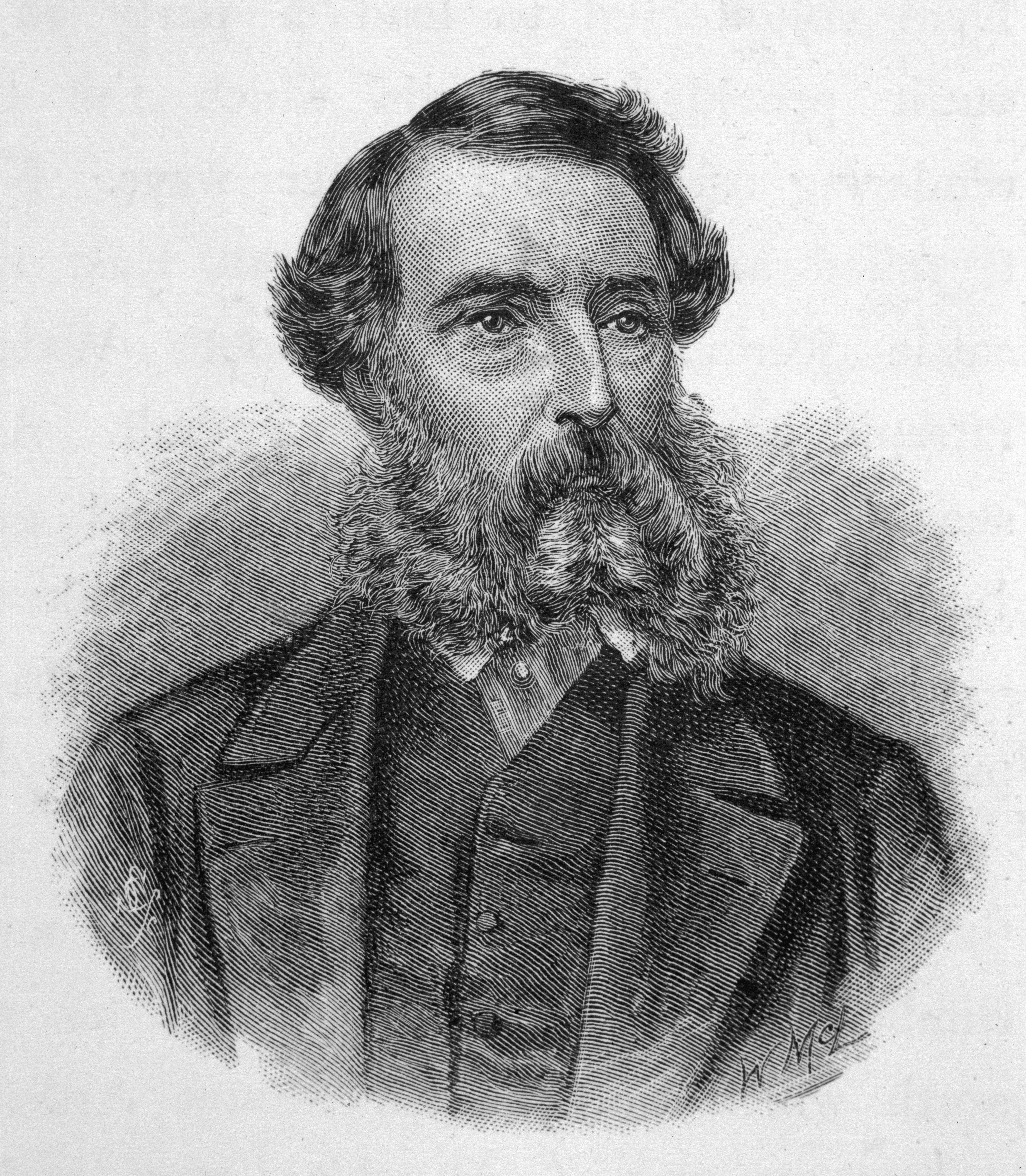
In 1857, the British explorers Richard Francis Burton and John Hanning Speke began to search for the source of the White Nile. In 1858, they reached Lake Tanganyika, which is bordered by Burundi and Tanzania in the east and Zambia and the Democratic Republic of the Congo in the west. Arabs in the region told Burton and Speke about another large lake nearby. Speke went alone to find the lake and became convinced that it was the source of the Nile. He named it Lake Victoria in honor of Queen Victoria of the United Kingdom. This lake, known as Victoria Nyanza in Africa, lies partly in Kenya, Tanzania, and Uganda. 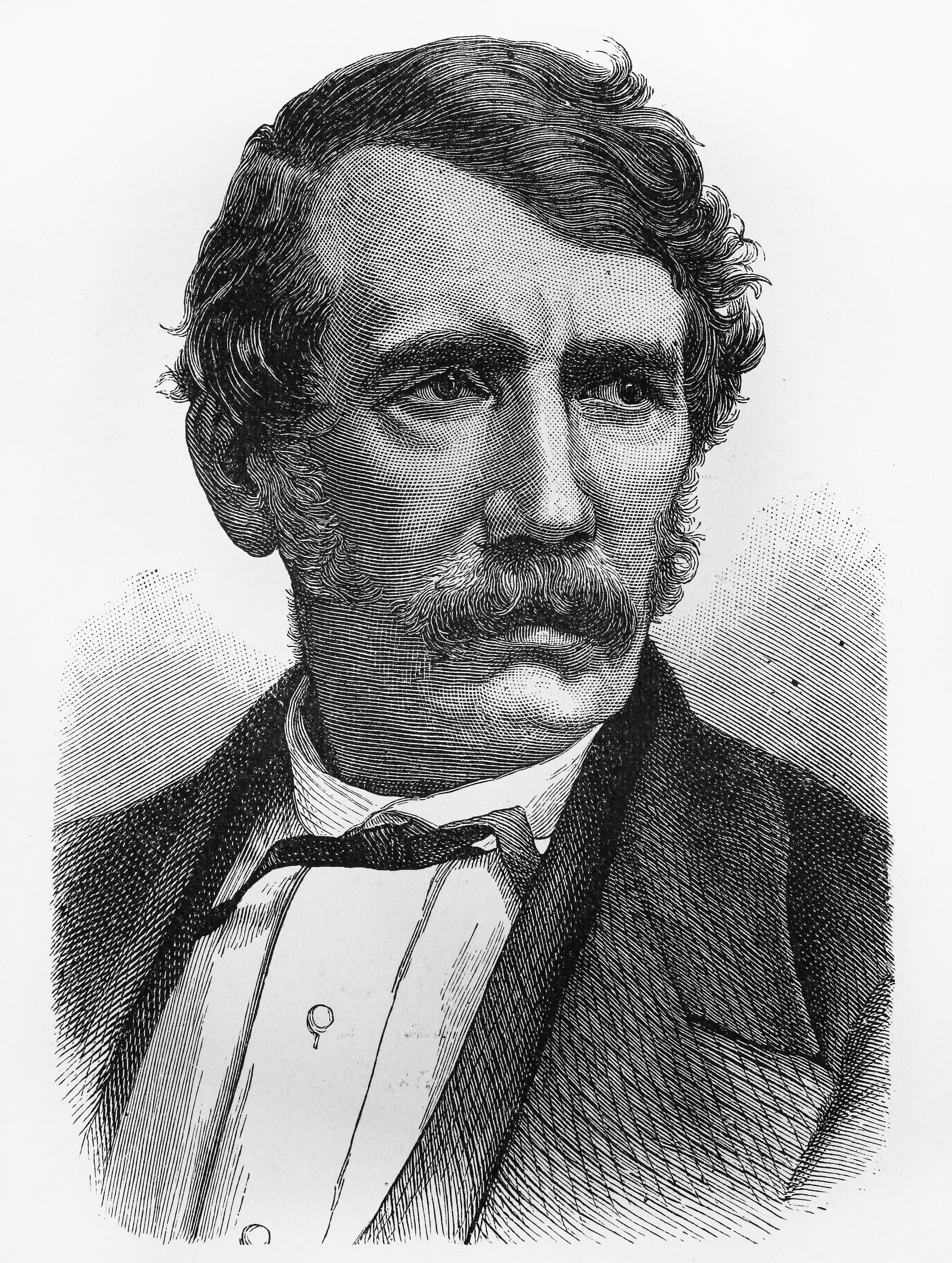
Speke returned to Lake Victoria in 1862. He identified the source of the Nile as a large waterfall at the lake’s northern end. This waterfall is now submerged by the Nalubaale Dam. Burton and others believed that Speke was wrong, but later explorers proved him right.
During the early 1860’s, a British explorer named Samuel White Baker explored many rivers of eastern Africa. He traveled with a companion, Florence, who later became his wife. In 1864, they became the first Europeans to reach Lake Albert (Albert Nyanza) and Murchison Falls.
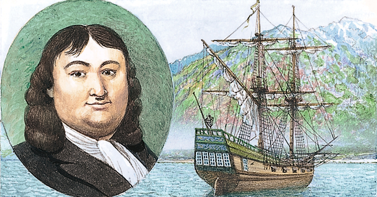
The most famous European explorer in Africa was David Livingstone, a Scottish missionary. From 1853 to 1856, he became the first European to cross Africa. In 1855, he became the first European to see the Victoria Falls on the Zambezi River. He followed the Zambezi during part of his journey from Angola to Mozambique. In 1859, during a later expedition in southeast Africa, he reached Lake Nyasa, also known as Lake Malawi. From 1866 until his death in 1873, Livingstone explored the lakes and rivers of central Africa.

Arctic exploration.
By 1800, the discoveries of early explorers had revealed much about the Arctic. However, no one had found either the Northwest or the Northeast passage. European governments realized that these northern passages, if they could be found, would be too hazardous for commercial shipping. Nevertheless, they continued to search for the Northwest and Northeast passages as a way to demonstrate the bravery of their explorers and the advanced technology of their ships.
The Arctic passages.
In the early 1800’s, the British Navy began to send expeditions to try to find a Northwest Passage in Arctic waters north of Canada. In 1819, William Edward Parry, a British naval officer, almost succeeded. He found an entrance to the Northwest Passage. He sailed through Lancaster Sound more than halfway to the Pacific, as far west as Melville Island.
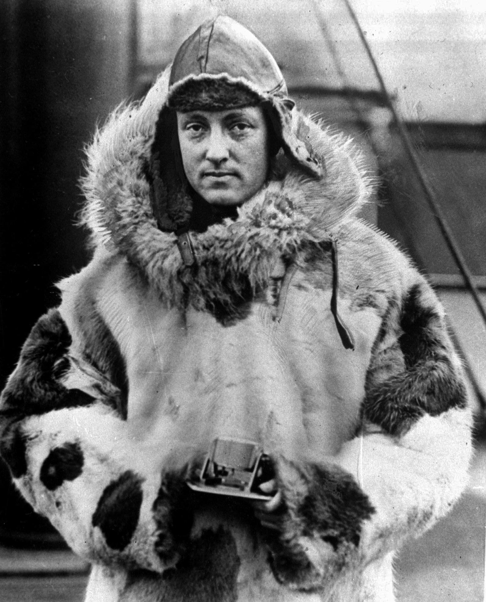
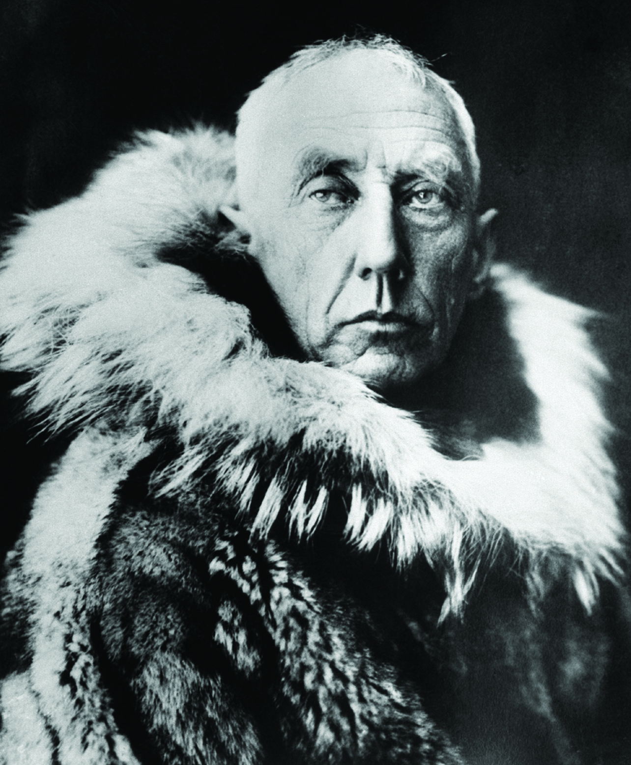
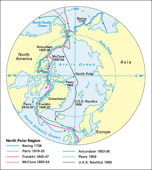
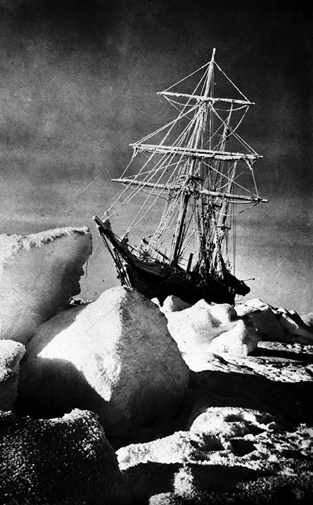
In 1845, Sir John Franklin left England with two ships and 128 men to search for the passage. By 1848, nothing had been heard from Franklin and his men. The remains of the expedition were found in 1859. Franklin and his crew had died after their ships became jammed in sea ice. From 1850 to 1854, Robert McClure, a commander of one of the search ships, traveled from the Bering Strait to the Atlantic. He claimed that he had found the Northwest Passage. But he had sailed on several ships and had gone part of the way over ice on sleds. As a result, it was not clear whether a single ship could travel through the passage. This feat was finally accomplished from 1903 to 1906 by Roald Amundsen << ROH ahl AH muhn suhn >>. Amundsen, a Norwegian explorer, sailed from the Atlantic Ocean to the Bering Strait.
Meanwhile, Nils Adolf Erik Nordenskjöld << nihls AH dawlf AY rihk NOOR duhn `shoold` >>, a Swedish explorer, completed the Northeast Passage from Europe to Asia. In July 1878, he sailed east from Tromsø, Norway, and reached the Pacific Ocean a year later.
The North Pole.
During the 1800’s, European explorers turned their attention to the North Pole. Reaching the pole was a symbolic quest that had little practical value. The cold and ice of the Arctic made exploration extremely dangerous. Ships could get trapped in sea ice or destroyed by it. Food was scarce, and starvation was a real danger if explorers used up their supplies.
During the late 1800’s, many people believed that there was open water in the Arctic Ocean and that the North Pole might be reached by ship. But it soon became clear that the Arctic Ocean has a permanent cover of ice that explorers would have to cross by sled to reach the pole.
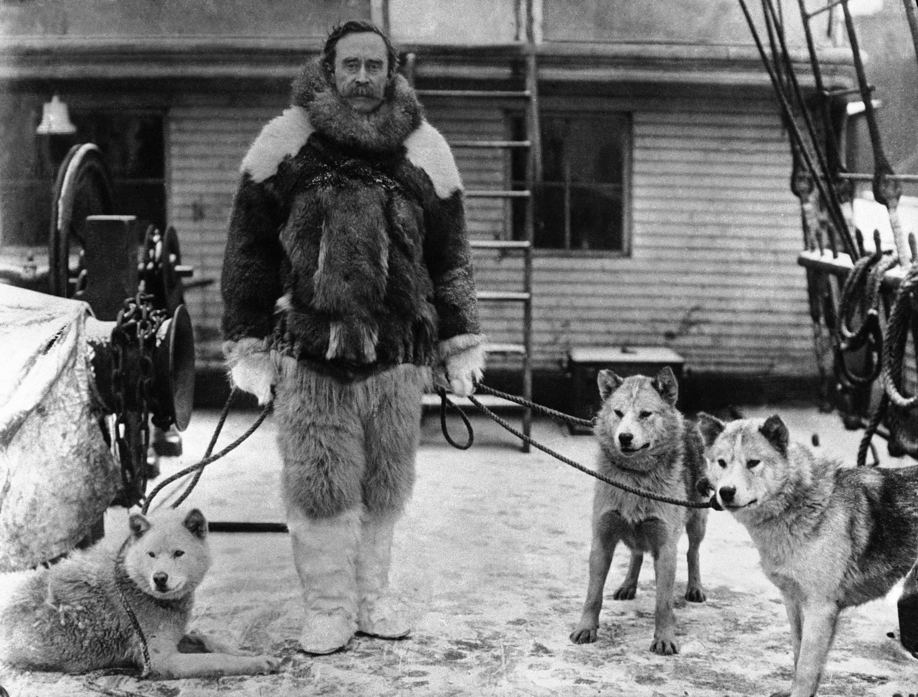
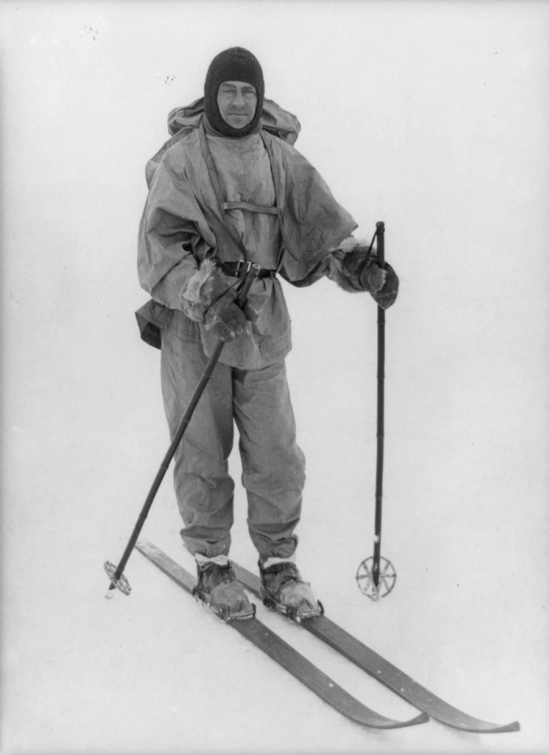
From 1898 to 1905, Robert E. Peary, an American explorer, led expeditions to try to reach the North Pole. He began his final expedition in 1908. It headed north to the pole from Ellesmere Island in the Canadian Arctic in early 1909. Peary claimed to have reached the North Pole on April 6, 1909. His party included his chief assistant, Matthew A. Henson, and four Inuit men: Ootah, Egigingwah, Seegloo, and Ooqueah. Upon returning to the United States, Peary learned that another American explorer, Frederick A. Cook, claimed to have reached the pole a year before Peary, on April 21, 1908. By 1910, most experts decided that Peary’s story was more believable than Cook’s. But the dispute has never been definitely settled. Neither man offered convincing proof that he had reached the North Pole.
The invention of the airplane and other technological advances in the 1900’s brought new methods of polar exploration. In 1926, Richard E. Byrd, an American naval officer, and Floyd Bennett, an American pilot, claimed they flew from Svalbard to the North Pole and back. Some scholars today dispute that claim. Also in 1926, a team of explorers flew from Svalbard to Alaska by way of the North Pole in an airship called the Norge. The explorers included Umberto Nobile << um BER taw NOH bee lay >>, an Italian Air Force officer, who piloted the craft; Lincoln Ellsworth, an American civil engineer; and Roald Amundsen, who had earlier sailed through the Northwest Passage. In 1958, the U.S. nuclear-powered submarine Nautilus passed underneath Arctic ice to the position of the North Pole.
The exploration of Antarctica.
By the early 1800’s, Antarctica remained the only continent still unknown to the world. This uninhabited frigid continent was difficult to reach and explore. Stormy, ice-filled waters surround it, and a thick layer of ice covers it.
Nobody knows who first saw the Antarctic continent. But many historians divide the credit among three individuals known to have sighted Antarctica on separate voyages in 1820. These three are Edward Bransfield, a British naval officer; Nathaniel Brown Palmer, an American sea captain; and Fabian von Bellingshausen, of the Russian Imperial Navy.
Several countries sent expeditions to Antarctica to carry out scientific research. In 1840, an American naval officer named Charles Wilkes led an expedition that charted part of the coast. From 1839 to 1843, James Clark Ross, a British naval officer, commanded an expedition that sailed into what is now the Ross Sea. Ross discovered the volcanoes Mount Erebus and Mount Terror, named after his ships, Erebus and Terror. He continued southward until a massive barrier of ice now known as the Ross Ice Shelf blocked his progress.
During the late 1890’s and early 1900’s, Belgium, the United Kingdom, Germany, and Sweden sent scientific expeditions to explore the continent. Robert Falcon Scott, a British naval officer, led an expedition from 1901 to 1904 that discovered what is now called Edward VII Peninsula. Scott’s expedition used sleds pulled by dogs to travel deep into the interior of the continent.
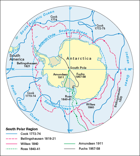
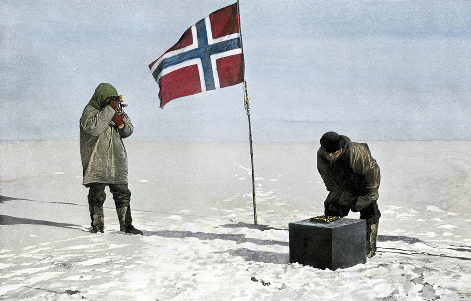
In 1911, two groups of explorers raced across Antarctica to reach the South Pole. One group was led by Amundsen, and the other by Scott. Amundsen reached the pole on Dec. 14, 1911, about five weeks before Scott. Scott and the four other members of his group reached the pole, but they all died on the return trip.
During the 1920’s, aircraft were first used to explore Antarctica. George Hubert Wilkins, an Australian explorer, made the first Antarctic airplane flight in 1928. The same year, Byrd went to Antarctica with three airplanes. He built a base on the Ross Ice Shelf called Little America. On Nov. 28 and 29, 1929, he led the first flight, piloted by Bernt Balchen, over the South Pole.
During the 1950’s, many nations built bases on Antarctica from which to conduct scientific research. In 1957 and 1958, an expedition led by Vivian Fuchs << fyooks >>, a British geologist, accomplished the first overland crossing of Antarctica. The explorers used snow tractors and dog teams to make the crossing. Their journey covered 2,158 miles (3,473 kilometers) and took 99 days.
In 1989 and 1990, Will Steger of the United States led a team from six nations across Antarctica. The expedition traveled by dog sled and ski. It was the first to cross the continent without motorized vehicles.
The new frontiers
Throughout history, the unknown has attracted explorers to Earth’s farthest and most isolated places. Today, this same urge continues to draw men and women toward new frontiers of exploration: the ocean depths and outer space.
Deep-sea exploration.
Early explorers and geographers were curious about the seas and the life in them. They often measured the depth of the oceans. They also tried to determine deep-sea temperatures and used dredges to haul marine life up to the surface.
The United Kingdom’s Royal Navy and the Royal Society, a British scientific association, organized the first expedition devoted entirely to the study of the sea. A naval vessel called the Challenger was specially equipped for the expedition in 1872. Captain George S. Nares commanded. Charles Wyville Thomson, a Scottish naturalist, headed a team of scientists. The Challenger spent more than three years at sea and traveled nearly 70,000 miles (113,000 kilometers). The expedition made hundreds of measurements, gathered much information about the ocean floor, and discovered many marine organisms.
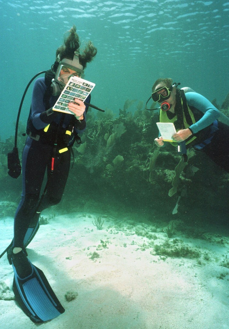
In the mid-1900’s, explorers and scientists began to get firsthand views of the underwater world. In 1943, Jacques-Yves Cousteau << zhahk eev koo STOH >>, a French naval officer, and Émile Gagnan << ay MEEL GAHN yahn >>, a French engineer, invented the aqualung. This device allowed divers to breathe air from canisters on their backs and to move freely underwater.
In the late 1900’s, divers penetrated deep into the ocean with the help of improved suits and breathing apparatus. In 1979, Sylvia A. Earle, an American marine biologist, made a record-breaking dive. She descended 1,250 feet (381 meters) to the ocean floor off Hawaii wearing a kind of diving suit called a Jim suit. The suit is named for the British diver Jim Jarrett, who made the first dives with it in the 1920’s.
Explorers also used deep-sea vessels known as submersibles to study the oceans. In 1934, William Beebe, an American naturalist, and Otis Barton, an American engineer, descended 3,028 feet (923 meters) into waters off Bermuda in a vehicle called a bathysphere.
The Swiss physicist Auguste Piccard << oh GOOST pee KAHR >> made a major contribution to ocean exploration during the 1940’s. He invented a diving vehicle known as a bathyscaph. It could descend farther than any craft of its day. In 1960, Piccard’s son Jacques and Donald Walsh of the U.S. Navy used a bathyscaph to dive into the Mariana Trench, a valley in the Pacific Ocean floor that is the lowest known place in the world. They reached the bottom at 35,800 feet (10,910 meters) beneath the surface.
By the late 1900’s, the marine geologist Robert D. Ballard and other scientists had developed new types of equipment to explore the sea. Their equipment included remotely operated diving vessels and robots. In the late 1970’s, Ballard and a team of explorers discovered strange worms and other life forms at the bottom of the Pacific Ocean. In 2012, the Canadian-born filmmaker James Cameron completed the first solo submarine voyage to the bottom of the Mariana Trench. Equipment on Cameron’s submarine collected samples and captured three dimensional video images.
In 2019, the American explorer Victor Vescovo made the deepest dive ever recorded. His submersible Limiting Factor descended 35,853 feet (10,927 meters) to the bottom of the Mariana Trench.
For more information on deep-sea exploration, see Ocean (Exploring the ocean).
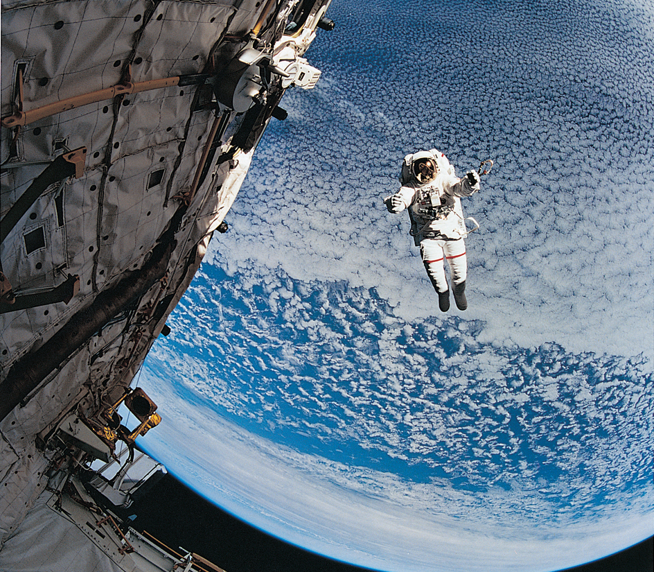
Space exploration.
Long before the invention of rockets, humans explored Earth’s atmosphere in lighter-than-air craft. In 1783, two Frenchmen made the first human free flight in a hot air balloon. The two—Jean-François Pilâtre de Rozier, a scientist, and François Laurent, Marquis d’Arlandes, a nobleman—drifted over Paris for about 25 minutes. For the next century, explorers used lighter-than-air craft, such as balloons and dirigibles, to learn more about the regions above Earth.
The first rockets used for space exploration were developed for warfare during World War II (1939-1945). Germany developed a rocket called the V-2. The United States captured some of these rockets and used them to launch exploratory instruments into the atmosphere after the war.
After World War II ended, the United States and the Soviet Union engaged in an intense rivalry known as the Cold War. On Oct. 4, 1957, the Soviet Union launched Sputnik 1, the first artificial satellite, into orbit around Earth. On Jan. 31, 1958, the United States sent up its first space satellite, Explorer 1.
Human space travel.
Loading the player...
Space exploration: Apollo 11
The first person to travel in space was Yuri Gagarin, a Soviet Air Force officer. On April 12, 1961, he circled Earth in a spacecraft called Vostok 1. On Feb. 20, 1962, John H. Glenn, Jr., a U.S. Marine test pilot, became the first American to orbit Earth. On July 20, 1969, U.S. astronauts Neil A. Armstrong and Buzz Aldrin became the first people to set foot on the moon. During the next three years, 10 other U.S. astronauts landed there. Because the United States portrayed landing on the moon as a race against the Soviet Union, interest in moon exploration waned after the race had been won. The last human mission to the moon ended in 1972.
In 2003, the United States began planning for the next stage in human space travel. President George W. Bush directed the National Aeronautics and Space Administration (NASA) to develop new spacecraft that would return astronauts to the moon. In 2010, President Barack Obama revised these goals. Under Obama’s plan, astronauts would bypass the moon and travel to other destinations in the solar system instead. The plan called for sending the first humans to visit an asteroid by 2025. By the 2030’s, Obama said, “I believe we can send humans to orbit Mars and return them safely to Earth. And landing on Mars will follow.”
Robotic spacecraft
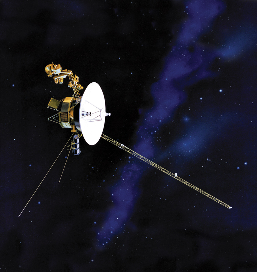
In the 2010’s, the two Voyager probes entered interstellar space, the vast region between the stars. Their flights rank as the most distant journeys of human-made spacecraft yet achieved.
