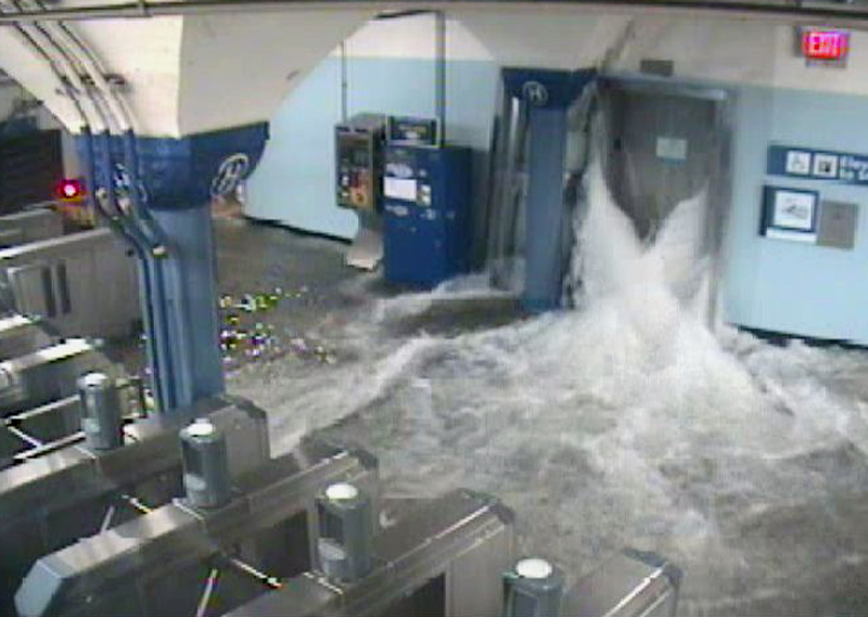
Flood is a body of water temporarily covering what is normally dry land. Floods most commonly occur along rivers. In addition, they can occur around lakes, wetlands, and seacoasts. Floods occur naturally and can benefit certain ecosystems. However, human activities can change the frequency and severity of floods, contributing to destruction. In developed areas, floods can cause great damage to property. Floods consistently rank among the costliest natural disasters around the world. They cause billions of dollars in damage each year. 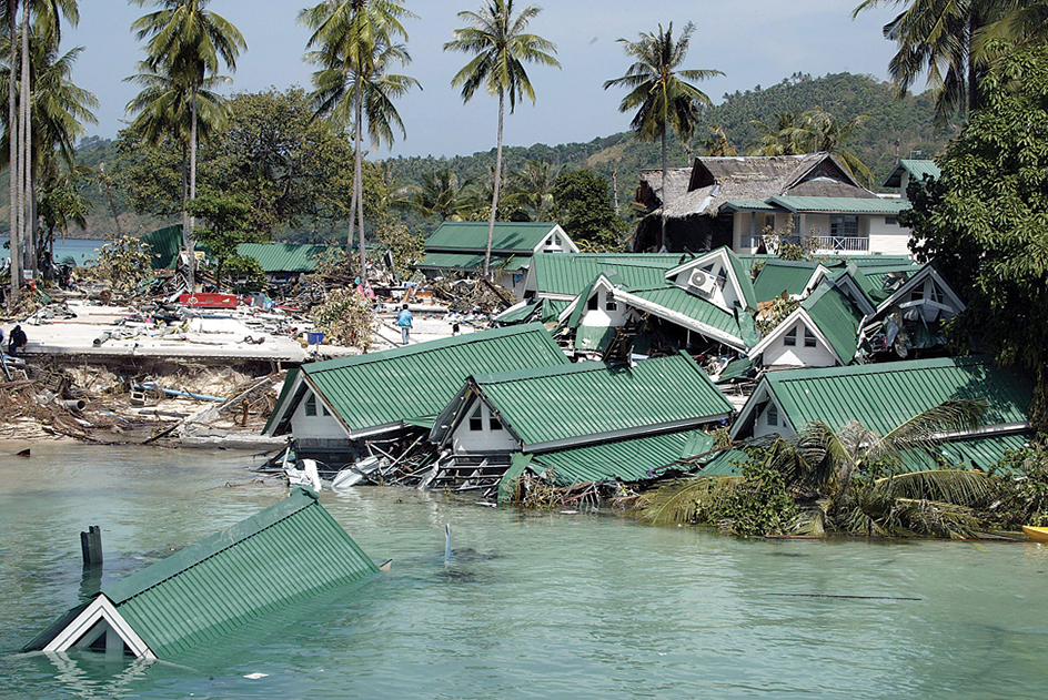
River floods.
Most rivers overflow their channels with small floods about once every two years. Larger floods occur less frequently. For example, moderate floods might occur once every 5 to 10 years on a particular river. Exceptionally large floods might occur only once in a hundred years. The period over which a flood of a particular magnitude will occur is called that flood’s recurrence interval. For example, an exceptionally large flood that only occurs once in a hundred years has a 100-year recurrence interval. It is called a 100-year flood.
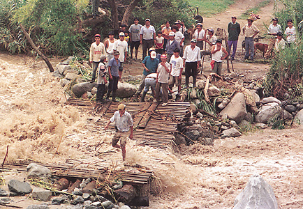
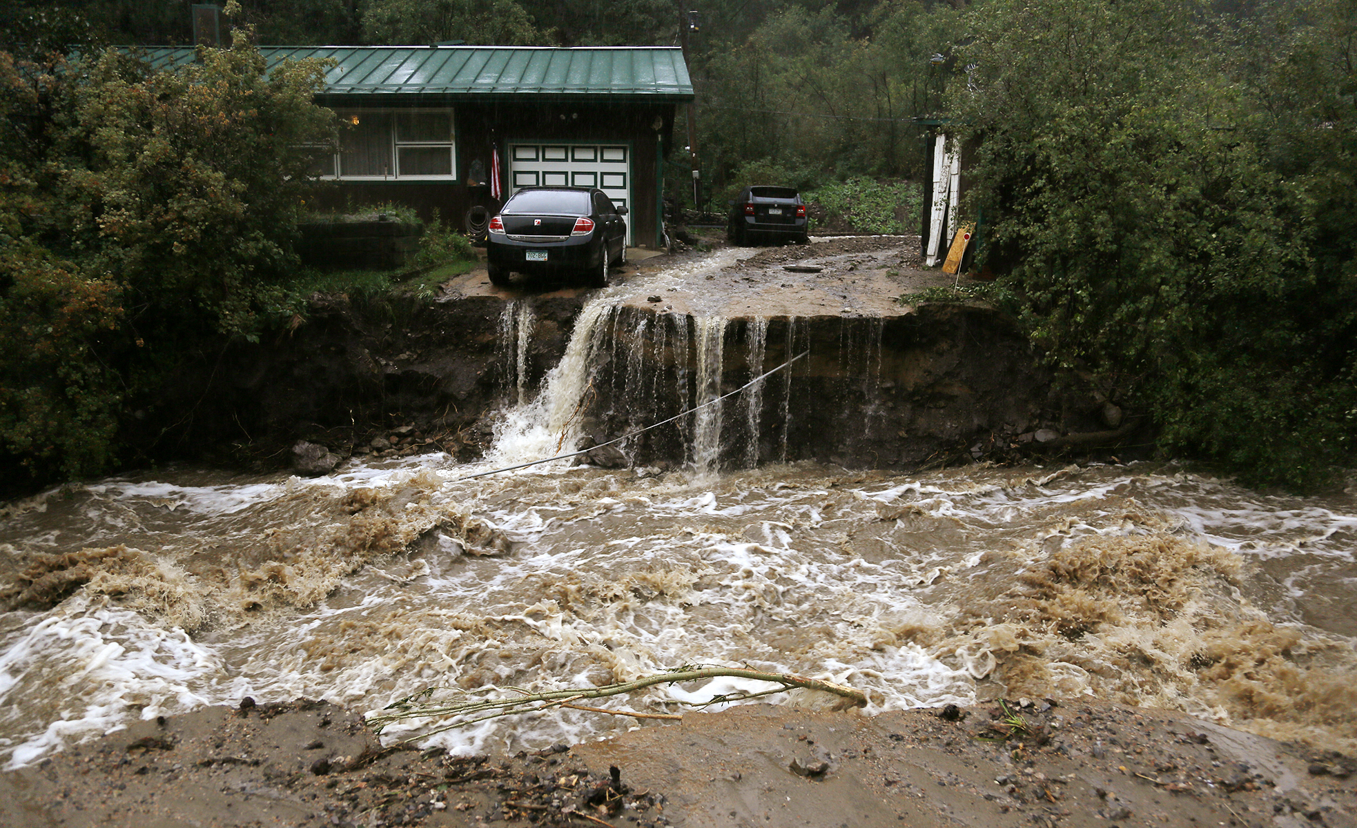
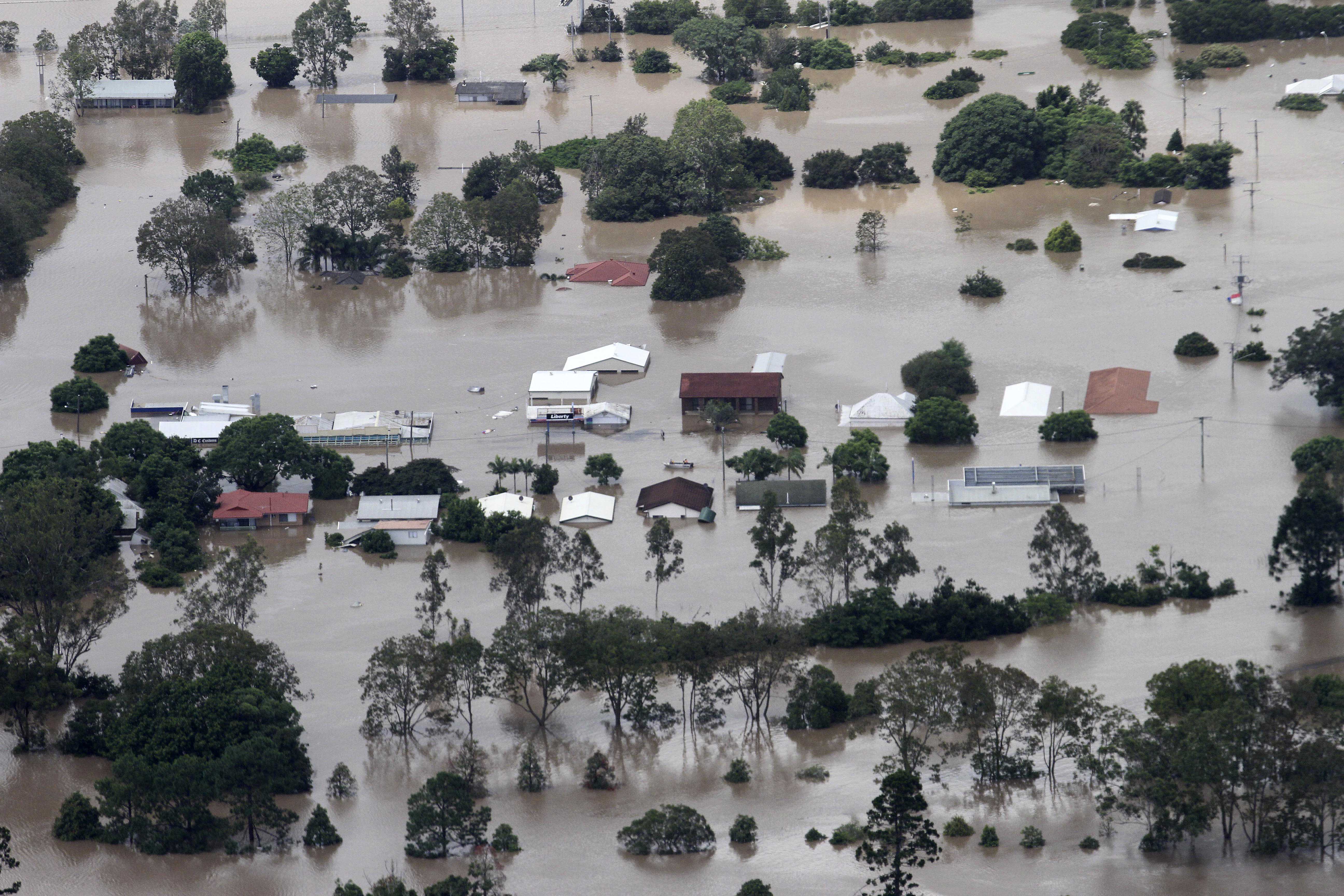
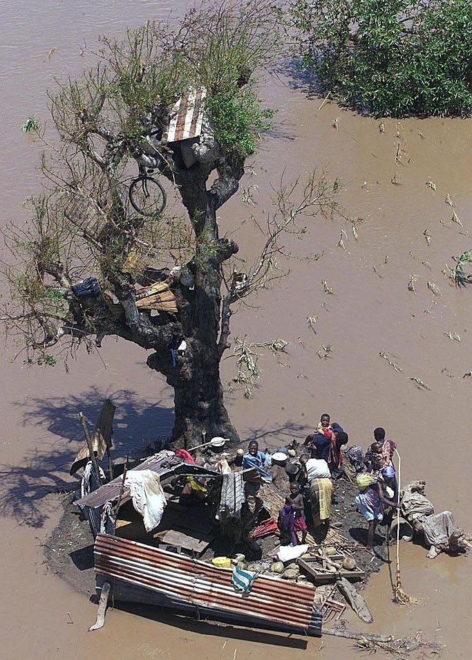
Common causes of river floods include excessive rainfall and the sudden melting of snow and ice. Heavy rains can produce flash floods. In such floods, a small river or stream rises suddenly and overflows. Flash floods occur chiefly in mountainous areas and often with little warning.
In 1993, several months of heavy rains in the United States Midwest resulted in flooding along the upper Mississippi and the Missouri river systems. The floods caused about $15 billion to $20 billion in damage. They forced tens of thousands of people from their homes. Heavy rains, strong winds, and storm surges from Hurricane Irene in 2011 caused about $16 billion in damage throughout the Caribbean and the eastern United States. Relatively few people were killed in each flood, however, due to effective emergency response and regulations that limit development in flood-prone areas. Excessive rainfall from Tropical Storm Washi in 2011 caused flash floods in the Philippines that killed more than 1,200 people. The floods caused tens of millions of dollars in damage.
Rivers that cannot carry their load of sediments (sand and gravel) pose a particular flood risk. For example, the Huang He (Yellow River) in China receives more sediment than it can carry to the ocean. The sediment settles out in the riverbed. The added sediment makes the river channel more shallow, increasing the chance of flooding. One of the worst Huang He floods ever recorded was in 1887. Up to a million people were killed in the flood. Possibly millions more died from the starvation and disease that followed. The Huang He has been called China’s Sorrow because its floods cause such great destruction.
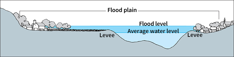
The land next to a river that can become covered with water during a flood is called the flood plain. Floods enable an important natural exchange of water, sediment, and nutrients between a river and its flood plain. In ancient Egypt, for example, yearly floods of the Nile River deposited fresh, nutrient-rich soil in the Nile Valley. This yearly replenishment enabled the early Egyptians to grow crops, helping their civilization to thrive for thousands of years. However, the severity of the floods was somewhat unpredictable, and large floods could cause significant damage. In the mid-1900’s, therefore, the Egyptians constructed a dam on the Nile River to control floodwaters. The Nile Valley no longer floods. The use of irrigation and fertilizer has replaced the water and nutrients once delivered by flooding.
Seacoast floods.
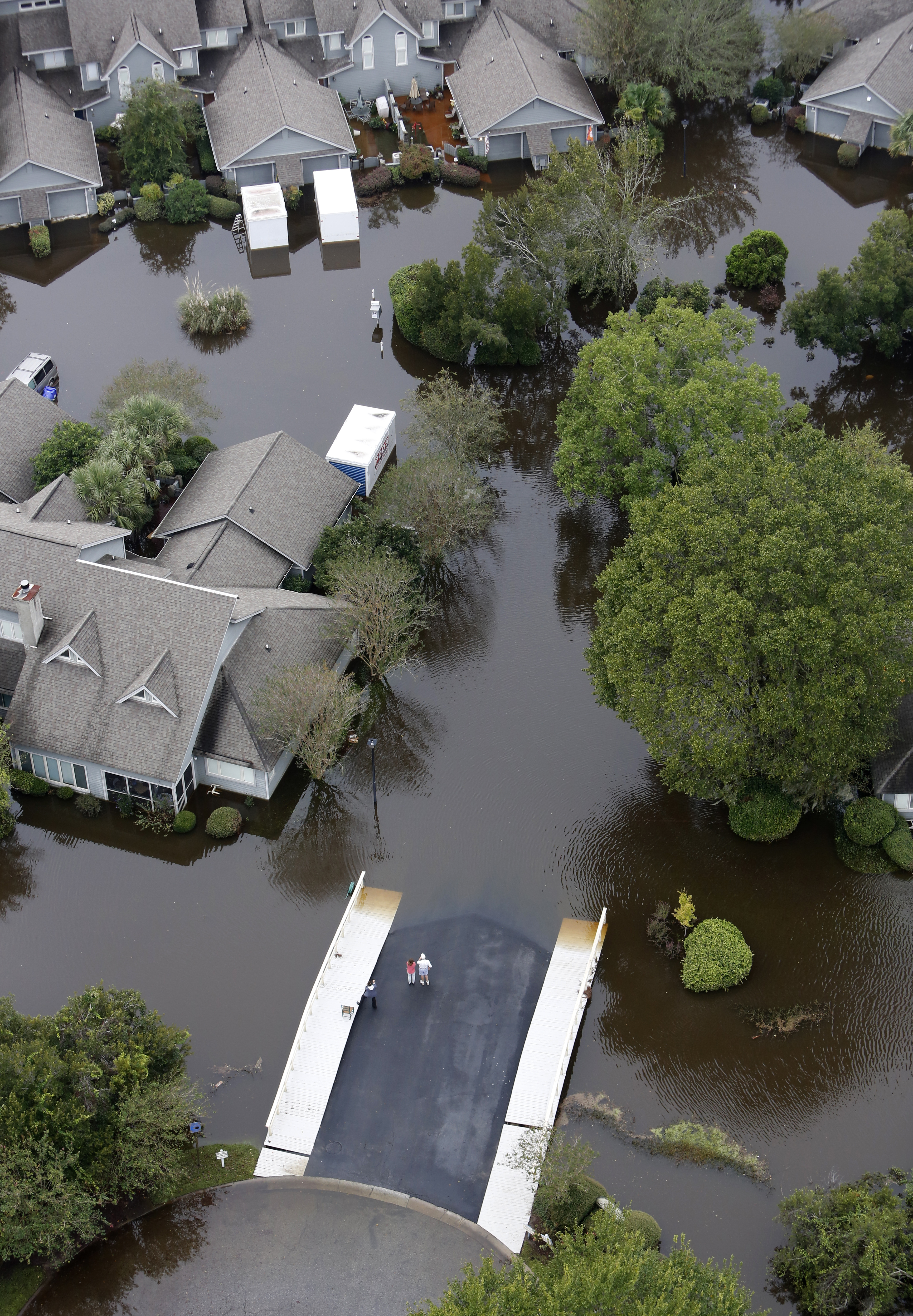
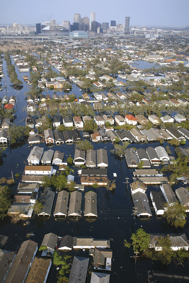
Most seacoast floods result from storms. Hurricanes and other powerful storms create giant rushes of seawater called storm surges that can travel far inland. In 1970, a cyclone and storm surge in the Bay of Bengal caused huge waves that struck the coast of Bangladesh (then called East Pakistan) and possibly killed from 300,000 to 500,000 people. The flood also destroyed the cattle, crops, or homes of millions of other victims. In 2005, Hurricane Katrina caused a storm surge and severe flooding in the U.S. Gulf Coast. These floods contributed to the storm’s more than 1,800 deaths and estimated $100 billion in damage. The most severe destruction occurred in New Orleans.
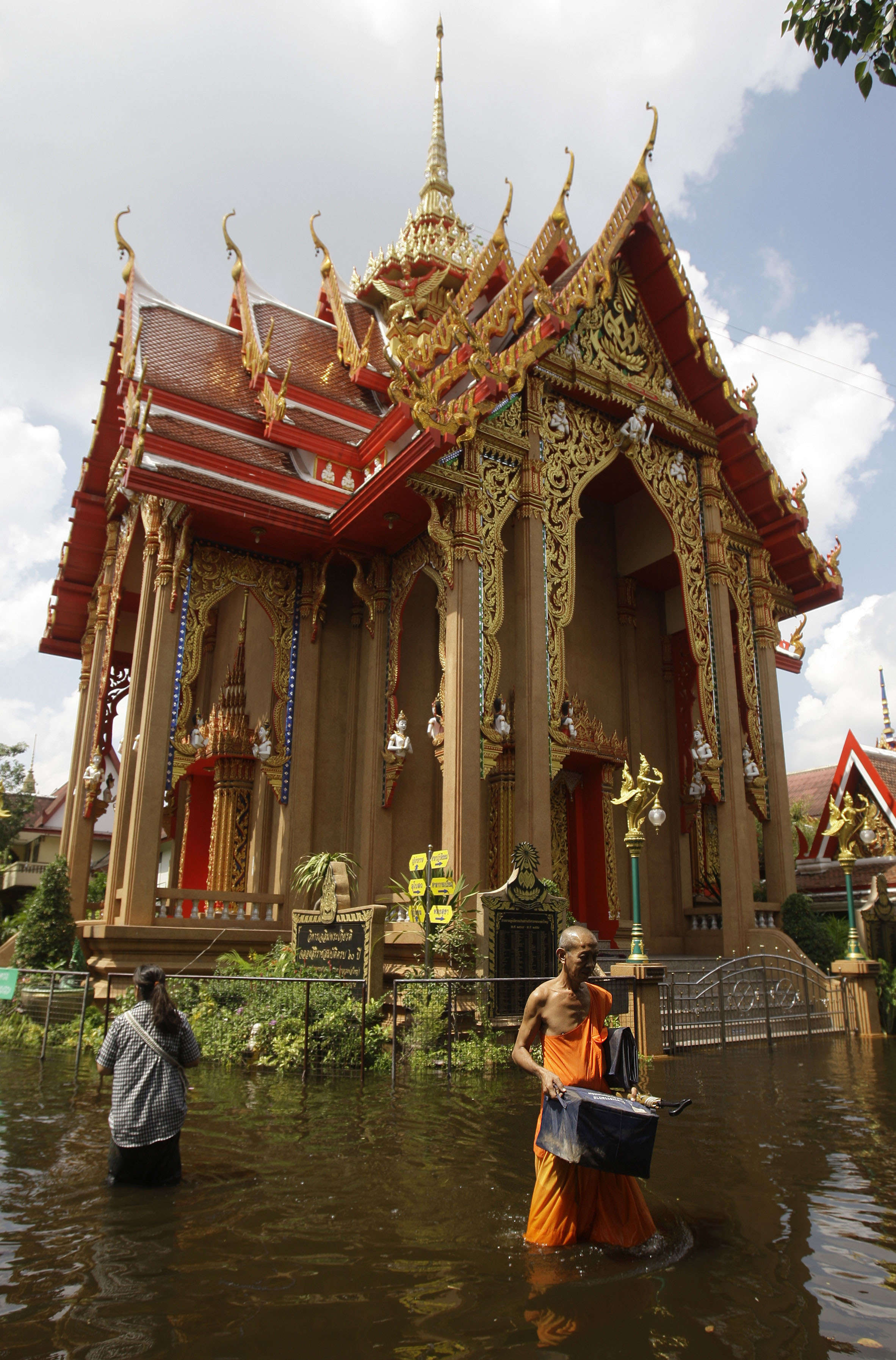
Seacoast flooding can also result from a tsunami. A tsunami is a series of powerful ocean waves generated by an earthquake, landslide, volcanic eruption, or asteroid impact. The giant waves of a tsunami can travel long distances, flooding vast stretches of coastline. Tsunamis are most common along coasts of the Pacific and Indian oceans and of the Mediterranean Sea. These regions undergo frequent earthquakes and volcanic eruptions. In 2004, an undersea earthquake near the island of Sumatra, Indonesia, caused a tsunami that rose up to 100 feet (30 meters) high as it reached shore. The waves flooded coastal areas in many countries bordering the Indian Ocean. About 228,000 people were killed.
Other floods.
A megaflood is a sudden and enormous flood. Megafloods result from catastrophic releases of water, often from large lakes or glaciers. One such flood occurred about 14,500 years ago at Lake Bonneville (now the Great Salt Lake) in Utah. The lake overflowed and then washed away a natural dam at its northern end. The resulting megaflood released a volume of water comparable to that of Lake Michigan. Similarly, a natural ice dam containing glacial Lake Missoula in Montana periodically ruptured between about 15,000 and 13,000 years ago. The ruptures caused megafloods that sculpted the Channeled Scablands in the state of Washington.
Lakes can also flood. For example, Tonle Sap Lake in Cambodia floods each year when the Mekong River overflows to fill its basin. The lake’s waters can rise more than 30 feet (9 meters). Entire towns within the lake basin are built on stilts or floats to accommodate the flooding. Storms and high winds can cause floods along lakeshores. Some floods occur when the water of a lake rocks suddenly from side to side. Such a movement is called a seiche.
Flood control
involves constructing dams and retention basins to store water. It also involves building levees, dikes, and flood walls to confine floodwaters.
Some of the most extensive flood control systems in the world include the floodway diversions on the Red River of the North, which crosses the border between the United States and Canada, and the system of levees, spillways, and wetlands maintained along the Mississippi River system. Adjustable gates called floodgates are commonly used to control storm surges in places near or below sea level. Such places include the Netherlands, New Orleans, and Venice, Italy.
Reducing flood losses.
The losses that result from floods can be reduced in many ways. In many places, for example, regulations limit the construction of permanent buildings on flood plains. Emergency response programs help by warning and evacuating people in flood-prone areas. They also provide relief aid for flood victims. In some places, flood insurance can be purchased to help cover the costs of flood damage.
Government agencies in many countries identify flood-prone areas. They use this information to set forth regulations for managing flood plains. Many of these regulations require that a small strip of land along a waterway be left vacant. Such a strip is called a floodway. Numerous communities reserve a wider area along the floodway for use as farmland or parkland. In the United States, floodway maps are available from the Federal Emergency Management Agency (FEMA).
Scientists called hydrologists forecast floods using complex mathematical models. The models depend on radar and satellite images to estimate rainfall and snowmelt. They also make use of live measurements of the flow of rivers. In the United States, the National Weather Service maintains a network of river forecast centers and hydrologic service areas. This network provides flood warnings that can greatly reduce loss of life and damage to property.
The World Health Organization (WHO) documents the most significant floods in its Emergency Events Database. The database resides at the Collaborating Centre for Research on the Epidemiology of Disasters in Brussels, Belgium. The center studies the effects of floods and other disasters on public health. It also helps emergency aid workers.
