Indiana is a small state of the United States with a large population. It covers the smallest area of any state in the Midwest. No other state west of the Appalachian Mountains is smaller, except Hawaii. Indiana ranks 38th in size among all the states but is 17th in population. It is also a major manufacturing and farming state.
Indiana is called the Hoosier State, and its people are known as Hoosiers. Historians do not know the origins of this famous nickname, but there have been several theories about it. One theory says the name is taken from a contractor named Samuel Hoosier, who liked to hire workers from Indiana. But most of the theories attribute the word to some slang expression, such as “Who’s yer?” for “Who’s here?”; “husher” for someone who could hush a brawl; or “hoozer,” meaning “hill.”
Indiana has broad, fertile plains that help make it a leading farm state. These plains form part of the rich Midwestern Corn Belt, and corn is one of Indiana’s chief farm products. Hoosier farmers also produce large amounts of soybeans and hogs. But manufacturing is Indiana’s single most important economic activity. The great steel mills and oil refineries of northwestern Indiana are symbols of the state’s industrial power. Indianapolis, the capital and largest city, is a leading manufacturing center.
Indiana’s varied landscape offers many opportunities for outdoor recreation. Many people enjoy the famous sand dunes along Lake Michigan. The state’s plentiful lakes and streams provide opportunities for boating, fishing, and swimming. Hunters find small game in the woods and on the plains. The colorful, rolling hills of Brown County attract many artists and nature lovers. French Lick, a well-known health and vacation resort, and Wyandotte Cave, one of the largest caverns in the United States, are in southern Indiana.
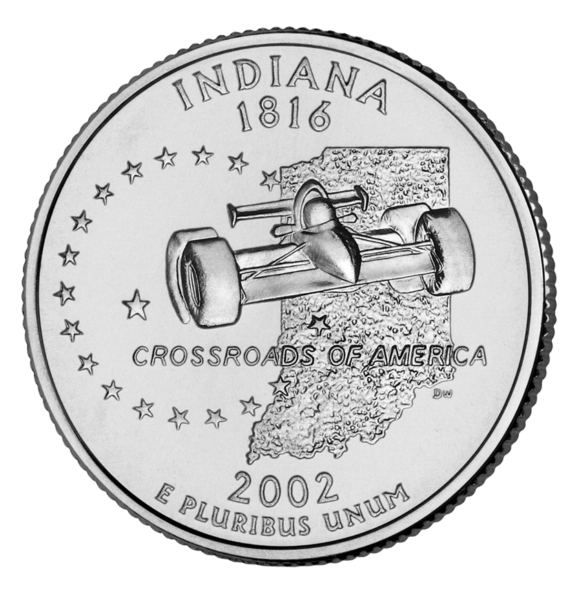
The Hoosiers chose The Crossroads of America as their state motto because of Indiana’s central location. The state lay on the path of the westward movement of the 1800’s. In 1811, General William Henry Harrison defeated several Indigenous (native) American tribes in the Battle of Tippecanoe. Harrison, Indiana’s first territorial governor, became the ninth U.S. president, in 1841. His grandson, Benjamin Harrison, a Hoosier for many years, became the 23rd president in 1889. Another Hoosier, Wendell L. Willkie, was the unsuccessful Republican presidential candidate in 1940.
Many famous writers have come from Indiana. The humorous poems of James Whitcomb Riley and stories of George Ade have delighted children and adults of several generations. The novels of Theodore Dreiser, Booth Tarkington, and Kurt Vonnegut include major works of American literature. The cartoonist Jim Davis won fame for his comic strip “Garfield.”
People
Population.
The 2020 United States census reported that Indiana had 6,785,528 people. The population had increased about 5 percent over the 2010 figure of 6,483,802. According to the 2020 census, Indiana ranks 17th in population among the 50 states.
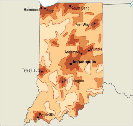
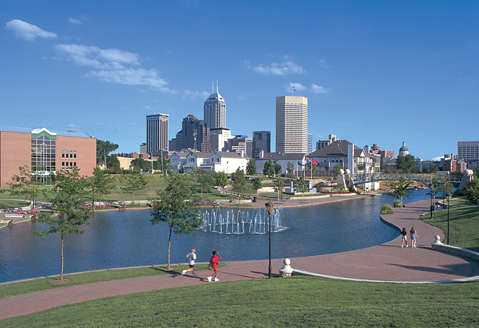
About 80 percent of Indiana’s people live in one of the state’s metropolitan areas. About 30 percent live in the Indianapolis-Carmel-Greenwood metropolitan area. Indiana has 15 metropolitan areas (see Metropolitan area). Eleven of these areas lie entirely within the state. One lies partly in Kentucky, one lies partly in Michigan, one includes part of Illinois, and another includes parts of Ohio and Kentucky.
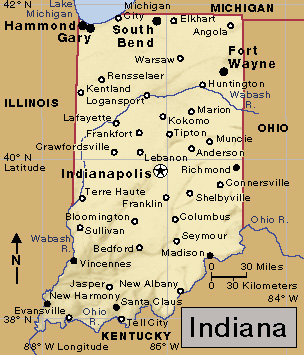
Indianapolis, the state capital, is the largest city in Indiana. Three other Indiana cities have populations of more than 100,000. They are, in order of size, Fort Wayne, Evansville, and South Bend.
Indiana’s largest population groups include people of English, German, and Irish descent. About 10 percent of Indiana’s population are African Americans.
Schools.
The State Board of Education directs Indiana’s school system. Voters elect a superintendent of public instruction, who serves as the board’s chairman and as the head of Indiana’s Department of Education. The leaders of the state House of Representatives and state Senate each appoint one board member, and the governor appoints the rest. The Department of Education administers elementary and secondary school policy as directed by the Board of Education and the state legislature. Local school boards control local school districts. Children must attend school from age 7 through 17, with some exceptions. For the number of students and teachers in Indiana, see Education (table: U.S. students, teachers, and school expenditures).

In 1816, Indiana became the first state to provide in its Constitution for a statewide system of free public schools. However, the state legislature did not establish taxes to pay for these schools until 1849. In the meantime, nearly every township had a log schoolhouse built by the parents of the children. The parents took turns providing a home and salary for the schoolmaster. Some cities had private schools operated by the teachers.
In 1825, an experiment in community living began in New Harmony. The colony soon broke up, but many of its educational experiments are still used by schools today. The colony had the first classes in the country in which boys and girls were taught together. It also had one of the first nursery schools. See New Harmony.
In 1900, the educator William Wirt started a school system in Bluffton that combined study, play, and work. Gary adopted this school system in 1906, and it became known as the platoon school or Gary School Plan. Many cities in the United States adopted this plan or took ideas from it.
Libraries.
The first public subscription library in Indiana opened in Vincennes in 1807. The Old Cathedral Library in Vincennes has one of the oldest library collections in the state, with some books dating back to the 1200’s. The Indiana University library system has the largest collection of books in the state. The Lilly Library at Indiana University in Bloomington has outstanding collections of rare books and manuscripts. The Indiana State Library, founded in 1825, has extensive research collections.
Museums.
The Indianapolis Museum of Art has art from different periods and cultures. The Indiana State Museum in Indianapolis has exhibits on the history of the state. The Children’s Museum of Indianapolis is the largest children’s museum in the world. It has exhibits on history, science, and different cultures. The Eiteljorg Museum, with collections of Indigenous and Western art, is also in Indianapolis.
Visitor’s guide
The varied landscape of Indiana offers a wide variety of activities. In the north, rolling sand dunes along Lake Michigan attract many visitors. Winter resorts provide skiing, tobogganing, and other sports. On the central plains, hunters shoot game birds, rabbits, and other wildlife. Southern Indiana has famous caves, in which tourists can explore the winding underground passageways. Brown County and other southern areas have beautiful forested hills, ridges, and valleys. Many painters go there in autumn to paint the leaves turning brilliant orange, red, and yellow. Throughout the state, visitors can hike or ride horseback along trails forged by Indigenous Americans. Boating, fishing, and swimming are popular sports in Indiana’s many lakes and streams.
Indiana’s most famous annual event is the Indianapolis 500 automobile race. It is held during the Memorial Day weekend at the Indianapolis Motor Speedway in the town of Speedway. About 250,000 people attend this race each year. It is one of the most popular sporting events in the nation (see Automobile racing).
Land and climate
Land regions.
Indiana has three main land regions. They are: (1) the Great Lakes Plains, (2) the Till Plains, and (3) the Southern Hills and Lowlands.
The Great Lakes Plains
of northern Indiana form part of the fertile lowland that lies along much of the Great Lakes shoreline. This area is sometimes called the Northern Lake and Moraine Region. It has many small lakes and moraines (low hills of earth and rock left by melting glaciers). Great sand dunes border Lake Michigan’s shore in Lake, La Porte, and Porter counties. South of the dunes lie fertile farmlands of rich, black soil.
Through this region runs the east-west divide (high land separating different river systems) that crosses North America. This divide separates the Mississippi and St. Lawrence river systems. Along the divide, many streams whose waters reach the Mississippi River are only a short distance from those that flow toward the St. Lawrence River.
The Till Plains
in central Indiana are part of the great Midwestern Corn Belt. The region has soil rich for growing grain and for grazing livestock. Some low hills and shallow valleys break the region’s level surface. The highest point in Indiana—1,257 feet (383 meters) above sea level—is in the eastern Till Plains, in Wayne County.
The Southern Hills and Lowlands
of south-central Indiana make up the only section of the state that was not covered by glaciers during the most recent ice-age glacial advances. As a result, this region is the hilliest part of the state. It has several series of knobs (steep hills), with stretches of lowlands in between. Some underground streams have washed out large hollows in deposits of limestone. This action has left many caverns, including Marengo and Wyandotte caves. The southwestern section of the Southern Hills and Lowlands region provides most of Indiana’s coal and petroleum. Indiana’s lowest point—320 feet (98 meters) above sea level—is in Posey County, where the Wabash River flows into the Ohio River.
Rivers, lakes, and waterfalls.
The Wabash River and its major branches, the White and Tippecanoe rivers, drain about two-thirds of the state. Other important rivers flowing into the Wabash include the Eel, Mississinewa, and Salamonie. The St. Joseph River joins the St. Marys at Fort Wayne to form the Maumee River, which flows into Lake Erie. The Kankakee and the Whitewater are other major rivers in Indiana. The state’s southern boundary runs along the north bank of the Ohio River, but no part of the river flows through the state.
Lake Wawasee, the largest of Indiana’s natural lakes, covers 4.6 square miles (12 square kilometers) in the northeastern part of the state. Other large lakes in that area include the Manitou, Maxinkuckee, and Turkey. Monroe Lake is Indiana’s largest artificial lake. It covers about 17 square miles (44 square kilometers). Many small lakes are recreation areas. Clifty Falls, the state’s highest waterfall, plunges 100 feet (30 meters) in Clifty Falls State Park in southern Indiana.
Plant and animal life.
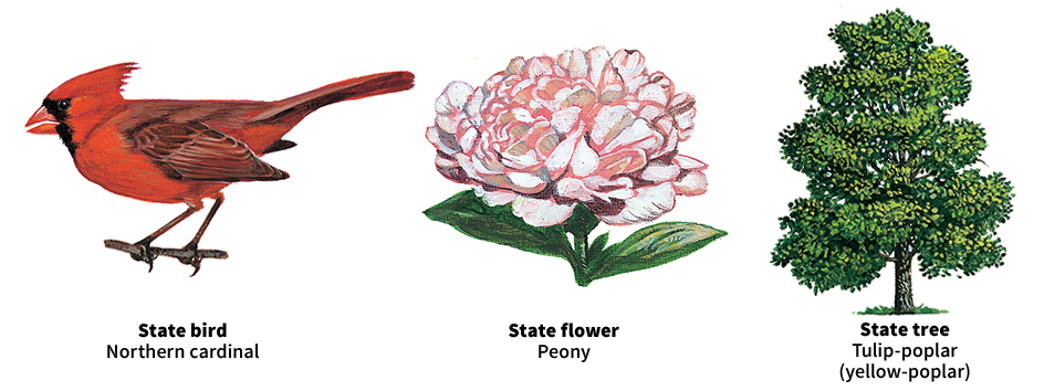
Forests cover about one-sixth of Indiana. The most valuable timber includes black walnut, hickory, and many varieties of maple and oak. Ash, beech, black willow, elm, sycamore, tamarack, and tuliptree (yellow-poplar) also grow in the state. The baldcypress, black tupelo, cottonwood, persimmon, and Virginia pine grow along the Ohio River.
Prickly-pear cactuses grow in sands near moist, shady nooks with irises and orchids. Floating pondweeds and peppermint are seen in the northern lake region. Insect-eating plants, including the bladderwort, pitcher plant, and round-leaved sundew, also grow there.
Pussy willows, jack-in-the-pulpits, and violets appear early in spring. The spicy scent of the peony, Indiana’s state flower, fills the springtime air. Sweet clover, ox-eye daisies, corn cockle, and Queen Anne’s lace bloom during the summer. Autumn brings asters, fringed gentians, goldenrod, and sunflowers.
Deer, muskrats, opossums, rabbits, raccoons, skunks, squirrels, and woodchucks are found in Indiana’s forests and on the prairies. Bass, catfish, pickerel, pike, salmon, and sunfish swim in the lakes and streams.
Yellow-winged sparrows and prairie larks may be seen in the prairies near swamps. The shy wood thrush lives in thick woods. Other birds include blue jays, orioles, swallows, and wrens. The cardinal is the state bird. The quail is Indiana’s most common game bird. Other game birds include pheasants and wild turkeys.
Climate.
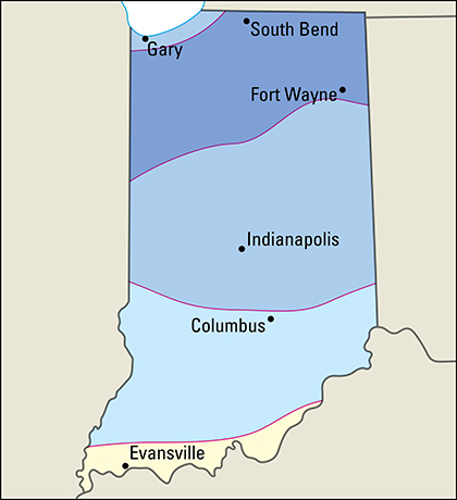
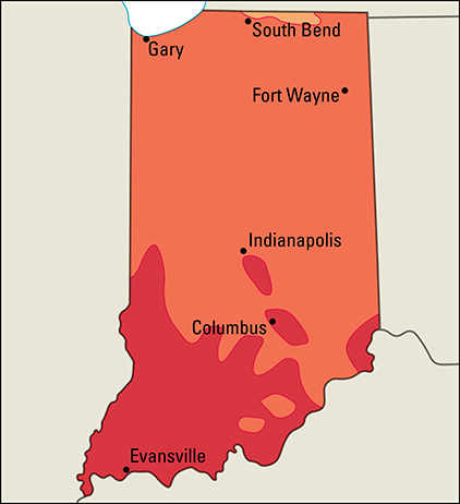
Indiana has a humid climate, with cool winters and warm summers. The average January temperature ranges from 25 °F (—4 °C) in northern Indiana to 33 °F (1 °C) in the south. In July, the temperature averages 74 °F (23 °C) in the north, and 77 °F (25 °C) in the south. The state’s lowest recorded temperature, —36 °F (—38 °C), occurred at New Whiteland on Jan. 19, 1994. The highest temperature, 116 °F (47 °C), was recorded at Collegeville on July 14, 1936. 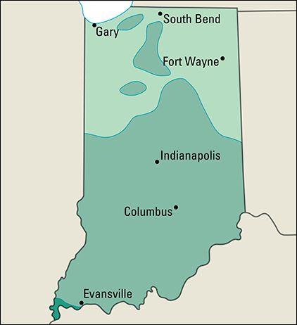
Geographical differences within Indiana affect the climate in small areas of the state. The relatively warm waters of Lake Michigan warm the nearby land in the winter and cool it in the summer. Thus, winter temperatures near the lake may be slightly warmer, and summer temperatures a little cooler, than those farther inland. The many hills, valleys, and forests of southern Indiana cause temperatures in that part of the state to vary slightly within short distances.
Precipitation averages 38 inches (97 centimeters) a year in northern Indiana, and 46 inches (117 centimeters) in the south. Dry periods and floods occur occasionally in the southern section, especially in the Ohio River Valley. Snowfall ranges from more than 40 inches (100 centimeters) a year in the northern section to about 10 inches (25 centimeters) in the south. Much of the snow in northwestern Indiana is caused by moist air crossing Lake Michigan and turning into snow over land.
Economy
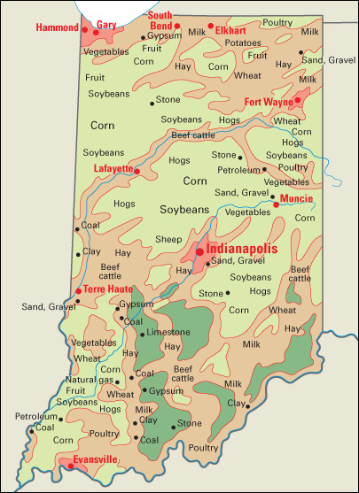
Indiana’s economy depends more on manufacturing than the economy of any other state. Manufacturing accounts for about 25 percent of Indiana’s gross domestic product—the total value of all goods and services produced in the state in a year. But service industries, as a group, form the state’s leading economic activity. Although mining and agriculture contribute smaller amounts to the gross domestic product, they continue to play important roles in Indiana’s economy. Coal is the most valuable mined product, and corn and soybeans are the most valuable farm products.
Natural resources.
Fertile soil is one of Indiana’s greatest natural resources. Other resources of the state include mineral deposits and plentiful water.
Soil.
Fertile, gray-brown soils called alfisols cover most of northern and central Indiana. Dark, fertile soils known as mollisols are found in northwestern and west-central Indiana. The soils in southern Indiana are thinner and less fertile. They are called ultisols and consist of heavy clays, brown silt loams (combinations of clay, silt, and sand), or yellowish soils of silt and sand.
Minerals.
Indiana’s most valuable mined product, bituminous (soft) coal, is mined in the southwestern counties of the state. Clay is found in many areas. Lawrence and Monroe counties, in south-central Indiana, have large limestone quarries. Sand and gravel come from many parts of the state. Southwestern Indiana has most of the state’s deposits of petroleum.
Service industries
account for the largest portion of both Indiana’s gross domestic product and its employment. Most of the service industries are concentrated in the metropolitan areas.
Indianapolis, the state capital, is the center of government activities. The city is also the state’s leading retail center. Hotels and restaurants in Indianapolis receive much business as a result of the many conventions that are held in the city. Anthem, Inc., one of the largest U.S. health insurers, is headquartered in Indianapolis.
CNO Financial Group, a major financial services firm, is based in Carmel. A large wholesale hardware distributor, Do it Best Corp., is based in Fort Wayne. Indiana handles more railroad freight traffic than most other states. Several ocean freight shipping companies operate along Lake Michigan.
Manufacturing
accounts for a larger portion of the gross domestic product in Indiana than it does in any other state. Chemicals rank among Indiana’s leading manufactured products in terms of value added by manufacture. Pharmaceuticals (medicinal drugs) are the state’s leading chemical product. Eli Lilly and Company, a major pharmaceutical company, is headquartered in Indianapolis. Companies in Evansville and Mishawaka also produce pharmaceuticals.
Indiana produces more steel than any other state. Northwestern Indiana is one of the world’s major steel-producing areas. Burns Harbor, East Chicago, and Gary are the major steelmaking centers of this region. Indiana is also an important aluminum-producing state. 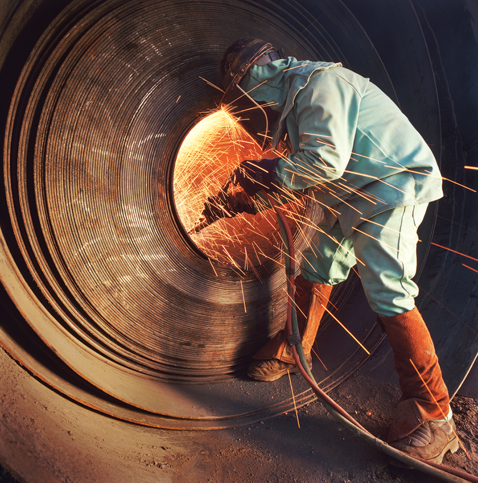
Transportation equipment is also important. Motor vehicle assembly plants operate in the Fort Wayne, Lafayette, and Princeton areas. Indiana ranks among the leading states in the production of automobile parts and trucks. Many food products are manufactured in the Fort Wayne, Indianapolis, La Porte, and Logansport areas. Baked goods, corn and soybean products, dairy products, meats, and soft drinks are the state’s leading food and beverage products. Much of the fabricated metal production is in the Elkhart, Fort Wayne, and Indianapolis areas. Indiana is a leading producer of surgical instruments and appliances.
Agriculture.
Farmland covers about two-thirds of Indiana’s land area. Corn and soybeans are Indiana’s most valuable farm products. Together, they earn about half of the state’s annual farm income. Indiana ranks among the leading states in both corn and soybean production. Farmers throughout Indiana grow these crops, especially on the central plains. Other important field crops in the state include hay and wheat.
Tomatoes are Indiana’s most valuable vegetable crop. Other important vegetables include cucumbers, snap beans, and sweet corn. Apples, blueberries, cantaloupes, and watermelons are the leading fruit crops. Indiana is a leading popcorn-producing state. Greenhouse and nursery products are also important agricultural products grown in Indiana.
Hogs are Indiana’s chief livestock product. Most parts of the state have hog farms, but production is heaviest in the region around Lafayette. Other major livestock products include beef cattle, eggs, milk, and turkeys. Farmers raise cattle throughout the state. Indiana is a leading producer of eggs and turkeys.
Mining.
Bituminous coal is Indiana’s chief mined product. Coal provides about half of Indiana’s mining income. Much of Indiana’s coal, however, has a high sulfur content that contributes to air pollution when burned. Most of the coal comes from mines in the southwestern part of the state.
Indiana’s other mined products include crude oil, limestone, portland cement, and sand and gravel. Indiana’s crude oil comes from the Illinois Basin in the southwest part of the state. Much of the limestone is produced in quarries south of Indianapolis, especially around Bedford and Bloomington. Indiana is a state leader in the production of cement. Much of the sand and gravel is produced from pits near major cities.
Electric power and utilities.
Most of the electric power generated in Indiana comes from power plants that burn coal. Most of the rest of the state’s power comes from plants that burn natural gas.
Transportation.
Major railroads, bus lines, and highways crisscross the state. Oceangoing ships carry goods to world ports from the Calumet region.
The first road to cross the state from east to west was the historic Cumberland Road, or National Road, of the early 1800’s. It is now U.S. Highway 40, which goes through Indianapolis.
Many railroads provide freight service in Indiana. Passenger trains serve many Indiana cities. Indianapolis International Airport is Indiana’s busiest airport. Fort Wayne and South Bend also have important airports.
Indiana’s largest ports include the Port of Indiana-Burns Harbor in Portage, Indiana Harbor in East Chicago, and the Port of Gary. Oceangoing ships connect the ports with many countries by way of the Great Lakes and the St. Lawrence River. Lake freighters bring coal and iron ore for the region’s steel mills. State-operated ports at Jeffersonville and Mount Vernon, lie along the Ohio River.
Communication.
Elihu Stout, the first printer in Indiana, established the weekly Indiana Gazette in Vincennes in 1804. The Gazette was the first newspaper in what is now Indiana. Indiana’s first daily newspapers, the Journal and the Sentinel, were published in Indianapolis in 1851. The Journal later became part of The Indianapolis Star, which today is the largest newspaper in Indiana. The state’s other leading newspapers include the Times of Northwest Indiana of Munster and The Journal Gazette of Fort Wayne.
Government
Constitution
of Indiana, the second in the state’s history, was adopted in 1851. It replaced the Constitution of 1816, the year Indiana became a state. An amendment to the Constitution must be proposed in the state legislature. It must then be approved by a majority of each house of two separately elected state legislatures. Finally, the proposed amendment must receive the approval of a majority of the citizens voting on it in a regular or special election. Indiana’s Constitution does not provide for constitutional conventions to propose amendments.
Executive.
The governor of Indiana is elected to a four-year term and may serve any number of terms, but not more than two terms in a row. The governor has the power to appoint and dismiss the heads of nearly all the state commissions, departments, and institutions and to establish the salaries of these officials in cooperation with the state budget agency. The governors of most other states do not have this power.
All high state officials in Indiana are elected to four-year terms. These officials include the lieutenant governor, attorney general, secretary of state, auditor, and treasurer.
Legislature
of Indiana, called the General Assembly, consists of a 50-member Senate and a 100-member House of Representatives. The state has 50 senatorial districts and 100 representative districts. Voters in each senatorial district elect one senator, and voters in each representative district elect one representative. Senators serve four-year terms. Representatives serve two-year terms. 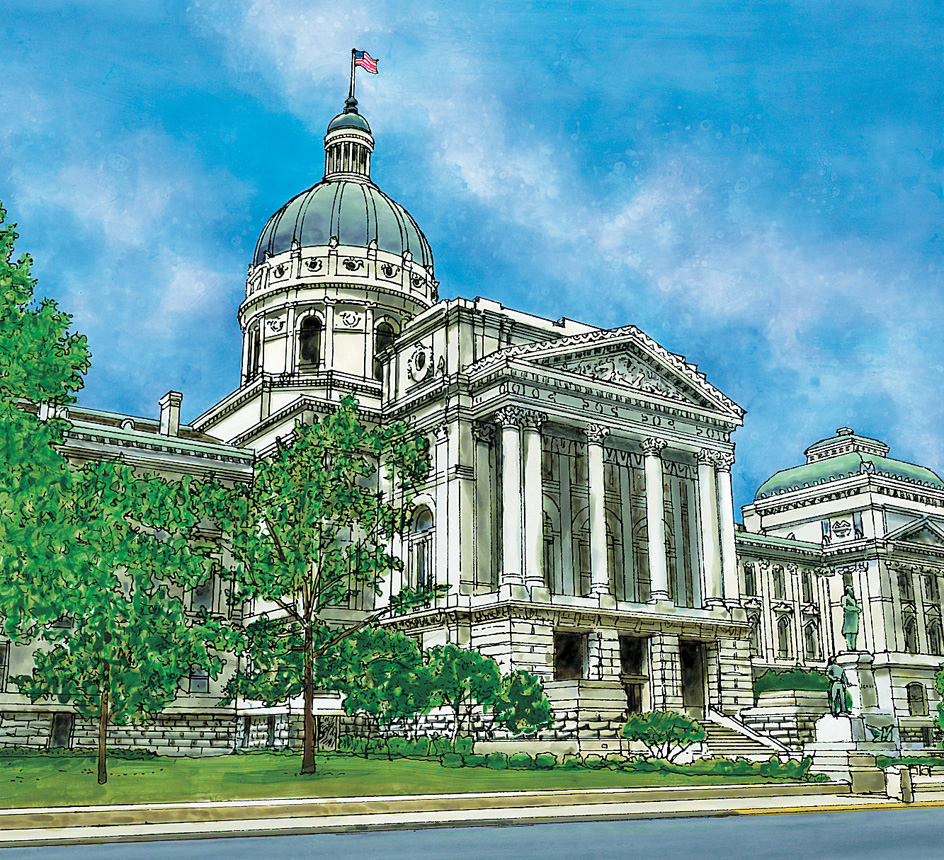
The legislature meets every year. The regular sessions begin by the second Monday of January. Regular sessions cannot extend beyond April 29 in odd-numbered years or beyond March 14 in even-numbered years. The governor can call a special session that cannot last more than 30 legislative days.
Courts
in Indiana are headed by the state Supreme Court and the Court of Appeals. The Supreme Court consists of a chief justice and four associate justices. A nonpartisan judicial commission selects one of the Supreme Court judges to serve as the chief justice for a five-year term. The Court of Appeals has 15 judges. One judge serves on a state tax court. New judges of the Supreme Court, the Court of Appeals, and the tax court are appointed by the governor to serve two years. The voters then decide whether a judge should be approved or rejected for a new 10-year term. Circuit courts cover one or more of all the counties in the state. Most counties also have superior and special courts.
Local government
units in Indiana include counties, townships, cities, towns, school corporations, and a variety of other special taxing districts. All of Indiana’s 92 counties except one are governed by three-member boards of county commissioners, elected to four-year terms. On Jan. 1, 1970, Marion County and Indianapolis adopted a metropolitan government plan providing for a mayor and 29-member council, all elected to four-year terms. The council now has 25 members.
The chief township official is the township trustee, also elected to a four-year term. Indiana is the only state that has townships throughout its entire area. Indiana cities cannot adopt their own charters, and must operate within the powers granted by the state government. All cities have a mayor-council government. Town councils govern almost all towns.
Revenue.
Taxation provides about half of Indiana’s general revenue (income). About a third of the state’s general revenue comes from federal grants and from other United States government programs. A general sales tax and a personal income tax are the major sources of tax revenue in the state. Other major sources of tax revenue include taxes on corporate income, legalized gambling, motor fuels, and tobacco.
Politics.
The Republican Party generally controlled Indiana politics after the American Civil War (1861-1865) and through much of the 1900’s. The Democratic Party gained strength during the Depression years of the 1930’s. Republicans have frequently dominated state politics since then, but Democrats were competitive in many state races from the 1960’s through the 2000’s. In most presidential elections, Indiana has voted for the Republican candidate.
History
First peoples.
The first people to live in what is now Indiana were probably prehistoric Indigenous Americans called mound builders. Many of their burial mounds, earthen forts, and village sites can still be seen (see Mound builders). When the first white explorers arrived in 1679, they found only a few hundred Indigenous people. Most of them belonged to the Miami Nation.
Many more peoples lived in the Indiana region at various times during the 1700’s and 1800’s. The Delaware, Mahican, Munsee, and Shawnee had come from the East after losing their lands to white settlers. The Huron, Kickapoo, Piankashaw, Potawatomi, and Wea had arrived from the Great Lakes area to the north. White people forced most of these groups to sell or surrender their lands in Indiana.
The Potawatomi were the last Indigenous group to enter and to leave the Indiana area. They built villages in the northern section about 1795. By 1836, many Potawatomi had sold their land to the government. The rest were driven out by military force in 1838. Only a few Indigenous people remained in the region after that.
Exploration and settlement.
The first known white person in the Indiana region was the French explorer René-Robert Cavelier, Sieur de La Salle. He came from the French colonies in Canada in 1679, seeking a water route to the Pacific Ocean. La Salle traveled through the region down the St. Joseph and Kankakee rivers. He returned late in 1680 and explored much of the northern Indiana area.
French fur traders soon pushed farther inland from Lake Michigan. They traded beads, blankets, knives, paint, and whiskey to Indigenous groups for animal furs. During the 1720’s, the French built fur-trading posts in Miami (near present-day Fort Wayne) and in Ouiatenon (near what is now Lafayette). About 1732, the French founded Indiana’s first permanent settlement, Vincennes, and built a fort there.
From the beginning of the fur trade with the Indigenous Americans, the French competed with British traders. For many years, the French gained favor with Indigenous people because they treated them as equals. But the British slowly won over Indigenous groups because they paid higher prices for furs and also traded firearms.
The struggle for the fur trade was a major reason for a series of wars between the French and the British in North America. The British, who claimed all the territory that stretched westward from their Atlantic colonies, defeated the French. In 1763, France gave the United Kingdom its claims to Indiana and other regions. See French and Indian wars.
British troops began to control the Indiana region after 1763. During the Revolutionary War (1775-1783), however, the area was defended mostly by local settlers. Virginia troops under George Rogers Clark occupied Vincennes and its stronghold, Fort Sackville, in 1778. A British expedition recaptured the fort, but Clark seized it again in 1779. This victory helped give the Americans control over the Northwest. In 1787, Indiana became part of the Northwest Territory (see Northwest Territory). 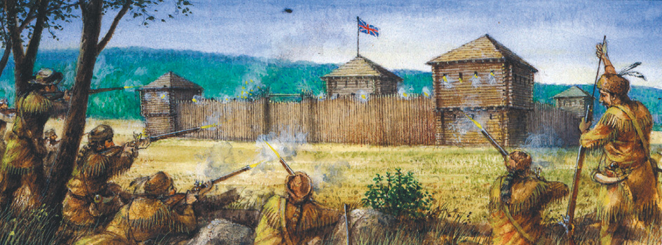
Territorial days.
Indigenous groups often attacked the early settlers. The Miami, led by Chief Little Turtle, burned villages and killed many settlers. In 1794, federal troops under General Anthony Wayne defeated the Miami and other nations in the Battle of Fallen Timbers, along the Maumee River near present-day Toledo, Ohio. 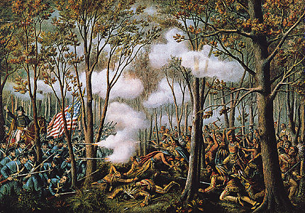
Congress created the Indiana Territory in 1800. It included the present states of Indiana, Illinois, and Wisconsin, and parts of Michigan and Minnesota. Vincennes was the capital of the territory. President John Adams appointed General William Henry Harrison the first territorial governor. By the time Illinois became a separate territory in 1809, Indiana had almost the same borders it has today.
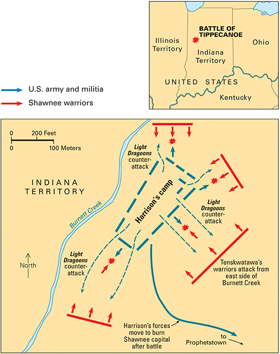
In 1809, Harrison bought about 2,900,000 acres (1,170,000 hectares) of Indigenous lands in southern Indiana for the federal government. But Tecumseh, the famous Shawnee chief, objected to the purchase treaty as unfair (see Tecumseh). Several tribes banded together, obtained guns and powder from the British, and prepared for war. Harrison defeated the Shawnee-led forces in 1811 in the Battle of Tippecanoe, at present-day Battle Ground. Indigenous nations joined with British forces during the War of 1812 (1812-1815). In 1813, Harrison again defeated Indigenous forces and the British in the Battle of the Thames, at Moraviantown, Ontario. Tecumseh was killed in this battle. These American victories ended British influence in the territory. The Indigenous groups stopped their attacks, and the settlers were free to develop the land. Corydon became the new capital of the Indiana Territory in 1813.
Early statehood.
On Dec. 11, 1816, Indiana joined the Union as the 19th state. Its population totaled about 64,000. Jonathan Jennings, a Democratic-Republican, became the first governor. The new state government found it had no money except the little taken in by a land tax. But new settlers did not have to pay this tax for five years after buying their land from the federal government. Other farmers had little money with which to pay taxes. They made only small profits from their crops because transportation to eastern markets was expensive and risky. 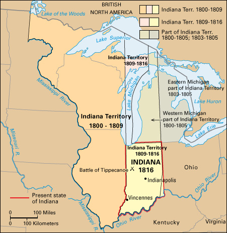
In 1818, the federal government bought the central part of the state in treaties with Indigenous nations. The government gave the area to Indiana. Soon after this so-called New Purchase, settlers came to central Indiana. In 1824, the legislature made Indianapolis the capital, because of its central location. The legislature moved there in 1825.
In 1825, Robert Owen, a Scottish social reformer, established the town of New Harmony in the lower Wabash River Valley. He hoped to start a new social system, and set up rules for community living. The group included scholars, teachers, and scientists. Under Owen’s leadership, the community adopted progressive ideas, especially in education. For a time the colony prospered, and foreign leaders came to study Owen’s methods. The experiment failed in 1827, largely because many persons in the group had not cooperated. 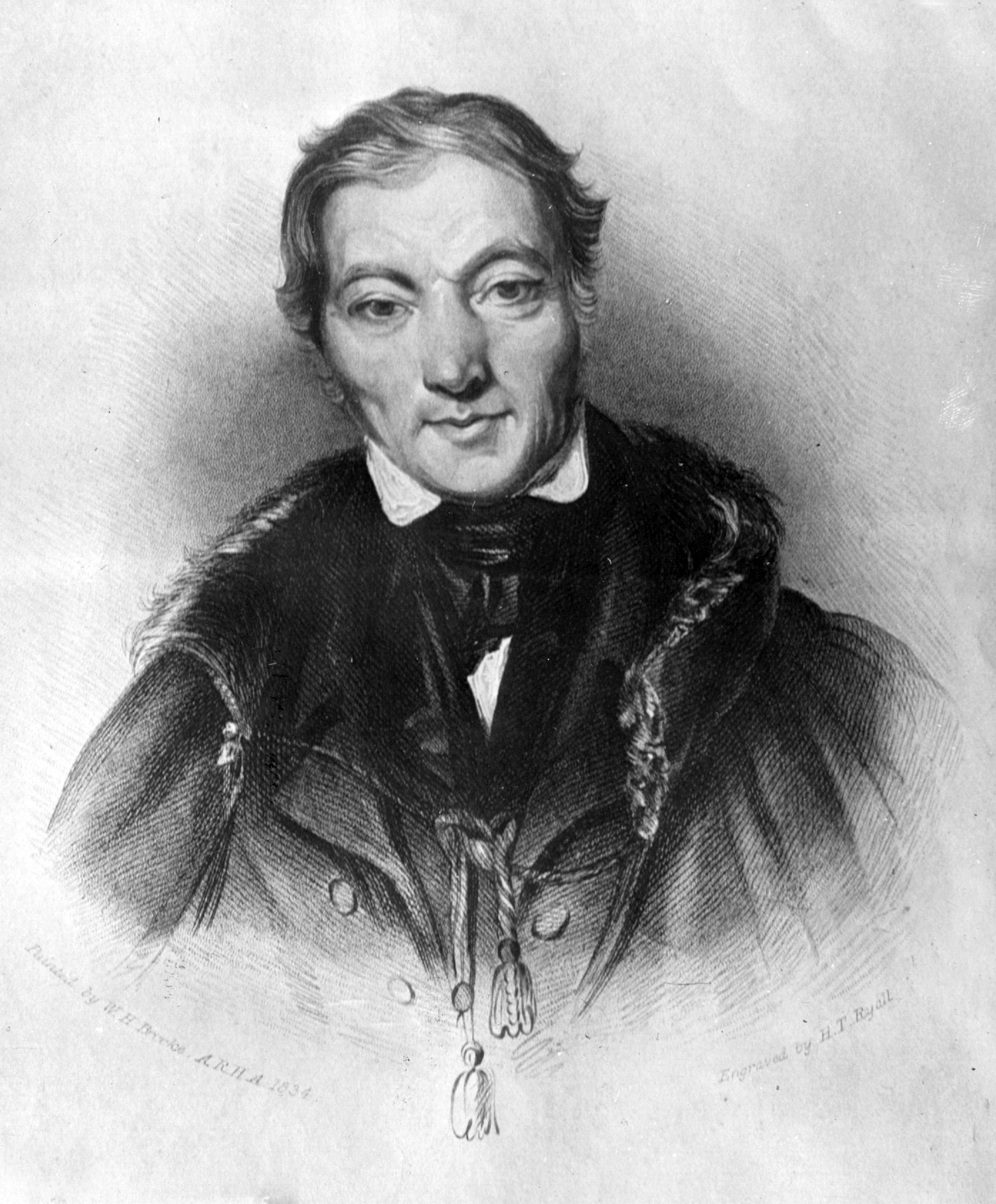
During the 1820’s, the state received land grants from the federal government to build roads and canals. These developments started a period of wild spending. The state found itself heavily in debt by 1840, and many of the projects were never completed.
William Henry Harrison, Indiana’s first territorial governor and the hero of the Battle of Tippecanoe, became president of the United States in March 1841. He died only 30 days after entering the White House.
Indiana’s economy improved during the 1850’s, when railroads pushed into the state. Cities began to grow, and farmers found new markets for their crops. The Studebaker brothers, Clement and Henry, opened a blacksmith and wagon shop in South Bend in 1852. Their company became the largest wagon manufacturer in the country. Other industries were developed in Indiana. Richard Gatling invented the first practical machine gun in Indianapolis in 1862. During the 1860’s, James Oliver invented and improved a hard-steel plow that could easily cut through the tough prairie sod.
The Civil War.
During the American Civil War (1861-1865), the only recorded fighting in Indiana took place at Corydon in 1863. General John Hunt Morgan had led his Confederate cavalrymen, called Morgan’s Raiders, across the Ohio River from Kentucky. They raided Corydon, and then rode across eastern Indiana into Ohio.
Progress as a state.
After the Civil War, Indiana farmers were troubled by debts, low prices for their products, and high freight rates. Prices for farm products did not start increasing until the 1890’s. But new industries developed rapidly throughout Indiana during the 1800’s. One of the first gasoline pumps in the United States was made in Fort Wayne in 1885. The discovery of natural gas near Portland in 1886 attracted out-of-state industries that wanted to be near this fuel source. In 1889, Benjamin Harrison, a grandson of William Henry Harrison and a resident of Indianapolis, became president of the United States. That same year, the Standard Oil Company built one of the world’s largest oil refineries in the little village of Whiting, on Lake Michigan. In 1894, Elwood Haynes of Kokomo designed one of the first successful gasoline-powered cars.
The early 1900’s.
By 1900, about a third of Indiana’s population of over 21/2 million lived in cities. In 1902, the Studebaker brothers’ company in South Bend made its first electric-powered vehicles. It began to make gasoline-powered cars in 1904. In 1906, the United States Steel Corporation began building the city of Gary. The company also built its largest steel plant there. In 1911, the first Indianapolis 500 automobile race was held in the Indianapolis Motor Speedway. The state adopted the Workmen’s Compensation Act in 1915. This act required employers to pay workers injured on the job. 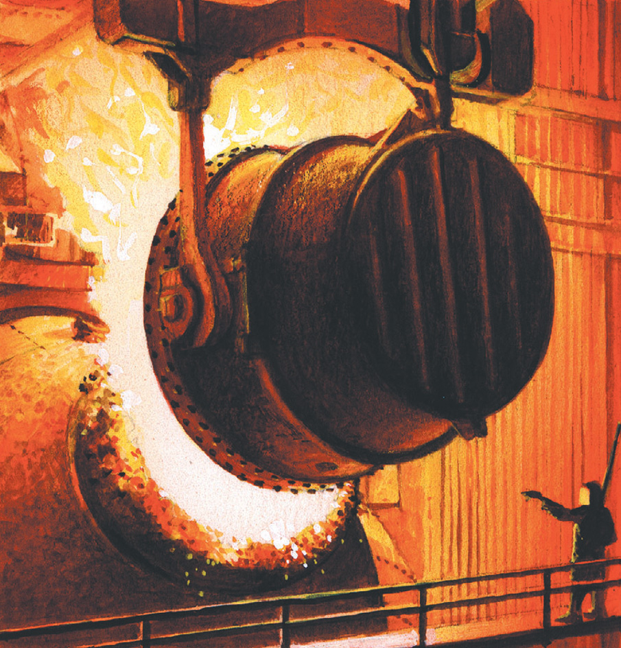
During the 1920’s, Indiana’s automobile and other metal-products industries expanded rapidly. In 1933, the state reorganized various governmental departments, giving the governor greater powers. In 1937, the state division of labor was created to help deal with labor-management problems. Also in 1937, the Ohio River flooded, causing many deaths and great property damage.
The mid-1900’s.
In 1940, Governor Henry F. Schricker was the only Democrat elected to an executive state office in Indiana. The next year, the Republican-controlled legislature passed a bill that would have limited much of the governor’s authority. But the state Supreme Court ruled the bill unconstitutional.
In 1956, Clifty Creek, one of the nation’s largest privately owned power plants, was built in Madison. Also in 1956, the Northern Indiana Toll Road was opened. Indiana continued to shift from an agricultural to an industrial economy during the 1950’s and 1960’s. The farm population decreased, and the urban population grew. The increased use of farm machinery lessened the need for farmworkers, many of whom moved to cities and took manufacturing jobs. The large industrial cities, including Gary and Indianapolis, also attracted workers from the South.
Indiana generally had been a Republican state since the Civil War. But Democrats gained strength in the cities in the 1960’s because most farmers and Southerners who moved to urban areas were Democrats.
In 1963, the Indiana legislature made major changes in the state’s tax program. The greatest change was adoption of a 2 percent retail sales tax, the first in Indiana history. Unemployment increased in some parts of Indiana during the 1960’s, largely because of automation. Some industries also left the state. Thousands of workers lost their jobs in 1963 when the Studebaker Corporation (now Studebaker-Worthington, Inc.) ended automobile production in South Bend.
In 1970, Indianapolis and Marion County began a reorganization plan called Unigov. The plan combined the local governments and expanded the city boundaries of Indianapolis to take in nearly all the county’s 402 square miles (1,041 square kilometers). The reorganization includes countywide executive and legislative bodies and combined budgets.
The state experienced major economic growth during the 1970’s, aided by the Port of Indiana in Burns Harbor on Lake Michigan. The port, which opened in 1970, serves oceangoing ships by way of the St. Lawrence Seaway. Indiana also faced problems in the 1970’s. The costs of government rose sharply, and so the state legislature increased the retail sales tax in 1973. It raised the tax again during the mid-1980’s.
During the early 1980’s, a recession developed in Indiana. A nationwide decline in the demand for steel, automobiles, and other manufactured goods caused unemployment to rise dramatically in the state’s manufacturing sector. In addition, many of Indiana’s farmers went into debt or went bankrupt as they faced high operating costs and declining prices for their products. The recession and rising unemployment reduced state tax revenue.
Recent developments.
Indiana’s economy improved in the late 1980’s and the 1990’s. The state’s agricultural and manufacturing sectors recovered, and growth in the high-technology and service industries made the economy more diversified. Higher rates of both income taxes and sales taxes contributed to an increase in tax revenues. Indiana used this additional revenue to help finance programs to attract new businesses to the state. Indiana also increased its spending on education, and many cities began redevelopment projects. Older sections of Indianapolis that were rebuilt feature new office, government, and university buildings, and hotels and sports facilities.
