Lake Ontario is the smallest and most eastern of the five Great Lakes. It forms an important link in the St. Lawrence Seaway system. Although Lake Ontario is open to large ships throughout the year, it has less traffic than the other Great Lakes.
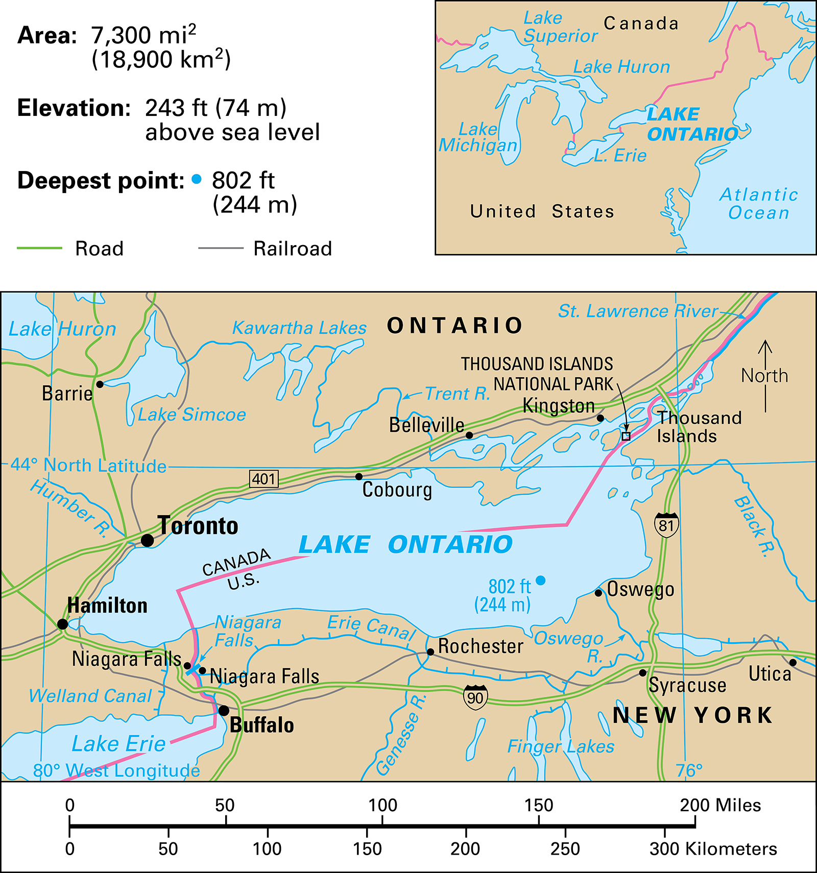
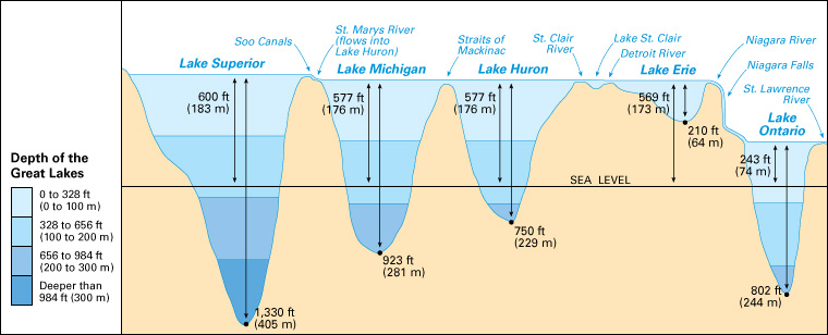
Lake Ontario lies between the province of Ontario and the northwestern part of New York. The lake is 193 miles (311 kilometers) long and 53 miles (85 kilometers) wide. It covers an area of 7,300 square miles (18,900 square kilometers). The shore of the lake is about 480 miles (772 kilometers) around. Offshore, the lake is very deep, ranging from 500 to 802 feet (152 to 244 meters). Its surface lies about 243 feet (74 meters) above sea level. The great depth of the lake, together with its lowlying surface, means that two-thirds of its waters lie below sea level and are not touched by surface winds and currents. A steady top current moves across the lake from west to east at a rate of about 1/3 mile (0.5 kilometer) per hour.
Lake Ontario does not freeze in winter, except along the shore, where the water is more shallow. The depth of its waters makes its surface cooler than the air above in summer, and warmer in winter. So the lake has a moderating effect on the climate of the area. The temperature of the southern shore is so moderate that fruit trees grow throughout this region on both sides of the United States-Canada border.
Lake Ontario empties into the Atlantic Ocean through the St. Lawrence River. The Niagara River and the Welland Canal connect it to Lake Erie on the southwest. It is connected with the Hudson River and New York City by the Erie Canal, the Genesee River, and the Oswego Canal. The rivers that empty into Lake Ontario include the Black, Genesee, Oswego, Trent, and Humber. The lake has many good harbors. The chief lake ports include Rochester and Oswego, N.Y. Important Canadian ports are Cobourg, Toronto, Hamilton, and Kingston.
