Maryland is an important industrial and shipping state of the United States. It lies in the northeastern corner of the Southern States. Chesapeake Bay cuts deep into Maryland. The bay provides the state with several excellent harbors. Historic Baltimore, the state’s largest city, is one of the world’s greatest port cities. Annapolis, the home of the U.S. Naval Academy, is the capital of Maryland.
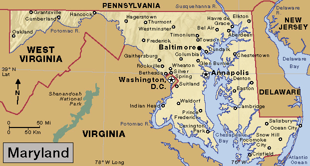
Chesapeake Bay divides Maryland into two parts. The part of Maryland east of the bay is called the Eastern Shore. The part west of the bay is the Western Shore. The two parts join north of the bay in the northeastern corner of the state. The Eastern Shore shares the Delmarva Peninsula with parts of Delaware and Virginia. The Eastern Shore and part of the Western Shore are low and flat. But western Maryland has rolling plains, hills and valleys, mountains, and plateaus. Most parts of Maryland have good farmland. Forests cover about 40 percent of the state.
Service industries, such as government and trade, play a leading role in Maryland’s economy. The state’s chief manufactured products include chemicals, computer and electronic products, and processed foods. Manufacturing in Maryland is centered in the Baltimore area and in the Maryland suburbs of Washington, D.C.
Many farms on the Eastern Shore raise chickens. Many dairy farms lie in the river valleys of the Western Shore. Greenhouse and nursery products are important in the larger cities. Maryland is an important producer of clams, crabs, and oysters.
Maryland was named for Queen Henrietta Maria, the wife of King Charles I of England. In 1632, Charles granted the Maryland region to Cecilius Calvert, the second Lord Baltimore. Calvert, a Roman Catholic, believed in religious freedom. He welcomed settlers of all faiths to Maryland. Calvert and his descendants—the Lords Baltimore—ruled Maryland during most of the period when it was an English colony. During the American Revolution (1775-1783), the Second Continental Congress met for about three months in Baltimore. After the revolution, the Congress of the Confederation met for several months in the Maryland State House in Annapolis. In 1791, Maryland gave part of its land to the federal government for the District of Columbia (or Washington, D.C.), the new national capital. See Baltimore, Lord.
Francis Scott Key wrote “The Star-Spangled Banner” while watching the British bombard Baltimore’s Fort McHenry during the War of 1812 (1812-1815). Maryland, though a Southern state, remained loyal to the Union during the American Civil War (1861-1865). Several Civil War battles were fought in Maryland, including the Battle of Antietam—one of the bloodiest of the war.
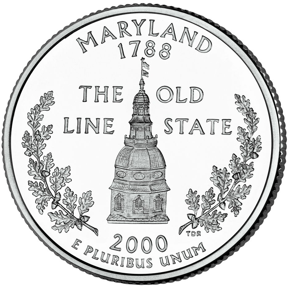
Maryland is nicknamed the Old Line State after its heroic “troops of the line.” These troops won praise from George Washington, who was commander in chief of the Continental Army during the Revolutionary War.
People
Population.
The 2020 United States census reported that Maryland had 6,177,224 people. The population had increased 7 percent over the 2010 figure of 5,773,552. According to the 2020 census, Maryland ranks 18th in population among the 50 states.
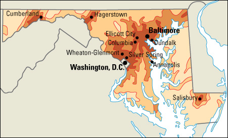
About 96 percent of the population lives in the state’s metropolitan areas. Maryland has seven metropolitan areas entirely or partly within the state (see Metropolitan area). The Baltimore-Columbia-Towson, Lexington Park, and Salisbury metropolitan areas lie entirely in Maryland. Metropolitan areas shared with other states are Hagerstown-Martinsburg (West Virginia); Philadelphia (Pennsylvania)-Camden (New Jersey)-Wilmington (Delaware); and Washington, D.C.-Arlington (Virginia)-Alexandria (Virginia).
Baltimore is the state’s largest city. Other large population centers, in order of population, are Columbia, Germantown, Waldorf, and Silver Spring.
Maryland is one of the most densely populated U.S. states. Only New Jersey, Rhode Island, Massachusetts, and Connecticut rank higher in population density.
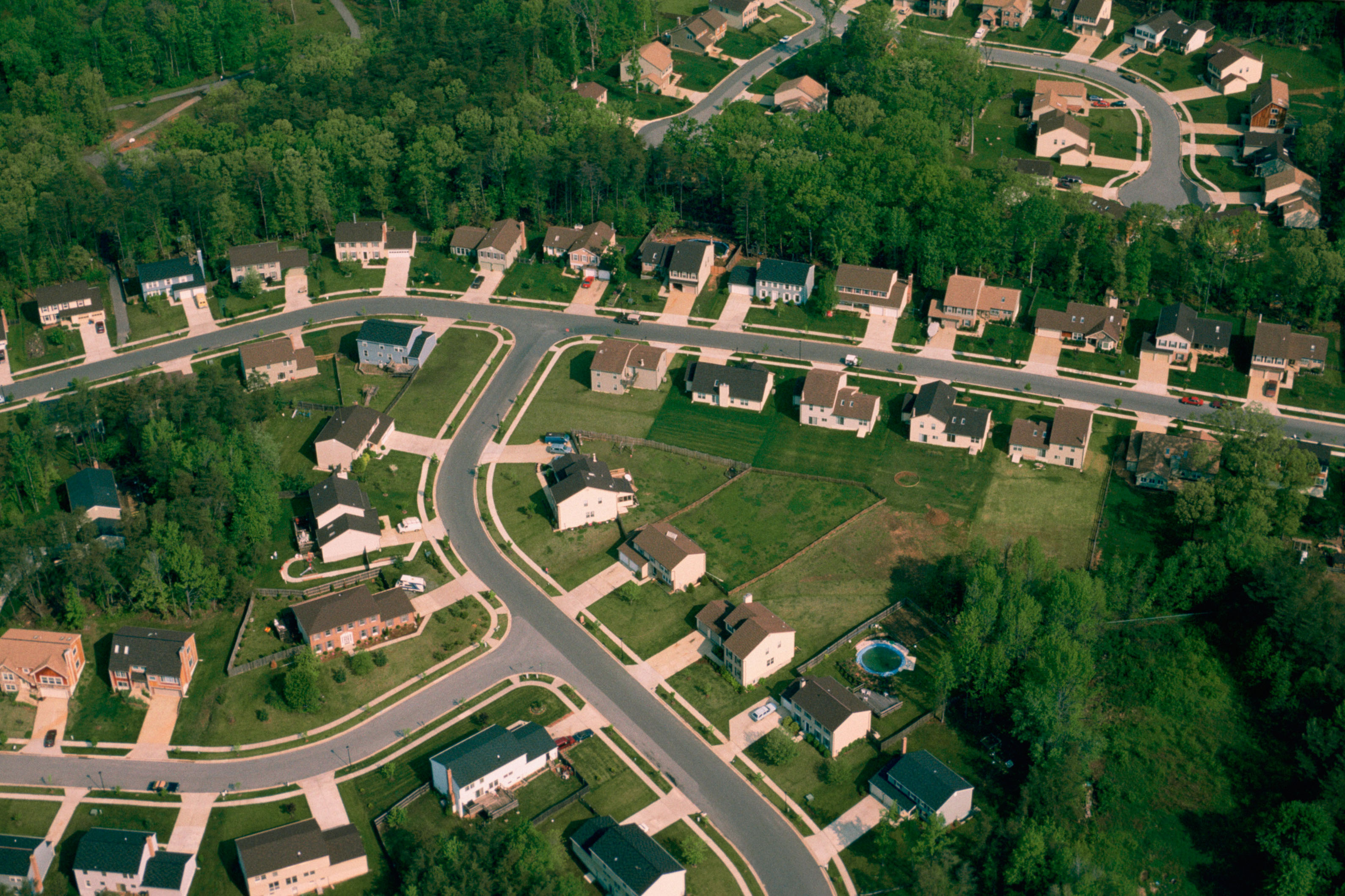
About 30 percent of Maryland’s people are African Americans. Other large population groups in Maryland include people of English, German, Irish, Italian, and Polish descent. Hispanic Americans account for about 12 percent of Maryland’s population. Asian Americans account for about 7 percent.
Schools.
Church leaders and private tutors taught children in colonial Maryland. Only the children of wealthy families received schooling. The colony first provided funds for public education in 1694. King William’s School in Annapolis was the colony’s first free school. It was founded in 1696. It became St. John’s College in 1784. In 1826, Maryland provided for the establishment of public schools throughout the state. The State Board of Education was established in 1870.
Today, the State Board of Education sets policy for the public school system. The board is appointed by the governor. The board appoints the state superintendent of schools to carry out its policies. A state law requires children to attend school from ages 5 through 17. For the number of students and teachers in Maryland, see Education (table: U.S. students, teachers, and school expenditures).
Libraries.
In 1699, Thomas Bray, an Episcopal minister, set up 30 parish (church district) libraries in the colony. He also established a central library in Annapolis. These were Maryland’s first libraries and probably the first in the colonies to loan books. In 1886, Enoch Pratt, a Baltimore merchant, established the Enoch Pratt Free Library of Baltimore. The Pratt Library is one of the oldest public library systems in the United States.
The libraries at Johns Hopkins University in Baltimore have a large collection of medical history materials. The Maryland Center for History and Culture in Baltimore was founded in 1844. The Maryland State Archives in Annapolis was founded in 1935. The Center for History and Culture and the State Archives have outstanding collections of books and documents dealing with the state’s history. The Historical Society’s collection contains the original manuscript of “The Star-Spangled Banner” (1814). The State Archives owns George Washington’s handwritten copy of his speech resigning as commander-in-chief of the Continental Army. The National Agricultural Library in Beltsville has a huge collection of material on farming. The Thurgood Marshall State Law Library, in Annapolis, has many rare books, maps, and newspapers. 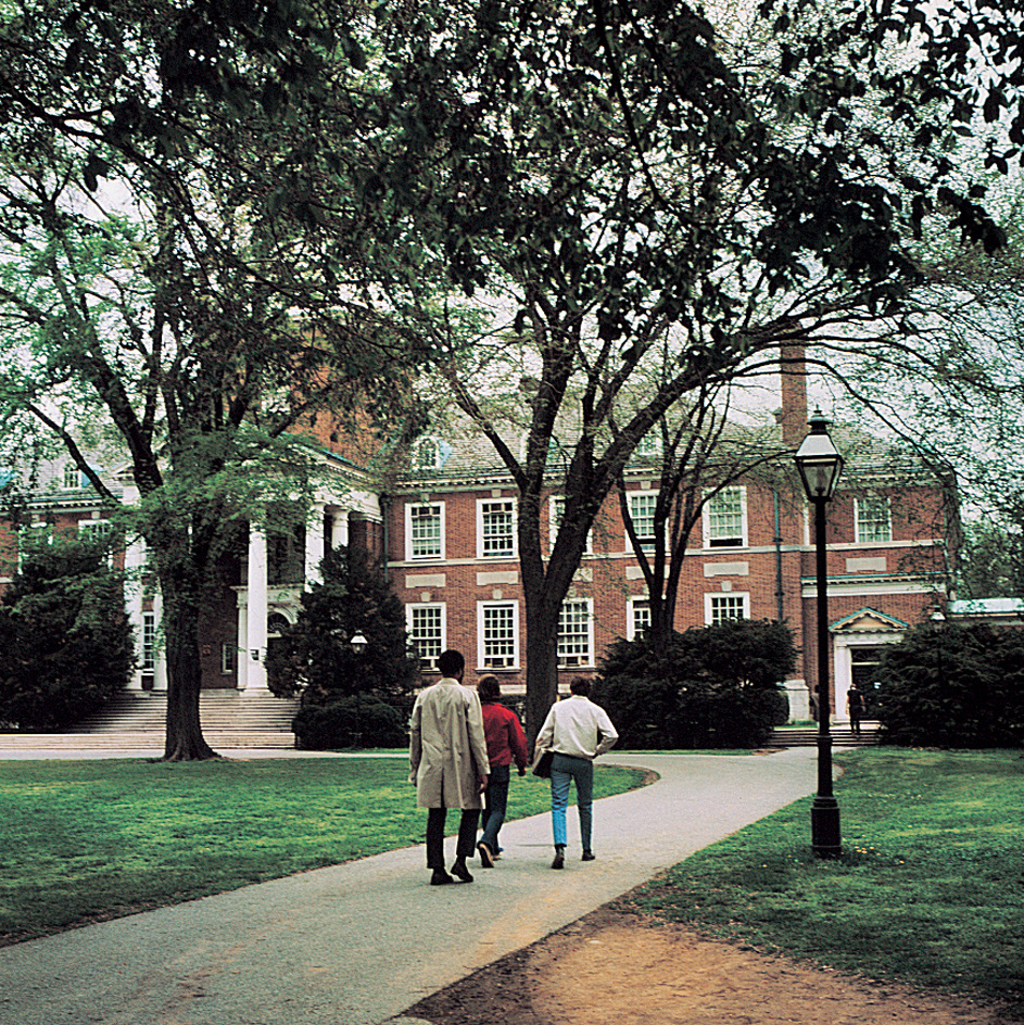
Museums.
The Baltimore Museum of Art contains works of art from around the world. The museum’s famous Cone Collection features hundreds of works by the French artist Henri Matisse.
The Maryland Center for History and Culture in Baltimore runs a museum. It displays clothing, furniture, paintings, quilts, silver, and other items related to Maryland history.
The Maryland Science Center in Baltimore features hands-on exhibits dealing with science and nature. The Science Center also includes an IMAX theater and a planetarium. The Walters Art Museum in Baltimore exhibits world art from ancient to modern times. The U.S. Naval Academy Museum in Annapolis houses artifacts and works of art relating to the history of the U.S. Navy and the Naval Academy. It includes a gallery with dozens of models of ships from the 1600’s to the 1800’s.
Visitor’s guide
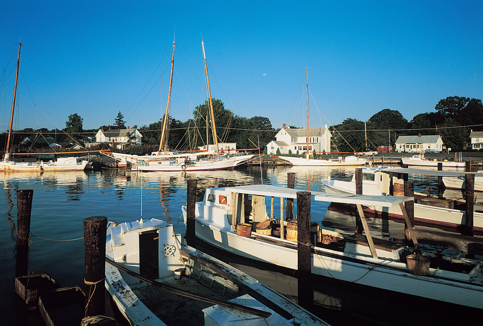
Maryland’s long Chesapeake Bay shoreline offers opportunities for boating, fishing, and swimming. Visitors can hunt game birds and animals in the fields and forests, and along rivers. Old mansions and historic sites throughout the state appeal to sightseers. Visitors can still watch a form of old English jousting. In jousting tournaments, galloping riders try to catch small rings on a spear. Tournaments are held throughout the year, including a major competition in Calvert County in August.
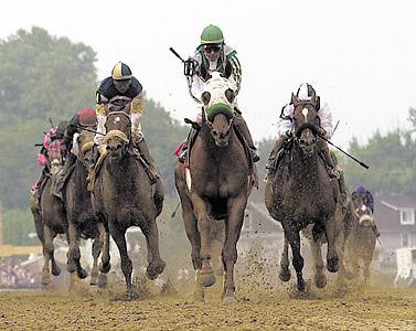
One of Maryland’s most famous annual events is the Preakness Stakes. The Preakness is a horse race run each May at the Pimlico race track in Baltimore. The Preakness, the Kentucky Derby, and the Belmont Stakes make up the famous Triple Crown of horse racing in the United States.
Land and climate
Land regions.
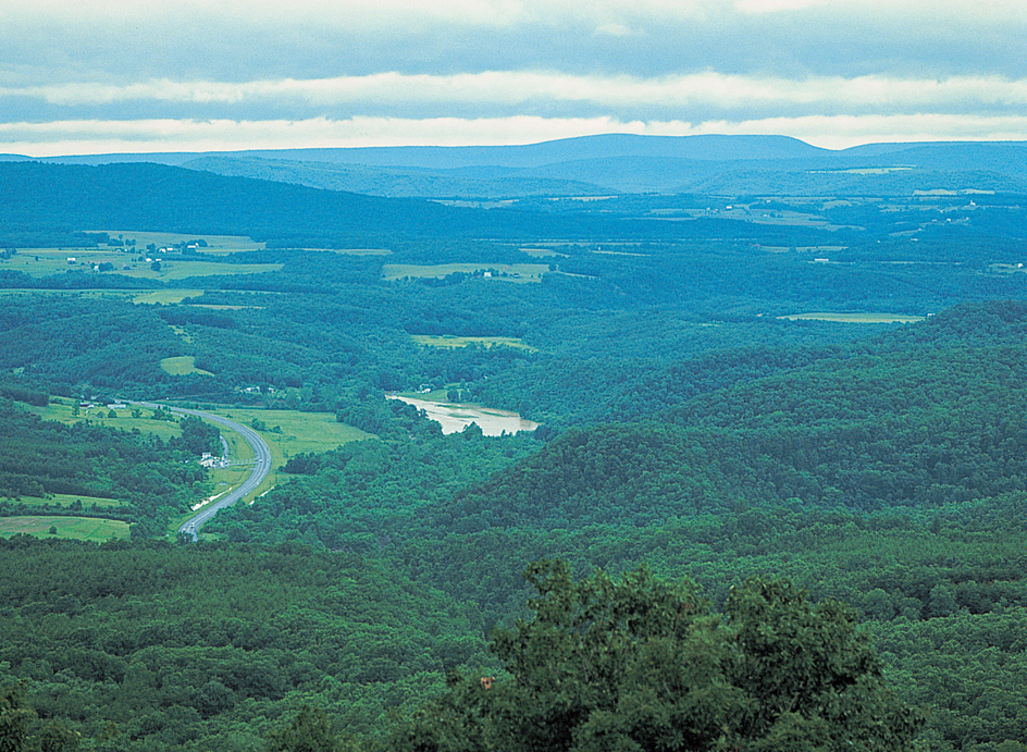
Chesapeake Bay divides most of Maryland into two sections. The area east of Chesapeake Bay is called the Eastern Shore. The area west of the bay is called the Western Shore. Maryland has five main land regions. They are, from east to west: the Atlantic Coastal Plain, the Piedmont, the Blue Ridge, the Appalachian Ridge and Valley, and the Appalachian Plateau.
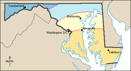
The Atlantic Coastal Plain
stretches along the east coast of the United States from New Jersey to southern Florida. In Maryland, this coastal lowland covers the entire Eastern Shore and part of the Western Shore—about half of the state’s land area. The coastal plain also touches a narrow tip of northeastern Maryland. It extends across southern Maryland from the southeastern corner of the state almost to Washington, D.C. The coastal plain has little elevation on the Eastern Shore. It rises to about 400 feet (120 meters) on the Western Shore.
The Eastern Shore has some marshy areas. The Pocomoke Swamp extends from Pocomoke Sound to the Delaware border. The swamp is 2 miles (3 kilometers) wide. The part of the Western Shore south of Baltimore is called Southern Maryland. Tobacco has been raised in Southern Maryland since colonial times.
The Piedmont
extends from New Jersey to Alabama. In Maryland, the Piedmont is about 50 miles (80 kilometers) wide. It stretches from the northeastern to the central part of the state. Low, rolling hills and fertile valleys cover the region. The Piedmont rises to about 880 feet (268 meters) at Parrs Ridge. It reaches about 1,200 feet (366 meters) at Dug Hill Ridge on the Pennsylvania border. Both of these ridges run in a southwesterly direction. They form the divide between streams flowing westward into the Potomac River and those flowing eastward into Chesapeake Bay. Frederick Valley lies along the Monocacy River. The valley is a rich dairy-farming area.
The Blue Ridge
region extends from southern Pennsylvania to northern Georgia. In Maryland, the region is a narrow, mountainous strip of land. It lies between the Piedmont and the Appalachian Ridge and Valley region. South Mountain and Catoctin Mountain form most of the Blue Ridge. Nearly all the region is more than 1,000 feet (300 meters) above sea level. It rises to a height of over 2,000 feet (610 meters) near the Pennsylvania border. The Blue Ridge region was named for the blue haze that sometimes hangs over its forest-covered ridges.
The Appalachian Ridge and Valley
is a land region that stretches southwestward from New Jersey to Alabama. The Maryland portion is a strip of land that separates Pennsylvania from West Virginia. At Hancock, Maryland measures less than 2 miles (3 kilometers) from its northern to its southern borders.
The Great Valley covers the eastern portion of the state’s ridge and valley region. The valley is known in Maryland as Hagerstown Valley. Much of this fertile valley is filled with orchards and farms. West of the valley, a series of ridges crosses the state from northeast to southwest. Some of the ridges rise to almost 2,000 feet (610 meters). Forests cover about two-thirds of the region.
The Appalachian Plateau
extends from New York to Georgia. It covers a triangle-shaped area in the extreme western part of Maryland. The Allegheny Mountains cover most of the region. They make up part of the huge Appalachian Range. Backbone Mountain, in the northwest, is the highest point in Maryland. It rises 3,360 feet (1,024 meters). Streams have cut deep valleys into the Appalachian Plateau. The valleys served as early trails to the West. Forests cover nearly three-fourths of the area.
Coastline
of Maryland measures only 31 miles (49 kilometers) along the Atlantic Ocean. But the many arms and inlets of Chesapeake Bay give Maryland a total coastline of 3,190 miles (5,134 kilometers). These arms and inlets provide excellent harbors. Islands in Chesapeake Bay include Bloodsworth, Deal, Hooper, Kent, Smith, South Marsh, Taylors, and Tilghman.
Rivers and lakes.
Most of Maryland is drained by rivers that flow into Chesapeake Bay. Several rivers cross the Eastern Shore area. They include the Chester, Choptank, Elk, Manokin, Nanticoke, Pocomoke, Sassafras, and Wicomico. The Susquehanna River flows into the state from Pennsylvania. It empties into Chesapeake Bay. The Bush, Gunpowder, Patapsco, Patuxent, and Severn rivers all drain the Western Shore. They also flow into the bay.
The Potomac River forms Maryland’s southern and southwestern boundary. South of Washington, D.C., it widens into an arm of Chesapeake Bay. Tributaries of the Potomac drain much of western Maryland.
All Maryland lakes are artificially created. The largest, Deep Creek Lake in the Allegheny Mountains, covers about 4,000 acres (1,600 hectares). It was formed by a dam built across a small tributary of the Youghiogheny River. The dam provides hydroelectric power.
Plant and animal life.
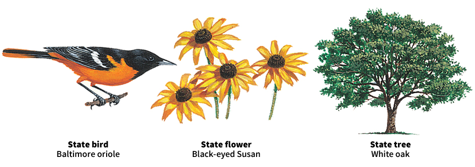
Forests cover more than 40 percent of Maryland’s land area. The state has over 150 kinds of trees. Oaks are the most common. Others include the ash, beech, hickory, maple, and tupelo.
The black-eyed Susan, Maryland’s state flower, grows on the Western Shore. The Western Shore also has many kinds of berries. They include blackberries, dewberries, raspberries, and wild strawberries. Grasses and grasslike plants called sedges grow on the Eastern Shore. Azaleas, laurel, and rhododendrons grow along the edges of the woods.
Maryland’s animal life includes eastern cottontail rabbits, minks, opossums, raccoons, red and gray foxes, and white-tailed deer. The north-central part of the state has chipmunks, otters, squirrels, and woodchucks. Hunters find grouse, partridge, wild turkeys, and woodcocks in western Maryland. Wild ducks and geese live along the coastal plain. The Eastern Shore lies along the Atlantic Flyway. The flyway is a route heavily traveled by migrating geese and ducks. Songbirds are plentiful.
Maryland’s coastal waters have great quantities of bluefish, menhaden, sea trout, and striped bass (called rockfish or rock in Maryland). Crabs, oysters, and shrimps are plentiful. Maryland waters also have many diamondback terrapins. Each spring, croakers, alewives, and other fishes swim up Chesapeake Bay to lay their eggs in the larger rivers. Trout live in the cold rivers and streams of northern and western Maryland. Carp, catfish, and suckers are found in the waters of the Piedmont and the coastal plain.
Climate.
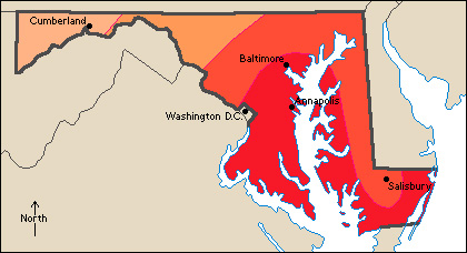
Maryland has a humid climate, with hot summers and generally mild winters. Temperatures in the mountainous northwest are lower than those along the Atlantic coast and in the Chesapeake Bay region. 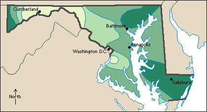
January temperatures average 29 °F (–2 °C) in the northwest. They average 37 °F (3 °C) along the Atlantic coast. Average July temperatures range from 72 °F (22 °C) in the northwest to about 78 °F (26 °C) in the Chesapeake Bay region. The record high temperature, 109 °F (43 °C), has occurred multiple times, most recently at Cumberland and Frederick on July 10, 1936. Oakland had the lowest temperature, –40 °F (–40 °C), on Jan. 13, 1912.
Maryland’s precipitation averages about 42 inches (107 centimeters) a year. Rain falls fairly evenly throughout the state. Snow ranges from about 10 inches (25 centimeters) a year in the southeast to over 100 inches (250 centimeters) in the Appalachian Plateau.
Economy
Maryland’s economy is based largely on service industries. These industries, taken together, account for the largest part of Maryland’s gross domestic product. Gross domestic product is the total value of all goods and services produced in the state in a year. Because Maryland adjoins Washington, D.C., the U.S. government plays a major role in the state’s economy. Many federal offices are in Maryland. Many businesses in this region provide support services to federal agencies. The Baltimore area is Maryland’s other major economic center. It is one of the East Coast’s leading areas for finance, manufacturing, and trade. Many high-technology companies operate in Maryland.
Natural resources
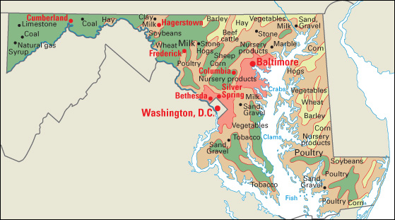
of Maryland include fertile soils and some building materials. Light, sandy loams and stiff, clay soils cover much of the Eastern Shore. The Western Shore south of Baltimore also has loam and clay soils. North-central Maryland has fertile limestone soils. The valleys of western Maryland have a thin covering of soil. Sand and gravel deposits are found in many counties of the state. Other mined products include coal, limestone, and natural gas.
Service industries
account for more than 85 percent of both Maryland’s employment and its gross domestic product. Many of these industries are in the Baltimore and Washington, D.C., areas.
Baltimore is one of the leading financial centers in the eastern United States. Several major banking companies and holding companies are headquartered in the Baltimore area. The port of Baltimore is a center of wholesale trade. Hotels and restaurants benefit from the tens of millions of tourists who visit Maryland each year.
Government is an important service industry in Maryland. Federal government agencies in Maryland include the National Institutes of Health in Bethesda and the U.S. Census Bureau in Suitland. Military facilities include several bases, the Walter Reed National Military Medical Center Bethesda, Goddard Space Flight Center in Greenbelt, and the U.S. Naval Academy at Annapolis. Most state government offices are in Annapolis and Baltimore.
Manufacturing.
Most of Maryland’s manufacturing is done in the Baltimore area and urban areas near Washington, D.C. Chemicals, computer and electronic products, and food and beverages are Maryland’s leading types of manufactured products.
Pharmaceuticals (medicinal drugs) are the state’s most important chemical product. Communications equipment and surveillance and navigation instruments rank among the state’s most valuable electronic products. Lockheed Martin, a leading manufacturer of aerospace and defense systems, is headquartered in Bethesda. Maryland’s major types of food products include bread, dairy products, soft drinks, and spices. McCormick and Company, Inc., one of the world’s largest spice makers, is based north of Baltimore.
Agriculture.
Farmland covers about a third of Maryland’s land area. Livestock and livestock products provide over half of the farm income. Broilers (young, tender chickens) provide more than half of Maryland’s livestock income. Broilers are primarily raised in the southeastern part of the state. Milk is also an important product. Carroll, Frederick, and Washington counties lead the state in milk production. Other livestock products include beef cattle, eggs, hogs, and turkeys.
Crops in Maryland account for under half of the farm income. Greenhouse and nursery products make up the state’s leading crops. These crops include flowers, ornamental shrubs, and young fruit trees. The state’s leading field crops are corn, soybeans, and wheat. Potatoes, sweet corn, and tomatoes are among the most valuable vegetable crops. Apples and watermelons are the leading fruit crops.
Mining.
Maryland’s most valuable mined products include limestone and portland cement. Large quantities of sand and gravel come from pits in southern Maryland and the Eastern Shore. Allegany and Garrett counties in western Maryland produce all of the state’s coal and natural gas.
Fishing industry.
Maryland ranks among the leading states in the number of blue crabs caught. Valuable catches in the waters of Chesapeake Bay include blue crabs, clams, eels, flounder, menhaden, oysters, scallops, and striped bass. Fish caught in Atlantic coastal waters include croakers, flounder, striped bass, and tuna.
Electric power and utilities.
Nuclear plants and plants that burn coal or natural gas account the majority of the electric power generated in Maryland. Hydroelectric plants and other renewable sources supply most of the rest.
Transportation.
Early transportation in the Maryland region was provided by steamboats traveling over Chesapeake Bay and its tributaries. In 1828, construction began on the Baltimore and Ohio Railroad. This railroad was the first in the Western Hemisphere to carry both passengers and freight. The Chesapeake and Delaware Canal was completed in 1829. It connected Chesapeake Bay with the Delaware River.
In 1963, the John F. Kennedy Memorial Highway became the state’s first modern tollway. It is part of Interstate 95. The William P. Lane, Jr., Memorial Bridge links the Eastern and Western shores. Baltimore/Washington International Thurgood Marshall Airport is the chief airport. Passenger trains serve Baltimore and Washington, D.C. Baltimore is a leading Atlantic Coast port. 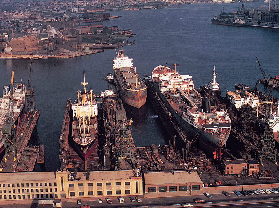
Communication.
The Maryland Gazette was the first colonial newspaper south of Philadelphia. The Gazette was published in Annapolis from 1727 to 1734. Today, The (Baltimore) Sun is Maryland’s leading newspaper.
Government
Constitution.
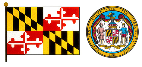
The current Maryland Constitution was adopted in 1867, shortly after the American Civil War (1861-1865). Earlier constitutions were adopted in 1776, 1851, and 1864.
An amendment (change) in the Constitution may be proposed by the state legislature or by a constitutional convention. Legislative amendments must be approved by three-fifths of the members of both houses of the legislature. All amendments must be approved at the polls by a majority of those who vote on the amendment.
Executive.
Maryland’s governor serves a four-year term. The governor may be elected to an unlimited number of terms but may not serve more than two terms in a row.
The people elect the lieutenant governor, the attorney general, and the comptroller to four-year terms. The governor appoints the secretary of state, the adjutant general, and most members of state boards. The legislature elects the state treasurer to a four-year term.
Legislature,
called the General Assembly, consists of a 47-member Senate and a 141-member House of Delegates. Each of the state’s 47 legislative districts elects one senator and three delegates. All Maryland legislators serve four-year terms. Legislative sessions begin on the second Wednesday in January. Sessions are limited to 90 days. However, regular sessions may be extended 30 days by a three-fifths vote of the members of each house. The governor also may call to have a regular session extended. Special sessions may be called by the governor or by the legislature if a majority of its members sign a petition requesting such a session. 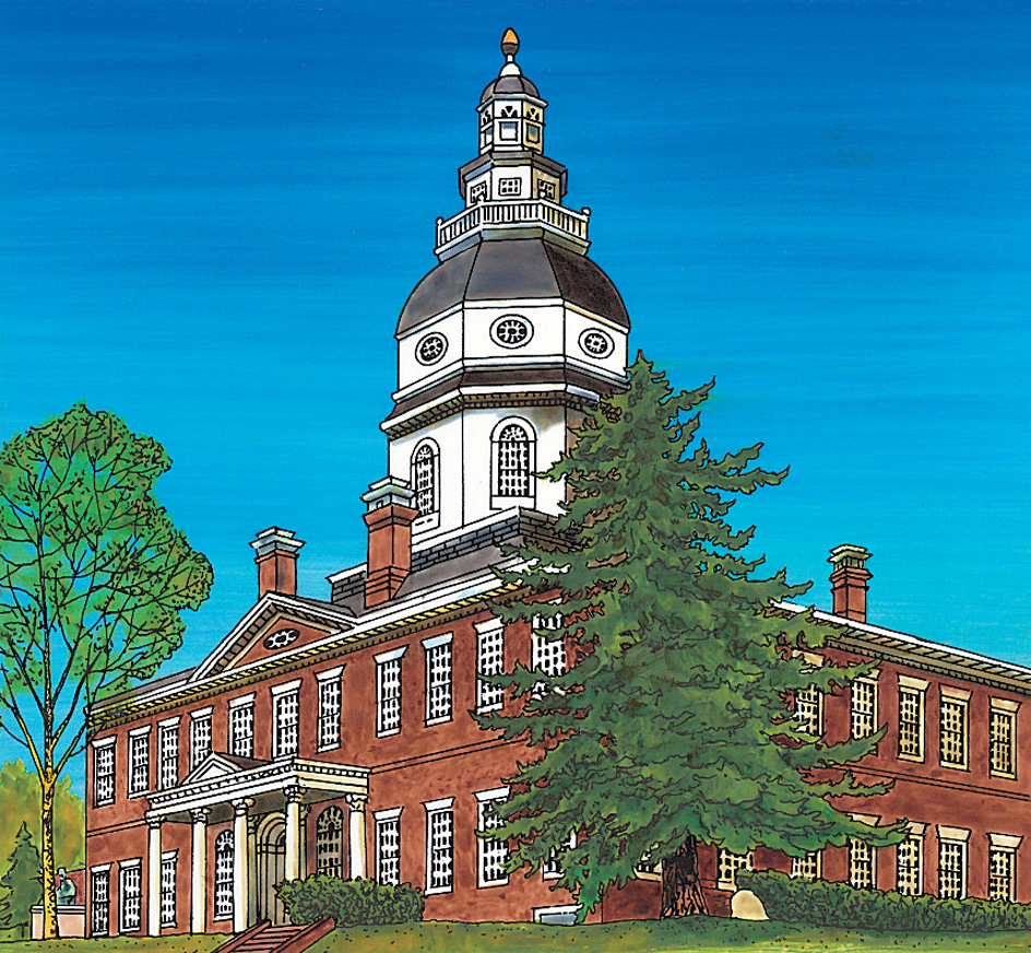
Courts.
Maryland’s chief courts include the Supreme Court, the Appellate Court, and 24 circuit courts divided among eight judicial districts. The Supreme Court, the highest state court, hears cases appealed from the Appellate Court. It has seven judges. The Appellate Court hears cases appealed from the circuit courts. This court consists of 15 judges. The circuit courts hear general cases. The circuit courts are divided among eight judicial circuits. The number of judges in each circuit varies. The governor appoints all the Supreme Court and the Appellate Court judges, subject to confirmation by the Maryland Senate, and circuit court judges to serve for at least one year. At the next general election, Supreme Court and Appellate Court judges may run for 10-year terms. Circuit court judges may run for 15-year terms. The governor also designates the chief judges who head the Supreme Court and the Appellate Court.
Maryland also has a district court system that is divided into 12 districts. District courts hear minor civil and criminal cases and traffic cases. A chief judge heads the system. The governor appoints all district court judges to 10-year terms, subject to confirmation by the Maryland Senate. The chief judge of the Supreme Court appoints the chief judge of the District Court. The chief judge serves a 7-year term.
Local government
in Maryland is centered in the state’s 23 counties and in the city of Baltimore. Incorporated cities function as independent units of government. But all other areas in a county come under the jurisdiction of county government.
Some of Maryland’s counties are governed by elected boards of county commissioners. These boards serve executive and legislative functions. Board members are elected to four-year terms. The other counties are governed by county councils. Council members are elected to four-year terms. Voters also choose such county officers as circuit court clerk, state’s attorney, sheriff, and treasurer or financial director.
Baltimore, which is not part of any county, is governed by a mayor, a 14-member City Council, and a council president. Most other cities use the mayor-council or commissioner form of government. 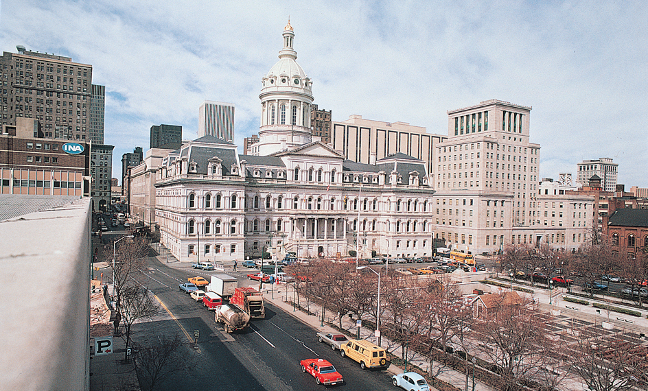
Counties in Maryland may adopt either of two forms of home rule. Both forms allow counties to govern many of their own affairs without control by the state legislature. Several Maryland counties have adopted home rule. Incorporated cities in Maryland also have it.
Revenue.
Taxes account for about half of the state government’s general revenue (income). Federal grants and programs also contribute to the state’s general revenue. Other sources of revenue include government services and a state lottery. Important sources of tax revenue include taxes on corporate income, general sales, insurance, motor fuels, motor vehicle licenses, and personal income.
Politics.
Maryland is strongly Democratic, though the state’s voters occasionally favor Republican governors. The greatest Democratic strength is in Baltimore County, Montgomery County, Prince George’s County, and the city of Baltimore. The Republican Party is strongest mainly in the state’s less populated counties. In presidential elections since the early 1900’s, Democratic candidates have won the state’s electoral votes about twice as often as Republicans (see Electoral College).
History
Indian days.
American Indians are known to have lived in the Maryland region by about 10,000 B.C. Early European explorers found Algonquian Indians and a few Susquehannock in the region. The Algonquian tribes included the Choptank, Nanticoke, Patuxent, Portobago, and Wicomico. Most of the Indians left the region during the early years of colonial settlement. But they gave their names to many of Maryland’s rivers, towns, and counties.
Exploration and settlement.
Pedro Menéndez de Avilés, the Spanish governor of Florida, explored Chesapeake Bay in 1572. He was one of the first Europeans to visit the Maryland region. In 1608, Captain John Smith of Virginia sailed northward up Chesapeake Bay into the Maryland region. Smith wrote a description of what he saw. In 1631, William Claiborne, also of Virginia, opened a trading post on Kent Island in the bay. Claiborne’s was the first colonial settlement in the Maryland region.
In 1632, King Charles I of England granted the Maryland region to George Calvert, the first Lord Baltimore. But Calvert died before the king signed the charter. King Charles then chartered the region to Calvert’s son, Cecilius, the second Lord Baltimore. The region was named Maryland in honor of Queen Henrietta Maria, the wife of Charles. Cecilius Calvert sent colonists to Maryland on two ships, the Ark and the Dove. In 1634, the ships anchored in the Potomac River. The colonists established St. Marys City (now St. Mary’s City) near the southern tip of the Western Shore.
Colonial days.
Cecilius Calvert appointed his brother, Leonard, as governor of the Maryland colony. Cecilius encouraged the colonists to suggest laws and to assist his brother in the colony’s administration. Cecilius was a Roman Catholic, but he had to support the Church of England. However, he wanted freedom of worship for those of his faith. He also wanted people of other faiths to settle in Maryland. He believed that religious restrictions would interfere with the colony’s growth and development. In 1649, the colonial assembly approved Cecilius Calvert’s draft of a religious toleration law. The law granted religious freedom to all Christians. After the law was passed, a band of Puritans fled from Virginia and came to Maryland. Maryland became famous for its religious freedom.
William Claiborne’s trading settlement on Kent Island was part of the Maryland colony. But Claiborne refused to recognize Calvert’s authority. In 1654, Claiborne led a group of Protestant settlers who overthrew Calvert’s government. Claiborne controlled Maryland for four years. See Claiborne’s Rebellion.
On orders from the English government, Claiborne returned Maryland to Calvert in 1658. Calvert promised to uphold the religious freedoms established in 1649. But many Protestants in Maryland resented a Catholic as proprietor of the colony. In 1689, a group called the Protestant Association seized control of the colony. John Coode, the group’s leader, demanded that England take over the government of Maryland. As a result, the English crown appointed a royal governor in 1691. Early in 1692, the governor arrived to rule the colony.
The Calvert family regained control of Maryland in 1715 under Benedict Leonard Calvert, the fourth Lord Baltimore. He was a Protestant. In 1718, Catholics in Maryland lost the right to vote. They did not regain this right until 1776. Maryland remained in the hands of the Calverts until the American Revolution (1775-1783). Maryland prospered during the years before the Revolution. Tobacco farming in the colony became profitable. Many colonists grew wealthy and built beautiful mansions. Maryland’s population grew rapidly. In the 1700’s, Maryland and Pennsylvania quarreled over the boundary line between them. In 1763, both colonies agreed to have Charles Mason and Jeremiah Dixon of England survey the land. The survey was completed in 1767. The boundary became known as the Mason-Dixon Line.
The American Revolution.
In the mid-1700’s, the United Kingdom found itself deeply in debt. To help raise money, the United Kingdom placed severe taxes and trade restrictions on the American Colonies. The people of Maryland, like those of the other colonies, opposed these measures. Marylanders resisted the Stamp Act of 1765 (see Stamp Act). In 1774, colonists in Maryland protested the Boston Port Act. This act was a British attempt to punish the people of Boston for the Boston Tea Party (see Boston Port Act). Marylanders burned the British ship Peggy Stewart and its cargo of tea in Annapolis.
In 1774, delegates from Maryland attended the First Continental Congress in Philadelphia. They supported a policy forbidding the colonists to trade with the United Kingdom. The American Revolution began in Massachusetts in April 1775. That May, the Second Continental Congress met in Philadelphia. On July 2, 1776, Maryland delegates voted for independence. Maryland adopted its first constitution on Nov. 8, 1776. In December 1776, the Continental Congress moved to Baltimore because the British threatened Philadelphia. The Congress remained there until the following March. Thomas Johnson, Maryland’s first governor under its Constitution, took office on March 21, 1777.
Maryland troops fought throughout the Revolutionary War. Baltimore industries built ships and cannons for the colonial forces. But little fighting took place on Maryland soil. British Vice Admiral Richard Howe sailed up Chesapeake Bay in 1777. He landed troops at the mouth of the Elk River. The troops moved into Pennsylvania that same year. There, they defeated General George Washington in the Battle of Brandywine.
Statehood.
During the war, the Continental Congress formed a government of the United States under the Articles of Confederation. Some of the states claimed western land that extended beyond their colonial boundaries. Maryland refused to sign the Articles of Confederation until the states promised to turn these western lands over to the United States government. Maryland signed the Articles of Confederation on March 1, 1781. 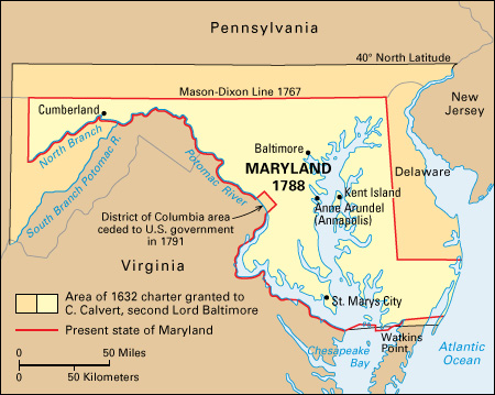
After the war, the Congress of the Confederation accepted Maryland’s invitation to meet there. The Congress met at the Maryland State House in Annapolis from November 1783 to June 1784. George Washington resigned his commission as commander in chief of the Continental Army in the State House. In the same building, Congress ratified the Treaty of Paris in 1783. That treaty ended the Revolutionary War.
During the early 1780’s, Maryland and Virginia disagreed over navigational rights in Chesapeake Bay and on the Potomac River. In 1785, commissioners from the two states approved the Mount Vernon Compact. The agreement allowed both states to benefit from use of the waterways. Another interstate conference, the Annapolis Convention, met in Annapolis on Sept. 11, 1786. The convention discussed trade and commerce problems. When the meeting attracted representatives from only five states, the delegates called for a meeting of all the states in Philadelphia in 1787. The delegates who met in Philadelphia wrote the Constitution of the United States. Maryland ratified (approved) the Constitution on April 28, 1788. Maryland thus became the seventh state of the Union. In 1791, Maryland gave land to Congress for the District of Columbia, the new national capital.
The War of 1812 and industrial development.
Several battles of the War of 1812 (1812-1815) were fought in Maryland. In 1813, the British raided a number of Maryland towns and farmhouses along Chesapeake Bay. During the summer of 1814, a large British force under General Robert Ross sailed up the Patuxent River. Ross’s troops defeated American forces in the Battle of Bladensburg on Aug. 24, 1814. The British moved on to Washington, D.C., that same day. They burned the Capitol and other government buildings. 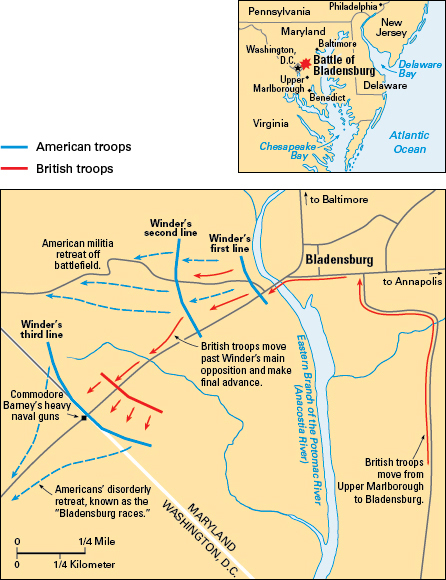
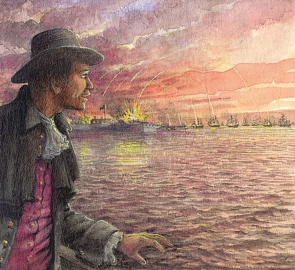
On Sept. 12, 1814, the British attacked Baltimore. British troops landed at North Point, southeast of Baltimore at the mouth of the Patapsco River. British ships sailed up the river and fired on Fort McHenry. But American forces defended the city and drove the British out of Maryland. The Battle of Baltimore inspired Francis Scott Key to write “The Star-Spangled Banner.” The song later became the national anthem of the United States. See Star-Spangled Banner.
During the early and middle 1800’s, Baltimore grew into an important industrial city. It became a leading seaport and shipbuilding center. Goods were shipped between Baltimore and the West on the Baltimore and Ohio Railroad and on the Chesapeake and Ohio Canal. Goods were shipped eastward on the Chesapeake and Delaware Canal. In 1830, Peter Cooper built the Tom Thumb, the first coal-burning American steam locomotive. The Baltimore and Ohio Railroad used the Tom Thumb between Baltimore and Ellicott’s Mills (now Ellicott City). The De Rosset was completed in Baltimore in 1839. It was the first oceangoing iron steamship built in the United States. Maryland adopted a new constitution in 1851, its first since 1776.
The American Civil War.
Maryland was a slave state. But it also was one of the original 13 states of the Union. When the American Civil War began in 1861, Marylanders were divided in their loyalties between the Union and the Confederacy. After Virginia joined the Confederacy, the fate of Washington, D.C., depended on whether Maryland remained in the Union. If Maryland joined the Confederacy, Washington, D.C., would be surrounded by Confederate territory. Union forces rushed across Maryland to defend the nation’s capital. Although Maryland remained in the Union, many Marylanders joined the Confederate armies.
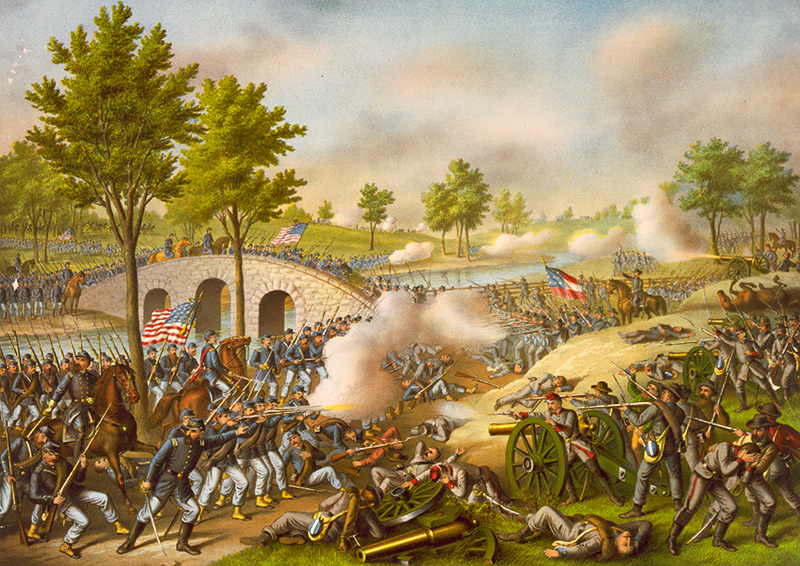
Several Civil War battles were fought on Maryland soil. In 1862, General Robert E. Lee’s Confederate troops invaded Maryland. Union forces fought them in the Battle of Antietam, near Sharpsburg, on September 17. That day, more than 12,000 Union soldiers and 10,000 Confederates were killed or wounded. Lee withdrew to Virginia the next day. In June 1863, Lee led his troops across Maryland into Pennsylvania. There he was defeated in the Battle of Gettysburg. In 1864, Confederate General Jubal A. Early crossed the Potomac River into Maryland. He defeated a Union division in the Battle of Monocacy, near Frederick, on July 9. Early’s forces advanced to within sight of Washington, D.C., before Union forces drove them back. 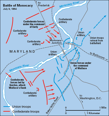
In 1864, Maryland adopted a constitution that abolished slavery. The new Constitution also placed harsh penalties on Marylanders who had supported the Confederate cause. A less severe constitution was adopted in 1867 and is still in effect.
Maryland maintained its industrial and commercial development after the Civil War. Baltimore was already a great industrial city. But it became a well-known cultural center in the middle and late 1800’s. Philanthropists established many important cultural institutions. These institutions included the Peabody Conservatory of Music (now the Peabody Institute) in 1857, Johns Hopkins University in 1876, and the Enoch Pratt Free Library in 1886.
The early 1900’s.
Maryland’s industrial expansion continued into the 1900’s. The state’s factories and shipyards expanded greatly after the United States entered World War I in 1917. The U.S. Army established the Aberdeen Proving Ground, its first testing center, along the northwest shore of Chesapeake Bay in 1917.
In 1919, the U.S. Congress passed a law making it illegal to manufacture, sell, and transport alcoholic beverages. Marylanders were among the leading opponents of Prohibition because they considered it a violation of their state’s rights. As a result, Maryland became known as the Free State. This nickname is still sometimes used to honor Maryland’s traditions of political and religious freedoms.
The Great Depression of the 1930’s struck the industrial city of Baltimore hard. Maryland passed social and welfare laws in cooperation with the U.S. government to ease hardships. Between 1935 and 1938, the U.S. government built the city of Greenbelt to provide housing for moderate-income families. In 1937, the state legislature approved Maryland’s first state income tax law.
The mid-1900’s.
During World War II (1939-1945), manufacturing activity increased greatly in Maryland. Thousands of workers came to the state from the Appalachian mountain region and other parts of the South.
After the war, Maryland’s industry and population continued to grow. The state improved its transportation systems. Baltimore’s Friendship International Airport (now Baltimore/Washington International Thurgood Marshall Airport) opened in 1950. Between 1952 and 1963, the state completed several transportation facilities. They included the Baltimore Harbor Tunnel, the Chesapeake Bay Bridge (now the William P. Lane, Jr., Memorial Bridge), the John F. Kennedy Expressway, and an expressway connecting Baltimore and Washington. The town of Columbia, a community completely designed by city planners, was founded in the 1960’s.
The growth of Maryland’s urban population created political problems. Until the 1960’s, voters in thinly populated rural areas elected most of the state’s legislators. Between 1962 and 1966, Maryland reapportioned (redivided) its state legislative and United States congressional districts for more equal representation.
Maryland expanded its school system during the 1960’s and 1970’s. The University of Maryland, which has its main campus in College Park and branches in Baltimore and Princess Anne, opened a branch in Catonsville as well. Several state teachers’ colleges became general state colleges. Many two-year community colleges opened.
In 1967, Spiro T. Agnew became the fifth Republican governor in Maryland’s history. In 1969, Agnew took office as vice president of the United States under President Richard M. Nixon. Agnew resigned as vice president in 1973. He left the office when a federal grand jury investigated charges that he had participated in graft as an officeholder in Maryland and as vice president (see Agnew, Spiro T.).
The late 1900’s.
Maryland’s industrial growth and its location on Chesapeake Bay have tied the state economically to the northeastern industrial states. Many new cities, suburbs, and industrial communities have grown up between Baltimore and Washington. The state has faced the challenge of providing these expanding areas with schools, water and power supplies, and other services. In 1972, Maryland voters approved a state lottery to raise money for the state government. State officials also emphasized the need to solve the problems of air and water pollution.
The rising population brought changes in housing and education that are still going on. Thousands of the people who moved to Maryland from the South were African Americans. As they settled in Baltimore, increasing numbers of other families moved to the city’s suburbs. At this time, Maryland public schools were segregated.
In 1954, however, the Supreme Court of the United States ruled that compulsory segregation of public schools was unconstitutional. Baltimore desegregated its public schools almost immediately. School desegregation in the rest of the state proceeded slowly but steadily, and nearly all of Maryland’s school systems became officially integrated by the end of the 1970’s. In many areas, however, schools remained largely segregated as wealthier parents sent their children to private schools. By the late 1900’s, Maryland’s increasing Hispanic and Asian populations had further diversified the state’s public schools.
In 1985, Maryland’s government began a major effort to clean up Chesapeake Bay and its watershed (waterways that drain into the bay). Excess nutrients from lawn and agricultural fertilizers had polluted the bay and severely harmed aquatic life. The cleanup involved close cooperation with Virginia, Pennsylvania, Delaware, and Washington, D.C. It continued into the 2020’s.
Recent developments.
Today, Maryland is a national center for space research, development, and production. Basic planning for space projects is carried out at the National Aeronautics and Space Administration’s Goddard Space Flight Center in Greenbelt.
