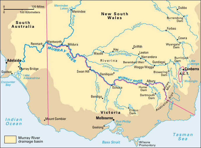
Murray River is the longest river in Australia. It is 1,558 miles (2,508 kilometers) in length. The Murray is an important source of water for irrigation and industry. The Murray River system, which includes the Darling, Lachlan, and Murrumbidgee rivers, drains an area larger than that of France and Spain combined.

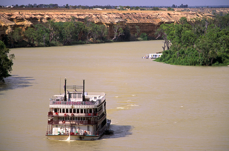
The Murray River rises (begins) in the Australian Alps near the northeastern border of Victoria. It flows northwest and forms the state boundary between Victoria and New South Wales. The river then crosses into the state of South Australia. It winds its way southwest and empties into Encounter Bay and the Indian Ocean south of Adelaide. The Murray River drains the Murray-Darling Basin, an agricultural region that produces much of Australia’s food. Small recreational boats operate on the Murray. But the river is not navigable into Australia’s interior by ships. Systems of dams and reservoirs positioned along the Murray and its tributaries help to irrigate farmlands and generate hydroelectric power for Victoria and New South Wales.

Indigenous peoples, also called First Nations peoples, have lived near the Murray River for thousands of years. The river flows through the traditional lands of several First Nations groups. The Ngarrindjeri Aboriginal peoples live near the lower Murray, from the river’s mouth to Mannum, South Australia. The Erawirung, Ngaiawang, Nganguruku, Ngaralte, Ngarkat, Ngawait, and Ngintait peoples, collectively called the First Peoples of the River Murray and Mallee Region, live farther upstream. They inhabit the northern Murray region from Morgan, South Australia, to the border with Victoria.
People of European descent began exploring the Murray River in 1824. That year, William Hovell and Hamilton Hume reached the upper region of the river near present-day Albury, New South Wales. In 1830, the British explorer Charles Sturt named the river in honor of Sir George Murray, the secretary of state for the British colonies in Australia. In 1841, Edward John Eyre established the first non-Indigenous settlement along the Murray River. It was called Moorundie and lay southwest of present-day Renmark, South Australia.
The Murray River has a history of flooding. In 1956, months of heavy rain caused the worst flood in the river’s recorded history. The Murray and the Darling rivers both overflowed their banks. By late August, the floodwaters had reached about 30 feet (10 meters) at Renmark. Hundreds of residences and businesses were flooded, and thousands of people had to evacuate the area. The flooding seriously harmed regional agriculture for years after the disaster.
In 1981, the mouth of the Murray closed for the first time since European colonization of Australia. Diversion of the river’s water, mainly for irrigation, was largely responsible. Since then, the river has faced such serious problems as poor water quality, especially a high salt content; the decline of native wildlife; and the deterioration of river wetlands. In 2002, the Murray-Darling Basin Ministerial Council launched the Living Murray initiative. The initiative seeks ways to improve the health of the Murray River system.
