North Dakota is a Midwestern state of the United States. It borders Canada and lies at the center of the North American continent. The geographic center of North America is near the town of Rugby. Bismarck is the capital of North Dakota, and Fargo is the largest city.
Soil is North Dakota’s most precious resource. It is the base of the state’s great agricultural wealth. But North Dakota also has enormous mineral resources. These mineral resources include billions of tons of lignite coal. In addition, North Dakota has large oil reserves. Petroleum was discovered in the state in 1951 and quickly became one of North Dakota’s most valuable mineral resources. In the early 2000’s, the emergence of hydraulic fracturing technologies enabled mining companies to extract huge amounts of oil from the Bakken shale rock formation in the western part of the state.
North Dakota’s economy is based more heavily on farming than are the economies of most other states. Many North Dakota factories process farm products or manufacture farm equipment. Many of the state’s merchants also rely on agriculture.
Farms and ranches cover nearly all of North Dakota. They stretch from the flat Red River Valley in the east, across rolling plains, to the rugged Badlands in the west. Wheat, one of the chief crops, is grown in nearly every county. North Dakota harvests much of the nation’s canola and flaxseed. The state is also the country’s top producer of barley and a leader in the production of beans, honey, lentils, oats, peas, sugar beets, and sunflower seeds.
Few white settlers came to the North Dakota region before the 1870’s because railroads had not yet entered the area. During the early 1870’s, the Northern Pacific Railroad began to push across the Dakota Territory. Large-scale farming also began during the 1870’s. Eastern corporations and some families established huge wheat farms covering large areas of land in the Red River Valley. The farms made such enormous profits that they were called bonanza farms. White settlers, attracted by the success of the bonanza farms, flocked to North Dakota, rapidly increasing the territory’s population. In 1870, North Dakota had 2,405 people. By 1890, the population had grown to 190,983.
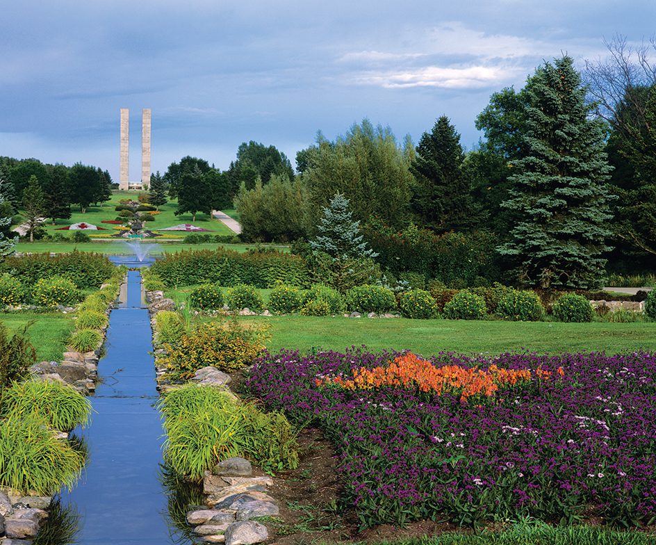
North Dakota was named for the tribes of Sioux people who lived in the territory for centuries. The Sioux called themselves Dakota or Lakota, meaning allies or friends. One of North Dakota’s nicknames is the Peace Garden State. This nickname honors the International Peace Garden, which lies on the state’s border with Manitoba, Canada. North Dakota is also called the Flickertail State because of the many flickertail ground squirrels that live in the central part of the state.
People
Population.
The 2020 United States census reported that North Dakota had 779,094 people. The population had increased by about 16 percent over the 2010 figure, 672,591. According to the 2020 census, North Dakota ranks 47th in population among the 50 states.
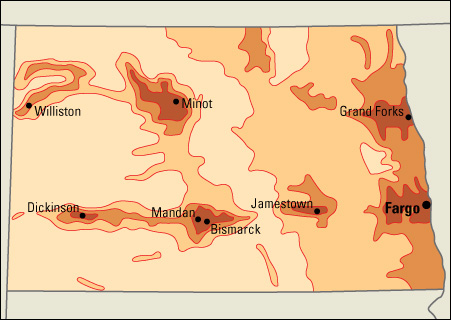
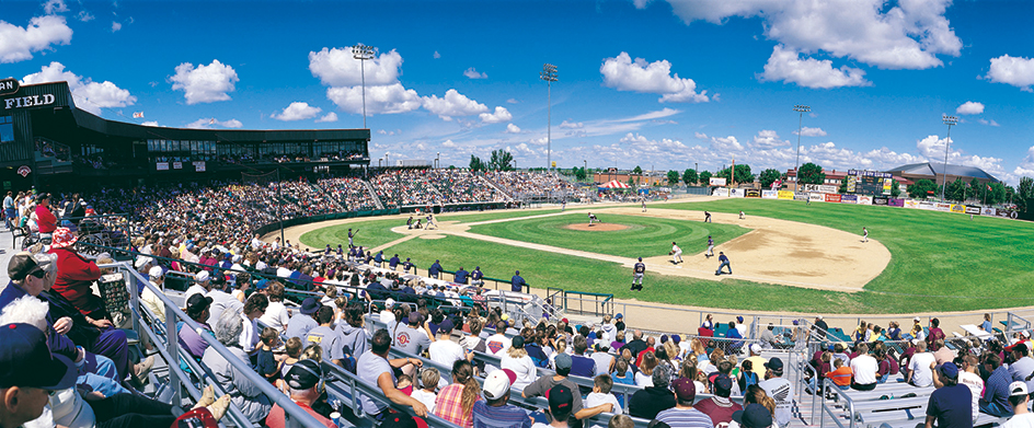
About 60 percent of the people of North Dakota live within one of the state’s four metropolitan areas (see Metropolitan area). The Bismarck and Minot metropolitan areas are entirely in North Dakota, and the Fargo and Grand Forks areas extend into Minnesota.
North Dakota has few large manufacturing industries to encourage the growth of big cities. Only five cities in the state have more than 30,000 people. They are, in order of size, Fargo; Bismarck, the state capital; Grand Forks; Minot; and West Fargo. North Dakota’s larger cities still serve their original function as centers of shipping, supply, and trade for the surrounding agricultural regions.
White settlers began to pour into North Dakota by the thousands in the 1870’s and 1880’s. They were attracted by reports of the large profits made in wheat farming and the availability of free government land.
Settlers came from states to the east and south and from Europe. The largest number from other nations came from Norway. They settled throughout the region. Germans from Russia settled in the south-central area, and Canadians moved into the northern Red River Valley. Today, the state’s largest population groups are made up of people of German and Norwegian descent.
Today, population trends present North Dakota with a number of challenges, particularly in the areas of health care and education. The state’s metropolitan areas have grown, but many rural counties have lost population. North Dakota also has a higher than average proportion of elderly people, and it has had problems keeping its young people from migrating to other states.
Schools.
In 1818, Roman Catholic missionaries set up the first school in the North Dakota region, at Pembina in the northeast. The missionaries taught Métis—people of mixed white and Indigenous (native) American ancestry—of the region and the children of Scottish and Irish settlers who came from Canada. The school closed in 1823, when Pembina was abandoned. In 1848, Father George Belcourt, a Catholic priest, reopened the school as a Catholic mission.
In the early days, teachers traveled from village to village, teaching groups of children in homes. As the settlements grew, the colonists built schools and hired teachers. Railroad companies, anxious to attract settlers, helped by supplying building materials.
In 1862, the first legislature of the Dakota Territory passed “An Act for the Regulation and Support of Common (public) Schools.” Between 1862 and statehood in 1889, the territory reorganized its educational system several times. The first state legislature created a fund for the support of all schools teaching the English language. Taxes now support the public schools in North Dakota.
The superintendent of public instruction administers the North Dakota public school system. He or she is elected to a four-year term. This official and a special staff make up the state Department of Public Instruction. Children must attend school from ages 7 through 15.
Libraries and museums.
Women’s clubs did much to organize and improve North Dakota’s early libraries. In 1897, a women’s club opened the state’s first public library at Grafton. Today, North Dakota has numerous public libraries around the state. North Dakota’s statewide library catalog—which includes academic, public, school, and special libraries—is available on the Internet. 
North Dakota State University in Fargo and the University of North Dakota in Grand Forks have the largest libraries in the state. Both house large collections on North Dakota’s history. The State Historical Society in Bismarck also operates a library with large collections relating to the state’s history.
The North Dakota Heritage Center and State Museum in Bismarck serves as the headquarters of the State Historical Society. The center features exhibits on the life of early Indigenous people of North Dakota, pioneer days, and natural history. The Pembina State Museum, in Pembina, focuses on regional history.
Visitor’s guide
North Dakota’s crisp autumn days attract thousands of hunters to streams and lakes where migrating waterfowl pause on their way south. Hunters also shoot ring-necked pheasants, grouse, ducks, geese, and other game birds. Vacationers catch walleye, catfish, trout, bass, northern pike, and other fishes. Favorite summer-resort areas include the Badlands region, with Theodore Roosevelt National Park; Devils Lake; Killdeer and Turtle Mountains; and Pembina Gorge.
During the summer, musicals are offered at Fort Totten, on a reservation for bands of the Indigenous Dakota people south of Devils Lake. Fort Totten has the nation’s only preserved “cavalry square.” Variety shows are offered in the Burning Hills Amphitheatre near Medora, a picturesque old West town that has been restored. The town is a popular tourist attraction.
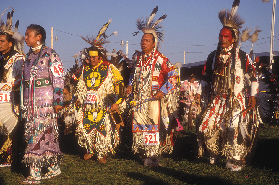
Summer visitors to North Dakota also enjoy colorful powwows conducted by Indigenous groups on various reservations in the state. Many tourists attend the exciting rodeos that are held in numerous communities throughout North Dakota.
Land and climate
Land regions.
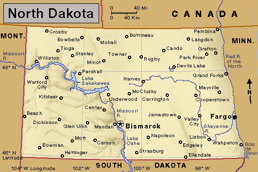
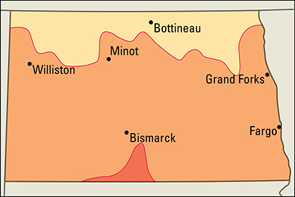
North Dakota has three major land regions: (1) the Red River Valley, (2) the Drift Prairie, and (3) the Great Plains. These regions rise in three broad steps from east to west.
The Red River Valley
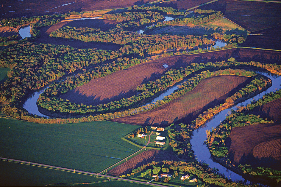
lies along the Minnesota border. This region is extremely flat. The valley is part of the bed of an ancient glacial lake, Lake Agassiz (see Lake Agassiz). The silt (soil particles) of the former lake bottom makes this valley one of the most fertile farming areas in the world. Livestock farms and fields of wheat and other crops cover most of the region. The valley is the most heavily populated part of North Dakota.
The Drift Prairie
rises on the western border of the Red River Valley. An escarpment (steep slope) separates the two regions. The escarpment is steepest in the north in the Pembina Hills (sometimes called the Pembina Mountains), which tower several hundred feet or meters above the Red River Valley. Generally, the Drift Prairie rises gradually toward the west and southwest. Near the region’s western border, the land is from 300 to 2,000 feet (91 to 610 meters) above the Red River Valley. The glaciers that crossed the Drift Prairie during the Pleistocene Epoch, which ended about 11,500 years ago, left rich deposits of earth materials called drift. The passage of glaciers also earned the area the name Glaciated Plains. Most of the region has rolling hills, and is cut by stream valleys. In the north, the Turtle Mountains rise about 550 feet (168 meters) above the surrounding plains. The Drift Prairie has many small lakes where thousands of wild ducks nest every year.
The Great Plains
cover the southwestern half of North Dakota. This region is part of the immense highland that extends from northern Canada to southern Texas (see Great Plains). North Dakotans call the region the Missouri Plateau. The region begins at the Couteau Slope. The slope rises 300 to 400 feet (91 to 120 meters) above the Drift Prairie just east of the Missouri River. It crosses the state from northwest to southeast. The area is hilly, and is used for grazing cattle. It is also rich in mineral deposits.
A narrow band of lowlands called the Missouri Breaks follows the sweep of the Missouri River. The area south and west of the river is called the Slope. There, rough valleys and buttes (steep hills that stand alone) break up the flatness of the plains. Many small streams wind around the hills as they flow toward the larger rivers.
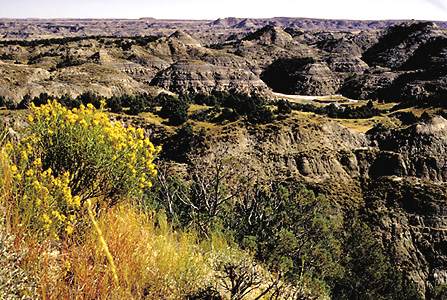
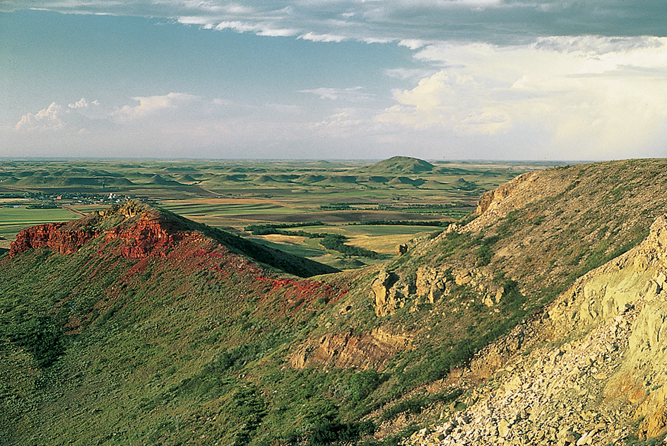
The Badlands of the Little Missouri River lie in the southwest. This strip of rough, beautiful land is 6 to 20 miles (10 to 32 kilometers) wide and about 190 miles (306 kilometers) long. The Badlands are a sandstone, shale, and clay valley in which wind and water have carved weird formations. Buttes, domes, pyramids, and cones—colored with bands of browns, reds, grays, and yellows—rise from the floor of the valley. One of the buttes, White Butte, is 3,506 feet (1,069 meters) above sea level, the highest point in North Dakota. In parts of the Badlands, the rocks contain lignite coal. Some coal beds have been burning for many years, turning the clay above them bright red and pink. This burned material, called scoria, is used for surfacing roads.
Rivers and lakes.
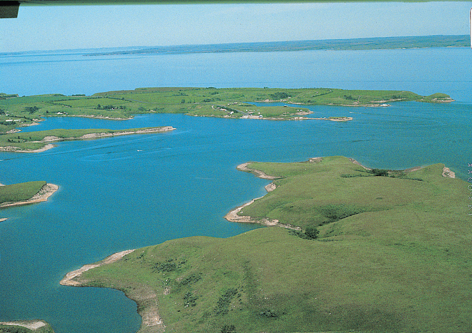
The Missouri River drains about 60 percent of North Dakota, and the Red River of the North drains most of the rest of North Dakota. The Bois de Sioux River forms part of the border between North Dakota and Minnesota. It begins in Lake Traverse and flows north to Wahpeton, where it joins the Otter Tail River to form the Red River of the North. The great Missouri winds through the western part of the state. Its branches include the Cannonball, Heart, Knife, and Little Missouri rivers. The James River begins in central North Dakota and flows southward into South Dakota. Garrison Dam, 12,000 feet (3,658 meters) long, spans the Missouri near Riverdale. The waters above the dam form Lake Sakakawea. This narrow lake is 178 miles (286 kilometers) long. The dam helps control floods, and provides water for irrigation and hydroelectric power.
The Red River of the North and its branches flow northward through eastern North Dakota and empty into Lake Winnipeg in Canada. The largest branches include the Goose, Park, Pembina, and Sheyenne rivers. The Souris River drains a flat, fertile area in the north-central section. It flows southward from Saskatchewan, and then circles back north into Manitoba.
Small lakes dot the Drift Prairie. Many lie in beds scooped out by the glaciers. Devils Lake, in the north-central part of the region, is the largest natural lake in North Dakota. The lake, which is prone to flooding, has a human-made outlet on the Sheyenne River. Its water, however, is salty and high in minerals that can negatively affect wildlife and soil fertility in the area.
Plant and animal life.
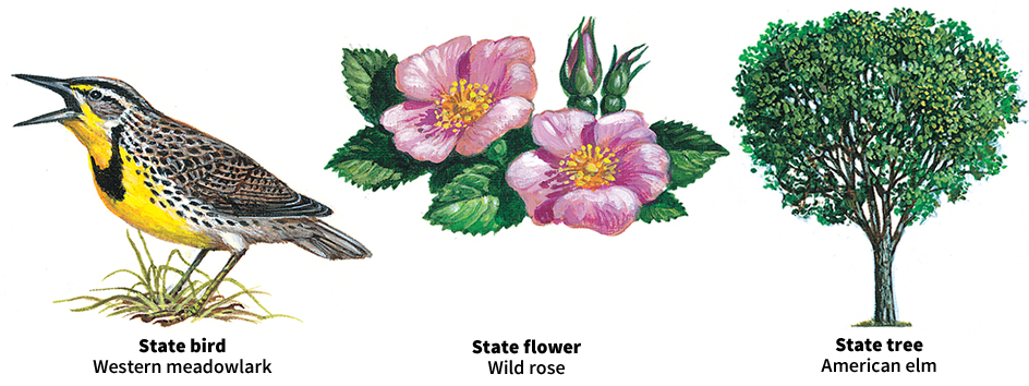
Forests cover only about 1 percent of North Dakota. Trees that grow in the east include the ash, aspen, basswood, boxelder, elm, oak, and poplar. The largest stands of timber are in the Turtle Mountains and Pembina Hills and in the hills surrounding Devils Lake. Ash, cottonwood, elm, and willow trees grow along the Missouri River and its branches.
In spring and summer, brilliantly colored flowers bloom. They include beardtongues, black-eyed Susans, gaillardias, pasqueflowers, prairie mallows, red lilies, and wild prairie roses. Chokecherries, highbush cranberries, and wild plums grow in many parts of North Dakota. Bluegrass thrives in the northeast, and buffalo and grama grasses thrive in the southwest.
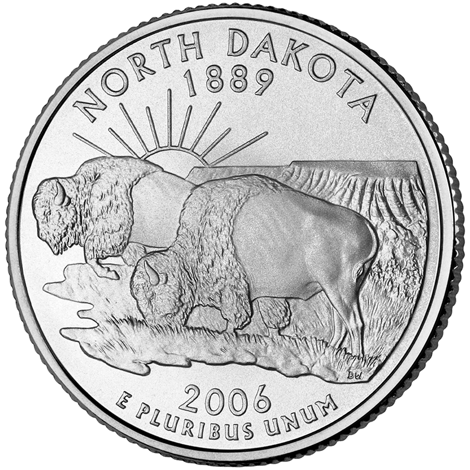
White-tailed deer graze throughout North Dakota. Mule deer and pronghorns range the western plains. In the Badlands, prairie dogs live in scattered colonies called dog towns. Fur-bearing animals found in the state include badgers, beavers, bobcats, coyotes, foxes, lynxes, minks, muskrats, rabbits, raccoons, skunks, and weasels. Flickertail ground squirrels are commonly seen.
Every summer, ducks migrate to North Dakota to breed in the lakes, marshes, and grainfields. More waterfowl hatch in North Dakota than in any other state. Game birds include grouse, Hungarian partridges, and pheasants. Fish in the state’s waters include bass, carp, catfish, perch, trout, and walleye pike.
Climate.
Summers in North Dakota are generally clear and pleasant. The sun shines more than 15 hours on each clear day from mid-May through July. Even the hottest days are seldom uncomfortable because the humidity is low. Winters can be severe. Winds that sweep across the plains make the cold bitter. 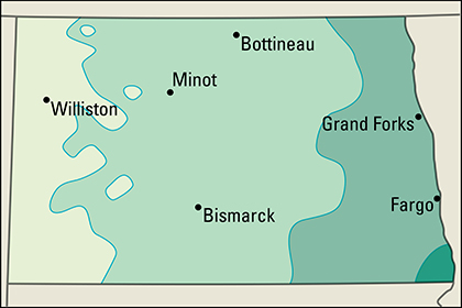
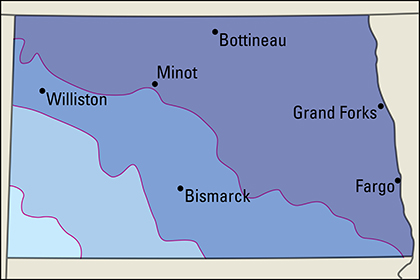
July temperatures average 67 °F (19 °C) in the northern part of North Dakota and 72 °F (22 °C) in the south. The state’s record high temperature was 121 °F (49 °C), at Steele on July 6, 1936. January temperatures average 4 °F (–16 °C) in the northeast part of the state and 17 °F (–8 °C) in the extreme southwest. The state’s lowest temperature, –60 °F (–51 °C), was recorded at Parshall on Feb. 15, 1936.
The southeast has the most precipitation—about 21 inches (53 centimeters) a year. Some western areas of the state receive only about 14 inches (36 centimeters). Most of the rain in North Dakota falls between April and September. Snowfall averages about 40 inches (102 centimeters) yearly.
Economy
The large output of such commodities as grain, beef cattle, and petroleum help make agriculture and mining more important in North Dakota than they are in most other states. However, services and manufacturing continue to grow in economic importance in the state.
Service industries account for over half of North Dakota’s gross domestic product—the total value of goods and services produced annually. The strong agricultural base greatly benefits the service industries. For example, trains carry wheat to wholesale distributors in the state’s large cities. Trains are part of the transportation and communication industry; and wholesale distributors are part of the trade industry. Agriculture also benefits North Dakota’s manufacturing industry. The state’s leading manufactured products include farm machinery and processed foods.
Natural resources.
North Dakota’s greatest natural resources are its outstandingly fertile soil and its enormous mineral deposits.
Soil
is North Dakota’s most valuable resource. It is the basis of one of the state’s major industries—agriculture. North Dakota’s richest soil lies in the Red River Valley. This fertile black soil is free of stones and contains much organic matter (decayed plant and animal remains). Loamy and sandy soils lie on the Drift Prairie west of the Red River Valley. Shale and limestone make up most of the soil of the Great Plains region.
Minerals.
North Dakota has large deposits of petroleum in the west. These deposits lie in the Williston Basin, which extends from North Dakota into northern South Dakota, eastern Montana, and southern Canada. Bowman County in the southwest and other oil-producing counties in the west have natural-gas wells.
North Dakota has large deposits of lignite, a low-grade coal. These deposits lie in the western part of the state. Sand and gravel are found throughout North Dakota. The southwest has great amounts of clay, ranging in quality from common brick to the finest pottery clay.
Service industries
provide most of the state’s employment and its gross domestic product. Service industries are concentrated in the Bismarck and Fargo areas.
Fargo is North Dakota’s center of banking and insurance. Bismarck, Fargo, Grand Forks, and Minot have large medical centers. Many hotels, restaurants, and retail trade establishments also operate in these areas. Such businesses benefit from the state’s tourism industry, which has grown in importance since the late 1900’s. The wholesale trade of farm machinery, food products, and mined products is also important in North Dakota.
Bismarck, the state capital, is the center of state government activities. Government services also include the operation of U.S. Air Force bases near Grand Forks and Minot and the operation of five reservations for Indigenous groups either partially or completely in the state. The U.S. government administers many wildlife refuges in North Dakota.
Transportation and communication are more important in North Dakota than in most other states because North Dakota’s small population is widely scattered. Farm products and mined products often must travel great distances to reach market. Trucks and railroads transport much of the state’s farm and coal output. Pipelines transport petroleum and natural gas.
Agriculture
accounts for a larger portion of the gross domestic product in North Dakota than in most other states. Cropland and pastures cover over 85 percent of North Dakota’s total land area.
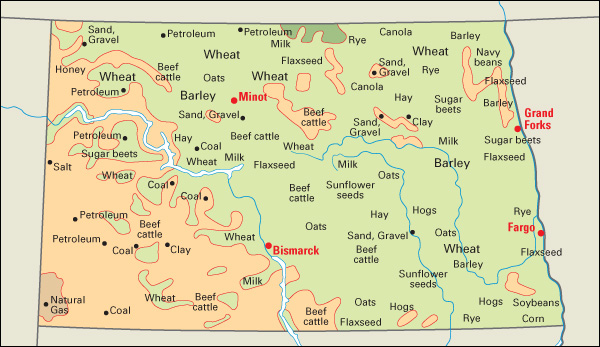
Wheat is one of North Dakota’s leading farm products, and the state is a leading producer of this crop. Wheat is grown throughout the state. Much of the wheat grown in northwestern North Dakota is durum wheat—a hard form of wheat used to make spaghetti and other kinds of pasta. North Dakota farmers grow over half of the nation’s durum wheat. 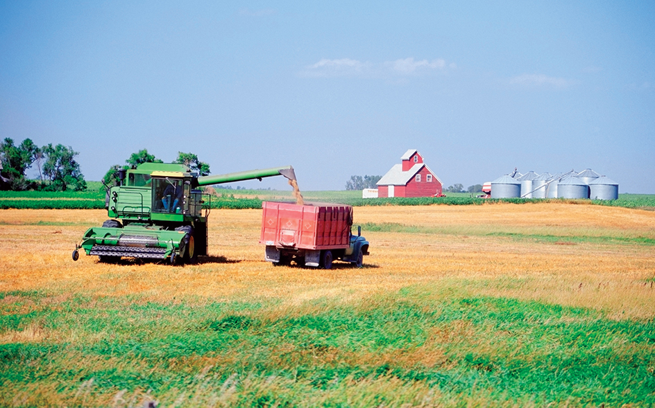
North Dakota is among the leading producers of barley and sunflower seeds. Barley is mainly in the eastern half of the state. Many sunflowers grow in the western half of the state. North Dakota farmers produce the majority of the nation’s flaxseed. The state also ranks among the leading producers of beans, canola seed, oats, and sugar beets. Corn is primarily grown in the southeastern part of the state. The central and western parts of North Dakota produce the most hay. Soybeans are grown in the eastern part of the state.
Livestock and livestock products account for much of North Dakota’s agricultural income. The raising of beef cattle is the leading type of livestock farming in the state. The central and western plains of North Dakota provide good pastureland and winter feed for beef cattle. Many dairy farms are in the south-central part of the state. North Dakota farmers raise hogs in the eastern part of the state, where corn is plentiful. North Dakota is among the leading states in honey production. 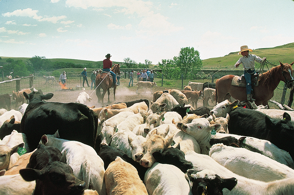
Manufacturing.
Food processing and machinery production are North Dakota’s leading manufacturing activities. Food processing benefits greatly from the state’s strong agricultural base. North Dakota’s major food products include bread and pasta, dairy products, meat, oils from oil seeds, and refined sugar. Most food-processing plants are in the eastern part of the state. The Bobcat Company, a leading manufacturer of construction machinery, is headquartered in West Fargo and has plants in Bismarck and Gwinner. Many cities manufacture farm machinery.
Other manufactured products include fabricated metal products, processed oil, transportation equipment, and wood products. Circuit boards are the most important electronic manufacture. Fabricated metal products are primarily made in eastern North Dakota. Dickinson and Mandan have large oil refineries. Airplane parts, motor vehicle parts, and other kinds of transportation equipment are also produced in the eastern part of the state. Factories in eastern North Dakota manufacture wood products.
Mining.
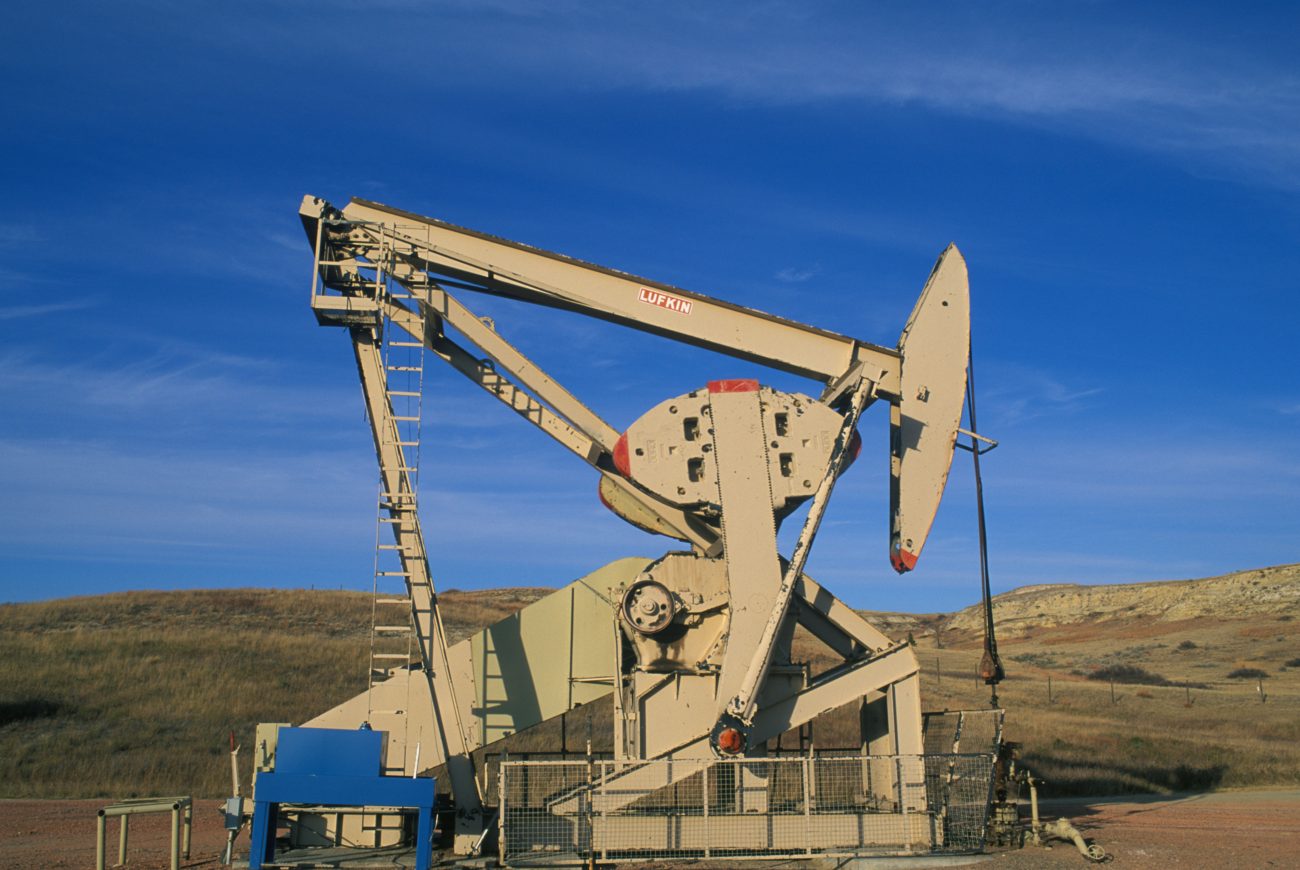
Petroleum is North Dakota’s leading mined product. Oil fields lie in the Williston Basin, which is in the western part of the state. Dunn, McKenzie, Mountrail, and Williams counties are the leading producers.
Coal and natural gas are also important mined products in North Dakota. Beds of lignite coal lie under almost all of the western part of the state. McLean, Mercer, and Oliver counties in west-central North Dakota provide most of the coal. The only major natural gas field lies in the southwest corner of the state. Natural gas is obtained as a by-product of oil and coal processing.
Among North Dakota’s other mined products, sand and gravel provide the most income. Several areas of the state produce sand and gravel. North Dakota’s other mined products include clays, crushed stone, and lime.
Electric power and utilities.
Steam plants that burn lignite coal generate over half of North Dakota’s electric power. Major coal-burning plants are at Beulah, Center, Stanton, and Underwood. Wind and water power is also important. Wind turbines generate electric power in many parts of the state. A hydroelectric project is at Garrison Dam in Mercer County.
Transportation.
North Dakota is a large state with a relatively small population. In addition, it is located far from the nation’s large population centers. Thus, the state’s transportation system is extremely important. The first railroad in North Dakota, the Northern Pacific, reached Fargo in 1872 and Bismarck in 1873. By 1881, the railroad line ran to the Montana border. Until a bridge was built, trains crossed the Missouri River at Bismarck on a ferry in summer and on tracks over the ice in winter. 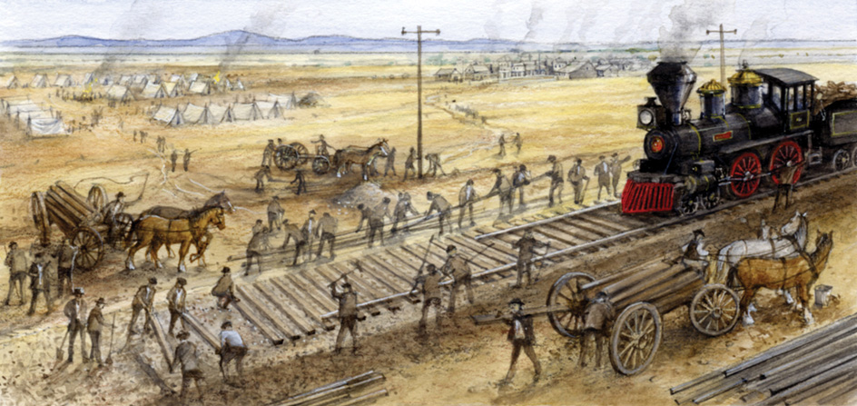
Also by 1881, the Great Northern Railway had established a route between Fargo and Grand Forks. The railway built a line westward through Minot and Williston to the Montana border by 1887. Today, rail lines provide freight service for North Dakota. In addition, passenger trains serve several North Dakota cities.
North Dakota has an extensive system of roads and highways. Interstate highways 94 and 29 are the state’s main trucking routes. Fargo is home to the state’s busiest airport.
Communication.
North Dakota’s first newspaper, the Frontier Scout, was published in Fort Union in 1864. In 1873, Colonel Clement A. Lounsberry founded the Bismarck Tribune, the oldest newspaper still published in the state. In 1876, Lounsberry wrote the first story of the Battle of the Little Bighorn. In this famous battle, Sioux and Cheyenne warriors killed Lieutenant Colonel George A. Custer and all the troops under his immediate command. To write the story, Lounsberry used notes found in the buckskin pouch of Mark Kellogg, a reporter who was killed in the battle. The largest daily newspapers in North Dakota include the Bismarck Tribune, The Fargo Forum, the Grand Forks Herald, and the Minot Daily News.
Government
Constitution.
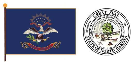
North Dakota is governed under its original constitution, adopted in 1889. An amendment (change) to the Constitution may be proposed in the state legislature. The proposed amendment must be approved by a majority of each house of the legislature. Then a majority of citizens voting on the proposal must approve it. The people may also sign a petition (formal request) proposing an amendment. After 4 percent of the people have signed the petition, the proposal is put on a statewide ballot. The proposal becomes law if a majority of voters approve it.
Executive.
The governor of North Dakota is elected to a four-year term. The governor may serve an unlimited number of terms.
The lieutenant governor, attorney general, secretary of state, treasurer, auditor, and superintendent of public instruction are also elected to four-year terms. All of these officials may serve an unlimited number of terms. The people of North Dakota also elect three public-service commissioners, an agriculture commissioner, an insurance commissioner, and a tax commissioner.
The governor, attorney general, and agriculture commissioner make up the state Industrial Commission. This commission regulates the North Dakota oil industry. It also oversees the operation of such state-owned enterprises as the Bank of North Dakota in Bismarck and the North Dakota Mill and Elevator in Grand Forks.
Legislature.
The state’s legislature, called the Legislative Assembly, has a 47-member Senate and a 94-member House of Representatives. Voters in each of the state’s 47 legislative districts elect one senator and two representatives. Both senators and representatives serve four-year terms. 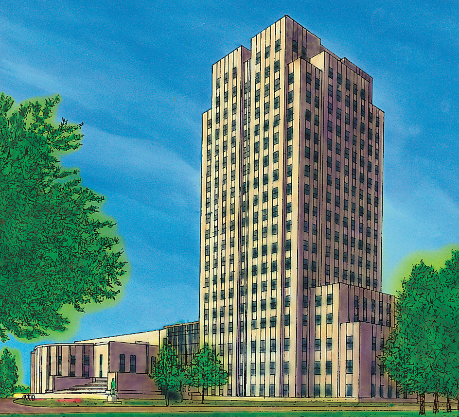
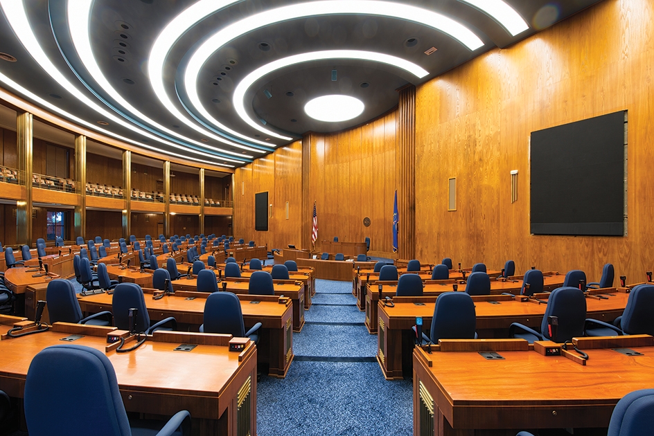
The Assembly holds its regular session in odd-numbered years, beginning usually on the first Tuesday after the third day in January. Regular sessions of the Assembly are limited to 80 legislative, or working, days. The governor may also call special sessions.
Courts
of North Dakota are headed by the state Supreme Court. The Supreme Court has five justices, all elected to 10-year terms. The people of North Dakota’s eight judicial districts elect district court judges to six-year terms. The Supreme Court and district court judges elect a chief justice of the Supreme Court to a five-year term.
Municipal courts handle violations of local ordinances. Communities of at least 5,000 people have municipal courts, and places of less than 5,000 people may decide whether to do so. Municipal court judges serve four-year terms. All North Dakota judges are elected on a “no party” ballot—the ballot has no political party labels.
Local government.
North Dakota has 53 counties. Each county is governed by a board of commissioners of three to five members elected to four-year terms. North Dakota has about 360 incorporated cities. The 1967 legislature classed all cities and towns in North Dakota as cities. The cities are organized under mayor-council, city-manager, or commission government. Five reservations for Indigenous American people are fully or partially located in the state.
Revenue.
Taxes bring in about half of the state government’s general revenue (income). Most of the remaining revenue comes from federal grants and charges for government services. The largest sources of North Dakota’s tax revenue are a general sales tax and a personal income tax. Other important tax revenue sources in the state include taxes on corporate profits, insurance premiums, motor fuels, motor vehicle licenses, and oil and coal production.
Politics.
Throughout most of its history, North Dakota has strongly favored the Republican Party. But the Democrats gained strength in the mid-1900’s. The Nonpartisan League, a political organization of farmers, was founded in North Dakota in 1915. During its early years, the league often controlled the Republican Party. In 1956, however, the league joined with the state Democratic Party. This new, strong political force helped to elect Democrats. For example, in 1958, North Dakotans elected the state’s first Democrat to the U.S. House of Representatives. This was Quentin N. Burdick. Burdick was elected to the U.S. Senate in 1960. He served as a U.S. senator until his death in 1992.
In 1889, the people elected a Republican as their first governor. Since that time, most of North Dakota’s governors have been Republicans. North Dakotans have voted for Republican candidates in most presidential elections.
History
Early days.
Seven groups of Indigenous American people lived in North Dakota when white explorers and fur traders first arrived there. The Mandan, Hidatsa, and Arikara tribes lived in permanent earthen lodges along the Missouri River. They were farmers but also hunted. The Ojibwe, or Chippewa, resided and hunted in the northeast. Nomadic groups of Assiniboine lived along what would become the United States-Canada border. The Nakota or Yankton Sioux lived in the James and Sheyenne river valleys, where they hunted. The largest and most powerful tribe, the Lakota or Teton Sioux, lived in the southwest and were hunters. Led by the great chiefs Sitting Bull and Gall, the Lakota fiercely resisted the United States Army.
Exploration and early settlement.
In 1682, René-Robert Cavelier, Sieur de La Salle, claimed for France all the land drained by the Mississippi River system. This territory included the southwestern half of present-day North Dakota, because the Missouri River—which drains this area—flows into the Mississippi. France also claimed the vast area south of Hudson Bay, which included the northeastern half of North Dakota. In 1713, France gave all this Hudson Bay territory to the United Kingdom.
North Dakota was first explored by a French Canadian, Pierre Gaultier de Varennes, Sieur de La Vérendrye. He set out from Canada in 1738 and reached the Mandan villages near present-day Bismarck. 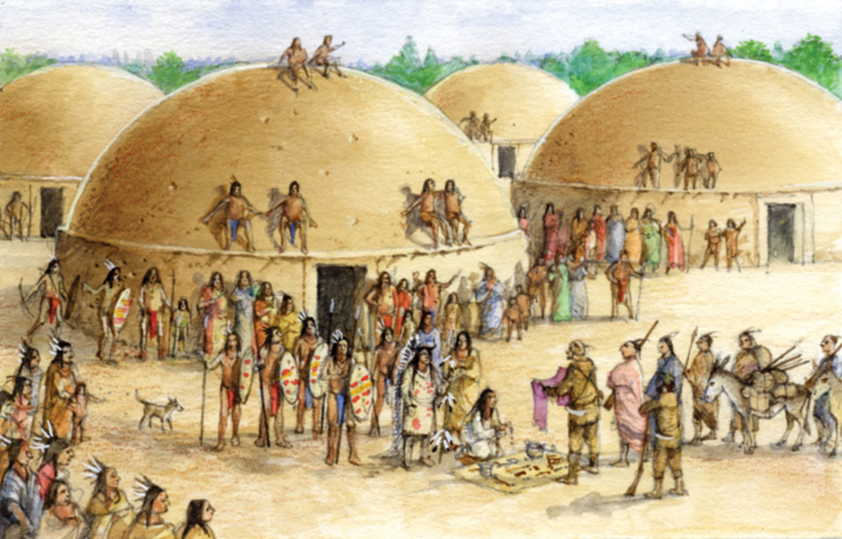
In 1762, France gave its land west of the Mississippi to Spain. Spain returned it to France in 1800. In 1803, the United States bought this region, then called Louisiana, from France (see Louisiana Purchase).
In 1804, President Thomas Jefferson sent Meriwether Lewis and William Clark to explore the Louisiana Territory and to blaze a trail to the Pacific Ocean. They reached central North Dakota in October 1804 and built Fort Mandan on the east bank of the Missouri River, across from present-day Stanton. The explorers stayed at Fort Mandan until April 1805. They passed through North Dakota again in 1806 on their return from the Pacific.
In 1812, Scottish and Irish families from Canada made a permanent settlement in North Dakota, in Pembina. In 1818, the United States obtained northeastern North Dakota by a treaty with the United Kingdom. All of present-day North Dakota then became U.S. territory. The 1818 treaty also set the United States-Canadian border at the 49th parallel. Some of the Pembina settlers moved north, to be sure they were on British territory. The rest left in 1823, when a survey confirmed that Pembina was actually located in the United States. A number of Métis (people of mixed white and Indigenous descent) remained in the region after the settlers left.
Territorial days.
Congress created the Dakota Territory in 1861. President Abraham Lincoln appointed William Jayne as governor. The territory included the present states of North and South Dakota and much of Montana and Wyoming. The first legislature met in Yankton (now in South Dakota) in 1862.
In 1863, the territory was opened for homesteading. Settlers were given free land if they lived on it and improved it. But the territory developed slowly. Transportation was poor, and the settlers feared Indigenous people. In 1862, Dakota, or Santee Sioux, warriors killed hundreds of settlers in an uprising in Minnesota. Some Dakota people then fled to the Dakota Territory. The U.S. government sent troops into the territory to punish the Sioux who had taken part in the Minnesota uprising. Several battles were fought as the soldiers pursued them across the territory.
The federal government signed several treaties with the tribes in the Dakota Territory, giving them land on reservations. But white people often broke the treaties, causing more uprisings. Peace came in 1881, when the great Lakota leader Sitting Bull voluntarily surrendered to U.S. troops. See Indian wars; Sitting Bull.
Large-scale farming began about 1875, when eastern corporations and some families established huge wheat farms. Most of the farms were in the Red River Valley and ranged from 3,000 to 65,000 acres (1,200 to 26,300 hectares). The farms earned such tremendous profits that they became known as bonanza farms. The farmers used machinery and orderly methods of planting, harvesting, and marketing. This was possible because only one crop—wheat—was raised. In time, other crops were introduced on the bonanza farms. As the bonanza farms developed, cattle companies from the southern plains moved into the Badlands. The future President Theodore Roosevelt was among those who helped open up the land along the Little Missouri River. Most of the bonanza farms were divided into smaller lots and sold to newcomers because low wheat prices in the 1890’s made them unprofitable.
Statehood.
During the 1870’s, the people began to ask Congress to divide the Dakota Territory into two parts. The population centers had developed in far corners of the territory—in the northeast and the southeast. North-south travel between these two centers was difficult because the railroads had laid their tracks in an east-west direction. The two groups of settlers had little in common and wanted their own governments. 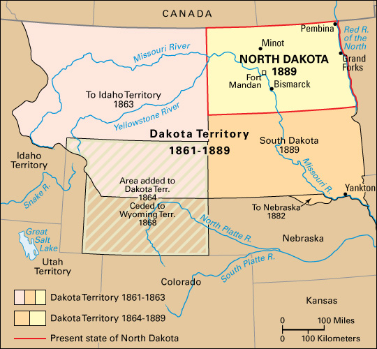
In February 1889, Congress established the present boundary between North Dakota and South Dakota. It also passed an enabling act, allowing the two regions to set up the machinery to become states (see Enabling Act). On Nov. 2, 1889, North Dakota became the 39th state, and South Dakota the 40th state. John Miller, a Republican, became North Dakota’s first governor.
The early 1900’s.
North Dakota’s population increased rapidly following statehood. The state had 190,983 people in 1890. In 1910, it had 577,056 people. Farming also grew rapidly. However, the farmers disliked having to deal with banks, grain companies, and railroad interests in Minnesota. In addition, they disliked the power that these out-of-state businesses held in North Dakota politics.
In 1915, the Nonpartisan League was founded in North Dakota. This organization supported the farmers and called for a state-owned grain elevator, flour mill, packing house, and cold-storage plant. It also wanted banks in farming areas that would grant loans at cost. Thousands of farmers joined the league.
In 1916, a league-supported candidate, Republican Lynn J. Frazier, was elected governor of North Dakota, and he was reelected in 1918 and 1920. During Frazier’s first two terms, the Nonpartisan League dominated the state legislature and supported the passage of a number of progressive laws. Rural schools received more funds. Taxes on farm improvements were lowered. An Industrial Commission was set up to manage businesses begun by the state. The commission consisted of the governor, the attorney general, and the commissioner of agriculture.
In 1919, the Bank of North Dakota was established in Bismarck. In 1922, the North Dakota Mill and Elevator in Grand Forks began operating. These state-owned businesses are still in existence, and the Industrial Commission still oversees their operations.
In the 1920 election, however, anti-league Republicans won control of the state’s House of Representatives. They called for an investigation of the Industrial Commission, and the investigation provided evidence of mismanagement. Also, an economic downturn that included falling prices for farm products, decreasing land values, and bank failures contributed to voter dissatisfaction with Frazier’s administration. In 1921, the state held a recall election. Frazier and the other two members of the Industrial Commission were removed from office. Frazier became the first governor of a U.S. state to be recalled. But he was elected to the U.S. Senate the following year and served as a senator from 1923 to 1940.
The Great Depression
struck the entire nation during the 1930’s. In addition, North Dakota suffered a severe drought. The state’s farm production plunged sharply, and its population also began to decline. The population had reached a peak of 680,845 in 1930.
During the 1930’s, the state and federal governments took many steps to help North Dakota farmers. In 1937, the State Water Conservation Commission was created. Since that time, state, federal, and private agencies have set up various projects to provide irrigation and prevent erosion of the soil. These agencies also encourage dry farming (farming methods that make the most of limited rain).
The mid-1900’s.
North Dakota’s economy recovered during World War II (1939-1945). Farmers broke all their production records in supplying much food for the armed forces. But in the late 1940’s, farm prices sagged as a result of farm surpluses throughout the country. The increased use of machines on farms left large numbers of farmworkers unemployed. Many found jobs in towns and cities, and North Dakota’s urban population increased. But thousands could not find jobs in the state and left in search of opportunities elsewhere.
Construction of the great Garrison Dam near Riverdale began in 1947. This dam provides flood control, hydroelectric power, and water for irrigation. The dam was completed in 1960. Two lignite-burning power plants near Stanton have also helped the economy.
Oil was discovered near Tioga in 1951 and became the state’s most valuable mineral. By 1970, oil wells were operating in 14 counties of western North Dakota.
In 1957, North Dakota established an Economic Development Commission that worked to attract industry to the state. Dozens of North Dakota communities also had their own development commissions. Largely as a result of these commissions, the state’s rate of industrial growth ranked among the highest in the country from 1958 to 1969. The U.S. Air Force helped the state’s economy during the 1960’s. It built bases near Grand Forks and Minot.
The Garrison Diversion Project was started in 1968. It included the construction of a canal system to bring water for irrigation from the Missouri River to large sections of North Dakota farmland. It also included plans to supply water to a number of cities and towns.
Late 1900’s.
During the early 1970’s, growing concerns about the environmental effects of the Garrison Diversion Project slowed construction. For example, the Canadian government protested because the project, which called for the transfer of U.S. water into Canada, could have introduced pollutants into Canadian waters. In 1986, the U.S. Congress passed an act that modified the project in response to some of these concerns about the environment.
During the 1970’s, North Dakota increased coal, oil, and natural gas production as a step toward broadening its economy. Farm production remained high in the 1980’s and 1990’s, but state leaders—fearing a possible crop failure or a disastrous drop in farm prices—continued to seek new industry for North Dakota. The number of nonagricultural jobs had been increasing, but not enough to keep up with the decline in farm jobs. The task of attracting new industry to the state remained difficult because North Dakota lies so far from the nation’s largest population centers.
Recent developments.
In 1993, after a prolonged wet period, Devils Lake in northeast North Dakota began to rise. The lake, which had no natural outlet, rose about 25 feet (8 meters) and flooded large areas of farmland and hundreds of homes. In response, the state developed a plan to construct an overflow outlet from the lake to the Sheyenne River. The Sheyenne empties into the Red River, which flows north into the Canadian province of Manitoba. Manitoba initially objected to the plan, however, in part because of the lake’s poor water quality. North Dakota began constructing the outlet in 2002. It opened in 2005, after North Dakota, Minnesota, and Manitoba reached an agreement providing for an improved filtration system for water flowing through the outlet.
In 1997, North Dakota suffered heavy snowfalls that produced damaging spring floods. Flooding of the Red River of the North forced almost 90 percent of the people of Grand Forks to evacuate. More than 70 percent of the buildings in Grand Forks experienced water damage. High river levels tested Fargo’s flood defenses again in 2009.
In 2000, Congress replaced the Garrison Diversion Project with a new act called the Dakota Water Resources Act. The new law authorized more than $600 million for water supply and recreation projects in the state.
In 2010, John Hoeven was elected to the U.S. Senate and became the first North Dakota governor to voluntarily resign. Two previous governors who resigned had been forced to do so, one because he was convicted of a crime and the other because he failed to meet the residency requirement. Lieutenant Governor Jack Dalrymple took Hoeven’s place as governor.
Due in part to an oil boom in the Williston area, North Dakota’s economy grew rapidly during the early 2000’s. Features of the strong economy included low unemployment and state budget surpluses. Rural areas of North Dakota continued to deal with an exodus of residents, especially young adults, to the state’s larger cities.
In 2016, the state became the focus of national attention after protesters held a large demonstration blocking the construction of a crude oil pipeline near the Standing Rock Sioux Reservation. Protesters argued that the Dakota Access Pipeline’s proposed route beneath Lake Oahe threatened the reservation’s water supplies. In December, the U.S. Army Corps of Engineers, taking direction from the administration of President Barack Obama, blocked construction of a disputed section of the pipeline. In January 2017, new President Donald J. Trump issued an executive order directing authorities to expedite (speed) approvals to construct and operate the pipeline. Workers completed the pipeline in the spring of 2017.
