Red River of the North is a major waterway of the United States and Canada. In Canada, it is called the Red River. But the full name is used in the United States to distinguish it from the Red River that rises in northern Texas. The Red River of the North flows north 545 miles (877 kilometers) and empties into Lake Winnipeg in the Canadian province of Manitoba. It forms part of Canada’s Saskatchewan-Nelson river system. It runs through a level plain that was formerly the bed of Lake Agassiz, a glacial lake (see Lake Agassiz ). The Red River Valley is one of the richest farming areas in the world.
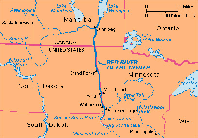
The Red River of the North is formed by the union of the Otter Tail and Bois de Sioux rivers at Wahpeton, North Dakota, opposite Breckenridge, Minnesota. The Red forms the boundary between North Dakota and Minnesota. The Otter Tail rises in west-central Minnesota, just west of the headwaters of the Mississippi River. The Bois de Sioux begins in Lake Traverse. The Red River flows northward into Lake Winnipeg.
Farmers in the Red River Valley raise wheat, oats, flax, barley, potatoes, sugar beets, sunflowers, hogs, and poultry. Cities along the Red River of the North include Fargo and Grand Forks, in North Dakota; Moorhead, Minnesota ; and Winnipeg, Manitoba. Boats carried large amounts of goods on the river between Winnipeg and Fargo until 1878, when a railway began to serve the valley. Winnipeg is now protected from flooding by the Red River Floodway, a channel that directs the flow of the river around the city.
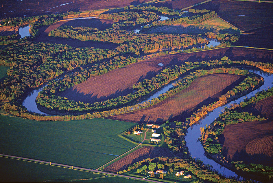
A combination of factors, including spring thawing and the area’s geology, have led to frequent spring floods on the river. In 1997, severe flooding caused major damage along the river, especially in the Grand Forks area.
