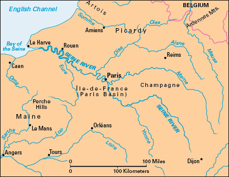
Seine, << sehn or sayn, >> River and its branches form the chief commercial waterway of France. It rises on the Langres Plateau 18 miles (29 kilometers) northwest of Dijon. From there, the Seine flows in a winding course about 480 miles (770 kilometers) northwest to its mouth in the English Channel near Le Havre. About 235 miles (378 kilometers) from its source, it becomes the broad river that flows through the heart of Paris.

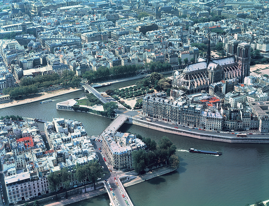
In Paris, the Seine moves under more than 30 bridges. On the Left Bank—the section of the city south of the Seine—are such landmarks as the Latin Quarter, the Sorbonne, the Luxembourg Gardens, and the Eiffel Tower. On the Right Bank, to the north, are the Louvre, the Champs Elysees, and the Trocadero. The Cathedral of Notre Dame stands on the Ile de la Cite (Island of the City) in the Seine.
Boats on the Seine carry sightseers through Paris. Boats also carry people and goods westward from Paris on the Seine past St.-Cloud, famous for its horse races, and past St.-Germain with its handsome palaces. The Seine then winds through the province of Normandy to Rouen and the seaport of Le Havre. Southeast of Paris, the river flows near Fontainebleau.

The Seine is important to commerce. It is joined by the Aube, Marne, Yonne, and Oise rivers. Canals connect the Seine with the Loire, Rhone, Rhine, Meuse, and Schelde rivers. Boats can sail about 340 miles (547 kilometers) of its length. The Seine has flooded its banks many times. It caused extensive damage to crops and property when it rose more than 24 feet (7 meters) during a flood in 1910.
