Surveying is the technique of measuring to determine the position of points, or of marking out points and boundaries. The points may be on, beneath, or even above the earth’s surface. Surveying is as old as civilization. Surveying began in Egypt. Every year, after the Nile River overflowed its banks and washed out farm boundaries, the Egyptians fixed new boundaries by surveying.

Types of surveys
Surveys can either be plane surveys or geodetic surveys. Plane surveys do not take into consideration the curved shape of the earth’s surface. They are used for all but the largest areas. Geodetic surveys make adjustments for the earth’s curvature. In the United States, the National Geodetic Survey, a unit of the federal government, establishes the location of geodetic control points. Plane surveys use these points as reference points.
The land survey
is the most familiar type of survey. It is used to find the areas of plots of ground and to fix boundaries. For example, a landowner who plans to build a fence might have a land survey done to determine the property lines.
The topographic survey
includes the measurement of elevations and depressions as well as horizontal distances for the purpose of making maps. The United States Geological Survey produces topographic maps of the United States.
The aerial survey
determines distances and sizes on the ground by means of photographs usually taken from airplanes. These photographs include a great amount of detail that a ground observer cannot easily obtain. Aerial surveying is frequently used for topographic mapping of large areas.
Other surveys
meet special needs. For example, construction, or engineering, surveys are made where buildings, bridges, roads, canals, and other structures are to be built. Underground surveys help engineers determine where to lay pipes or dig tunnels. Nautical, or hydrographic, surveys map out the bed of a river, lake, or ocean. By studying riverbeds, people can learn to control the flow of water and prevent water erosion.
Surveying tools
Modern tools.
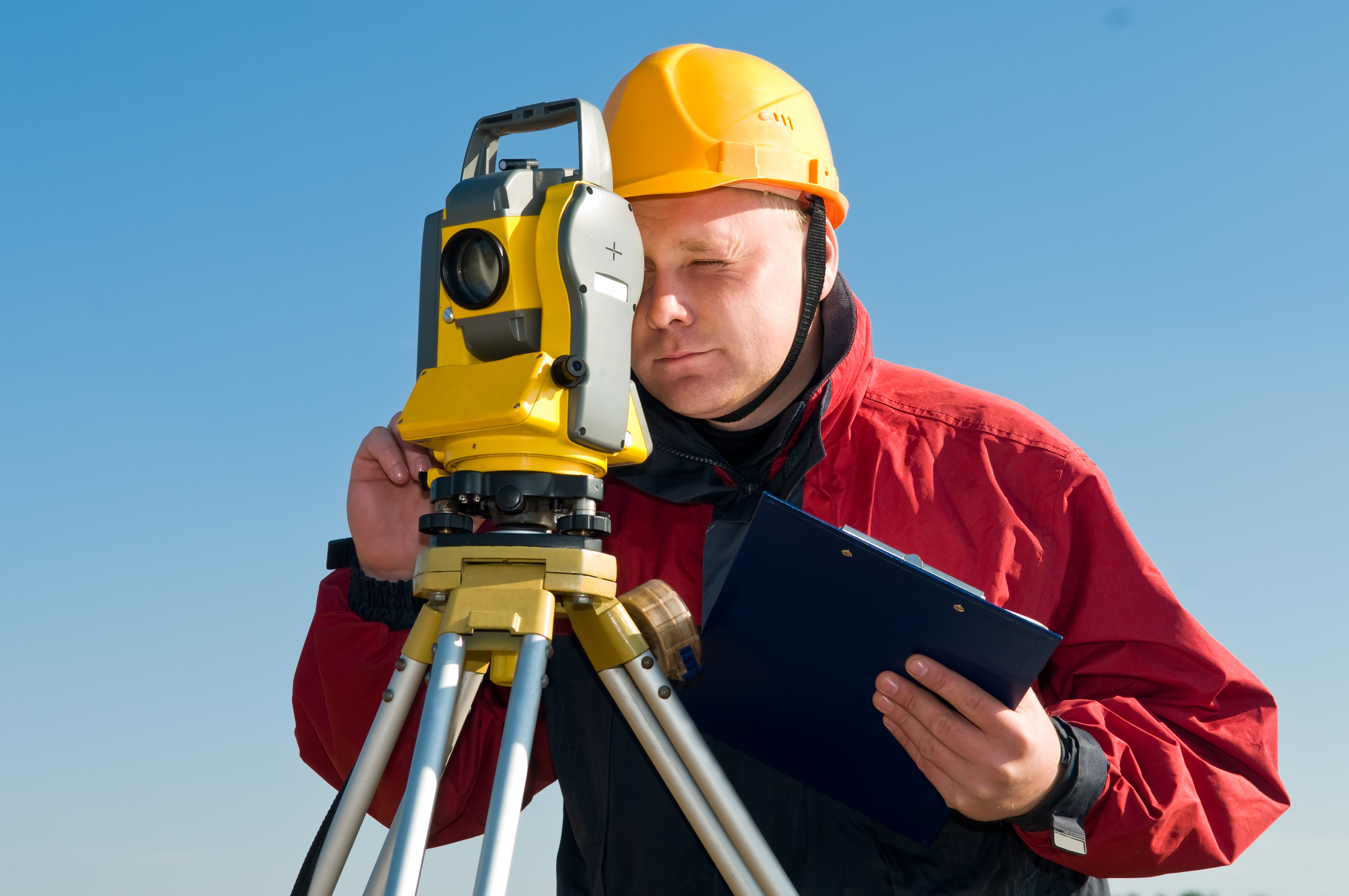
The most important surveying tool is the total station. This is a small telescope equipped with an electronic distance-measuring device and set up on a tripod (three-legged stand). The telescope pivots horizontally above a horizontal plate on which angles are marked. The telescope also pivots vertically beside a plate that has angle markings. Electronic devices measure the angles and display the results on a liquid crystal panel. Total stations also calculate the horizontal and vertical angles between points. In some total stations, the measurements are accurate to 1 second of arc. One second equals 1/3600 of 1 degree.
The total station uses a laser to measure distance. The measuring device that contains the laser is mounted on top of or inside the telescope. A laser beam sent out from this device reflects from a prism mounted on a pole held over the target point, then returns to the device. The device measures the time it takes for the signal to travel to and from the reflector, then uses the measurement to calculate the distance. The total station measures distances to the nearest millimeter (0.04 inch). The liquid crystal panel displays the distance in feet or meters. Some total stations also calculate differences in elevation.
Surveyors sometimes use a long steel tape to measure or set out distances. Most steel tapes are 100, 200, or 300 feet (30, 60, or 90 meters) long. Surveyors use an invar tape when making extremely precise measurements. Invar is a mixture of nickel, iron, and other metals. Temperature variations change the length of an invar tape much less than the length of a steel tape.
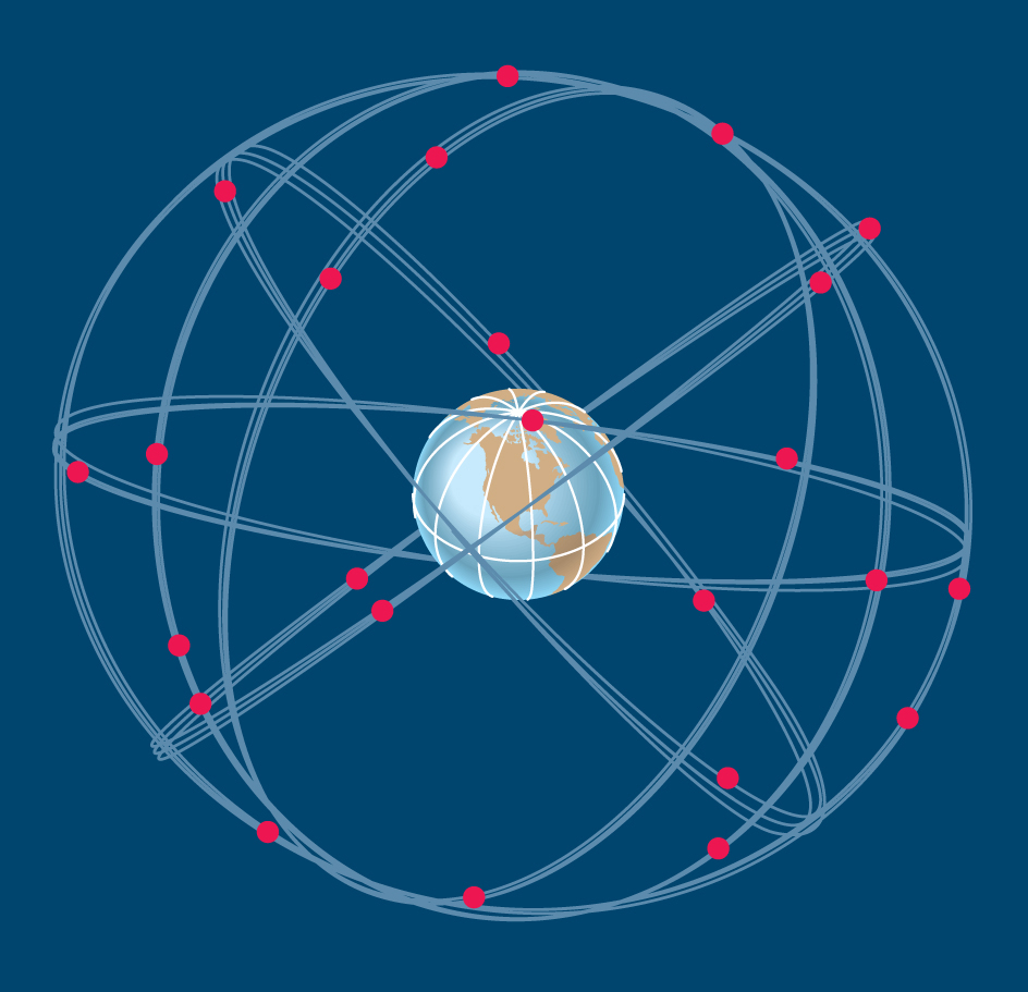
Surveyors also measure lines with the Global Positioning System, which consists of artificial satellites, radio receivers, computers, and other equipment. Satellites transmit signals that indicate their positions relative to the receivers. Computers use these signals to determine the lengths of lines.

The Global Positioning System has 24 satellites. A receiver must obtain signals from at least three of them to compute latitude and longitude. A receiver must obtain signals from at least four satellites to compute elevation as well.
Early tools.
Early surveyors in the United States measured distance with a Gunter’s chain, and direction with a surveyor’s compass. Today’s surveyors rarely use these instruments.
A Gunter’s chain is 66 feet (20 meters) long and has 100 links that each measure 7.92 inches (20.12 centimeters). The English mathematician Edmund Gunter invented this tool in the early 1600’s. The Gunter’s chain gave rise to a unit of distance for surveys, the chain, equal to 66 feet (20 meters). Surveyors no longer use this unit. However, the acre, which is based on the chain, is still in common use. Ten square chains, or 100,000 square links, make 1 acre (0.4 hectare).
A surveyor’s compass determines directions with a magnetic needle. The needle generally pivots on a jeweled bearing to keep friction at a minimum. The ends of the needle, sharpened to knifelike points, pass near ruled degree markings. Some surveyor’s compasses have a hinged lid with a mirror on the inside. The surveyor can read the reflection of the compass face while sighting a target.
Sighting instruments called transits and theodolites began to replace the surveyor’s compass in the early 1800’s. These instruments measure angles and determine directions. A theodolite provides more precise readings than does a transit and is sometimes used today. Both the theodolite and the transit, like the total station, have a telescope that pivots horizontally and vertically.
Surveyors and engineers formerly set a theodolite over a specific point using a string or line called a plumb line. A plumb line has a weight called a plumb bob attached to one end to keep the line hanging straight. Modern theodolites—and total stations—have a special telescope device called an optical plummet that provides more precise placement over a point.
Surveyors once made topographic surveys with a plane table and an alidade. These instruments are rarely used today. A plane table consists of a drawing board mounted on a tripod. The surveyor levels the drawing board and places a map on it. An alidade, which consists of a telescope fastened to a straightedge, is then set up on the map. The telescope and straightedge move parallel with one another. The surveyor sights an object through the telescope and uses the straightedge to draw a line on the map parallel to the line of sight. A mapmaker uses vertical angles measured with the alidade and distances read off the map to calculate elevations and depressions.
Careers in surveying
Modern surveying is closely connected with the various branches of engineering, especially civil engineering. Surveyors find work to do whenever there are roads, dams, bridges, and residential areas to be built. They determine the boundaries of private property and the boundaries of various political divisions. They also provide input for geographic information systems, computer databases that contain data on land features and boundaries.
Surveyors must have a thorough knowledge of algebra, basic calculus, geometry, and trigonometry. They must also know the laws that deal with surveys, property, and contracts. In addition, they must be able to use delicate instruments with precision and accuracy.
