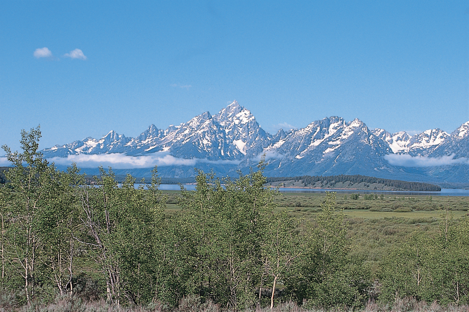
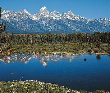
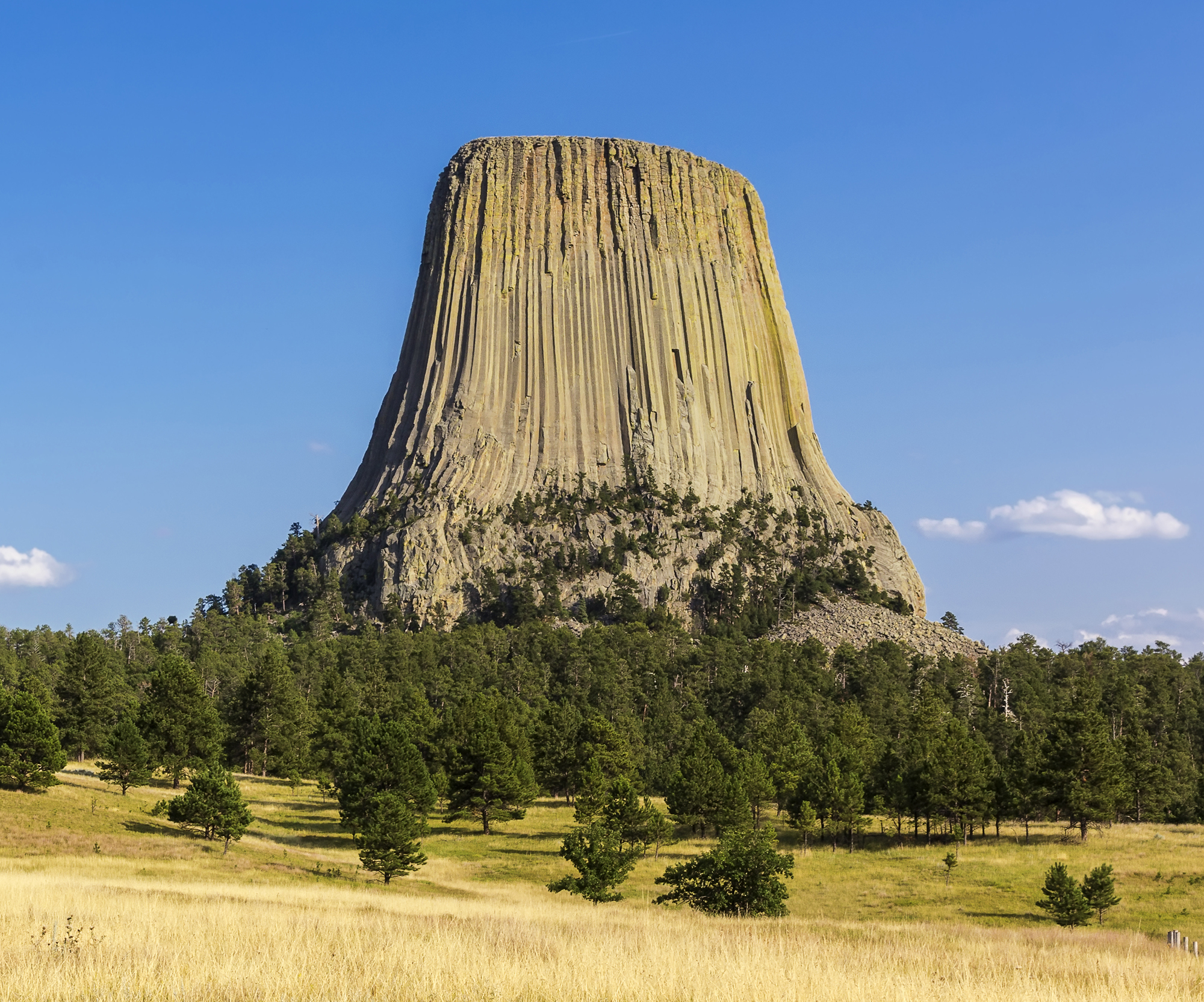
Wyoming is a state of the United States famous for the beauty of its mountains. The peaks of the Rocky Mountains tower over the landscape. They provide the setting for the world’s oldest national park—Yellowstone. Wyoming has the first national monument in the United States, Devils Tower. The state also has the first national forest, Shoshone. Another famous scenic wonder, Grand Teton National Park, includes some of the West’s most beautiful mountains. Millions of tourists visit Wyoming each year to enjoy the state’s scenery and historic places.
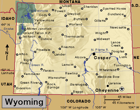
Not all of Wyoming is mountainous. Between the mountain ranges in the state lie broad, flat, treeless basins. Some of these basins are dotted with rugged, lonely towers of rock called buttes. In the eastern part of the state, a flat, dry plain stretches westward toward the mountains.
Much of Wyoming’s wealth comes from its land. About half of the state’s land is used for agriculture. Thousands of oil wells dot the prairies. Visitors to Wyoming may see a white-face steer cropping the grass near a pumping oil well. Petroleum, natural gas, coal, and other mineral products make Wyoming an important mining state.
Most of Wyoming’s workers are employed in service industries. Service industries include such activities as education, health care, real estate, and retail trade.
The federal government owns almost half the land in Wyoming. Since the state depends mostly on its land, this makes the government especially important in Wyoming’s economy. Federal agencies control grazing, logging, and mining activities on government land. The U.S. Air Force operates a nuclear missile base just outside Cheyenne, the state capital.
Wyoming has attracted travelers since the earliest days of white settlement. Three of the great pioneer trails cross Wyoming. The California, Mormon, and Oregon trails all took the covered wagons through South Pass. This pass became famous as the easiest way for the pioneers to cross the mountains.
Millions of people have crossed Wyoming. But relatively few have stayed. The state ranks last among the 50 states in population. Only Alaska has fewer people per square mile or square kilometer. Wyoming’s largest city, Cheyenne, has only about 65,000 people. Many of the state’s people live in small towns, which preserve some of Wyoming’s historic frontier character.
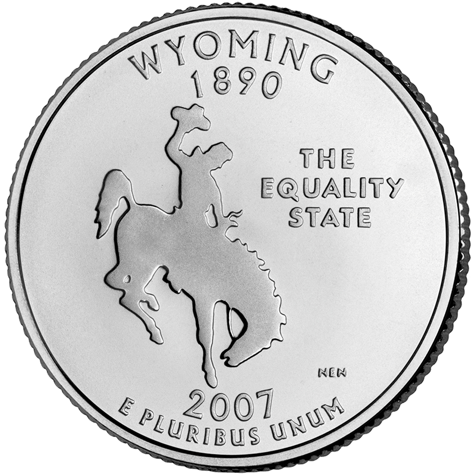
The word Wyoming comes from a word in the native Delaware language meaning upon the great plain. Wyoming is nicknamed the Equality State because Wyoming women gained equal rights before women in other states. Wyoming women were the first in the nation to vote, hold public office, and serve on juries. In 1870, Wyoming’s Esther H. Morris became the nation’s first woman justice of the peace. In 1924, Wyoming voters elected the first woman governor, Nellie Tayloe Ross.
People
Population.
The 2020 United States census reported that Wyoming had 576,851 people. The population had increased about 2 percent over the 2010 figure, 563,626. According to the 2020 census, Wyoming ranks 50th in population among the 50 states.
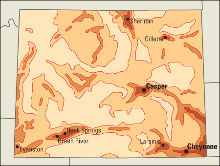
Most of Wyoming’s cities are small compared with those in other states. Cheyenne, the capital and largest city, has only about 65,000 people. Casper, the second largest city, has only about 60,000. The next three cities, in order of size, are Gillette, Laramie, and Rock Springs. Many of the state’s people live in cities and towns along a single major highway and rail line in southern Wyoming.
Only 30 percent of Wyoming’s people live in metropolitan areas. This percentage is the smallest among the 50 states. The state has only two metropolitan areas, the Casper metropolitan area and the Cheyenne metropolitan area (see Metropolitan area).
About 80 percent of the people in Wyoming are non-Hispanic whites. Nearly 10 percent of the state’s people are Hispanic Americans. Native Americans make up about 2 percent of Wyoming’s population.
Schools.
The first school in Wyoming was founded at Fort Laramie in 1852. William Vaux, the chaplain of the fort, started the school. In 1860, a school was built at Fort Bridger.
In 1869, the territorial legislature passed a law providing tax support for schools. There were district schools in many communities after 1870. The first high school in Wyoming opened in Cheyenne in 1875.
Wyoming’s public school system is supervised by an elected state superintendent of public instruction. The State Board of Education makes school policies. The governor, with the approval of the Senate, appoints board members to six-year terms.
Children are required to attend school either from age 7 through 15, or until they complete the tenth grade. For the number of students and teachers in Wyoming, see Education (table: U.S. students, teachers, and school expenditures).
The University of Wyoming is the state’s only university. It was founded in Laramie in 1886 and is state supported. Wyoming Catholic College, a Roman Catholic liberal arts college, is in Lander. Wyoming also has a number of community colleges. See Wyoming, University of.
Libraries and museums.
In 1886, Wyoming’s territorial legislature passed laws providing for a system of free county libraries. Today, each of Wyoming’s 23 counties has a public county library. The Wyoming Territorial Library was established in Cheyenne in 1871. It is now the Wyoming State Library. The chief libraries at the University of Wyoming include the Brinkerhoff Geology Library, the George William Hopper Law Library, and the William R. Coe Library.
Outstanding museum collections in the state include the exhibits at the Wyoming State Museum and the Cheyenne Frontier Days Old West Museum, both in Cheyenne. Historic museums include the Fort Caspar Museum in Casper; the Fort Bridger State Historic Site in Fort Bridger; and the Wyoming Pioneer Memorial Museum in Douglas. The National Museum of Wildlife Art in Jackson Hole specializes in paintings and sculptures of wild animals. The Centennial Complex at the University of Wyoming in Laramie includes the American Heritage Center, which has a collection on Western history. The university also has an art museum, which features items from many cultures and periods. The University of Wyoming Geological Museum has collections of fossils, minerals, and rocks; and exhibits about prehistoric times.
Other museums have exhibits about particular areas or points of interest. For example, the Fort Laramie National Historic Site has relics from the days of the pioneer wagon trains. The Jackson Hole Historical Society and Museum, in Jackson, has displays about the area’s early days. The National Park Service maintains exhibits at several visitor centers throughout Yellowstone National Park. It also operates the Colter Bay Visitor Center in Grand Teton National Park.
The Buffalo Bill Center of the West in Cody displays possessions of the famous hunter and showman Buffalo Bill Cody. Also in the center is the Cody Firearms Museum, which has a collection of thousands of firearms. Other museums in the center are the Draper Museum of Natural History; the Plains Indian Museum; and the Whitney Western Art Museum, which features paintings and sculpture by famous Western artists.
Visitor’s guide
Wyoming’s tourist attractions rank among the most spectacular in the nation. Each year, several million people visit the state. Yellowstone and Grand Teton national parks are the chief attractions. They have beautiful mountain scenery and many kinds of animals. Wilderness trails challenge the hiker’s skill. Visitors also come to Wyoming to hunt big game animals or to fish in the lakes and streams. Eatons’ Ranch, near Sheridan, is a famous dude ranch.
Wyoming’s most popular annual event is the Cheyenne Frontier Days celebration. It has been staged since 1897. The celebration is held for 10 days in July.
Land and climate
Land regions.
Wyoming lies where the Great Plains meet the Rocky Mountains. The Continental Divide winds through Wyoming from the northwest corner to the south-central edge of the state (see Continental Divide). Water on the east side of the divide flows to the Atlantic Ocean. Water on the west side goes into the Pacific Ocean. Wyoming has an average elevation of 6,700 feet (2,042 meters). It is higher than any other state except Colorado. Wyoming has three major land regions, the Great Plains, the Rocky Mountains, and the Intermontane Basins.
The Great Plains
cover the eastern part of the state. This region is part of the vast interior plain of North America that stretches from Canada to Mexico. In Wyoming, short-grass prairie covers much of the land. The grass provides good grazing for cattle and sheep. Cottonwoods and shrubs grow along the rivers. Little rain falls on the plains. But irrigation has turned portions of this region into valuable farmland.
A portion of the Black Hills lies in the northeastern part of the state. About a third of the Black Hills area is in Wyoming. The rest is in South Dakota.
The Rocky Mountains
sweep across Wyoming in huge ranges. Most of the ranges extend from north to south. In the north, the Bighorn Mountains form the front range of the mountain area. The Laramie Range stretches north from Colorado. Between these two front ranges lies a wide plateau. In the 1800’s, pioneers traveled westward on trails through this area. The Absaroka Range rises along the east side of Yellowstone National Park. The rugged Wind River Range to the south includes nine peaks that tower above 13,000 feet (3,960 meters). Among them is the highest mountain in Wyoming, 13,804-foot (4,207-meter) Gannett Peak. The Granite Mountains extend eastward from near the southern tip of the Wind River Range. The Gros Ventre, Salt River, Snake River, Teton, and Wyoming ranges are near the western border. The scenic Teton Mountains rise nearly straight up for more than 1 mile (1.6 kilometers) from the Jackson Hole Valley. Other major mountain ranges include the Medicine Bow and Sierra Madre in southern Wyoming.
There is one special link between the flat land of the plains and the heights of the mountains. It is in southeastern Wyoming. There a narrow finger of land rises gently from the plains to a point high in the Laramie Mountains. Along the slope are major rail and highway routes that bring a traveler from the plains to the mountains. This slope, sometimes called the Gangplank, is only about 100 yards (91 meters) wide.
The Intermontane Basins
include several flat areas between Wyoming’s mountain ranges. The word intermontane means between mountains. The major basins include the Bighorn and Powder River basins in the north, and the Wind River Basin in central Wyoming. The Green River, Great Divide, and Washakie basins are in southwestern Wyoming.
The basins are mostly treeless areas. They get less rainfall than the mountains. Short grasses and other low plants make most of the basins good for grazing sheep and cattle. The Great Divide Basin is an exception. It lies along the Continental Divide. But it has no drainage of water either to the Atlantic or the Pacific. The divide splits and runs around the 3,000 square miles (7,800 square kilometers) of this basin. The little rain that falls there soaks quickly into the dry ground. A part of the Great Divide Basin and the area to the south of it are sometimes called the Red Desert. Pronghorns and wild horses feed on the thinly scattered plant growth and sagebrush. Sometimes sheep are grazed there.
Rivers and lakes.
Parts of three great river systems start in the mountains of Wyoming. These three river systems are the Missouri, the Colorado, and the Columbia.
The tributaries of the Missouri flow both north and east. The Yellowstone, Clarks Fork, Bighorn, Tongue, and Powder rivers flow north. The Cheyenne, Niobrara, and North Platte rivers flow east.
The Green River forms the major source of the Colorado River. It , rises in the Wind River Mountains and flows south across western Wyoming into Utah. The Snake River is part of the Columbia River system. This river starts in the Absaroka mountains in Yellowstone Park. It flows into Grand Teton National Park, then turns west into Idaho. The Snake leaves Wyoming through a magnificent canyon that cuts through three mountain ranges. The Snake River is joined by the Salt River. Eventually, it reaches the Columbia. Bear River starts in the southwestern corner of Wyoming. It flows into the Great Salt Lake of Utah.
Many of the rivers have cut beautiful canyons. Some plunge over steep cliffs in spectacular waterfalls. Notable canyons include the Laramie River Canyon, the Grand Canyons of the Snake and the Yellowstone, the Platte River Canyon, the Shoshone River Canyon, and the Wind River Canyon. The most dramatic waterfalls are the Upper and Lower falls of the Yellowstone River.
Wyoming has hundreds of clear, cold mountain lakes. Among the largest are Fremont, Jackson, Shoshone, and Yellowstone lakes. The major artificially created lakes include Big Sandy, Boysen, Buffalo Bill, Glendo, Guernsey, Keyhole, Pathfinder, and Seminoe reservoirs. Two dams outside the state formed major lakes in Wyoming. Yellowtail Dam in Montana created a large lake in the northeastern part of Wyoming. Flaming Gorge Dam in Utah backs up water of the Green River 30 miles (48 kilometers) inside Wyoming.
Plant and animal life.
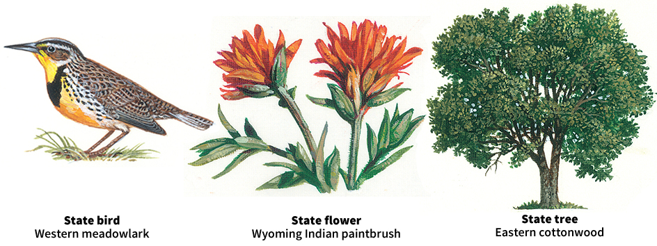
Forests cover nearly a sixth of Wyoming’s land. The chief commercial trees are Douglas-fir, Engelmann spruce, lodgepole pine, and ponderosa pine. Other trees include subalpine fir, aspen, and cottonwood.
The state has approximately 50 million acres (20 million hectares) of grazing lands. Bluegrass, wheat grass, tufted fescues, and redtops grow on much of the land. Cactus and sagebrush are found in the drier regions. Areas of Wyoming with poor soil produce greasewood brush, which is used as firewood. Mountain wildflowers found in the state include the arnica, buttercup, evening star, five-finger, flax, forget-me-not, goldenrod, saxifrage, sour dock, and windflower.
Wyoming’s most common larger animals include black bears, elk, mule deer, and pronghorns. Moose are common in the northwestern forests. Mountain sheep live on the rocky peaks of the higher mountains. Grizzly bears, lynxes, and mountain lions are sometimes seen. Some of the smaller fur-bearing animals include beavers, martens, raccoons, and otters. United States government biologists reintroduced the gray wolf to Yellowstone National Park in 1995. The reintroduction came about 70 years after the area’s last wolves were killed to protect livestock.
Pronghorns are common in the open areas of the basins. Other animals in the basin areas include badgers, cottontail and jack rabbits, coyotes, foxes, skunks, and wild cats. Game birds include ducks, geese, grouse, pheasants, sage hens, and wild turkeys. Wyoming also is the home of bald and golden eagles. The bald eagle builds its nest in tall pines near mountain streams or lakes. The golden eagle usually chooses a home farther from water.
Climate.
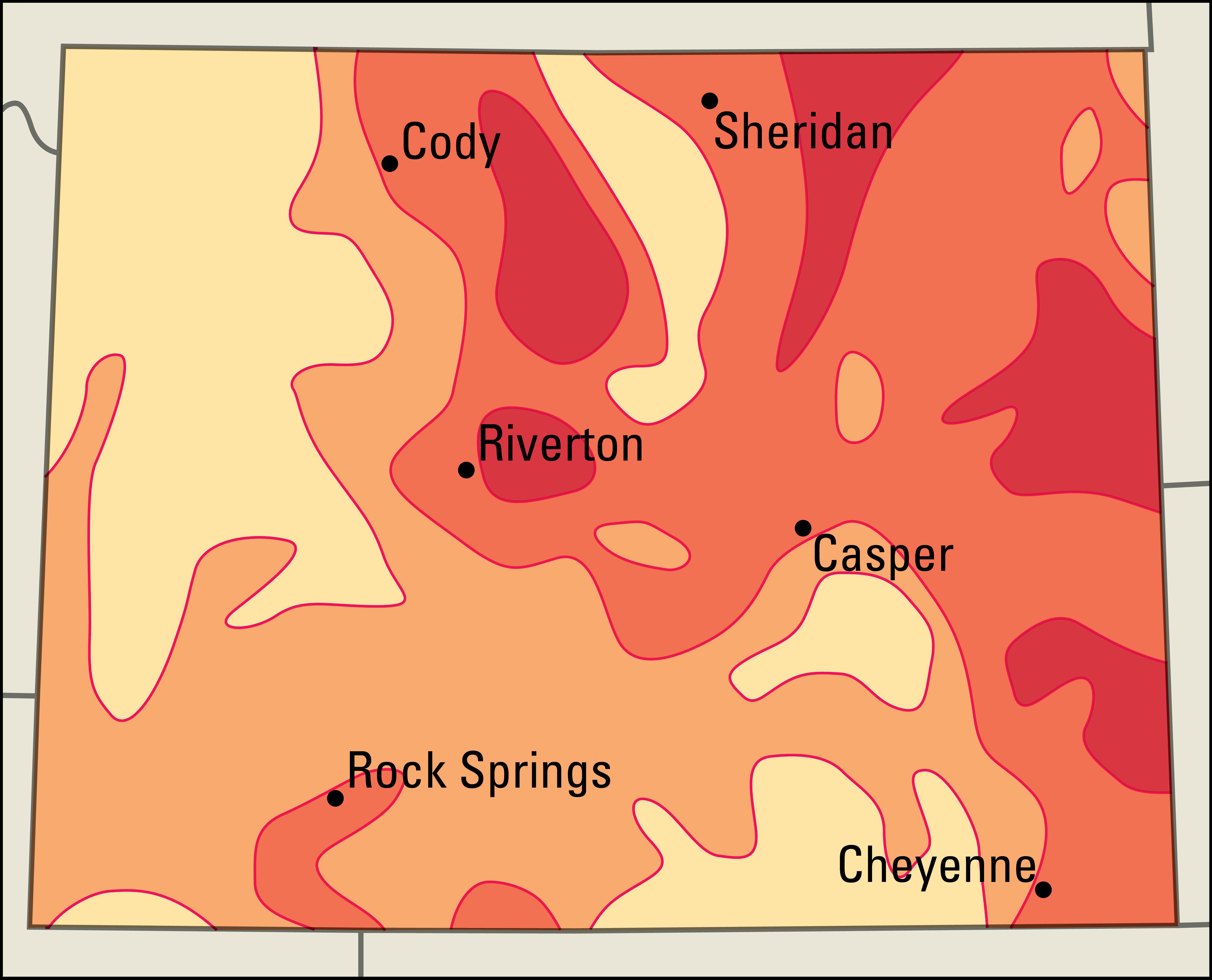
Wyoming has a dry, sunny climate. Winters are cold. Summers are warm. The dry air makes the climate more comfortable than the temperatures would indicate. Differences in altitude create large differences in temperature in various parts of the state. At Casper, in central Wyoming, the average January temperature is 25 °F (–4 °C). The average July temperature is 71 °F (22 °C). Near Yellowstone Lake, at a higher elevation, the January average is 13 °F (–11 °C). The July average is 57 °F (14 °C). In Wyoming’s high mountains, freezing temperatures can occur any time of the year.
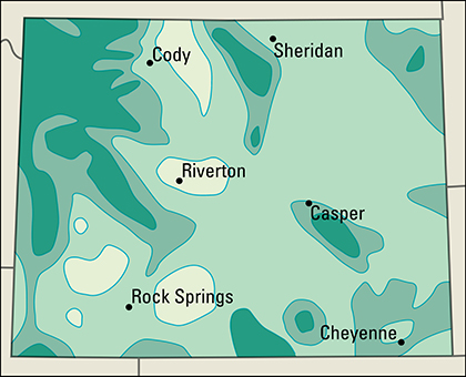
Wyoming’s highest recorded temperature, 115 °F (46 °C), occurred at Basin on Aug. 8, 1983, and at Diversion Dam, near Riverton, on July 15, 1988. Moran, near Elk, had the lowest temperature, –66 °F (–54 °C), on Feb. 9, 1933.
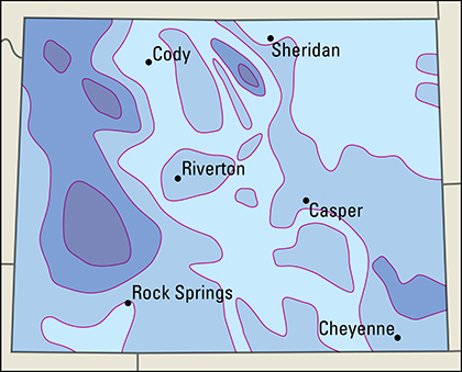
Much of Wyoming averages less than 15 inches (38 centimeters) of precipitation a year. The Yellowstone Park area averages about 50 inches (130 centimeters) of rain. Snowfall varies from 15 to 20 inches (38 to 51 centimeters) in the Bighorn Basin to about 260 inches (660 centimeters) in the northwestern mountains.
On the Great Plains, and in some open areas of southern Wyoming, the wind blows during the afternoons. It usually blows from the west or southwest. If dry snow is on the ground, the wind may whip it into a ground blizzard. An individual cannot see ahead in the swirling snow, even though the sky may be blue and the sun shining.
Economy
Service industries make up the largest part of Wyoming’s gross domestic product. Gross domestic product is the total value of all goods and services produced in the state in a year. However, Wyoming’s economy depends heavily on its land and the resources beneath it. Coal, natural gas, petroleum, and other mined products account for much of the gross domestic product. Wyoming’s land also provides grazing for cattle and sheep. Most of the state’s manufacturing plants process the products of Wyoming’s mines, farms, and forests. Millions of tourists come to the state to enjoy its scenic beauty.
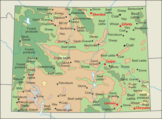
Government plays an important part in Wyoming’s economy. The federal government owns about half of the state’s land. The government controls grazing, logging, and mining rights in this huge area. The area includes national forests and parks, Native American reservation lands, and other public lands.
Natural resources.
Wyoming’s most important natural resources are mineral deposits, grazing land, scenery, wildlife, and water.
Soil.
Wyoming does not have large areas of fertile soil. Much of the state has sandy soil formed from sandstone rock that lies beneath the surface. The most fertile soils of Wyoming are those deposited in the major river valleys by floodwaters. Wind-blown dirt called loess also has formed fertile soil in some areas.
Minerals.
Wyoming’s reserves of bentonite clay, coal, petroleum, soda ash, and uranium rank among the nation’s largest. The mineral reserves are found mostly in the basin areas of the state.
Many of the petroleum and natural-gas reserves occur in an underground region called the Overthrust Belt. This region lies beneath southwestern Wyoming and parts of neighboring states. About 40 percent of Wyoming has coal under it. Most of Wyoming’s coal is found in the northeastern part of the state. Trona is found in southwestern Wyoming. It contains soda ash, a chemical used in the making of glass, paper, soap, and water softeners. The state’s largest uranium deposits are in the Powder River, Shirley, and Wind River basins. Bentonite is a clay used in oil drilling and in the manufacture of chemical products. The largest reserves of bentonite are in the northeast and north-central sections.
Forests
cover about a sixth of Wyoming’s land. Most of them grow in mountain areas. Millions of acres are set aside in parks and other reserves. The chief commercial trees are Engelmann spruce, lodgepole pine, and ponderosa pine. Other trees in Wyoming include subalpine fir, aspen, cottonwood, and Douglas-fir.
Service industries
account for over half of Wyoming’s gross domestic product. Most of the service industries are concentrated in Casper and Cheyenne, the state’s largest cities.
Government is one of Wyoming’s most important service industry groups. Cheyenne, the state capital, is the center of government activities. F. E. Warren Air Force Base lies just outside Cheyenne. The base is the control center for a network of long-range nuclear missiles. The federal government also operates Yellowstone National Park and Grand Teton National Park. Both parks provide hundreds of seasonal jobs.
Other service industries also contribute to Wyoming’s economy. Tourism growth in Wyoming has benefited the state’s hotels, dude ranches, restaurants, and ski resorts. Many hotels, restaurants, and retail trade establishments operate in the Casper and Cheyenne areas and near Grand Teton and Yellowstone national parks. Casper and Cheyenne are the leading financial centers. Pipelines carry Wyoming’s large oil and gas output to processing and distribution sites. Railroad companies transport other mined products and farm goods.
Mining
provides a larger portion of the gross domestic product in Wyoming than in any other state. Coal, natural gas, and petroleum are the state’s leading mined products. Bentonite and soda ash are the leading nonfuel products.
Wyoming is the leading state in coal production. It ranks among the leaders in petroleum and natural gas. Changes in the prices of any of these products have a large impact on Wyoming’s overall economy.
Almost all of Wyoming’s coal is obtained from surface mines. These mines provide a variety of coal called subbituminous. Campbell County provides most of Wyoming’s coal. Converse , Lincoln, and Sweetwater counties produce most of the remaining coal.
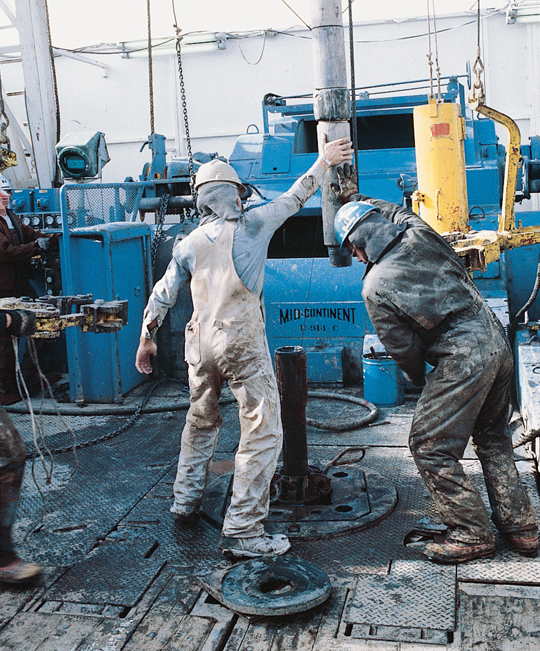
Natural gas is found in many parts of the state. Southwestern Wyoming is the leading area for conventional natural gas production. The Powder River Basin, in northeastern Wyoming, is the state’s main source of coal bed methane. Coal bed methane is a kind of natural gas extracted from coal deposits. Petroleum deposits also lie in several parts of Wyoming. The leading oil-producing counties include Campbell, Converse, Laramie, Park, Sublette, and Sweetwater.
Among the state’s nonfuel mined products, trona, which contains soda ash, is most valuable. All the trona comes from Sweetwater County. The state is the leading producer of bentonite clay. Other mined products include crushed stone, helium, and sand and gravel.
Manufacturing
in Wyoming makes up a smaller percentage of the gross domestic product than in most other states. The production of chemicals and petroleum products are two of Wyoming’s most important manufacturing activities. Wyoming leads the nation in the production of soda ash, the state’s chief chemical product. It is manufactured from local deposits of trona. Cheyenne and Sinclair have large oil refineries. Refineries also operate near Casper, Evanston, and Newcastle.
Other products made in Wyoming include fabricated metal products, food products, machinery, nonmetallic mineral products, and wood products. Machine shop products are the leading fabricated metal products. The state’s most important food products include refined sugar and soft drinks. Much of the machinery is made for mining oil and gas fields. Cement and ready-mix concrete are the state’s main nonmetallic mineral products. Sawmills operate throughout the state.
Agriculture.
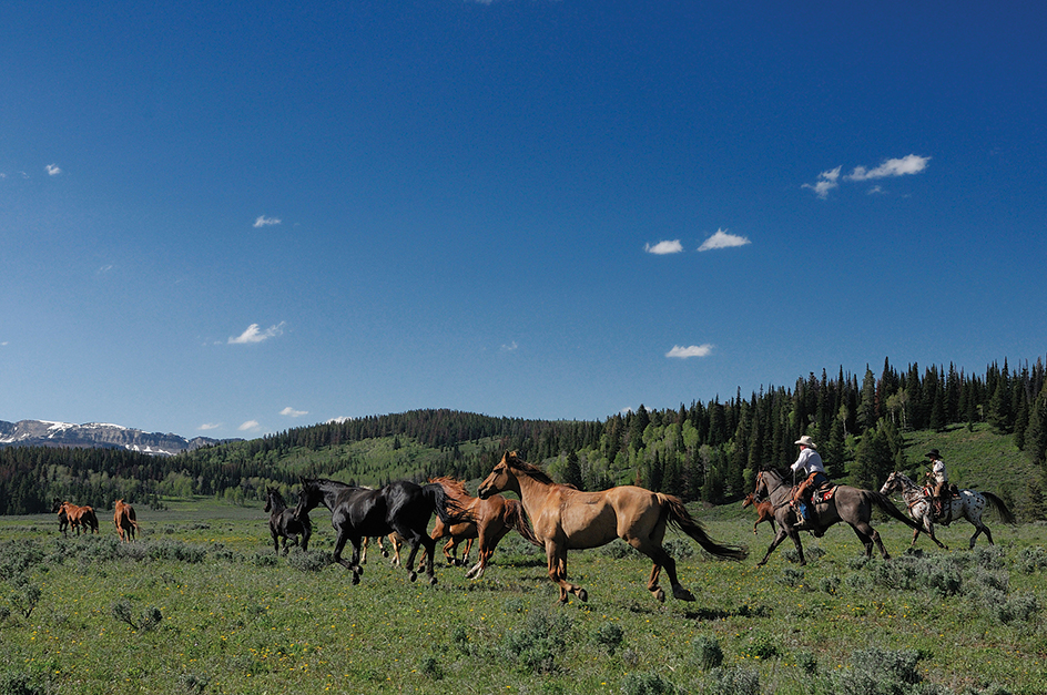
Farms and ranches cover about half of Wyoming. Livestock and livestock products account for most of Wyoming’s total agricultural income. Cattle ranching is by far the most important agricultural activity. Many beef cattle are raised in eastern Wyoming. Other livestock products include hogs, milk, sheep, and wool. Wyoming is among the leading states in the production of sheep and wool.
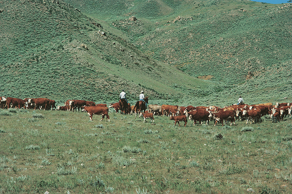
Crops provide much of Wyoming’s farm income. The state’s most valuable field crops are grown on irrigated land. Hay and sugar beets are among the state’s leading crops. Hay is grown throughout Wyoming. Sugar beets are primarily grown in the northwest portion of the state. Wyoming’s other crops include barley, beans, corn, and wheat. Farmers on the Great Plains use dryland farming. Dryland farming methods make the most of the limited rainfall (see Dryland farming).
Electric power and utilities.
Coal-burning power plants generate most of the state’s electric power. Major plants operate near Gillette, Glenrock, Kemmerer, Rock Springs, and Wheatland. Hydroelectric plants, wind turbines, and plants that burn natural gas provide much of the rest of Wyoming’s power.
Transportation.
Wyoming has an extensive system of roads and highways. Casper and Jackson have the state’s busiest airports. Rail lines provide Wyoming with freight service to other states.
Communication.
The first newspaper in Wyoming was the Daily Telegraph. It was published at Fort Bridger in 1863. Today, Wyoming’s newspapers with the largest circulations include the Casper Star-Tribune and the Wyoming Tribune-Eagle of Cheyenne.
Government
Constitution.
Wyoming is still governed under its original Constitution. The document was adopted in 1889. Amendments (changes) to the Constitution must be approved by a majority of the people voting in that particular election. Amendments may be proposed by a two-thirds vote of both houses of the Legislature, or by a constitutional convention. Such a convention must be approved by two-thirds of the members of each house of the Legislature. It must also be approved by a majority of the voters.
Executive.
The people of Wyoming elect the governor to a four-year term. The governor may serve no more than two terms during a 16-year period. Much of the governor’s power lies in the right to appoint other important state officials. For example, the governor appoints the attorney general and the heads of numerous state agencies.
The voters elect four other high state officials to four-year terms. These are the secretary of state, auditor, treasurer, and superintendent of public instruction. They have no term limits.
Wyoming does not have a lieutenant governor. If the governor dies or resigns, the secretary of state serves as governor until a new governor is elected.
Legislature
consists of a 30-member Senate and a 60-member House of Representatives. Senators are elected to four-year terms and representatives to two-year terms.
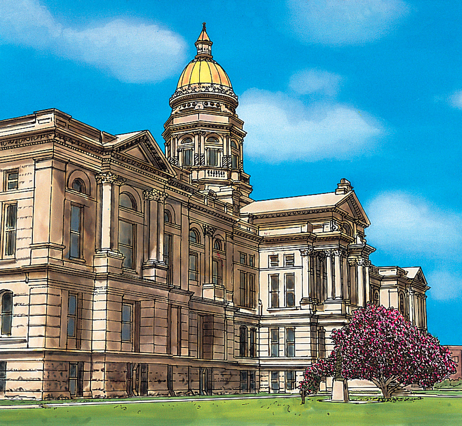
The two houses of the Legislature meet each year. General sessions of the Legislature begin on the second Tuesday of January in odd-numbered years. Budget sessions begin on the third Monday in February in even-numbered years. The Legislature may not meet more than 40 legislative days in any year or more than 60 days in each two-year period. The governor may call special legislative sessions.
Courts.
The highest court in Wyoming is the Supreme Court. It has five justices who are appointed to serve eight-year terms. These justices elect one of their number to serve as the chief justice. The Supreme Court usually hears only appeals from the lower courts.
Wyoming’s counties are organized into nine judicial districts. Most major civil and criminal trials in the state are held in district courts. Circuit courts handle minor criminal and civil cases. Each of Wyoming’s county seats hosts a district and a circuit court. The governor appoints all judges of the Supreme Court and district and circuit courts. District judges serve six-year terms. Circuit judges serve four-year terms. The governor chooses them from nominees of the Wyoming Judicial Nominating Commission. At the next election, voters then choose whether to have the judges stay in office. Other courts in Wyoming include municipal courts, which operate in all incorporated cities and towns. Municipal courts handle violations of local ordinances.
Local government.
Wyoming has 23 counties. Each county is governed by a board of three or five commissioners. The commissioners are elected to four-year terms. Most Wyoming cities have a mayor-council government. By state law, a community must have at least 4,000 residents to be classified as a city. Wyoming’s cities are called first class cities. Communities with populations between 150 and 4,000 are called towns.
Revenue.
Taxes account for less than half of the state government’s general revenue (income). Most of the rest comes from federal grants and other U.S. government programs. Leading sources of tax revenue include a tax on mineral production and a sales tax. Wyoming collects no state personal or corporate income taxes.
Politics.
In state and local elections, Republicans have won a majority of the contests since 1890. In presidential elections, Wyoming has voted for Republican candidates about three times as often as for Democratic candidates.
History
Early days.
Native Americans lived in the Wyoming area at least 11,000 years ago. Later, huge herds of bison roamed the prairies. This rich source of meat attracted people in great numbers. Before the arrival of white explorers, many groups of native peoples lived in the area. These groups included the Arapaho, Bannock, Blackfeet, Cheyenne, Crow, Shoshone, Sioux, and Ute peoples.
Exploration.
French trappers may have entered the Wyoming region in the mid-1700’s. However, exploration of the area did not begin until after 1800. The United States bought most of the region from France in 1803, as part of the Louisiana Purchase. After that, American trappers came to the area to find furs.
In 1807, a trapper named John Colter became the first white man to travel across the Yellowstone area. Five years later, in 1812, Robert Stuart and a party of fur traders from Oregon discovered an easy way across the mountains through South Pass. Stuart’s party crossed the pass from west to east. Most of the later travelers—bound for Oregon, California, or Utah—crossed from east to west.
During the 1820’s and 1830’s, the fur trade became more organized. Fur trader William Ashley established an annual rendezvous (gathering) of trappers. At these gatherings, Ashley’s fur company traded ammunition, food, and other supplies for furs. The first rendezvous took place in 1825 on the Green River, near the present Wyoming-Utah border. The yearly rendezvous became important to the trappers not only for trading, but also for exchange of news and as a social event.
A trapping and trading party of more than a hundred men came to the Wyoming area in 1832. The group was led by Captain Benjamin L. E. de Bonneville. Bonneville’s party discovered an oil spring in 1833 in the Wind River Basin. In 1834, traders William Sublette and Robert Campbell established Fort William in what is now eastern Wyoming. This fort, later called Fort Laramie, was the area’s first permanent trading post. In 1843, the famous Western scout and trapper Jim Bridger—with his partner, Louis Vasquez—founded Fort Bridger in southwestern Wyoming.
After trading posts were established, the rendezvous became less important. The last of these colorful gatherings was held in 1840.
In 1842 and 1843, Lieutenant John C. Frémont explored the Wind River Mountains. His party was guided by the famous scout Kit Carson. After Frémont made his report, Congress voted in 1846 to establish forts along the Oregon Trail to protect settlers moving west. In 1849, the United States Army acquired Fort Laramie for $4,000.
At various times, parts of what is now Wyoming were in the territories of Louisiana, Missouri, Nebraska, Oregon, Washington, Idaho, Utah, and Dakota. Part of southern Wyoming, south of the 42nd parallel, belonged to Spain from the 1500’s to the 1800’s. A large portion of southern Wyoming was once part of Mexico. This land became part of the United States after the Mexican War (1846-1848). A small section of Carbon County was part of Texas from 1845 to 1850.
The great trails.
By the mid-1840’s, pioneers were streaming west through the Wyoming area on three famous trails. These were the California Trail, the Mormon Trail to Utah, and the Oregon Trail to the Pacific Northwest. All three trails took South Pass through the mountains. Beyond South Pass, the Oregon Trail turned northwest. The Mormon and California trails went southwest. Settlers moving across southern Wyoming used the Overland (Cherokee) Trail. That route joined other trails at Fort Bridger. Thousands of settlers traveled through Wyoming. But few of them stayed.
The Shoshone, living in western Wyoming, often assisted early travelers. Other indigenous (native) groups, however, viewed the passage of whites across their lands as trespassing.
Settler conflicts.
By 1849, the Sioux and other indigenous peoples were alarmed at the number of settlers crossing their land. The U.S. government made a pact with Plains peoples called the Fort Laramie Treaty of 1851. It guaranteed safe passage for trail travelers and promised that land would not be taken from the native people. However, the U.S. government changed its policy in 1854. That year, a group of Sioux killed 21 U.S. soldiers during an incident known as the “Grattan fight.” In retaliation, General William Harney attacked a Sioux village at Ash Hollow in Nebraska, killing many people. Battles between the Army and Native Americans continued through the decade.
Gold was discovered in Montana in the 1860’s. Miners started crossing Sioux lands in northern Wyoming on the Bozeman Trail. The Sioux retaliated by killing some of the miners. The Army then built a series of forts to protect the miners and other travelers. The Army built Fort Phil Kearny in 1866. Throughout the fort’s construction, the Sioux and their allies, the Arapaho and the Cheyenne, resisted the Army’s occupation. On Dec. 21, 1866, Captain William Fetterman violated his commander’s orders to stay close to the fort and not to attack a group of Lakota Sioux over a nearby hill. Fetterman chose to attack. As a result, he and his entire command of 80 soldiers were killed. The incident became known as the “Fetterman fight.”
The following year, the U.S. government and the Sioux made a treaty. The Army gave up the forts along the trail. In exchange, the Sioux agreed not to interfere with construction of the transcontinental railroad across southern Wyoming.
In northeastern Wyoming, a troubled peace between the Army and indigenous groups lasted until 1875. Then gold was discovered in the Black Hills of neighboring South Dakota. After several battles, the government banished the Sioux and other Plains peoples to reservations.
In western Wyoming, the Shoshone had friendly relations with the whites. Their leader, Chief Washakie, believed his tribe could benefit if peace was maintained. The Shoshone settled on what later was called the Wind River Reservation. In 1877, the U.S. government sent the Northern Arapaho tribe to live temporarily on the Shoshone reservation while their own reservation was being prepared in Colorado. But the Northern Arapahoes never received their reservation. They continue to share the Wind River Reservation with the Shoshone.
Indigenous people of the Wyoming area used naturally occurring oil for medicines and horse liniments. They found the oil floating on pools near natural water springs. White pioneers used the oil to grease wagon axles and tan animal hides.
Territorial progress.
In 1867, a gold strike attracted many prospectors to the Wind River Mountains. Several boom towns, including South Pass City, sprang up. But prospectors left when production proved disappointing.
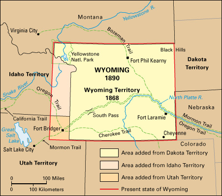
The Union Pacific Railroad entered Wyoming in 1867. Thousands of workers came into the area. A number of new towns sprang up along the line. They included Cheyenne, Laramie, Rawlins, Rock Springs, Green River, and Evanston. Because of the population growth, the U.S. Congress created the Territory of Wyoming from what had been part of the Dakota Territory. President Ulysses S. Grant appointed Ohio-born John A. Campbell as the first governor of the territory.
The first territorial legislature passed a bill that granted women the right to vote, hold office, and serve on juries. On Dec. 10, 1869, Campbell signed it into law. Wyoming was the first government in the United States to give women equal rights. In 1870, Esther H. Morris became the nation’s first woman judge when she was appointed justice of the peace in South Pass City.
Wyoming’s tourism industry got its start during the territorial days. In 1872, Congress created Yellowstone National Park, the nation’s first national park. The park immediately attracted tourists.
Coal mines opened across southern Wyoming along the tracks of the Union Pacific Railroad. Many of the coal miners were immigrants from Europe and Asia. In September 1885, a conflict between European and Chinese miners resulted in the Rock Springs massacre. More than 20 Chinese were killed. The Army was sent in to stop the violence.
The first oil well in Wyoming was drilled near Lander in 1883. Later in the decade, oil was found in central and southern Wyoming. An oil discovery in 1888 near the newly established railroad town of Casper caused a boom. By the end of the 1800’s, Casper was known as the “Oil Capital of the Rockies.”
Ranching also was important to the territorial economy. Large herds grazed on Wyoming’s open range. The open range was land owned by the federal government that ranchers could use for free. By the early 1880’s, huge open-range cattle companies operated in Wyoming. Profits were high in the early years. But cattle prices began to fall by 1885, as the range became more crowded with cattle. In addition, a drought in the summer of 1886 caused a severe shortage of grass for grazing. In 1886 and 1887, a series of blizzards killed thousands of cattle. Many of the big cattle companies went bankrupt. Homesteading by small ranchers and the use of barbed wire fencing on the federal lands finally brought an end to the open-range cattle industry.
Two cattle barons who stayed in business were Francis E. Warren and Joseph M. Carey. Warren was appointed the last territorial governor of Wyoming. Carey was the last territorial delegate to Congress. After Wyoming became the 44th U.S. state on July 10, 1890, Warren was elected the state’s first governor. Carey became the state’s first U.S. senator. Warren later resigned the governorship to accept the state’s other Senate seat.
Both Warren and Carey were members of the powerful Wyoming Stock Growers Association (WSGA). The association was a private organization made up of prominent ranch owners. This Cheyenne-based group controlled the cattle business in the state.
The Johnson County War.
In 1891, a group of smaller ranchers attempted to form an association of their own. They wanted to establish rules for cattle raising outside the control of the WSGA. In response, a group of WSGA members planned what was called an invasion of Johnson County. The goal of the invasion was to stop the smaller ranchers’ association. The invaders also wanted to end the rustling of WSGA-owned cattle in that county. In April 1892, an armed group of more than 60 men quietly left Cheyenne for Johnson County.
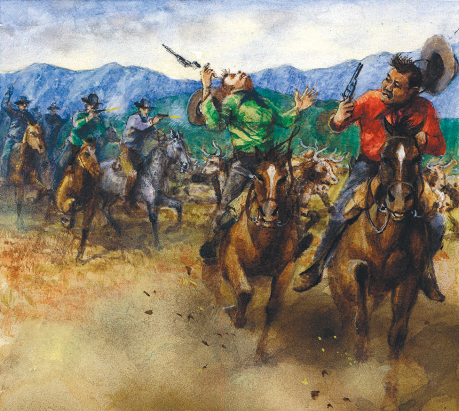
The invading force entered the county and killed two men south of Buffalo. In the meantime, residents of Johnson County learned about the invaders’ plans. Armed county residents intercepted the group. The U.S. Army intervened and arrested the invaders before a battle could begin. However, the men were released before they could be tried. The so-called Johnson County War diminished the political power of the cattlemen. However, WSGA members continued to exercise power in state politics well into the 1900’s.
Sheep raisers and cattlemen often fought over grazing lands in the early 1900’s. Later, as markets for wool and sheep prospered, cattlemen often raised sheep along with their cattle. Wyoming led the nation in wool production for many years.
The early 1900’s.
As gasoline-powered automobiles became more common in the early 1900’s, Wyoming’s oil industry continued to grow. Major oil fields were discovered north of Casper, near Lusk in eastern Wyoming, and in the Bighorn Basin.
The U.S. government set aside one Wyoming oil field as a reserve for the Navy in case petroleum was needed in a time of war. The field was named Teapot Dome after a nearby teapot-shaped rock formation. In the early 1920’s, U.S. Secretary of the Interior Albert B. Fall accepted bribes from oilmen to let them drill for oil in the reserve. The entire affair, known as the Teapot Dome scandal, tarnished the administration of President Warren G. Harding (see Teapot Dome).
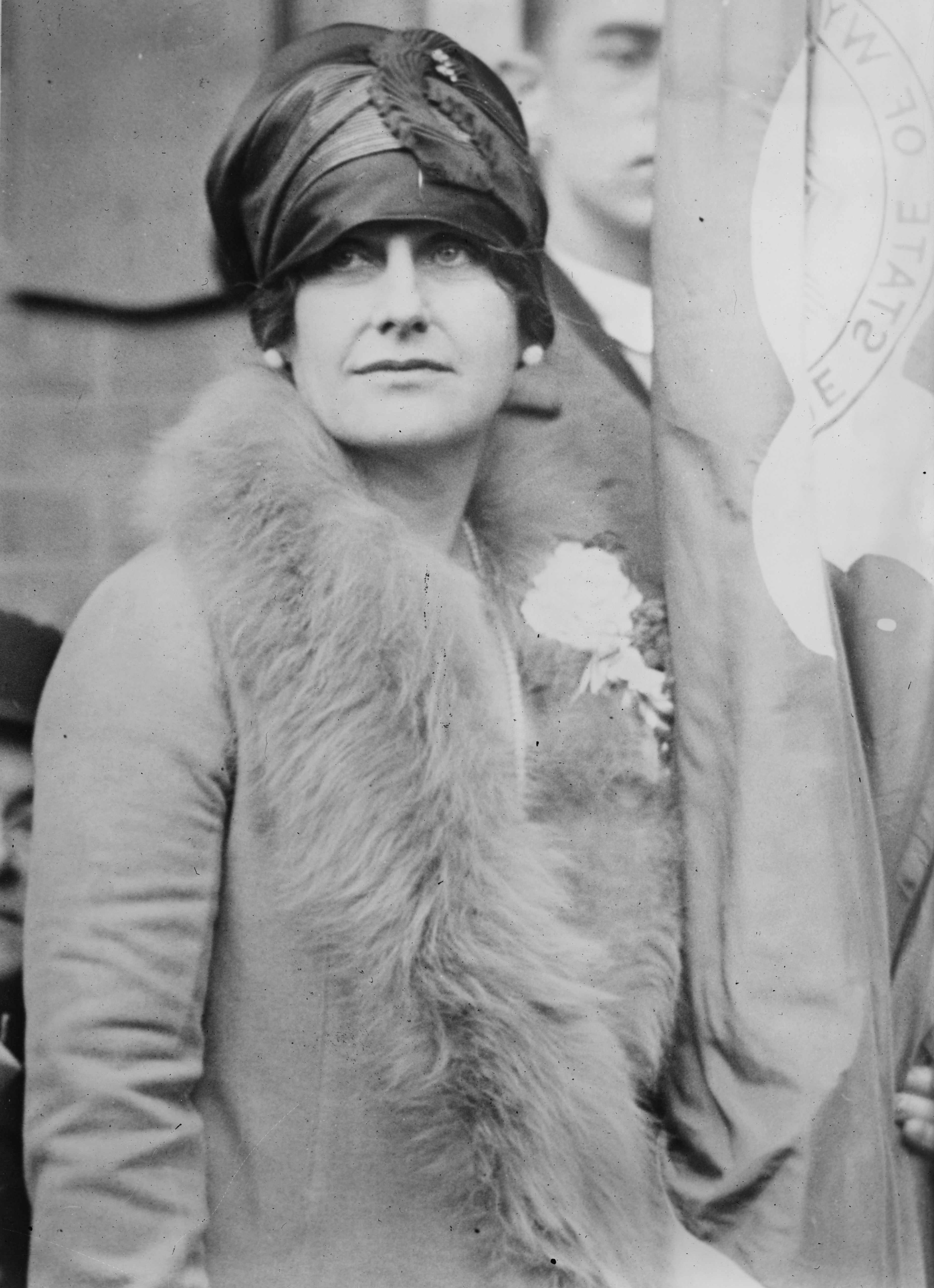
In 1924, Wyoming voters elected the nation’s first woman governor, Nellie Tayloe Ross. She lost a reelection bid in 1926.
Wyoming’s agricultural economy suffered from low prices and drought in the early 1920’s. As a result, banks and small businesses failed in record numbers. By 1929, at the start of the worldwide Great Depression, Wyoming already had experienced years of hard times.
In the 1930’s, a number of New Deal programs helped Wyoming. Numerous Civilian Conservation Corps (CCC) camps were in the state. Public Works Administration employees built many post offices, schools, and other public buildings. The U.S. Bureau of Reclamation built dams that provided water for irrigation projects and jobs for unemployed workers.
The mid-1900’s.
Wyoming’s economy boomed during World War II (1939-1945). The war brought demands for coal, oil, timber, and meat. After the war ended, many returning soldiers used veterans’ benefits to purchase homes or to attend the University of Wyoming.
Oil production increased. Refineries operated in many Wyoming towns during the 1950’s. But most of the state’s coal mines closed as railroads switched from coal-burning to diesel-powered locomotives. Two additional minerals, trona and uranium, aided the postwar economy. Sodium carbonate, the key ingredient in trona, has many industrial uses. Trona was first mined in Wyoming in 1947. By the 1990’s, Wyoming had become the world’s leading supplier of trona. In the early 1950’s, uranium was found in abundance at several locations in Wyoming. Entire towns were built to accommodate workers in uranium mines and mills.
The state’s economy was stagnant in the 1960’s. In 1969, the Legislature passed a severance tax on minerals. The severance tax is based on a percentage of the value of the mineral produced. The tax has provided substantial revenue for Wyoming.
The late 1900’s.
An Arab oil embargo in 1973 and 1974 increased energy prices worldwide. Wyoming’s energy industries were strong in the 1970’s and early 1980’s. Huge coal mines opened, many in Campbell County. New oil fields emerged along the Overthrust Belt in the southwestern part of the state. Major coal-fired power plants were constructed near Rock Springs, Wheatland, Kemmerer, and Glenrock.
Many people moved to Wyoming during the “boom years.” Between 1970 and 1980, the state’s population grew by 42 percent. Many of the new residents were single men who planned to make money in the mining industry and then return to their home states.
Wyoming’s sudden population growth forced the state to confront housing shortages and other problems in the communities near the mines and power plants. The Legislature passed laws to protect the environment and to help mining communities. Some of the severance tax revenues were returned to cities and counties to help pay for new schools, streets, water and sewerage systems, and additional law enforcement.
Wyoming’s economy suffered in the mid-1980’s as prices for coal and oil declined. Many people moved away from mining towns. During the 1980’s, Alaska passed Wyoming in population, leaving Wyoming as the least populous of the 50 states.
Severance tax revenues that had funded much of state government growth declined through the 1990’s. Despite the price declines, coal mines continued to operate in the Powder River Basin of Wyoming.
Recent developments.
Tourism remained an important part of the state’s economy in the 1990’s and the early 2000’s. The Jackson Hole area, around Jackson, became world renowned as a skiing destination. In the late 1990’s, housing prices increased statewide, but particularly in resort towns, such as Jackson, Cody, Buffalo, and Sheridan.
In 2000, Richard B. Cheney, formerly a U.S. representative from Wyoming, was elected vice president. He was the first Wyomingite elected to high national office. He and President George W. Bush were reelected in 2004.
In 2002, coal bed methane, a form of natural gas, began to be widely produced in Wyoming. Sublette and Campbell counties received the greatest economic benefits from natural gas. Other counties also experienced some prosperity. As energy prices rose in the early 2000’s, Wyoming’s economy boomed again.
Since the mid-1900’s, Wyomingites have become increasingly conscious of the need to protect the state’s environment. In the 1960’s, the Legislature passed clean air and clean water acts. The Legislature also established a state Department of Environmental Quality. Wyomingites have debated whether to allow snowmobiles and whether to reintroduce wolves to national parks. In 2005, the Legislature passed a law creating a trust fund to preserve and restore wildlife habitat.
The Wyoming economy grew during the early 2000’s, largely as a result of energy production. But many state leaders believed Wyoming was too dependent on the mineral industry for jobs and future growth. State leaders continued to look for ways to diversify the state’s economy and to keep young people from leaving the state. In 2006, the Legislature established the Hathaway scholarship program to fund higher education for eligible Wyoming high school graduates.
