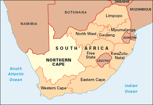
Northern Cape is South Africa’s largest province in area and smallest province in population. It covers 143,973 square miles (372,889 square kilometers) and occupies most of the northwestern part of South Africa. It is bordered to the north by the countries of Namibia and Botswana and to the west by the Atlantic Ocean. It shares provincial borders with Western Cape, Eastern Cape, Free State, and North West. Kimberley is the capital and largest city of Northern Cape.
Afrikaans is the most widely spoken language in Northern Cape. Other languages used by many people are Tswana (Setswana), Xhosa (isiXhosa), and English. About half of Northern Cape’s people are of African descent. About two-fifths are of mixed African, European, and Asian ancestry, and about one-twelfth are of European descent. South Africa’s original inhabitants, the San, inhabited the region for thousands of years, and a few San still do so today.
There are few towns in Northern Cape. Some settlements are isolated. The province has the lowest growth rate in South Africa because many young people move to other parts of the country.
Economy.
Northern Cape has little industry. Mining and agriculture form the basis of the province’s economy. Northern Cape has large deposits of iron ore and diamonds. Asbestos, copper, lead, limestone, manganese, and zinc are also mined in the province. Most agriculture in Northern Cape involves irrigation.
Farm products include beans, corn, cotton, dates, dairy products, grapes, and vegetables. Many farmers keep sheep and cattle. In some areas, overgrazing has led to soil erosion. Port Nolloth on the Atlantic coast is a fishing and lobster port.
Spectacular springtime displays of wildflowers attract many visitors to Namaqualand, a dry area along the coast. Other attractions include the Augrabies Falls, west of Upington, where the Orange River plunges into a rocky gorge. The Kgalagadi Transfrontier Park, which straddles the border between Northern Cape and Botswana, is a haven for desert wildlife.
Land.
Northern Cape’s coastline runs for 185 miles (300 kilometers) along the Atlantic Ocean. The narrow coastal plain is an arid, inhospitable area with sparse vegetation. The northeastern, central, and southern regions of Northern Cape lie on southern Africa’s central plateau and form part of the semidesert region of the Great Karoo. The northern part of the province forms part of the depression of the Kalahari Desert. The province’s western section drops in altitude toward the coast. Several mountain ranges form a rim along the province’s southern boundary.
South Africa’s longest river, the Orange, flows westward through the largely arid province, forming part of the Namibian border. The Molopo River forms part of the border with Botswana and can dry up in hot weather. Floods sometimes occur during the rainy season.
History.
Khoikhoi herders and San hunter-gatherers lived in the Northern Cape region for thousands of years before the first Europeans arrived in the late 1600’s. The Dutch East India Company, a powerful trading company, founded the Cape Colony in 1652. The colony covered what are now the provinces of Eastern Cape, North West, Northern Cape, and Western Cape. As the Cape Colony expanded during the 1700’s, communities of Khoikhoi and San, formerly enslaved people, and people of mixed descent developed on and beyond the colony’s northern border, and especially along the Orange River. When the northern boundary of the Cape was extended to the Orange River, some of these people, known as Oorlams, moved farther north into what is now Namibia.
People of mixed ancestry, named Griqua by missionaries, settled under missionary influence at Griekwastad (also called Griquatown) in the east of what is now Northern Cape. Griekwastad later became known as Griqualand West.
Diamonds were discovered, first along the Vaal River in 1867 and then a few years later east of the Vaal at what became Kimberley. The land in which the diamonds were found was disputed, and in 1871, an arbitration court ruled that it belonged to the Griqua under Nicholas Waterboer. The British, who wanted to impose order on the area, quickly annexed it. Griqualand West was ruled as a separate colony until 1880, when it was incorporated into the Cape Colony. The Griqua at first benefited from the new economic activity associated with diamonds, but they increasingly lost their lands to white people and descended into poverty.
Kimberley was soon a boom town second only in size to Cape Town. Tens of thousands of miners, most of them white, tried to make their fortunes as diggers. Larger numbers of Africans traveled long distances to Kimberley to find work, for which they were often paid in guns. Individual diggers were progressively bought out, and by 1888, one company owned the entire mine: the De Beers Mining Company established by Cecil Rhodes. In the mid-1880’s, underground mining began. From that time, thousands of African laborers were housed in closed compounds while they worked at Kimberley, to ensure that they did not keep any diamonds they found. For a century, Kimberley was dominated by De Beers.
Cape colonial control was gradually extended to and beyond the Orange River. Many Khoikhoi and San were killed. In 1878, there was a minor war along the Orange River, after which the Cape authorities imposed their control all along the river. White sheep farmers took over most of the land, leaving only isolated and mostly arid areas as reserves on which descendants of the indigenous people and Coloured (mixed-race) people lived in conditions of extreme poverty. White farmers began to use water from the Orange to irrigate land near Upington. Only on the scattered mission stations did the indigenous people retain any independence.
In the northeast, the mission station of Kuruman, founded by Robert Moffat, was for a time the start of a “missionaries’ road” to the north. The railway from Cape Town to Kimberley was extended in the 1890’s to the Rand through the more easterly part of the province. Major battles between the British and the Boers took place along this railroad line and at Magersfontein during the Anglo-Boer War of 1899-1902. See Anglo-Boer Wars.
Copper mining brought a short-lived boom to Namaqualand in the 1860’s. Almost a century later, iron ore began to be mined on a large scale at the isolated site of Sishen to the northeast. A railroad line was constructed to transport iron ore to the port of Saldanha for export.
The Cape Colony became the Cape Province in the Union of South Africa in 1910. The new province of Northern Cape was created in April 1994, the month in which South Africa’s first multiracial democratic elections were held. The African National Congress won most seats in the provincial legislature. Manne Dipiko became the premier of the province, a position he held for eight years.
