Visayan Islands is a group of islands in the central Philippines, lying between Luzon and Mindanao. There are many islands in the group. The six main islands are Samar, Negros, Panay, Leyte, Cebu, and Bohol. The island of Masbate and nearby smaller islands are sometimes classified with the Visayas, and sometimes classified with the Philippines’ northern island group. The Visayan Islands group is divided into three geographical areas: Eastern Visayas, Western Visayas, and Central Visayas.
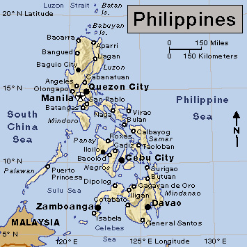
Eastern Visayas includes the hilly island of Samar and the rugged, mountainous island of Leyte. The San Juanico Bridge (also known as Marcos Bridge) links Samar and Leyte over the San Juanico Strait. The people of the islands rely mainly on agriculture and fishing for their income. But frequent typhoons cause the Eastern Visayas to remain largely undeveloped.
Western Visayas includes the island of Panay and the western part of the island of Negros. Panay has a well-developed central plain, which is heavily populated. In the southeastern part of the island stands Iloilo, the trading and commercial center of Western Visayas. The island of Negros is the major producer and exporter of sugar in the Philippines. Other important products include abacá (Manila hemp), coconuts, corn, minerals, and timber.
Central Visayas includes the eastern part of Negros and the islands of Bohol and Cebu. On Bohol, tourists are attracted by the hills known as the chocolate hills, which turn brown in summer. Cebu is a long island with a mountain range that extends throughout the province. Its capital, Cebu City, was founded in 1565 by the Spaniards. It became the first national capital of the Philippines.
