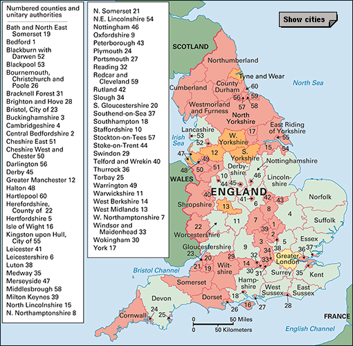
Wiltshire (pop. 510,330) is an inland unitary authority (local government area) in southwestern England. It is best known for its rich farmland and for its many prehistoric remains. It has large areas of chalk uplands separated by such pleasant vales (valleys) as White Horse, Pewsey, and Avon. The unitary authority covers an area of 1,346 square miles (3,488 square kilometers). Towns in Wiltshire, such as Chippenham, Salisbury, and Trowbridge, have a mixture of traditional agriculture and newer manufacturing and service industries. Trowbridge is the administrative center. Historic counties and ceremonial counties in the region have also been named Wiltshire. The British monarch appoints royal representatives, including a lord lieutenant and a high sheriff, to each of England’s ceremonial counties. The unitary authorities of Swindon and Wiltshire were created in 1997 and 2009, respectively, from the county of Wiltshire.
People and government
Local customs.
Almost all local customs have declined since the Industrial Revolution. But one custom that dates back at least 400 years survives in the village of Great Wishford. Villagers meet once a year to gather oak boughs in the forest of Grovely. The boughs are then taken to Salisbury Cathedral, where they are blessed. A celebratory procession then follows.
Recreation.
Many recreational activities are centered in nearby Swindon. Swindon’s football (soccer) team plays in the Football League. The authority’s cricket team competes in the minor counties championship. Castle Combe, near Chippenham, has motor and motorcycle racing. A gliding club is at South Marston.
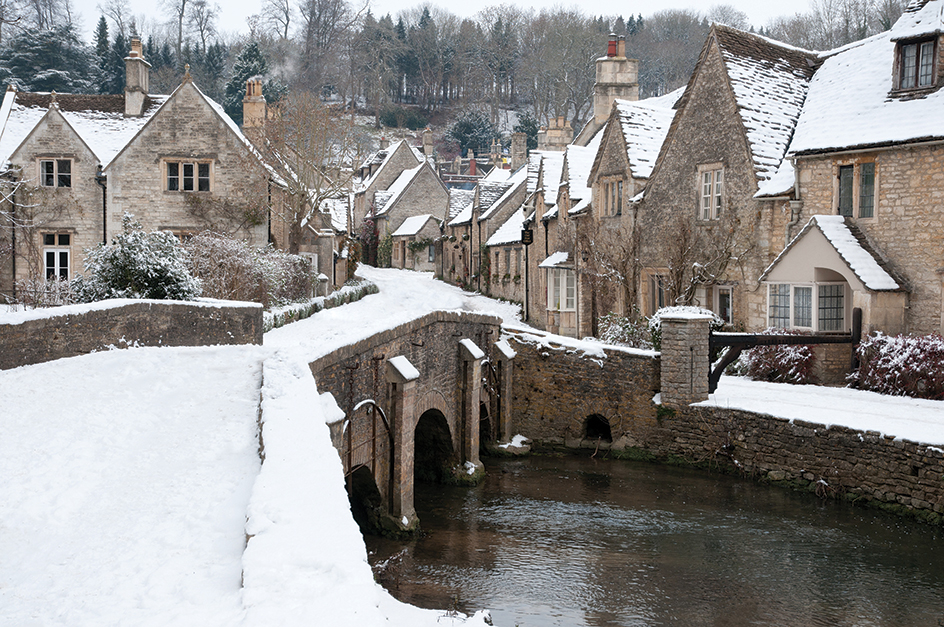
Horse-riding enthusiasts are well served in the Wiltshire area. Hunting is popular, and Salisbury has a race course. Boating and fishing are popular on both the Bristol Avon and the Salisbury Avon rivers, on the Kennet and Avon Canal, and on Swindon’s Coate Water. Walkers enjoy the scenery of the Marlborough Downs and Salisbury Plain. Savernake Forest attracts naturalists to observe its wildlife.
Local government.
The crown court meets at Salisbury and Swindon. The Wiltshire Constabulary has headquarters at Devizes, and fire brigade headquarters are at Potterne.
Economy
Agriculture.
Dairy farming is important in Wiltshire. The authority has good transportation links with London, and much of the authority’s dairy produce is sent there. Some milk is used in Wiltshire factories to make condensed or powdered milk, butter, or cheese. Most of the dairy herds graze in the rich, fertile valley of the Bristol Avon and in the area around Salisbury.
Wheat is the authority’s chief grain crop. Large quantities of wheat grow on the dry soils of the downs. Other crops include barley, hay, oats, and root crops.
Both dairy and cereal farmers are diversifying in a search for more profitable activities. They are attempting to grow such new crops as peas and beans. Meat production from chickens, hogs, and sheep also is increasing.
Much of Salisbury Plain is a military training area, and its only use for farmers is for rough grazing. An important activity in the Marlborough areas is breeding and training racehorses.
Manufacturing.
Swindon, northeast of the present Wiltshire unitary authority, was once one of the United Kingdom’s most important centers of railroad engineering. Steady contraction over many years greatly reduced the significance of engineering. But the area’s industrial base has diversified, and workers now produce electrical and electronic equipment, food products, motor vehicles, pharmaceuticals, and plastics. Other factories in the Wiltshire area produce automobile parts, beer, carpets, cement, clothing, farm equipment, fireworks, and printed goods. Wiltshire’s most important minerals are sand and gravel.
Chippenham is also a growing industrial center, and has electronics, engineering, and plastics industries. Trowbridge’s industries include brewing, handling eggs, making mattresses, and printing. It is growing in importance as a shopping and commercial center and has a business and technology park that has attracted new industries.
Salisbury has engineering and insurance firms and small manufacturing companies. It is a major shopping and service center. Calne, Devizes, Melksham, and Westbury are also small industrial towns.
The people of Wilton have made fine carpets since the 1690’s. The town has given its name to a particularly fine type of carpet weave.
Many of the towns in Wiltshire have factories or workshops that produce or maintain farming equipment. These towns include Calne, Chippenham, Devizes, Malmesbury, Trowbridge, and Wootton Bassett.
Quarrying.
Wiltshire’s most important minerals are sand and gravel. These are worked in the Upper Thames valley. An area excavated for sand and gravel has been converted into the Cotswold Water Park. Chalk and clay are used for cement manufacture at Westbury, and chalk is quarried in several places in south Wiltshire. Building stone is quarried near Bradford-on-Avon and Corsham. Stone excavated at Chilmark, west of Wilton, was chosen for the restoration work on Salisbury Cathedral.
Tourism.
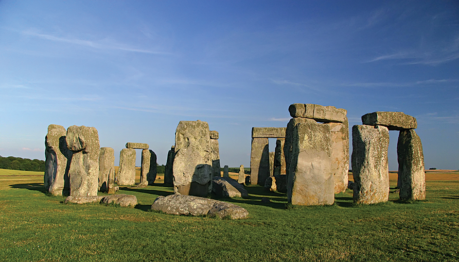
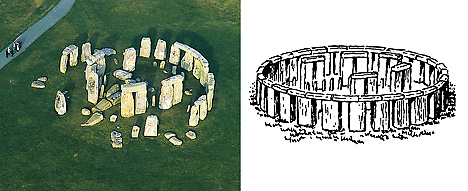
The authority’s beautiful countryside, historic houses, and prehistoric remains make Wiltshire a great attraction for tourists. Stonehenge, on Salisbury Plain, is one of the United Kingdom’s major tourist attractions.
Transportation and communication.
Wiltshire is served by both the Southern and Western regions of British Rail. The M4 motorway (highway), which links London, Bristol, and South Wales, crosses northern Wiltshire. Other important roads in the authority include the A30, which runs from London to Cornwall and passes through Salisbury and Wilton. Roughly parallel to the A30 in Wiltshire is the A303, which passes through Amesbury. Local bus services go through many of Wiltshire’s towns and villages. Long-distance coaches (buses) connect the main towns of Wiltshire to many parts of the United Kingdom.
In the 1800’s, a number of canals threaded through Wiltshire, linking the Bristol Channel with the North Sea. The Kennet and Avon Canal was restored in the 1980’s. The Wilts and Berks Canal and the Thames and Severn Canal are largely derelict.
Several towns have weekly newspapers, and nearby Swindon has its own daily newspaper. An independent radio station serves much of the authority.
Land
Location and size.
Wiltshire is bounded by Gloucestershire to the north, Oxfordshire and Berkshire to the east, Hampshire to the east and south, Dorset to the south, and Somerset to the west. The authority extends about 30 miles (48 kilometers) from east to west and 50 miles (80 kilometers) from north to south.
Land regions.
Wiltshire is a place of contrasting scenery. About two-thirds of its area is upland. The remainder consists mainly of the upper valleys of the Bristol Avon and Salisbury Avon rivers and their tributaries, and the upper Kennet valley.
Geographically, Wiltshire can be divided into four main areas: limestone uplands, clay valley, chalk uplands, and clay valleys. The limestone uplands, the lower slopes of the Cotswold Hills, lie across the extreme northwestern part of the authority. To the east and south of these uplands is the clay valley that contains the Bristol Avon.
The greater part of Wiltshire is chalk uplands, consisting of the Marlborough Downs and Salisbury Plain. These uplands extend from the eastern to the southwestern boundaries, and rise to about 1,000 feet (300 meters). The chalk bed has large areas of undulating grassland that provide good sheep pastures. The chalk uplands are the center from which the other chalk uplands of southern England radiate. The chalk uplands contain a number of forests, including Clarendon Forest, near Salisbury; Cranborne Chase, on the southern border; and Savernake Forest, near Marlborough. Along the northwestern edge of the Marlborough Downs are the White Horse Hills, so called because of the many silhouettes of horses that have been cut into the chalk.
In the southern part of the authority are the clay valleys of the Salisbury Avon and its tributaries, the Wilton, Wylye, Nadder, and Bourne. These wide, fertile valleys have large areas of woodland.
Climate.
In winter, Wiltshire is one of the coldest parts of southern England. The average January temperature varies between 36 °F and 41 °F (2 °C and 5 °C). The average July temperature is about 63 °F (17 °C) in the low-lying areas, and a little lower on the uplands. Wiltshire’s average annual rainfall is between 30 and 40 inches (760 and 1,020 millimeters).
History
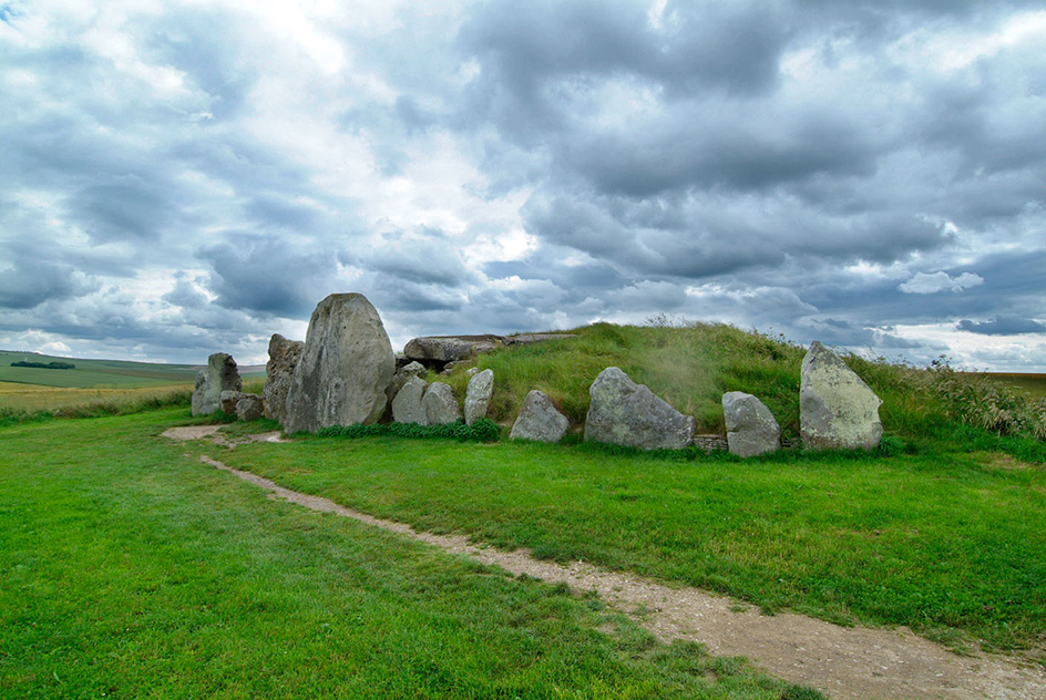
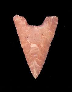
Many people claim that Wiltshire has more prehistoric remains than any other English authority. Prehistoric people preferred to live on high ground. It was easier to defend, and it gave them a wide uninterrupted view of the sky and the sun, which they worshiped. The uplands of the Marlborough Downs and Salisbury Plain show evidence that people lived and died there as long ago as 2000 B.C. The people of the New Stone Age, Bronze Age, and Iron Age left behind them many remains, including great monoliths (stone monuments), stone circles and avenues, defensive camps, and burial grounds. Much work has been done in excavating these remains.
The Romans used Old Sarum, a prehistoric site on a hill just north of Salisbury (New Sarum), as a military station. A number of Roman roads radiated from this point. From the 500’s to the 900’s, Wiltshire was a part of Wessex, the kingdom of the West Saxons. The Saxons also fortified the hill and used the site as a religious center. In the late 1000’s, William the Conqueror fortified Old Sarum, built a castle, and held court there (see Old Sarum).
Wardour Castle at Tisbury, in the southwest part of the authority, was built in the late 1300’s. During the English Civil War (1642-1648), Royalist troops under Lord Arundel attacked and destroyed the castle.
The ruins of Fonthill Abbey, near Salisbury, are the remains of a house built by William Beckford, one of the richest Englishmen of the late 1700’s. Three times he had a great tower built as part of the abbey, but each time the tower collapsed.
Canals and railways built in the 1800’s led to economic growth in the Wiltshire area. The town of Swindon grew rapidly. Thousands of people moved from London to the Swindon area under a government plan in the mid-1900’s. Swindon became a unitary authority, separate from the county of Wiltshire, in 1997. Wiltshire itself became a unitary authority in 2009.
