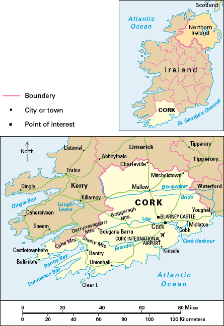
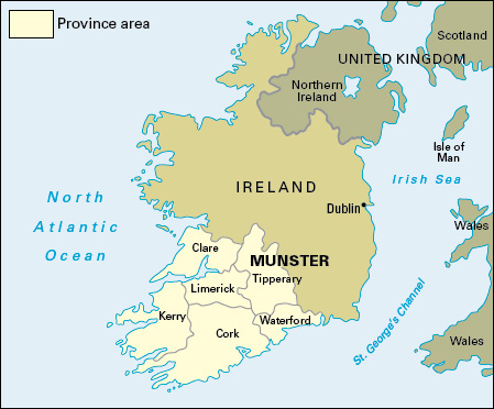
Cork, County, is the largest county in Ireland, also called the Republic of Ireland. It covers an area of 2,880 square miles (7,460 square kilometers) on Ireland’s southwest coast. County Cork lies within the province of Munster. The county is noted for its varied scenery. It has both remote rural settlements and large urban areas. Within Ireland, the city of Cork is second only to Dublin in population and economic importance. The Irish name for the city of Cork is Corcaigh.


The majority of people in County Cork live in urban areas. About half of the county’s urban residents live in and around Cork city. Most of the county’s people are Roman Catholics. Many others belong to the Church of Ireland or claim no religious affiliation. English is the everyday language of nearly all the county’s people. There are Gaeltacht areas—areas where many people speak Irish—on Clear Island and along the middle of the county’s western boundary.
University College Cork, in Cork city, is part of the National University of Ireland. The city also has a regional technical college, and colleges of art, music, and commerce and technology. In southwestern County Cork, there is an annual religious pilgrimage at Gougane Barra, where Saint Finbarr of Cork lived. Annual film and jazz festivals take place in Cork city.
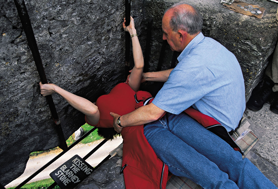
The castles, fortified houses, and mansions of County Cork are its most notable buildings. The most famous castle is Blarney Castle, which has the Blarney Stone. According to local folklore, people who kiss the stone receive the gift of flattering speech. The Charles and James forts in Kinsale date from the 1600’s.
Economy.
Agriculture is important to County Cork’s economy. Dairy farming is the leading activity, especially on grassland in the north and northwest. Barley for livestock feed is the main crop, but malting barley, potatoes, and wheat are also important. Malting barley is used for making alcoholic beverages. Farmers in the east and south raise beef cattle. In the southwest, farmers raise cattle and hogs and practice dairy farming.

Manufacturing industries are located mainly in and around the city of Cork. Industries in the city include baking, brewing, and publishing, and the making of chemicals, dairy products, electrical and electronic goods, furniture, paints, and textiles. Midleton is the center of the Irish whiskey-distilling industry. Charleville, Mallow, and Mitchelstown have dairy processing facilities.
Most of the county’s people work in service industries. Such industries include banking, education, health care, information services, insurance, public administration, retail and wholesale trade, social work, tourism, and transportation. Many service activities take place in Cork city. Tourism is important in the city, along the coast, and in the scenic southwest of the county.
Natural gas was discovered near Kinsale in the 1970’s. For more than 40 years, the extraction of natural gas in the Celtic Sea off the coast of County Cork was of major importance to the county’s economy. By 2020, the natural gas reserves were used up, and the gas field was decommissioned (taken out of use). Today, wind farms that generate electric power are found throughout the county. Hydroelectric power plants stand upon the River Lee.
Fishing is important along the coast of County Cork, especially in the west. Castletownbere is one of Ireland’s leading fishing ports and has fish-processing industries. Other fishing ports include Baltimore, Bantry, Cobh, Kinsale, and Unionhall. Forestry takes place in upland districts and a forest park at Gougane Barra.
Cork city is the hub of the county’s road network. The main railroad runs north from Cork city toward Dublin and Limerick. There are rail lines from Mallow to Tralee and between Cork and Cobh. Cork Harbour is a major commercial port. It has vehicle and passenger ferry links with France and Wales. The Irish naval headquarters are at nearby Haulbowline. Cork International Airport is to the south of the city of Cork.
Land.
County Cork’s southern and main boundary is its indented Atlantic coast. County Kerry bounds it to the west, County Limerick to the north, and Counties Tipperary and Waterford to the east. The greatest distance across County Cork is about 95 miles (153 kilometers) from northeast to southwest, and the average distance from north to south is about 45 miles (70 kilometers).
The main feature of the landscape is a series of long valleys and ridges which run east to west. The major valleys are those of the Rivers Blackwater, Bride, Lee, and Bandon. The valleys are broad in their lower sections but become narrower upstream and westward. The valley floors are of limestone and shale.
The ridges are mainly sandstone. They rise westward to over 1,640 feet (500 meters) in height in the Boggeragh, Derrynasaggart, Shehy, and Caha mountains. The ridges bend westward to form peninsulas separated by the long sea inlets of Bantry and Dunmanus bays.
History.
Stone Age monuments, fortified farm enclosures, and early Christian sites show the long history of human settlement in what is now County Cork. Saint Finbarr had a monastery there in the A.D. 600’s. The Vikings established the town of Cork as a trading center in the 900’s. An Irish family called McCarthy ruled over the kingdom of Desmond, a region now occupied by the counties of Cork and Kerry. After the Anglo-Norman invasion, much of this territory was granted to the Fitzgeralds, a Norman clan. As earls of Desmond, they became increasingly Irish.
Cork city remained a center of English power. In the late 1500’s, there was an attempted plantation (settlement) of Munster by English colonists. The most famous person to receive land was the author and explorer Sir Walter Raleigh, who was granted territory at Youghal. The Irish lost the battle of Kinsale in 1601. During the 1600’s, Richard Boyle, earl of Cork, became very powerful.
The towns of Kinsale and Youghal were founded by the Anglo-Normans, but most other towns in County Cork were founded by English colonists in the 1500’s and 1600’s. In the early 1920’s, the county played a prominent part in Ireland’s War of Independence and Civil War.
Cork’s large natural harbor has played an important role in the region’s history for thousands of years. In the past, many passenger ships crossing the Atlantic Ocean stopped at Cobh, known as Queenstown from 1849 to 1922. Cobh was the main departure point for Irish emigrants sailing to North America. In addition, it was the final port of call of the British ocean liner Titanic before it sank in 1912. In 1915, during World War II, the British passenger ship Lusitania was torpedoed off the county’s western coast. Rescue efforts were coordinated from the port of Cobh.
See also Cobh; Ireland, History of; Lee, River.
