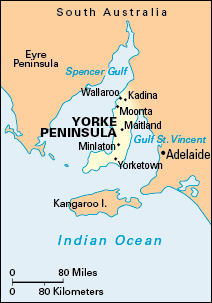
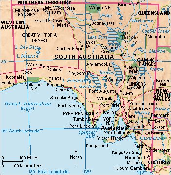
Yorke Peninsula is a cape in South Australia . It reaches into the Indian Ocean and is bounded by the Spencer Gulf and Gulf St. Vincent. It is 150 miles (240 kilometers) long and ranges in width from 9 to 12 miles (15 to 20 kilometers).

Yorke Peninsula is a flat, rolling, low-lying area covered by fertile red-brown soil. It receives only about 15 inches (380 millimeters) of rain a year, but careful soil management has made the peninsula one of South Australia’s important agricultural areas. There are bulk-handling facilities at Wallaroo, Ardrossan, and Port Giles. The main towns are Kadina, Wallaroo, Maitland, Moonta, Minlaton, and Yorketown.
The Naranga people were the area’s original Aboriginal inhabitants. In 1802, Captain Matthew Flinders named the peninsula in honor of Charles Yorke, first lord of the Admiralty.

After 1865, as wheat farmers began planting crops on the peninsula, the large agricultural leases were subdivided into smaller holdings. During the late 1800’s, the peninsula had about 20 jetties and wharves that provided facilities for shipping grain. The development of road transportation after World War II (1939-1945) ended in 1945, and the introduction of bulk-handling facilities in 1952 resulted in the decline of many of the ports on the peninsula.
