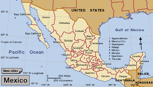
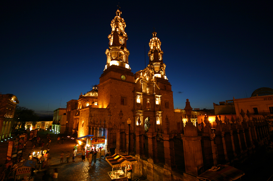
Aguascalientes << ah gwahs kahl YEHN tays, >> is a state in central Mexico. It has an area of 2,112 square miles (5,471 square kilometers). The Sierra Madre Occidental mountain range rises in the western part of the state, and the Mesa Central (Central Plateau) covers eastern and southern Aguascalientes. The state has a warm, dry climate. The name Aguascalientes comes from the Spanish words for hot waters and refers to the numerous hot springs in the area. At the time of the 2020 census, the population was 1,425,607. Most of the people live in or near the capital city, also called Aguascalientes.
The economy of Aguascalientes depends on agriculture, manufacturing, and tourism. The state’s chief agricultural products are corn, grapes, vegetables, and wine. Goods manufactured in Aguascalientes include automobiles, electronics, and textiles. The capital city is a popular destination for Mexican tourists.
The Chichimec Indians lived in Aguascalientes before the Spanish conquered Mexico in the 1500’s. Their descendants live in the state today. Aguascalientes became a territory of Mexico in 1835 and a state in 1857. Before 1835, it formed part of the state of Zacatecas. In 1914, at the height of the Mexican Revolution of 1910, a convention of revolutionary leaders took place in the city of Aguascalientes. The convention elected Eulalio Gutierrez as interim president of Mexico. But disagreements between those present led to civil war between the revolutionary forces of Venustiano Carranza and those of Pancho Villa and Emiliano Zapata in 1914 and 1915.
