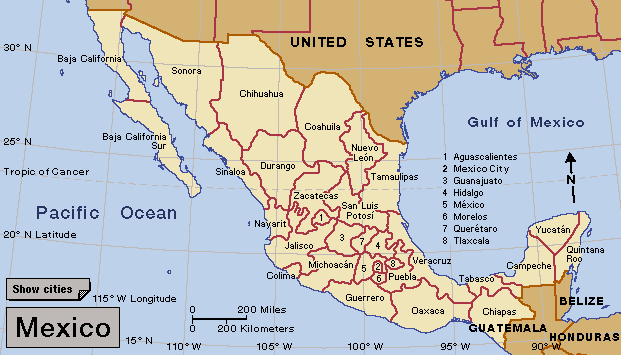
Tamaulipas, << tahm ow LEE puhs, >> is a state in northeastern Mexico. It borders the United States to the north and the Gulf of Mexico to the east. Tamaulipas has an area of 30,650 square miles (79,384 square kilometers). At the time of the 2020 census, its population was 3,527,735 Ciudad Victoria (Victoria City) is the capital. Tamaulipas has a variety of landscapes and climates. The northwest is flat and dry, while the southeast has a wet tropical climate. The Sierra Madre Oriental mountain range rises in the western part of the state.

Mining, manufacturing, and agriculture contribute to the state economy. The Gulf Coast of Tamaulipas is rich in petroleum, one of Mexico’s chief exports. Factories called maquiladoras, near the Mexican-U.S. border, produce goods for export to the United States and other countries. Agricultural products of Tamaulipas include beef, cotton, milk, sorghum, and sugar cane.
Native American peoples, including the Huastec Indians, lived in what is now Tamaulipas before Spaniards colonized the area in the 1500’s. Many historians believe that the name Tamaulipas comes from a Huastec word meaning place of high mounts.

Tamaulipas became one of the original Mexican states in 1824. It has played a significant role in the nation’s history. Some of the fighting in the Mexican War (1846-1848) between Mexico and the United States took place in Tamaulipas. Throughout the 1900’s, Tamaulipas was one of Mexico’s leading petroleum producers. The state is also the birthplace of Rafael Guillen, long known as Subcomandante Marcos, who led the Zapatista movement of the late 1900’s and early 2000’s (see Zapatista Army of National Liberation).
