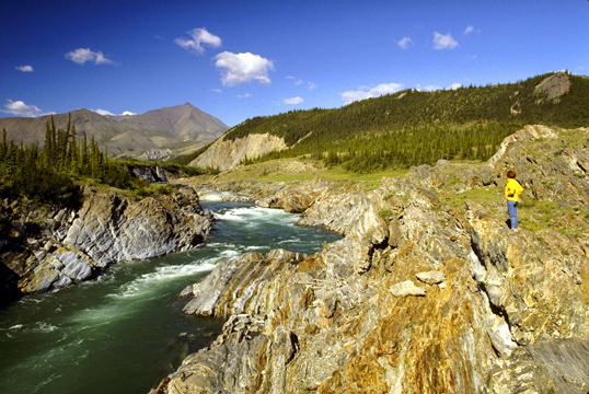
Ivvavik << EEV vah veek >> National Park is a protected wilderness area in Yukon, a far northern territory of Canada. The park shares its western border with Alaska, in the United States. Its northern coastline borders the Beaufort Sea. The park has an area of 2,415,400 acres (977,500 hectares), covered primarily by alpine and Arctic tundra (cold, dry, treeless land).

The British Mountains, which rise about 5,900 feet (1,800 meters), dominate Ivvavik’s landscape. Below the surface, much of the area’s land remains permanently frozen. Some trees grow in the southern portion of the park, but the plant life consists mainly of grasslike sedges, shrubs, and lichens. Several rivers—including the Babbage, Firth, Malcolm, Spring, Trail, and Tulugaq—flow through the area. From late May through mid-July, the sun never sets in Ivvavik National Park. However, the average daily temperature in July, the warmest month, is only 45 °F (7 °C). Winters are long and cold.
Animals that live in Ivvavik include Arctic foxes, caribou, Dall’s sheep, grizzly bears, and musk oxen. The park helps preserve the birthing grounds of the Porcupine Caribou Herd, a large herd of Grant’s caribou. The name Ivvavik means place for giving birth in the native Inuvialuktun language. Birds that make their homes in the park include golden eagles, gyrfalcons, peregrine falcons, and rough-legged hawks. Snow geese and tundra swans nest along the coast.
An agreement between the native Inuvialuit people and the governments of Canada, Yukon, and the Northwest Territories established Ivvavik National Park in 1984. The Inuvialuit people and Parks Canada, a Canadian government agency, manage the park together. Activities for visitors include camping, canoeing, hiking, and rafting.
