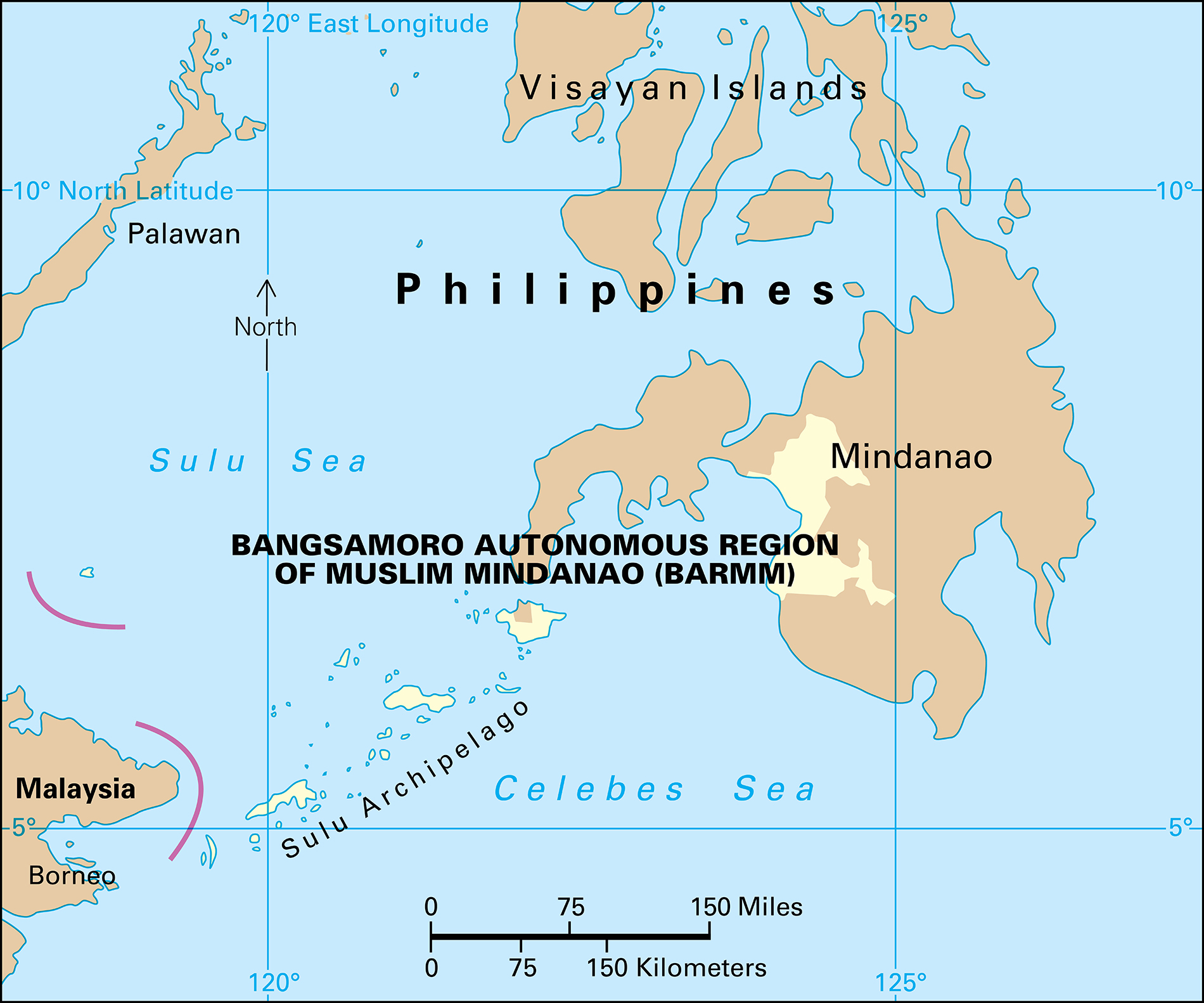
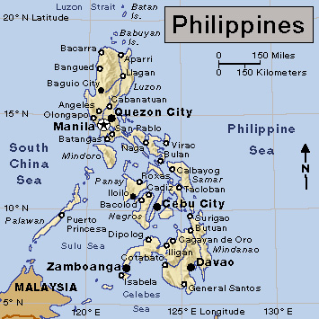
Bangsamoro Autonomous Region in Muslim Mindanao (BARMM) (pop. 4,404,288) is one of 17 administrative regions that make up the Philippines. BARMM is in the southwestern part of the island of Mindanao, the southernmost major Philippine island. Bangsamoro means nation of the Moro people. The region’s economy relies on agriculture.

The region has five provinces: (1) Basilan, (2) Lanao del Sur, (3) Maguindanao, (4) Sulu, and (5) Tawi-Tawi. It has three major cities: (1) Cotabato City, in Maguindanao; (2) Lamitan, in Basilan; and (3) Marawi, in Lanao del Sur. The region also has dozens of municipalities (towns) and over 2,000 barangays (villages or neighborhoods).
People
BARMM is the second smallest region of the Philippines by land area. Over half of the people live in Lanao del Sur and Maguindanao. The regional center is Cotabato City, which is densely populated.
Ancestry.
Almost all Filipinos are related to the Malays of Indonesia and Malaysia. The Indigenous (native) Moro peoples of BARMM make up 13 Islamic tribes. The Spaniards who settled in Mindanao called them Moro (Moor, their term for Muslim). The major Moro groups include the Maguindanaos, Maranaos, and Tausugs. Other Indigenous groups include the Lambangian and Teduray.
Language.
Most of the people of BARMM speak Filipino (a version of Tagalog), Tagalog, and English. Many people also speak Chavacano and Cebuano, the main native language of Mindanao. Indigenous languages commonly spoken include Maguindanaon, Manobo, and Tausug. Other Indigenous language groups include Binukid, Hiligaynon, Iranun, Mapun, Maranao, Sama, Tiruray, and Yakan.
Culture and attractions.
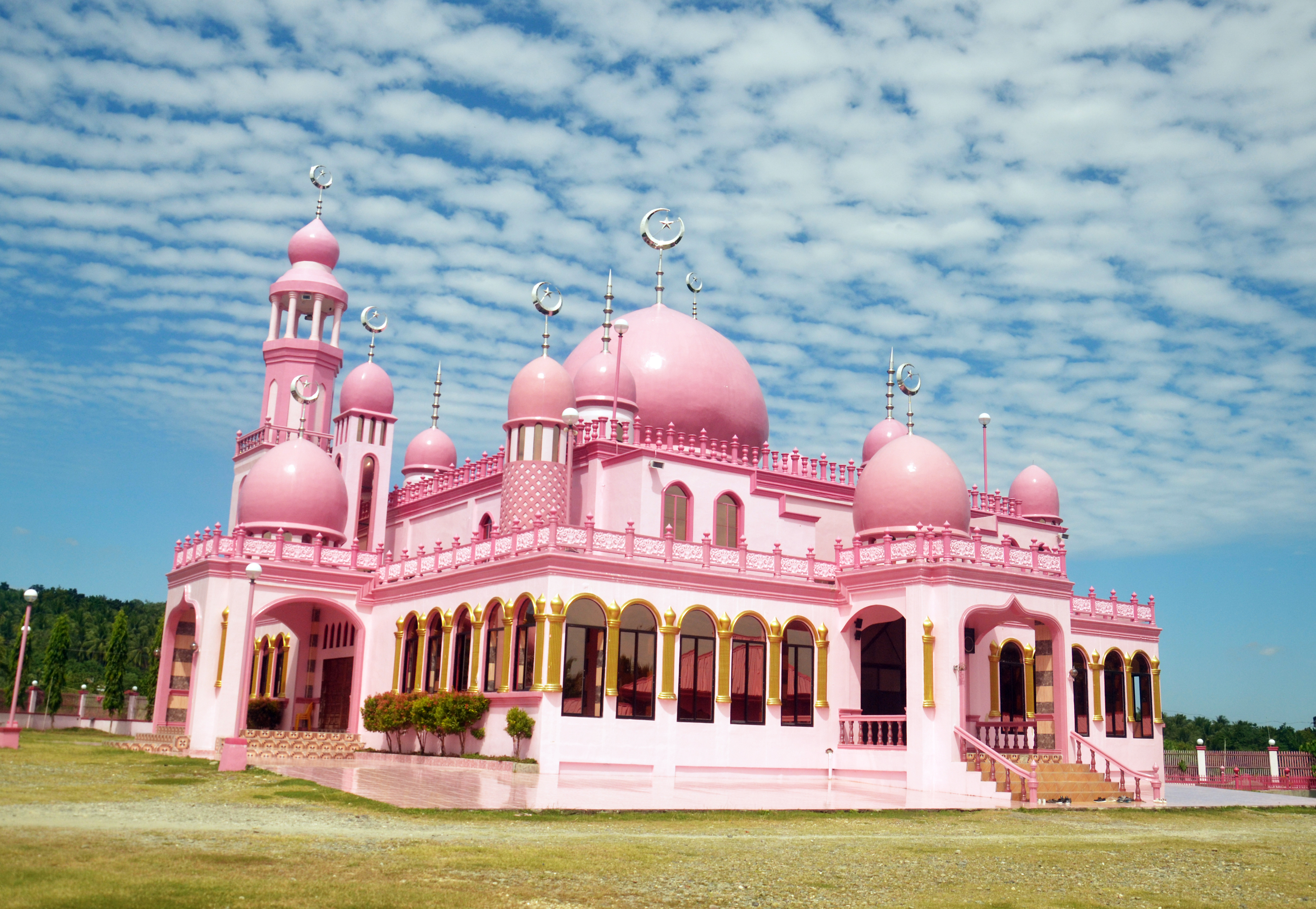
BARMM has many cultural festivals and regional attractions. The oldest mosque (Muslim place of worship) in the Philippines, Sheikh Karim al Makdum Mosque, was built in 1380 in Tawi-Tawi. Some of the original pillars of the mosque are still standing. The Masjid Dimaukom, also called the Pink Mosque, opened in 2014. It was built in Datu Saudi Ampatuan, Maguindanao, by the mayor of the municipality. It is known for its beautiful architecture and bright pink color, attracting worshipers and tourists alike.

Cotabato City is known for the Kutang Bato Caves. The city is also home to the largest mosque in the Philippines, Sultan Haji Hassanal Bolkiah Masjid. The annual Sharif Kabunsuan Festival honors Sharif Muhammad Kabunsuan (also spelled Kabungsuan or Kabungsuwan), the missionary who spread Islam in Mindanao during the early 1500’s. Cotabato Day, or Araw ng Kutabato, is a huge annual festival in celebration of the city’s founding.
The Aga Khan Museum of Islamic Arts in Marawi is a museum of Indigenous art. The museum collection includes records of Indigenous dances, music, and tools. The Lami-Lamihan festival celebrates the Indigenous Yakan people’s culture, traditions, and unique ceremonial garments. Maulidin Nabi (also spelled Maulid un-Nabi) is an annual Muslim celebration of the birth of the Prophet Muhammad.
BARMM is also known for its beaches, forests, islands, mountains, and waterfalls. The Bulingan Falls in Lamitan City is a 21-foot (6-meter) high waterfall. It cascades down stepped blocks of rock into a pool. The Blue Lagoon, also called Marguez Lagoon, fed by a natural spring in Maguindanao, is known for its bright blue water. Other natural wonders include the Limpongo Hotspring, Kiga Falls, Sapala Falls, and Tabuan Falls. The Sumpitan Falls in Marawi have seven tiers rising up to 40 feet (12 meters) high.
Tawi-Tawi is known for its Turtle Islands, a natural wildlife sanctuary where many sea turtles lay their eggs. Jolo, another island in Tawi-Tawi, is known for the smallest walled city in the world. The walled city was built by Spanish settlers in 1878. The city is surrounded by brick walls 8 feet (2.4 meters) high and 2 feet (0.6 meter) thick. Marawi is known for the royal Torogan houses, the homes of the upper-class Maranao families. Marawi is also known for its woven textiles. Bagang Beach lies on Lake Lanao in Marawi and serves as a popular tourist destination. Lanao del Sur is known for its monument to Jose Abad Santos, a government official who became a hero of the Philippines during World War II (1939-1945).
Religion.
Muslims make up the majority of the population. Most other people are Protestant Christians or Roman Catholics.
Education.
National law requires children from 5 to 17 years of age to go to school, from kindergarten through the 12th grade. The Department of Education provides free primary and secondary education. There are also many private schools. Teachers in the public elementary schools conduct classes in the local language for the first few years and then introduce English and Filipino. Most of the private schools teach in English. The high schools and universities mostly use English.
There are several public and private universities in BARMM. Public universities include Cotabato State University, in Cotabato City; Mindanao State University, in Marawi; Sulu State College, in Jolo; and Tawi-Tawi Regional Agricultural College, in Bongao. Private universities include Lake Lanao College in Marawi and Abubakar Computer Learning Center Foundation in Bongao.
Land and climate
Location and description.
BARMM covers an area of 14,151 square miles (36,651 square kilometers). Its provinces lie on a portion of the island of Mindanao, along with three small island chains. The region is known for its beaches, forests, and mountains. Agricultural land accounts for a small portion of the region’s area. Maguindanao is the largest province in size, followed by Lanao del Sur, Sulu, Basilan, and Tawi-Tawi.

Mindanao is a mountainous island at the southeastern end of the Philippines. The country’s highest mountains, including some active volcanoes, are on this island. BARMM is home to many mountains and volcanoes. The highest peak in the region is Mount Piapayungan, a dormant volcano in Lanao del Sur, at 9,235 feet (2,814 meters). It is also called Mount Ragang and Blue Mountain. It is the seventh highest mountain in the Philippines. Marawi is a mountain city. Its climate is cooler than that of the lowland areas of the Philippines, a result of its high elevation. Earthquakes, mudslides, and other geologic hazards sometimes occur in the region because of its location on active fault lines.
Rivers and lakes.
BARMM has many lakes and rivers. Lake Lanao, a major Philippine watershed, is in Lanao del Sur. Lake Lanao is the second largest lake in the Philippines. It is also the largest lake in Mindanao. The Agus River drains the lake and flows north into Iligan Bay, in Northern Mindanao. The Agus River is the most important source of hydroelectric power in the country.
Lake Sebu, in Cotabato City, is an important watershed for the Philippines as well. Lake Sebu is known for its seven beautiful waterfalls. The first waterfall is called Hikong Alu, meaning passage in the Indigenous language of Tboli. It is only about 35 feet (11 meters) tall, but it is the widest of the waterfalls. The highest waterfall, Hikong Bente, which means immeasurable in Tboli, is also called Dongon Falls. It rises about 70 feet (20 meters) high.
Climate.
Like the rest of the Philippines, BARMM has a tropical climate with high humidity and rainfall. The temperature varies slightly from month to month. The warmest months are March through May. The coolest month is January. The nights are generally mild due to land and sea breezes. The dry season runs from December to May.
Economy
BARMM contributes only a small portion to the economy of the Philippines. Agriculture, forestry, and fishing make up a large part of the region’s income. The region’s economy also depends on service industries. The majority of people work in agriculture and service industries. Manufacturing and construction account for little of the region’s economy and employment. BARMM’s leading exports include clothing, coconut products, coffee, palm oil, rubber, and woodcrafts.
Agriculture
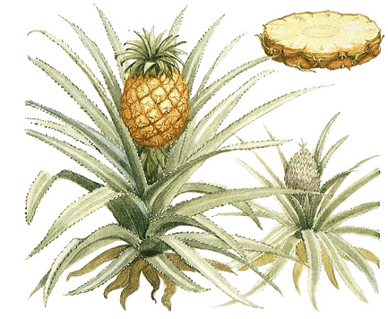
accounts for about two-thirds of the region’s economy and more than half of the employment. BARMM is a leading producer of cassava, coconuts, coffee, and copra (dried coconut meat). Other major crops include abacá (used to make a fiber called Manila hemp), corn, eggplant, palay (unhusked rice), sugar cane, sweet potatoes, tomatoes, and such other vegetables as cabbages, string beans, and root crops. Leading tropical fruits grown include bananas, calamansi (Philippine lime), durian, jackfruit, lanzones, mangoes, marangs, pineapples, and rambutan. Other leading crops include palm oil, peanuts, salago, and tobacco. Rubber trees and many fruit trees are grown. Orchid growing is common among farms. 
Farmers in BARMM also raise poultry and other livestock. The region raises such poultry as chickens and ducks and produces chicken and duck eggs. Important livestock include carabao (water buffalo), cattle, and goats.
Fishing industry
The fishing industry is important to the region. Its leading products include milkfish, roundscad, shrimp, skipjack, tilapia, and tuna. Marungas Island is known for its pearl farm. BARMM is a leading producer of seaweed.
Manufacturing
does not contribute significantly to the region’s economy. Only a small number of the region’s workers are employed in manufacturing and construction. Leading industries produce furniture and pottery. They also include blacksmithing, goldsmithing, and weaving. Other industries produce chemicals, clothing, jewelry, processed food, rubber, and embroidered textiles.
Indigenous groups produce malong, mats, and wood crafts. A malong is a traditional handwoven wrap garment. It is often patterned and made of silk or cotton. It is commonly worn as a dress by women or over trousers by men. Common patterns include the pako rabong, which means growing fern, and the patola, which means double ikat. Ikat is made with a technique in which threads are dyed in patterns before being woven. Indigenous peoples of Sulu are known for making handicrafts of brass, bronze, shells, and wood, and for their bladed weapons.
Service industries
account for a large part of BARMM’s economy. About one third of the region’s workers are employed in service industries, particularly in public administration and real estate sales. Many people are also employed by banks, schools, and the government. Tourism benefits the region’s hotels, restaurants, and stores.
Transportation and communication.
BARMM has several regional airports. It also has regional, national, and international seaports. Regional newspapers published in BARMM include the Kotawato Express in Cotabato City and The Mindanao Examiner.
Government
BARMM is the only autonomous (self-governing) administrative region of the Philippines. It is currently governed by the Bangsamoro Transition Authority, an interim government established in 2019. Elections for a regional assembly are planned for 2025.
Provinces, cities, and municipalities are the main local government units (LGU’s). In the Philippines, the people elect provincial, city, and municipal officials for three-year terms. These local officials may not serve more than three consecutive terms. Barangays are governed by barangay captains and councils. Barangay officials serve a fixed term of office that is determined by law.
Because of the large Muslim population of the region, Philippine law recognizes the jurisdiction of both regular courts and Sharī`a courts in BARMM. Sharī`a is traditional Islamic law. In BARMM, the Sharī`a courts may try cases involving Muslims from the region. They may try a case that involves a non-Muslim only if that person agrees to be subject to the court. The regular courts handle most other cases, though Indigenous people also may choose to settle disputes according to their traditional or tribal laws.
History
Early Philippine people in what is now BARMM lived in small communities, each headed by a datu (leader). Muslim traders from Indonesia brought Islam to the islands of the Sulu Archipelago around the 1300’s. The Sultanate of Sulu originated at Jolo in the 1400’s. Muslim missionaries came to what is now Cotabato City to spread Islam in the late 1400’s. The Sultanate of Maguindanao was established in southwestern Mindanao in the early 1500’s.
Spaniards began settling in the Philippines in the 1500’s. In most of Mindanao, however, Islamic sultanates and some highland tribes resisted Spanish authority until the mid-1800’s. Following Spain’s defeat in the Spanish-American War (1898), Spain ceded the Philippines to the United States. Japanese forces invaded the Philippines in 1941 during World War II. They completed their conquest of Mindanao in the spring of 1942, but Philippine guerrilla forces there continued to resist the occupation. Heavy fighting also took place in southwestern Mindanao when U.S. forces returned to retake the island from the Japanese in 1945. The Philippines became an independent nation in 1946.
In 1969, the Moro National Liberation Front (MNLF) was formed. The goal of this and other Islamic separatist groups was to lead an armed resistance against the government of the Philippines in an effort to establish self-ruling Muslim areas. In 1989, the Autonomous Region in Muslim Mindanao (ARMM) was created. In 1996, the Philippine government signed a peace agreement with the MNLF. The agreement created a region of self-rule for Muslims in the southern Philippines. Despite the agreement, fighting continued between the government and two other Muslim rebel groups, the Moro Islamic Liberation Front and the Abu Sayyaf Group (ASG).
In 2001, the government of Philippine President Gloria Macapagal-Arroyo signed a cease-fire with the Moro rebels and began talks with them. However, the government refused to negotiate with the ASG, because the group used such tactics as kidnapping. In 2002, the United States began providing military training and aid to Philippine forces in their fight against the ASG. In February 2003, fighting again broke out between government forces and the Moro rebels. In July 2003, the two sides signed a cease-fire. Also in July, several members of the Philippine military tried to overthrow the Macapagal-Arroyo government, but failed. Macapagal-Arroyo remained president after winning an election in 2004. In 2005, occasional fighting began again between the government and various Muslim rebel factions.
After years of negotiations, the Philippine government and the Moro rebels signed a peace agreement in 2014. Under the agreement, the government pledged to create an autonomous region named Bangsamoro in exchange for an end to the armed rebellion.
In June 2018, the Congress of the Philippines passed the Bangsamoro Basic Law, enabling the establishment of a Bangsamoro government. Congress passed the Bangsamoro Organic Law in July. That law created the Bangsamoro Autonomous Region in Muslim Mindanao. It replaced the ARMM, which included part of western Mindanao, Basilan Island, and parts of the Sulu archipelago. In 2019, the Bangsamoro Organic Law went into effect, officially establishing BARMM. Cotabato City and several barangays, previously part of the neighboring region of Soccsksargen, became part of BARMM as a result of a plebiscite (vote) by the people in those areas held earlier in 2019. Philippine President Rodrigo Duterte created the Bangsamoro Transition Authority (BTA) to act as an interim government for the Bangsamoro region.
Elections for a regional assembly originally were planned for 2022. In late 2021, however, the Congress of the Philippines voted to extend the authority of the BTA as an interim government until the 2025 national elections.
