Floods in Australia. Floods are extreme weather events caused by high water levels that frequently occur in Australia. The water levels of oceans, seas, and smaller bodies of water often rise after heavy rainfall, pushing water onto the surrounding land. Floods can lead to deaths and significant loss of property, particularly around urban areas.
The Aboriginal peoples of Australia have many stories and legends about floods. Local Aboriginal people warned early European settlers against building communities in floodplain areas, but these warnings were often ignored. As a result, settlers suffered many disastrous floods during Australia’s colonial period.
Causes of floods.
Floods are among the most common natural disasters in Australia. They are often the result of severe storms such as tropical cyclones. Another cause is the La Niña current, a seasonal weather pattern of low air pressure in the western Pacific Ocean, which brings heavy rainfall to Australia. In particular, the east coast of Australia experiences more frequent flooding during La Niña seasons.
Floods can also be caused by rare weather events such as high tides or tsunamis. High tide floods are a result of sudden sea level rise, which can be caused by unusual ocean currents or tidal forces. Tsunamis are enormous ocean waves triggered by earthquakes, volcanic activity, or other geological events.
In the 2020’s, Australia experienced a rise in the frequency of serious floods. Many scientists think these destructive floods have been caused or worsened by climate change.
Flood management.
In Australia, floods are handled by various federal, state, and local agencies. These groups educate people on flood risks and assist communities impacted by floods. The Bureau of Meteorology, a national agency responsible for forecasting floods, categorizes flood events as minor, moderate, or major.
Some important Australian floods.
This section describes some of the most destructive floods in Australia’s history.
Gundagai flood (1852).
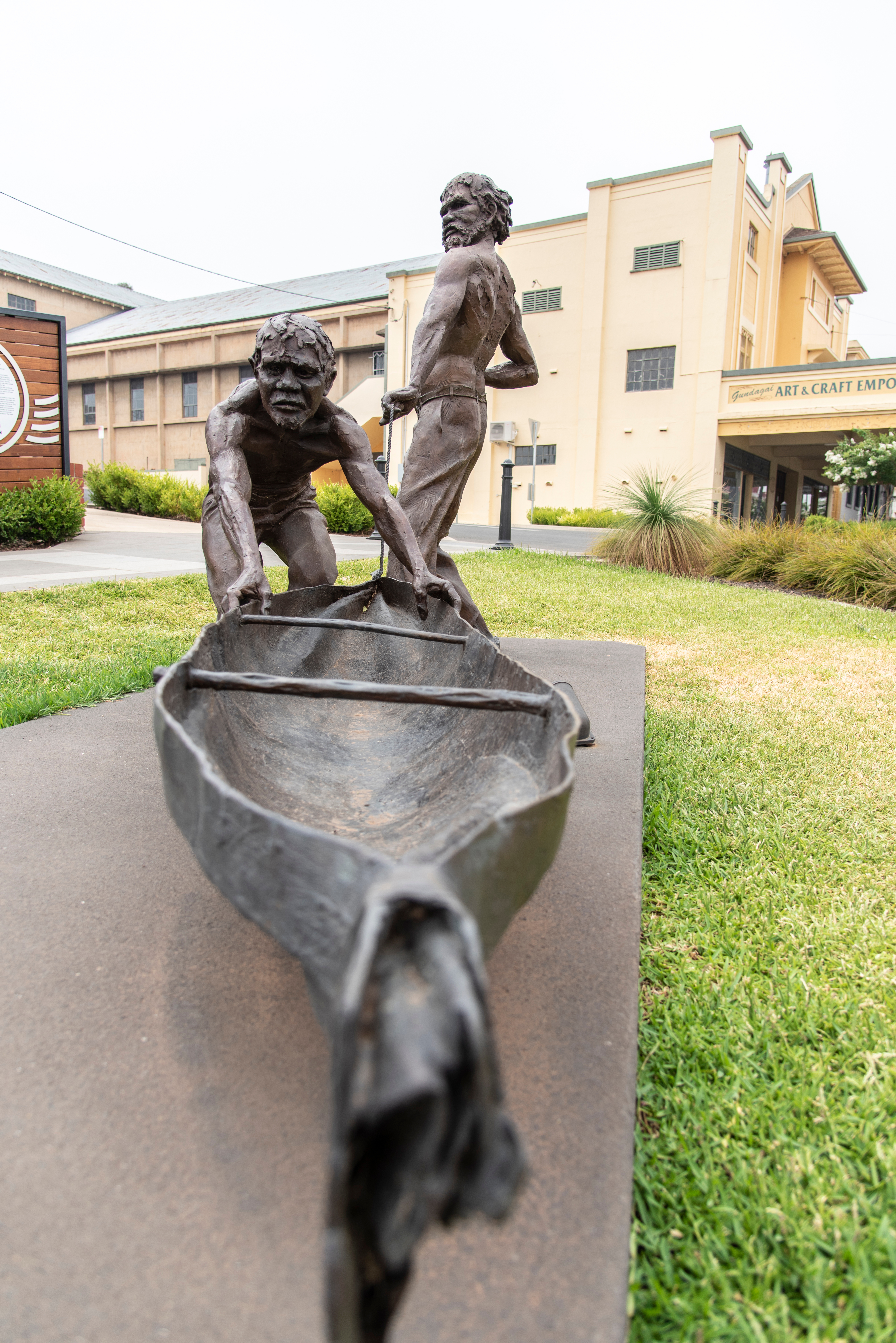
In June 1852, the rural community of Gundagai, New South Wales, suffered one of the deadliest natural disasters in Australian history. The Wiradjuri Aboriginal people had warned European settlers that the Gundagai settlement was in an area known for its dangerous floods. Their warnings proved true on June 24, 1852, when the Murrumbidgee River overflowed after a period of heavy rainfall. Its floodwaters swept through the community, killing at least 80 people—about a third of Gundagai’s population at the time. Other townspeople were rescued by local Aboriginal men, who went out into the floodwaters in their canoes and rowed many people to safety.
Clermont flood (1916).
On Dec. 27, 1916, a tropical cyclone struck the Queensland coast. The storm’s heavy rains fell over the mining communities of Clermont, Sapphire, and Peak Downs. By the following day, nearby waterways had quickly risen, creating a flash flood. A flash flood is a sudden accumulation of water on normally dry land. The floodwaters rushed into Clermont, submerging part of the town and killing more than 60 people. Clermont was later rebuilt on higher ground.
Queensland floods (1927).
A tropical cyclone made landfall north of Cairns, Queensland, in February 1927. The heavy rain accompanying the cyclone raised the water levels of the Condamine, Herbert, and Tully rivers, as well as other waterways along the Queensland coast. The resulting floods devastated many towns, including Cardwell, Ingham, and Tully. The floods caused the deaths of 47 people, destroyed infrastructure, and significantly harmed agricultural production in the region.
Melbourne flood (1934).
Beginning on Nov. 29, 1934, heavy rains poured down on the central region of Victoria. After two days, the South Gippsland area had received an estimated 11 inches (280 millimeters) of rainfall. Around Melbourne, waterways such as the Yarra River overflowed into the surrounding land. Thirty-six people died during the flood, and thousands more were left without homes.
Hunter Valley floods (1955).
This 1955 disaster affected most of the state of New South Wales, although its most devastating effects were felt by the towns of Maitland and Singleton. As the result of a particularly wet La Niña season, water levels were already high in the region when heavy rains came in late February. After the Hunter River rose above its banks, its floodwaters moved through Singleton and then Maitland, destroying homes and property. More than 40,000 people had to evacuate from towns in the Hunter Valley region. At least 14 people in the area died in the disaster, with the total death toll from the floods believed to be as many as 24 people.
Australia Day floods (1974).
The floods that devastated Brisbane, Queensland, in late January 1974 revealed the city’s unpreparedness for such a disaster. The Somerset Dam, built in 1959, was expected to stop floodwaters from reaching the city. Brisbane expanded into dangerous floodplain areas after the dam’s construction. On January 26, heavy rainfall from Tropical Cyclone Wanda passed over the area, filling creeks and rivers. With the dam unable to contain the rising floodwaters, the waterways around the city spilled over, submerging Brisbane and the nearby city of Ipswich. Out of a total death toll of 16 people, 14 people died in Brisbane. The floods also caused significant property damage, with estimated costs of around $200 million.
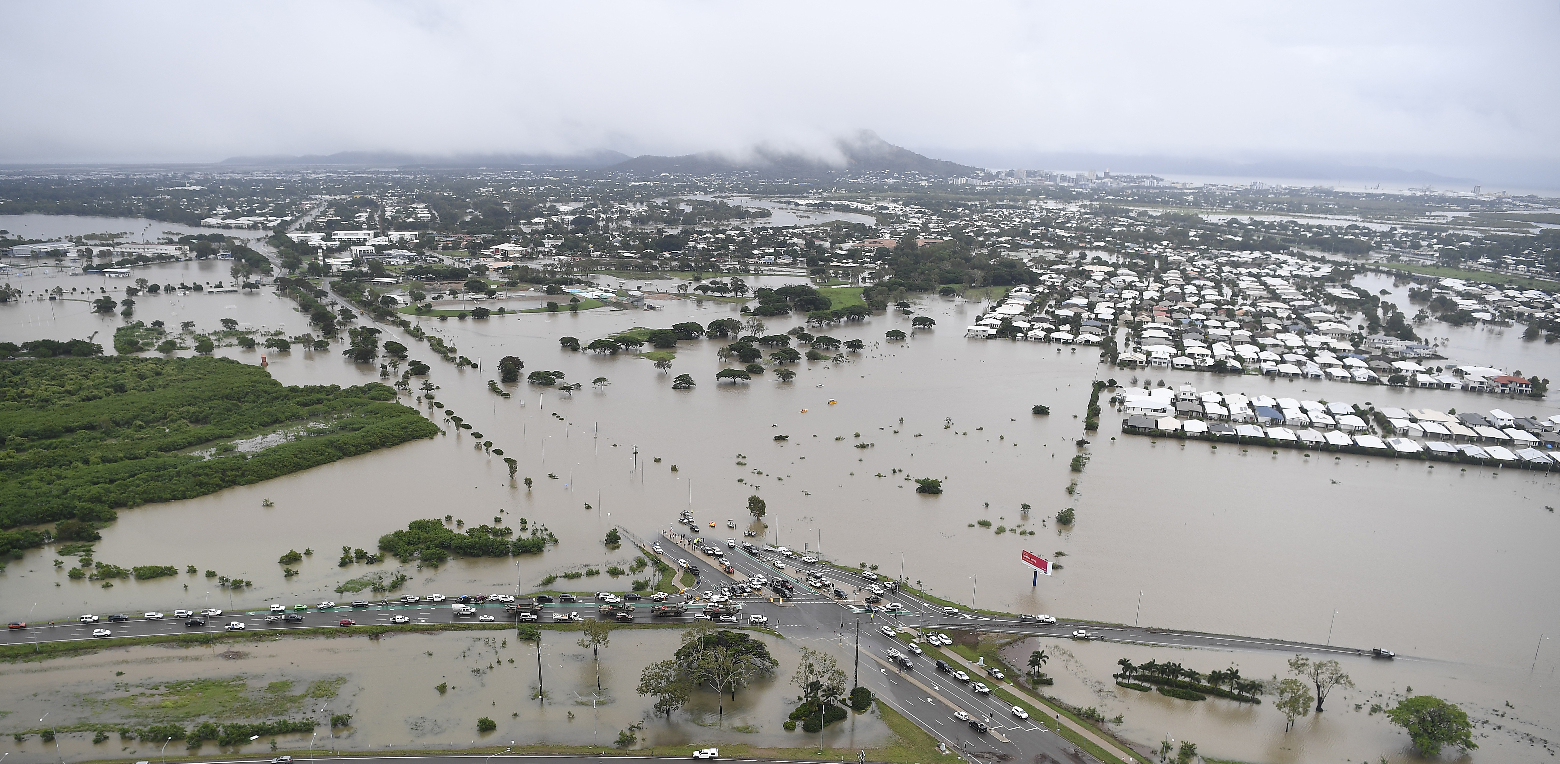
Queensland floods (2010-2011).
Heavy rains from a wet La Niña season began filling Queensland waterways in November 2010. Water levels in the region were pushed to their limits by Tropical Cyclone Tasha, which reached the Queensland coast on Dec. 25, 2010. By January 2011, the cyclone’s accompanying rainfall caused most waterways in the state to overflow their banks. Among the hardest hit areas were the cities of Brisbane and Toowoomba. Many rural communities were impacted in the Lockyer Valley region, west of Brisbane. One such town, Grantham, was completely devastated by a flash flood. Grantham was later rebuilt on higher ground. In total, 36 people died in the disaster. The floods’ damage costs were estimated to be more than $2 billion. 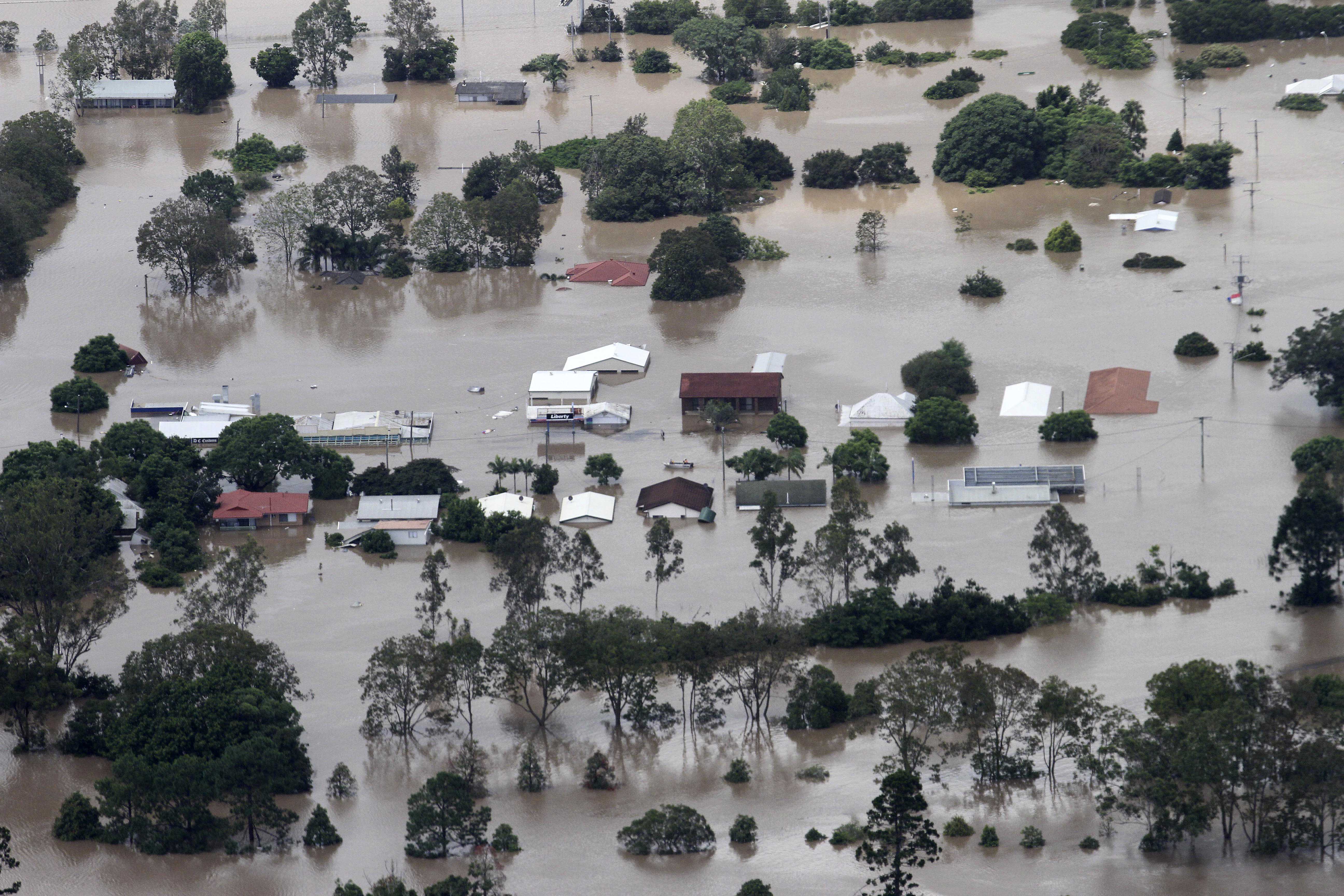
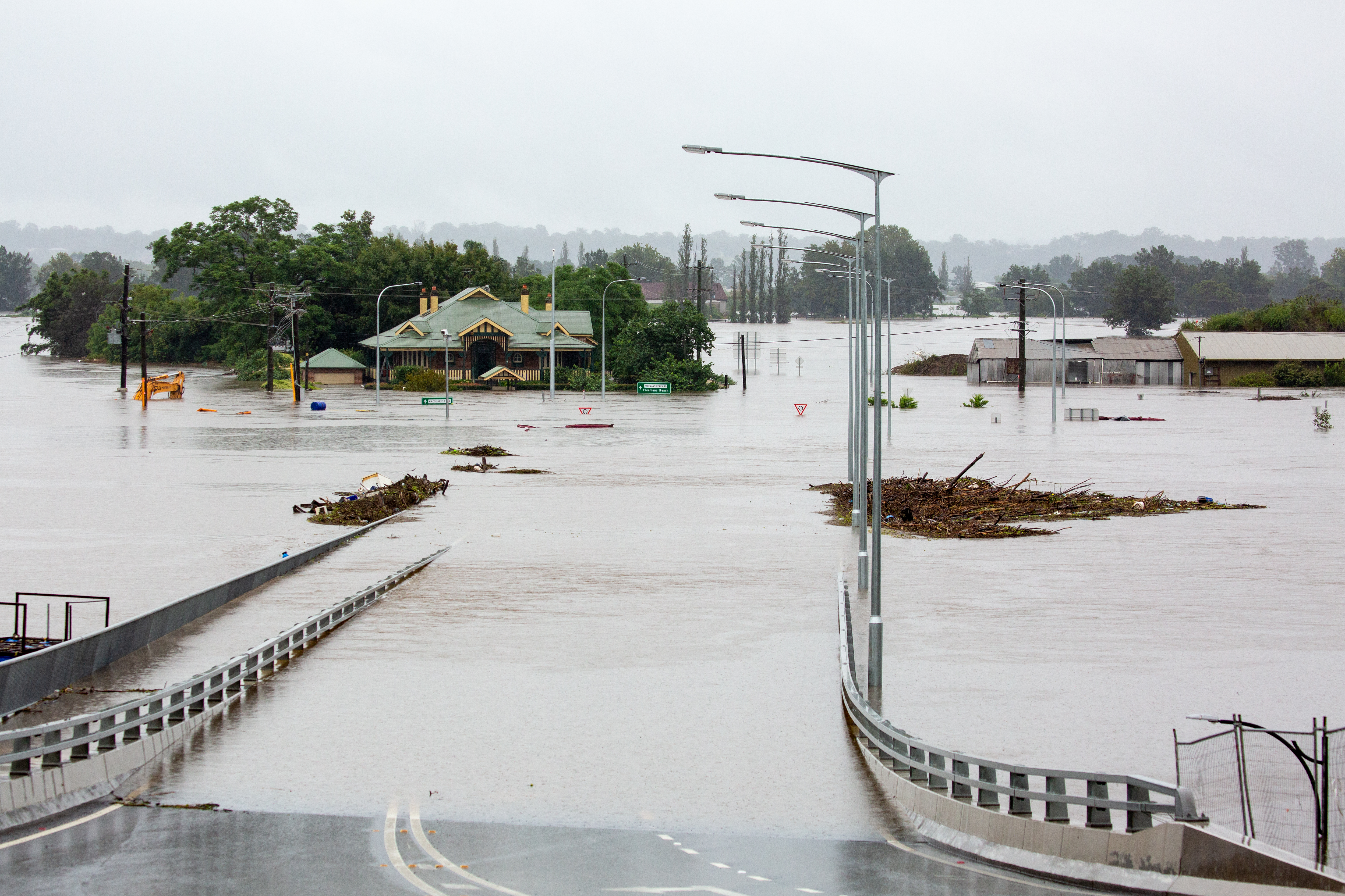
Eastern Australia floods (2022).
Beginning in late February 2022, the east coast of Australia was soaked by several severe storms brought by the seasonal La Niña current. Northern New South Wales and southern Queensland experienced extreme rainfall that overwhelmed the region’s waterways. The high water levels became a series of floods that flowed over the region, only leveling off in early April. The city of Lismore, in the far north of New South Wales, experienced the worst flood in its recorded history. The Queensland cities of Brisbane and Gympie and the Central Coast region of New South Wales were also seriously impacted, as well as the suburbs of Sydney. The floods caused the deaths of 22 people, as well as widespread damage to property and infrastructure. Cleaning up from the floods was estimated to cost more than $4 billion. 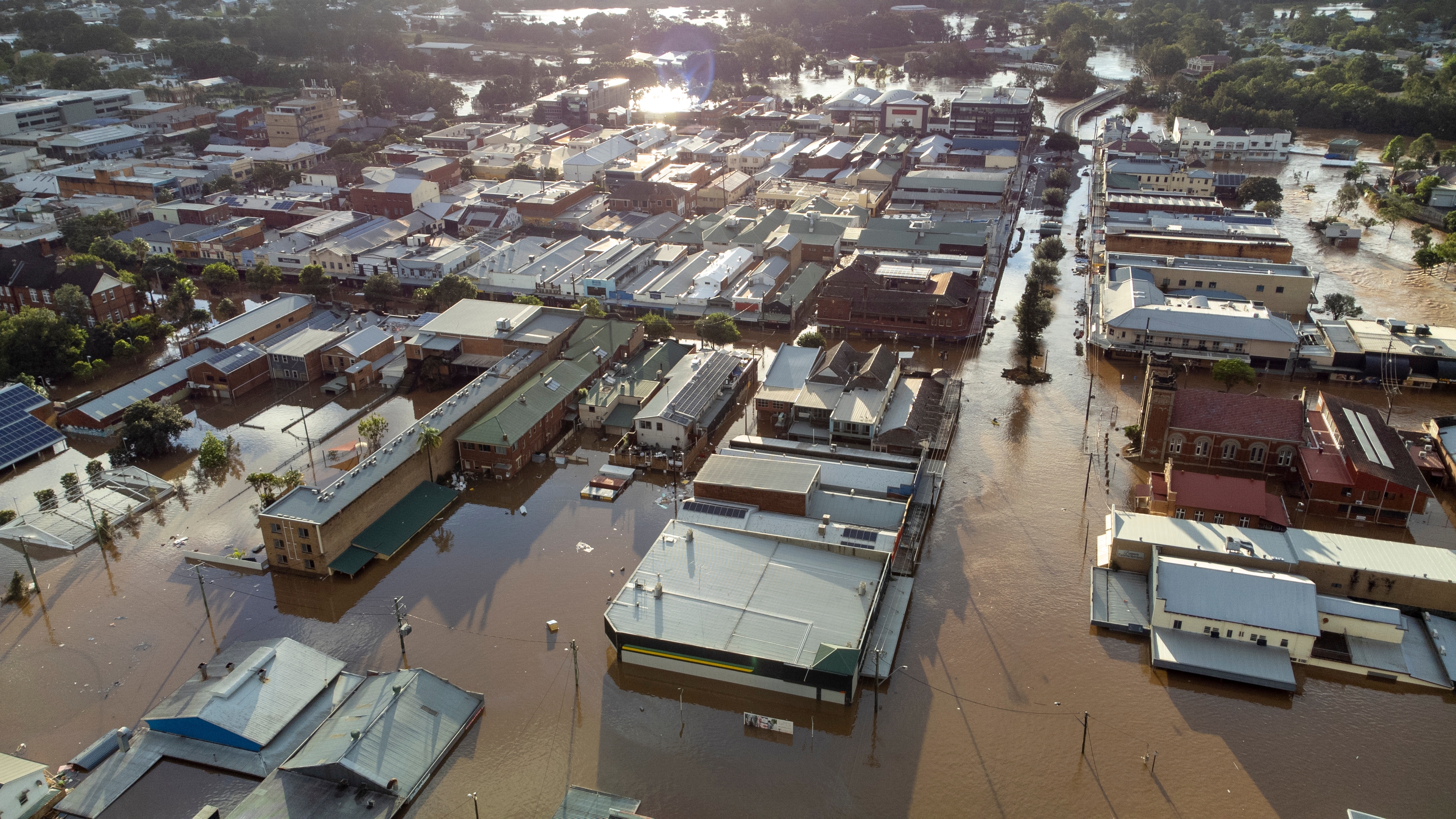
Far North Queensland floods (2023).
In early December 2023, Tropical Cyclone Jasper formed in the Coral Sea and began traveling toward the northeast coast of Queensland. The storm made landfall near the town of Wujal Wujal, north of Cairns, on December 13. By then, it had weakened to become a tropical depression—that is, a low-pressure area surrounded by winds that have begun to blow in a circular pattern.
In the following days, Jasper stalled over the region of Far North Queensland. Rainfall from Jasper raised the water levels of the region’s waterways, including the Barron River, to record heights. The waterways soon overflowed into Cairns and other neighboring communities. Hundreds of people, including the entire population of Wujal Wujal, were forced to evacuate their homes. The rain stopped in late December. The Australian Bureau of Meteorology reported a total of 88.7 inches (225.2 cm) of rainfall at Bairds on the Daintree River from December 12 to 19. It was a record for total rainfall from a tropical cyclone in Australia.
